Home Story Jigsaw of Broken Slate
Jigsaw of Broken Slate
Feature type Story
Read time 11 min read
Published Mar 03, 2020
Author Jan Bakker
Photographer Jan Bakker
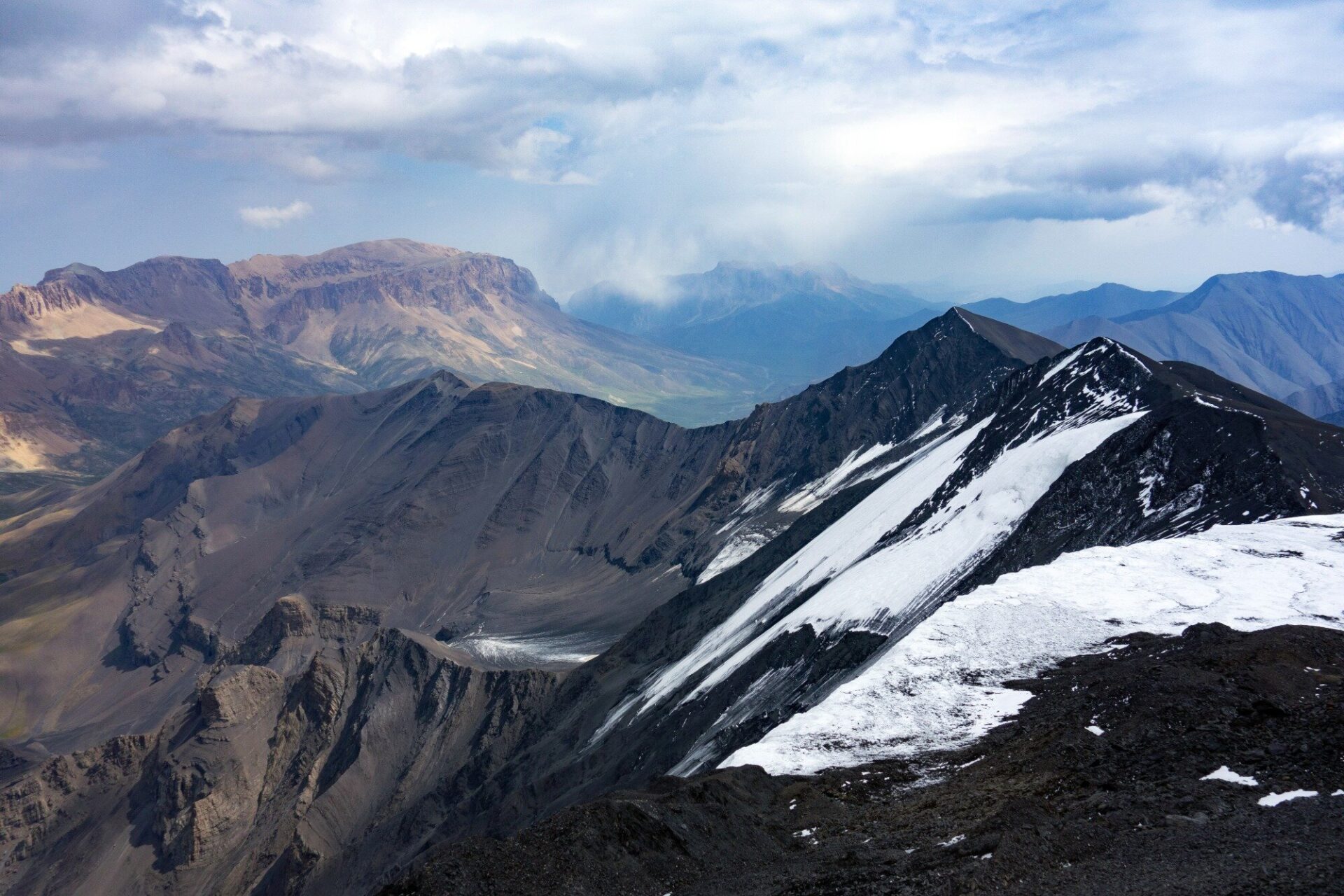
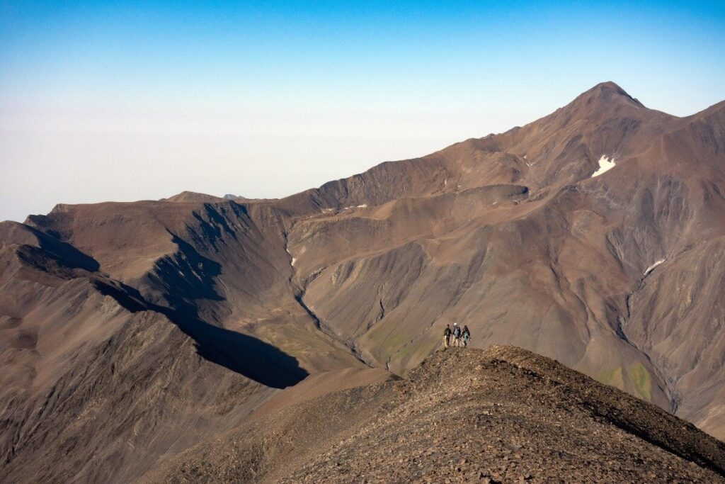
Overlooking the easternmost glaciers in the Greater Caucasus, seen from the summit of Bazarduzu, Azerbaijan’s highest peak.
‘It is very difficult to get a permit, so that’s why we don’t apply for one’. Our fixer and guide Tunar’s comment is a concise statement of Azerbaijani logic, yet it’s been three months since we received the last message from him. We were getting a little worried, as he’d previously planned to climb the infamous mountain Peak Pobeda in Kyrgyzstan. Relieved by a sign of life from Tunar, we finale the details of our expedition in the Azerbaijani Caucasus. We’re planning to climb four 4000m peaks, with an approach through an off-limits valley in the Shakhdag National Park. These mountains straddle the border of Azerbaijan and Russia’s Dagestan, making it a geopolitically sensitive area.
We’re on the road with an alpine club from Baku, of which Tunar Aliyev is the chairman. We set off from Azerbaijan’s modern capital city in an old, rattling Mercedes van across the dry plains, heading for the forested foothills of the Caucasus.
The base of our adventure is the hamlet of Qamarvan, where we stay in a mountain home owned by Igor Gagayev. He is a passionate storyteller and loves a good glass of vodka. He is, conveniently, the driver of the commander who runs the military border post that patrols the off-limits Yatakh Valley. Igor arranged ‘unofficial permission’ from the military commander to trek and climb in this unspoilt virgin river valley. Despite the commander’s consent, he advises us to pass the border post in the dark to avoid unnecessary delays. We get up in the dead of night and after we strap our packs on the rooftop of the rickety Soviet-era Lada, we head up to the start of the approach trek on a bumpy dirt track.
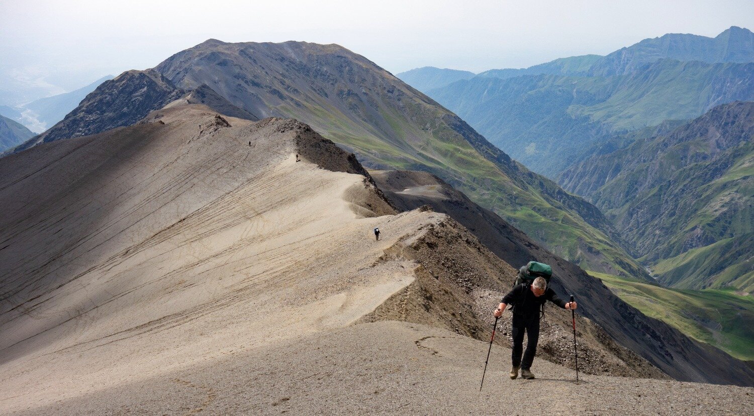
The brutal ascent of Bazarduzu’s south ridge. Azerbaijan’s highest mountain is located in a remote and geographically sensitive area.
We hit the trail with more than 20 kilos on our backs. The weight is mainly climbing equipment and food ratios for the six-day expedition. When we reach the military post, conversations are abruptly ended, we turn off our phones and head torches and we walk on the tips of our toes past the barracks. I’m relieved when we reach a small alpine meadow, out of sight and hearing from the border soldiers. First light trickles in and the contours of the mountains around us become visible. An indistinct path, sporadically used by shepherds and illegal hunters disappears into the dense forest.
Gradually we make our way through a pristine wilderness. We pass waterfalls without any barriers or warning signs, and cross crystal clear rivers from which we can drink without purification. Nature here is truly overwhelming. Via a small mountain pass, we are re-united with the Yatakh River, which has lost quite a lot of its volume at this altitude. However, the vertical relief of the river is considerable and at times it takes a while before we find a place to cross. Vertical cliffs on both sides of the river block our passage continuously. In total, we cross the river 16 times, sometimes hopping from boulder to boulder and sometimes it’s necessary to get the feet wet through the fast-flowing water. At an altitude of around 2400m we are reaching the tree-line, and continue our ascent on the boulder littered river bank towards our base camp.
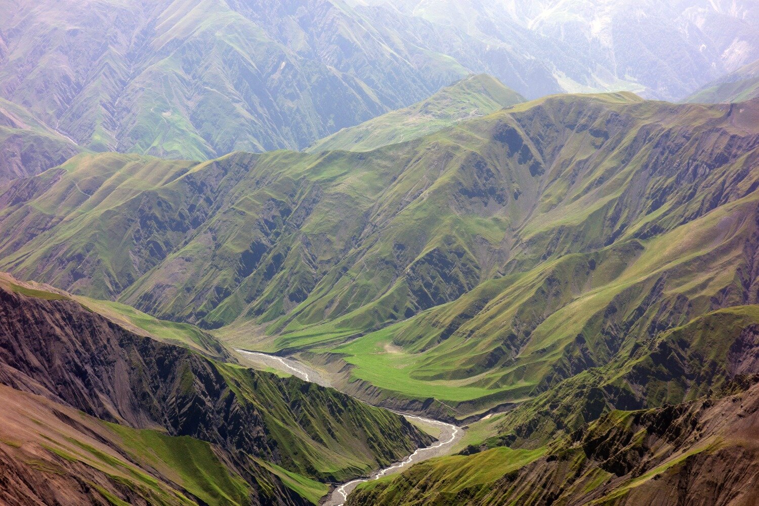
The wild, untouched border zone of Shadag National Park
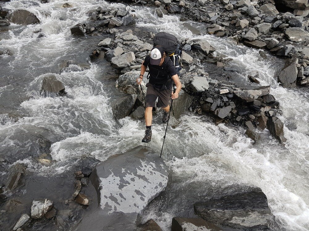
One of the many river crossing of the Yatakh River.
The first four thousand metre peak we aim for is the 4165m high Bazaryurd, invisible from our base camp. The approach to the ridge is steep, but Tunar doesn’t seem to care. Rather than zigzagging up he just scampers up the slope in a straight line to the craggy crest of the mountain ridge. The final ascent is messy pile of scree and boulders. We have to make a choice between a couloir with deep gravel and loose rocks or a section of scrambling on chossy, razor sharp slate rock. We choose the slate. In hindsight, it was perhaps not the best decision. The thin slate breaks off constantly and it’s hard not to cause some rock fall. Our Azerbaijani friends head up the gravel route, which is more strenuous but definitely safer. After an hour of meticulous climbing my climbing buddy Twan and I reach the top of the ridge and we can see our objective Bazaryurd, still far away.
The landscape up here is barren and bleak. It’s the end of the summer and most snow has disappeared. The terrain is not much better than below. Lots of scree is exchanged for instable rock formations. We climb for three hours and are treated to a very exposed, knife-edge ridge before arriving on the summit. On the top of Bazaryurd, Tunar is waiting with what appears to be a champagne bottle. This is indeed the case. It contains a note that he left on the mountain in 2013! We are waving the Azerbaijani flag on our first four thousand metre summit of the trip.
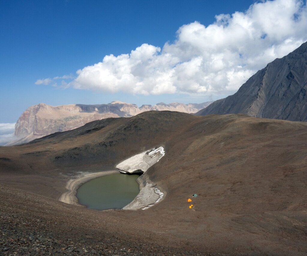
The next morning we wake up a little jaded from the tough day of climbing on Bazaryurd. Although we are not climbing any peaks today, it may be even a more strenuous day than yesterday. Our goal is to set up a high camp at a small glacial lake at 3600m on the main ridge of the Caucasus that separates Azerbaijan and Russia’s Dagestan. It sits between Azerbaijan’s highest mountain, Bazarduzu, and two remote 4000m peaks just to the west. According to the map the lake is situated on Russian territory, but we accept the minimal risk that a Russian border patrol will make it up this high. From base camp we climb out of the valley with our full packs, again on dizzyingly steep terrain. At 3300m we stash some climbing equipment and food. Previously we could see that the glacier between the two western peaks, Gora Ragdan and Charundag, has almost vanished, making some of our hardwear dispensable.
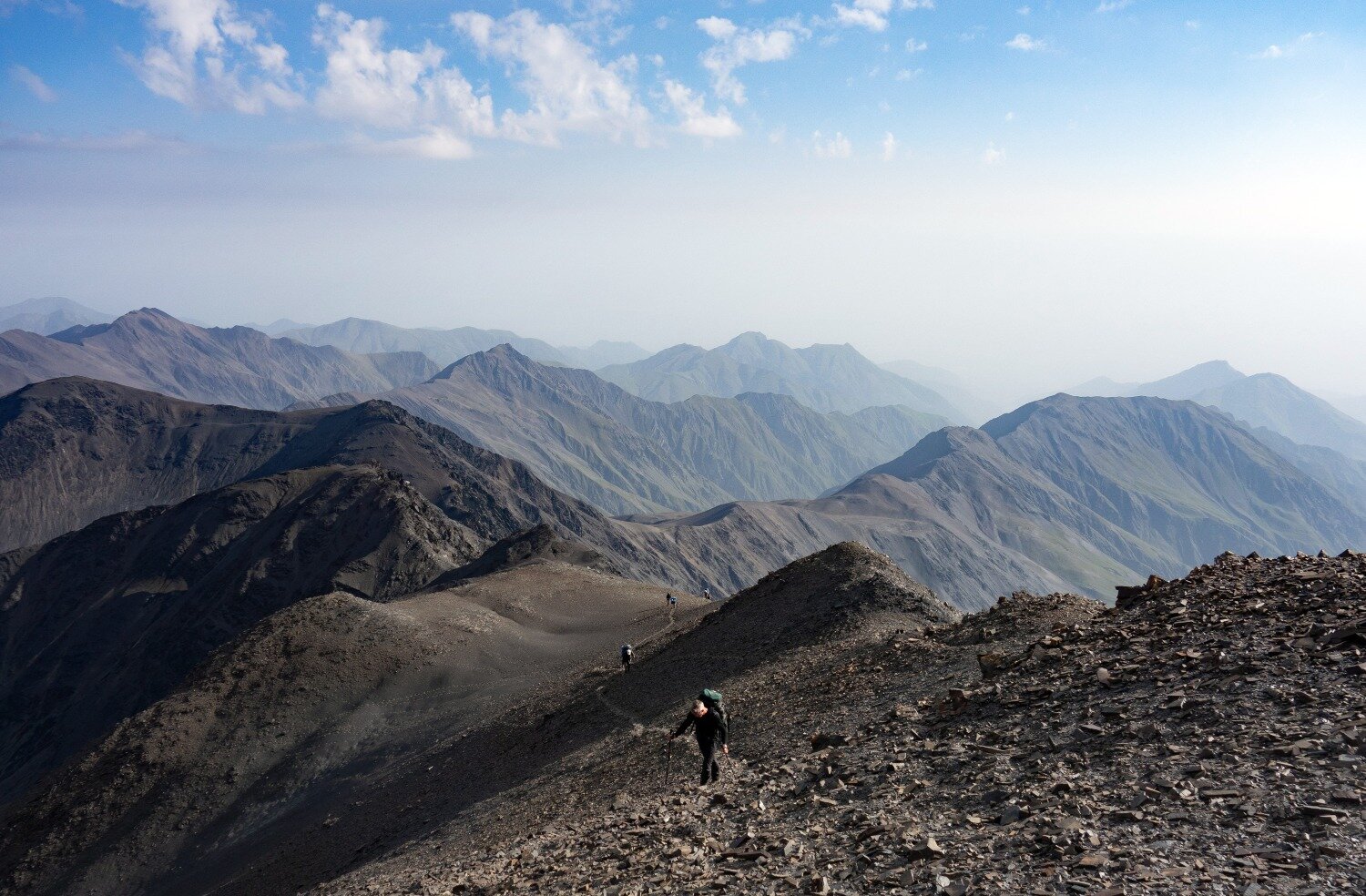
A fairly new way of categorising an expedition is measuring the level of enjoyment during and after the trip. Type 1 fun is enjoying the trip during and after. Type 2 fun is essentially being miserable while doing it, but it’s fun in retrospect. Day three of our expedition falls in the latter category. We’re looking up at the immense south buttress of Bazarduzu. It’s going up and down and looks utterly daunting. With a deep sigh we start the ascent of the remaining 1100 vertical metres. It’s like climbing a volcano. With each step in the deep gravel we slide down half a step again. We reach the first false summit and see how the ridge narrows and steepens. The next hurdle is today’s crux and perhaps of the entire expedition: a grade 3 scramble on rotten slate.
On the last 1100 metres of Baraduzu, with each step in the deep gravel we slide half a step down again; and on reaching the first false summit, all we can see is how the ridge narrows and steepens
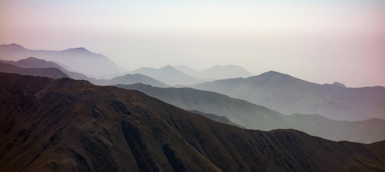
The layered ridges of the Azerbaijani Caucasus stretching into the distance.
The pathless wilderness, the uncertainty about the routes, and the unusual, remote location made this journey a proper adventure
Without a heavy pack and stable rock this climb is a walk in the park. It’s only a short climb, but left and right of the small saddle below is a 500-metre precipice. With sweaty palms, I try to find solid enough rock to hold on to. We are forced to solo this section, as there is no stable rock for an anchor. Besides that, the slate is razor sharp and would probably cut through a climbing rope. I’m relieved when the entire team makes it up without a scratch, but I do start to question the level of risk we are taking.
None of the other team members seem to be impressed by the climb. Perhaps I have become more risk-averse, now I’m a father of two young boys? Or is it my increased level of experience in the mountains that sharpens my risk assessment?
By the end of the afternoon we step onto the watershed between Russia and Azerbaijan. We’ve been moving for more than ten hours now and gradually daylight is fading. In the far distance on the Russian side we can see the village of Kurush. Situated at 2480m it’s Europe’s highest permanently inhabited settlement. The final descent on gravel is bliss as we “ski” down to our high camp where we pitch our tents just before the night falls.
The border mountains west of Bazarduzu are stark. Glaciers that used to cover the northern slopes are demoted to small patches of ice and will soon be gone forever. Still, all these different shades of brown and grey are beautiful in their own right, especially in the soft early morning light. The route to Gora Ragdan (4020m) and Charundag (4078m) is about 12km – one way. Tunar is ambitious. He hasn’t done these mountains before, and he wants to climb them both in one push. When we left our camp at 7am, I already decided that I would stick to one mountain. None of the team members know the route and we started far too late for an epic summit day like this. The first few kilometres along the broad ridge are easy and pleasant and I realise that yesterday I climbed with my head down the entire day. The views left and right across the Azerbaijani Caucasus and Dagestan are phenomenal. We can see our entire route to the cone-shaped Gora Ragdan in the far distance. The mountain looks like a dormant volcano. The ridge narrows and we are facing a short but very dicey section where the slopes on both sides drop hundreds of metres with an incline of at least 50 degrees. And again, that damned broken slate under foot.
We find a line just underneath the top of the ridge that seems safe enough to cross. Carefully we place our feet at what we hope is stable enough rock and without major problems we find solid ground again. The team re-groups at a small plateau. In my mind, I’m doing my maths on today’s objective. It’s 11am now. So far we’ve been on the move for four hours now, without breaks. I estimate the summit of Gora Ragdan to be another hour and a half of climbing on rotten, exposed rock. We could be back in camp by 6pm if don’t take breaks, about an hour before sunset.
“I’m heading back” I’m telling Tunar. He seems shaken by the announcement. “Why?” I explain that I feel that the terrain is simply too dangerous. I want to be back in camp before dark and above all climbing Azerbaijan’s highest mountain Bazarduzu is much more important to me than these other two mountains. Twan agrees and after a short break we traverse back to our camp. Tunar and two other team members continue their climb, knowing that they will have to make their way back in the dark. I feel we made the right decision.
I turn on my head torch and check the time. 11pm. Twan is also still awake. “Have you seen them coming in?”. “No.” I am very worried. They have been climbing for 16 hours now, of which four hours in darkness. What if one of them has fallen off the ridge? A fast rescue operation is impossible as there is no mountain rescue in either Dagestan or Azerbaijan. Attempting a rescue ourselves is not an option either. The slopes are too steep and the rock is too brittle and instable. I turn and turn in my sleeping bag and finally hear voices just past midnight. The three men stumble into camp, completely exhausted – but okay.
I wake up to the soft sound of snow falling on our tent sheet. The rest of the group is still asleep. Twan and I decide to pack our stuff and start our summit attempt up the 4465m high Bazarduzu. Clouds envelop the mountain, but occasionally the top of the peak reveals itself and we notice there is a dusting of snow around its summit. The climb looks incredibly steep and we scan the west face of the mountain for a feasible route up to the broad summit plateau. We leave the snoozing camp behind and zigzag around the soft gravel. The ascent feels good, we are well acclimatised and the packs feel much lighter. After four hours of sustained climbing, we reach the remains of a weather station on the highest point of Azerbaijan. Towards the east the vertical walls of the mountain Shakhdag rise up from the lowlands of Dagestan. The north face of the Bazarduzu summit ridge is plastered with the most easterly glaciers in the Caucasus Range. And to the west we can see the high Caucasus in Georgia, partly engulfed by clouds. There’s a brisk, cold wind and it’s time to start our almost three kilometre vertical descent back to Qamarvan via the broken terrain of the south buttress, the wild Yatakh Valley, and again a nerve-wrecking passage of the military border post.
Technically the climbing we encountered was terrible. The terrain was difficult to access. The combination of gravel, rotten slate and steep ground made the expedition hard going. But the pristine wilderness, the uncertainty about the routes, and the exciting geographical location made this journey a proper adventure; the kind of adventure that is becoming increasingly rare in our age of advanced technology and ever-increasingly human infrastructure in the mountains.
Don’t miss a single adventure
Sign up to our free newsletter and get a weekly BASE hit to your inbox
Other posts by this author
Story • Jan Bakker • Dec 15, 2022
Connecting The Dots of The Pamir Trail
An exploratory trek along the southern Pamir mountains to create a long distance hiking trail across Tajikistan
Story • Jan Bakker • Jul 27, 2022
Dusty Trails and Hidden Waterways
Bikerafting the wetlands of Mabamba Bay
Story • Jan Bakker • Jul 21, 2020
A Muddy Walk through the Mountains of the Moon
Tales from deep within the UNESCO listed Rwenzoris mountain range.
You might also like
Story • Kieran Creevy • Jun 16, 2023
Scrambling Before Scran on Scotland’s Misty Isle
Sun-drenched ridge lines with expedition chef Kieran Creevy on the Isle of Skye
Video • BASE editorial team • Jun 02, 2023
How To Clean And Care For Hiking Boots
Our top five tips to give your hiking boots a 'glow up'
Video • BASE editorial team • Mar 30, 2023
How To Break In Leather Walking Boots
5 fast hacks for breaking in your boots, beating the blisters and reducing the ankle rub
