Connecting The Dots of The Pamir Trail
Lines on the map. Lines that penetrate seemingly impenetrable mountains. I’m fascinated by them. When I started exploring trekking routes in the Pamirs back in 2009, the best available topographical maps were from the Soviet era. Maps that somebody had fortunately taken the effort to scan and publish on some obscure corner of the internet. I would spend hours digitally stitching these maps together, to then print and laminate them. In this day and age, we’re spoiled for choice. In recent years we’ve seen mapping applications pop up like mushrooms, riding the wave of the increased popularity of outdoor activities like hiking, biking and trail running. Using those apps for mapping trekking routes in one of the most remote mountain ranges on the planet however still seems a little ambitious.
Tajikistan is one of the most mountainous nations on the planet with a whopping 93% considered mountain terrain. For millennia shepherds have carved out an extensive network of pathways that connect valleys and mountain ranges. I had been researching routes for the Cicerone guidebook Trekking in Tajikistan for a number of years and creating a thru-hike seemed like the next logical step. It was something I’d been thinking about for a long time soo during one of the Covid lockdowns in 2020, I started working on connecting trekking routes throughout Tajikistan to create a long-distance hiking route, the Pamir Trail.
Rivers could be too big to cross, pathways may have been swept away by landslides or the pass may be impassable
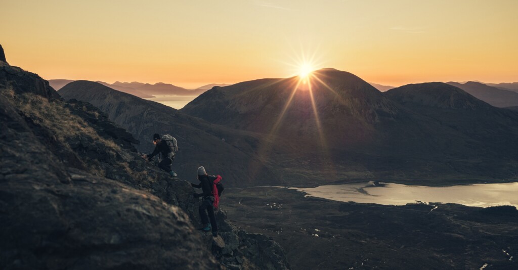
After a spectacular drive along the Pamir Highway, our recce team is dropped at the bottom of the Duzakhdara Valley. A local Pamiri friend chuckles when we share our plan to explore this particular valley, telling us its name translates as The Valley of Hell. But on the map it doesn’t look all too bad and it would make the perfect connection between the Bartang and Wakhan valleys, stitching up 15 stages in the southern part of the trail.
We spend the night in Duzakh, a sweet little village at 3300 metres. Fall has arrived and the leaves of the birch trees are vibrant yellow. It’s a stark contrast with the earthy colours of the mountains around us. This is the last settlement we will see for the next eight days.
Our route traverses a part of the Shugnan Range from west to east, a remote part of the Pamirs with a host of 5000m+ peaks. We are here to recce two high mountain passes we know very little about. The use of high-resolution satellite images and open-source maps gives us an idea what the terrain might look like. Still, rivers could be too big to cross, pathways may have been swept away by landslides or the pass may be impassable.
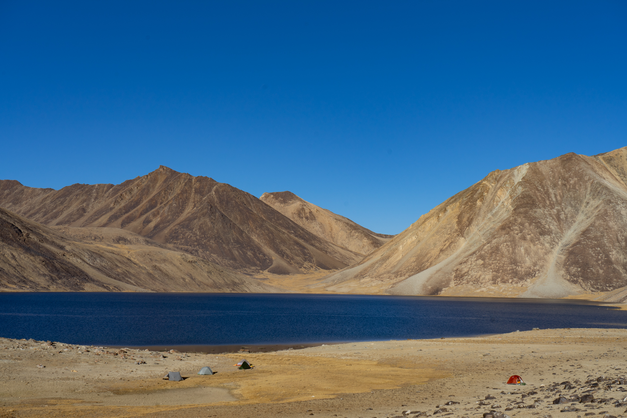
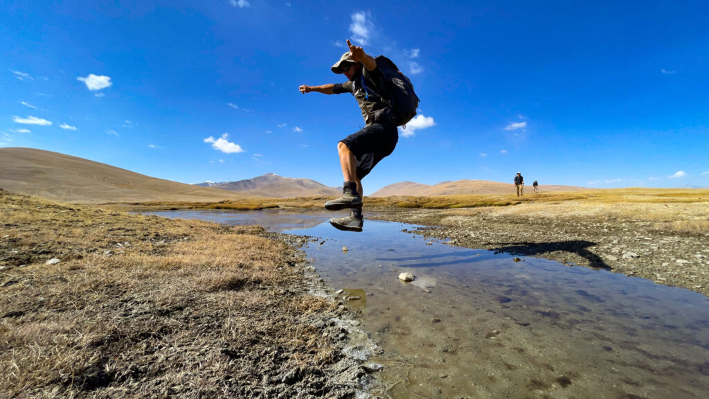
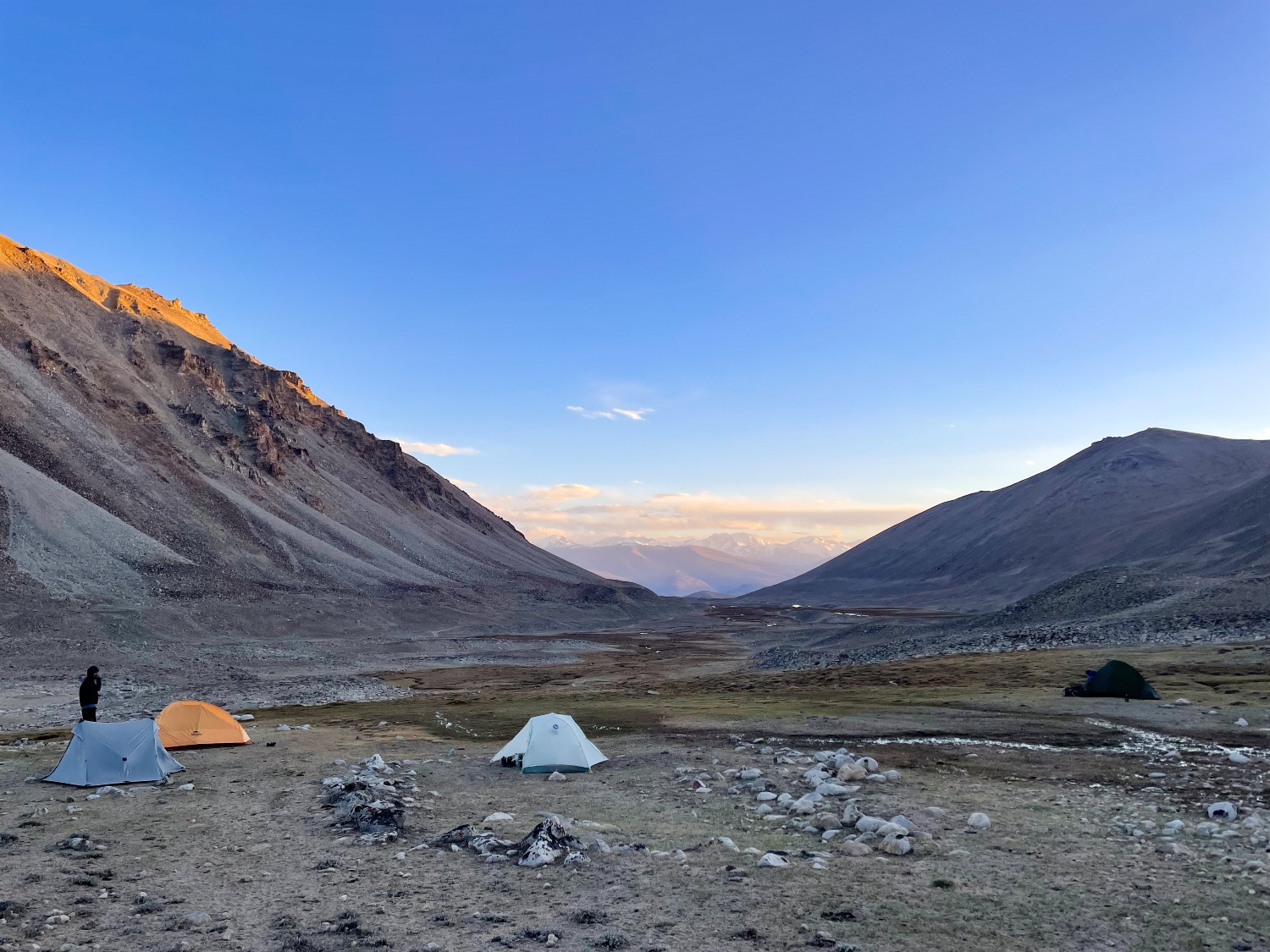
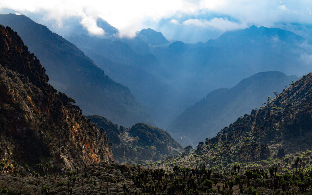
The first stretch of the Valley of Hell is not hell at all. The trail is marvellous, winding its way high above the valley floor. The side valleys on the opposite side reveal glaciated giants, each one reaching easily over 5000m in altitude and likely unclimbed. We pitch our tents on the sandy shores of a small glacial lake, despite the bear paw prints. In the late afternoon, with the sun touching only the top ridgelines, we spot a cloud of dust in the distance. A herd of Ibex plunges down an impossibly steep gully, not bothered by the boulders that are dislodged in the process. This valley is wild!
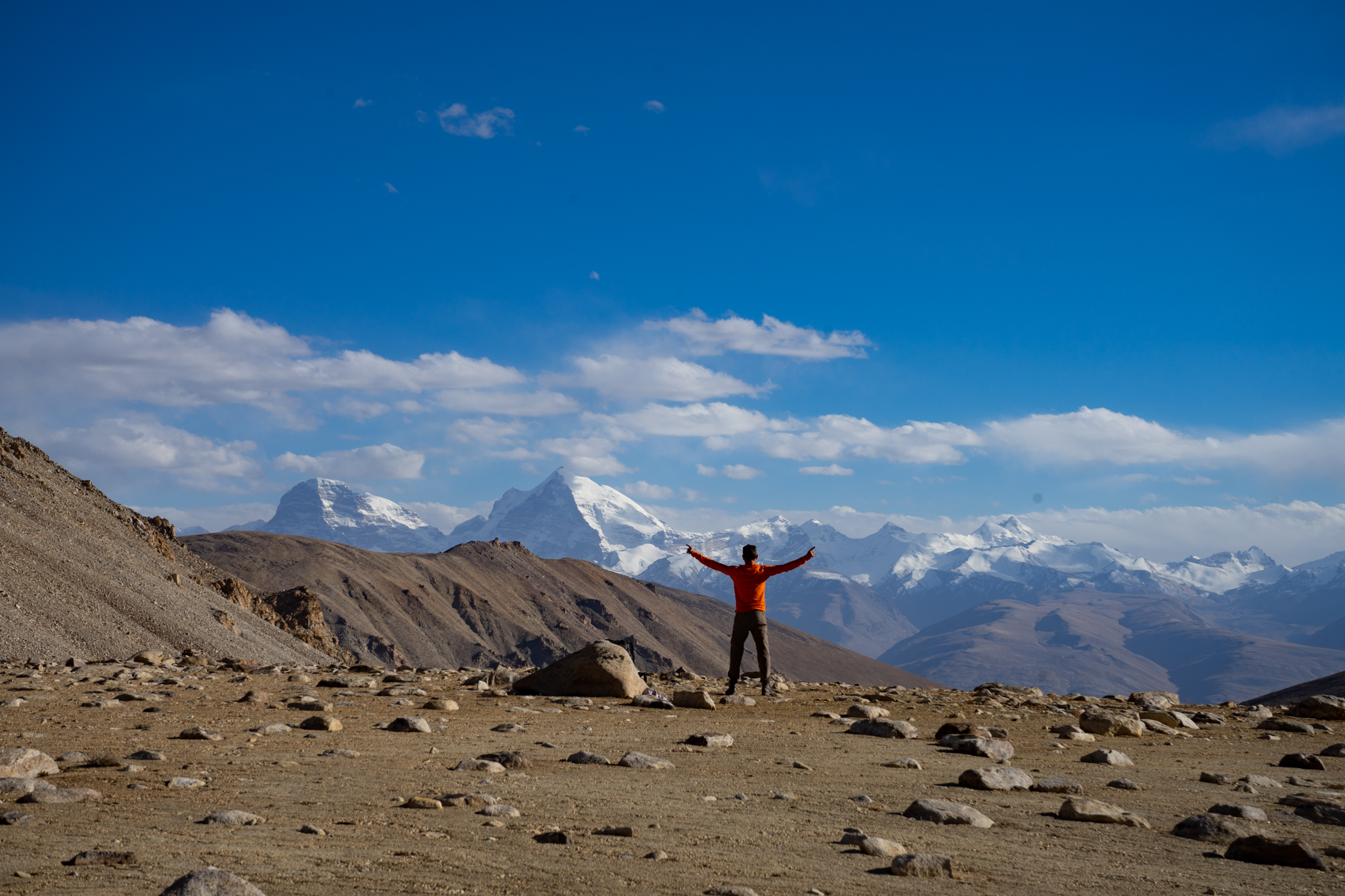
The approach of the Duzakhdara Pass, our main objective for this expedition, runs through a seemingly endless U-shaped valley. The only living creatures here are ourselves and a massive herd of yaks. Among the pack is a very agitated alpha male bull. It throws some charging moves at us, prompting us to make a detour behind a small ridge, out of sight. A vague path continues along a crystal-clear stream, taking us all the way to top of the pass. On the southern horizon looms the final frontier of the Pamir Trail, the Shakhdara Range with Pik Engels (6507m) and Pik Karl Marx (6723m) dominating the skyline. A small dip in the range marks the Vrang Pass, the final hurdle to the terminus of the trail at the Afghan border. The descent looks easy and I know we have succeeded in finding the missing link of the southern stretch of the Pamir Trail.
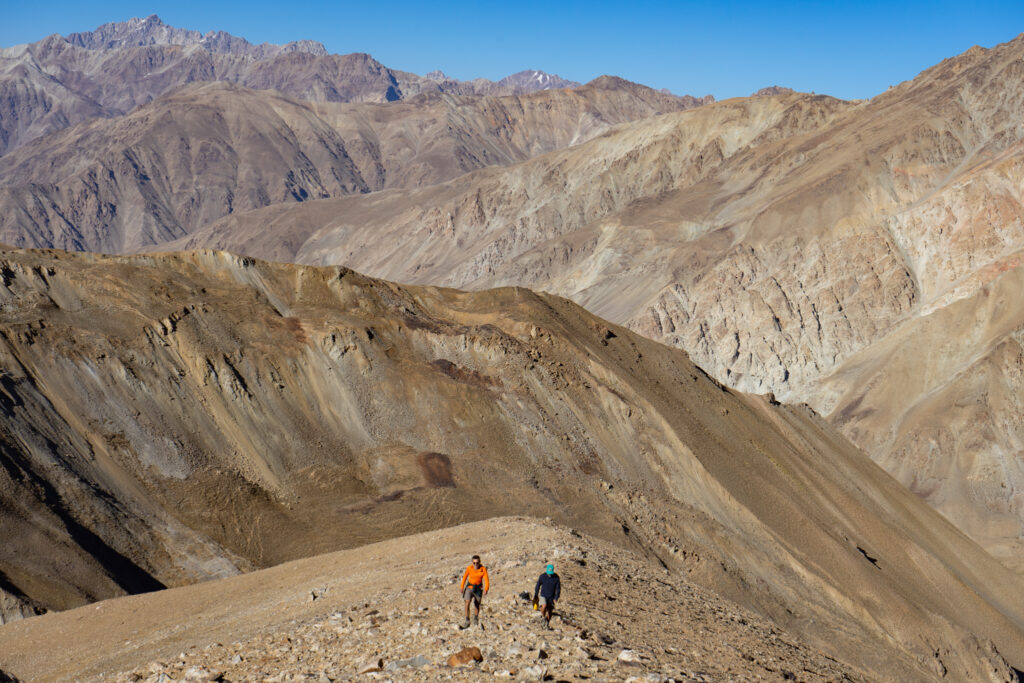
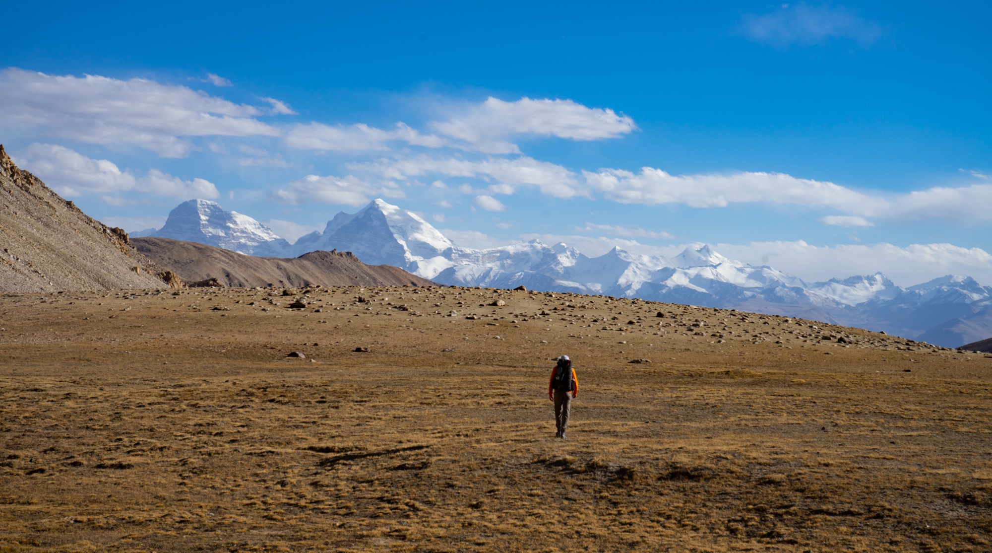
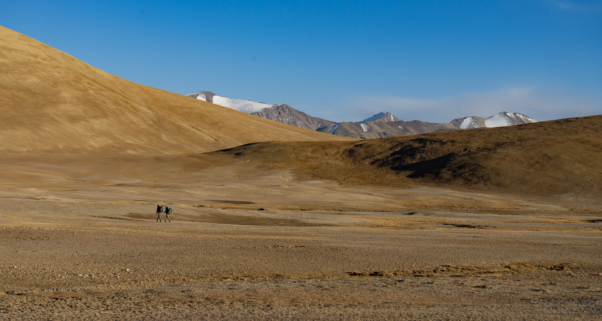
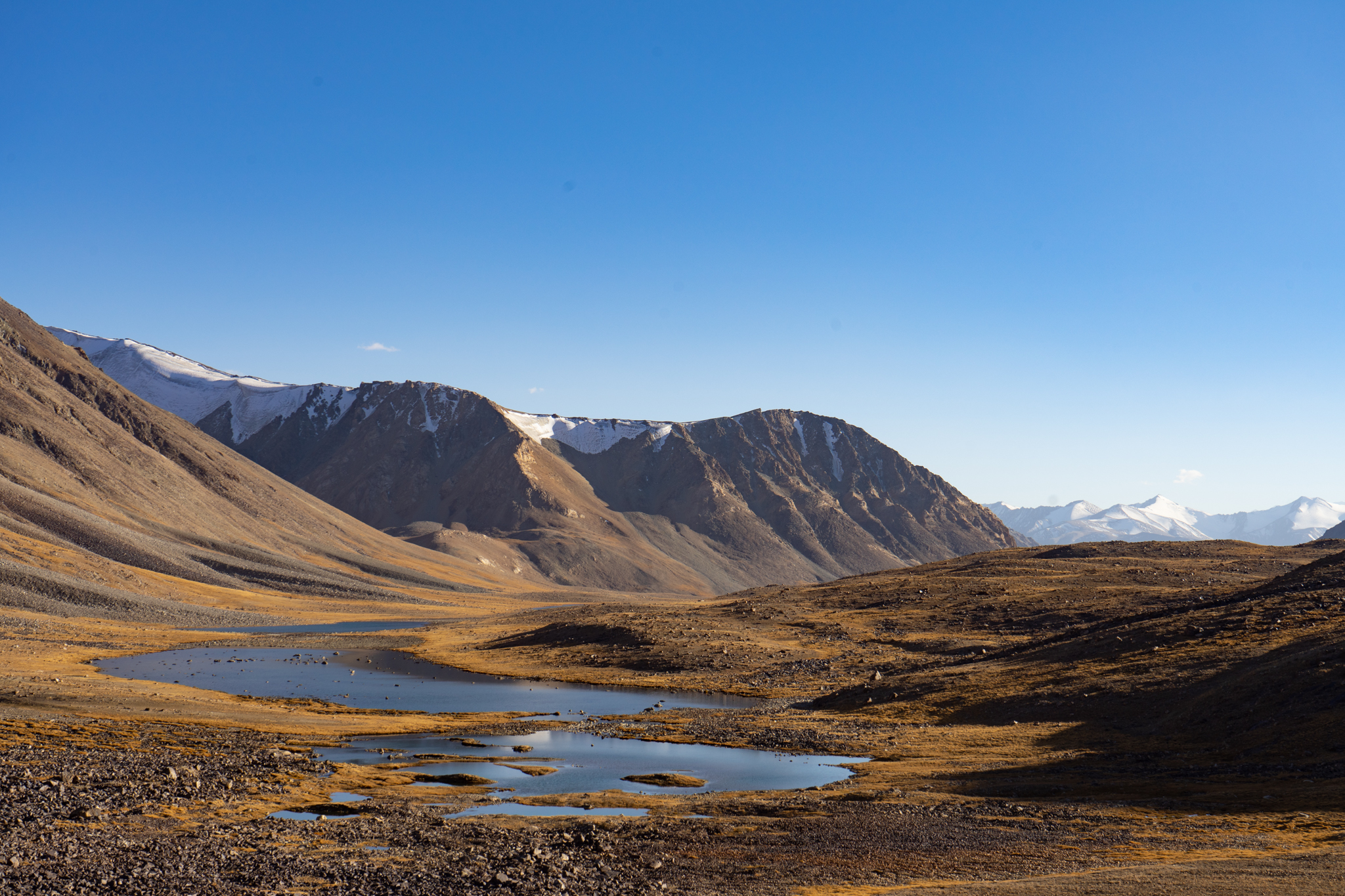
We’re headed east now towards another unnamed and unmapped pass of almost 5000m high. This pass could serve as a route variation in case the main route becomes impassable. The trail ascends up the vast high-altitude desert of the Murghab Plateau. The land is arid with snowcapped peaks, deep blue lakes and hardly any people. The altitude doesn’t drop below 3500m and at night it is bitterly cold.
We chose to do this trip in September, weather-wise possibly the most stable month of the year in the Pamirs. It’s also the month that night temperatures decrease dramatically. The stark surroundings of our camp are somewhat unsettling and makes us feel vulnerable. It’s our first night above 4000m and the mercury has plummeted to a bone chilling -10 Celsius, inside the tent. In the morning, the inner is plastered in a crust of ice. Nobody’s making a move until the morning sun hits the tents.
The inner is plastered in a crust of ice. Nobody’s making a move until the morning sun hits the tent
I realise that four weeks in the Pamirs has started to take its toll. The honest answer is that I’m not ok
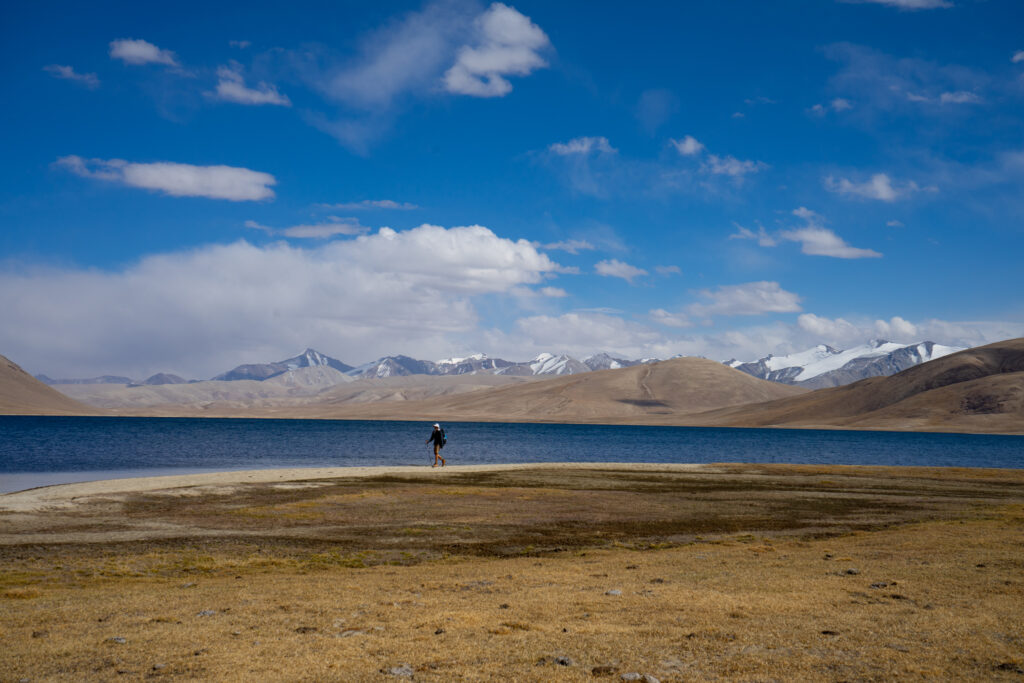
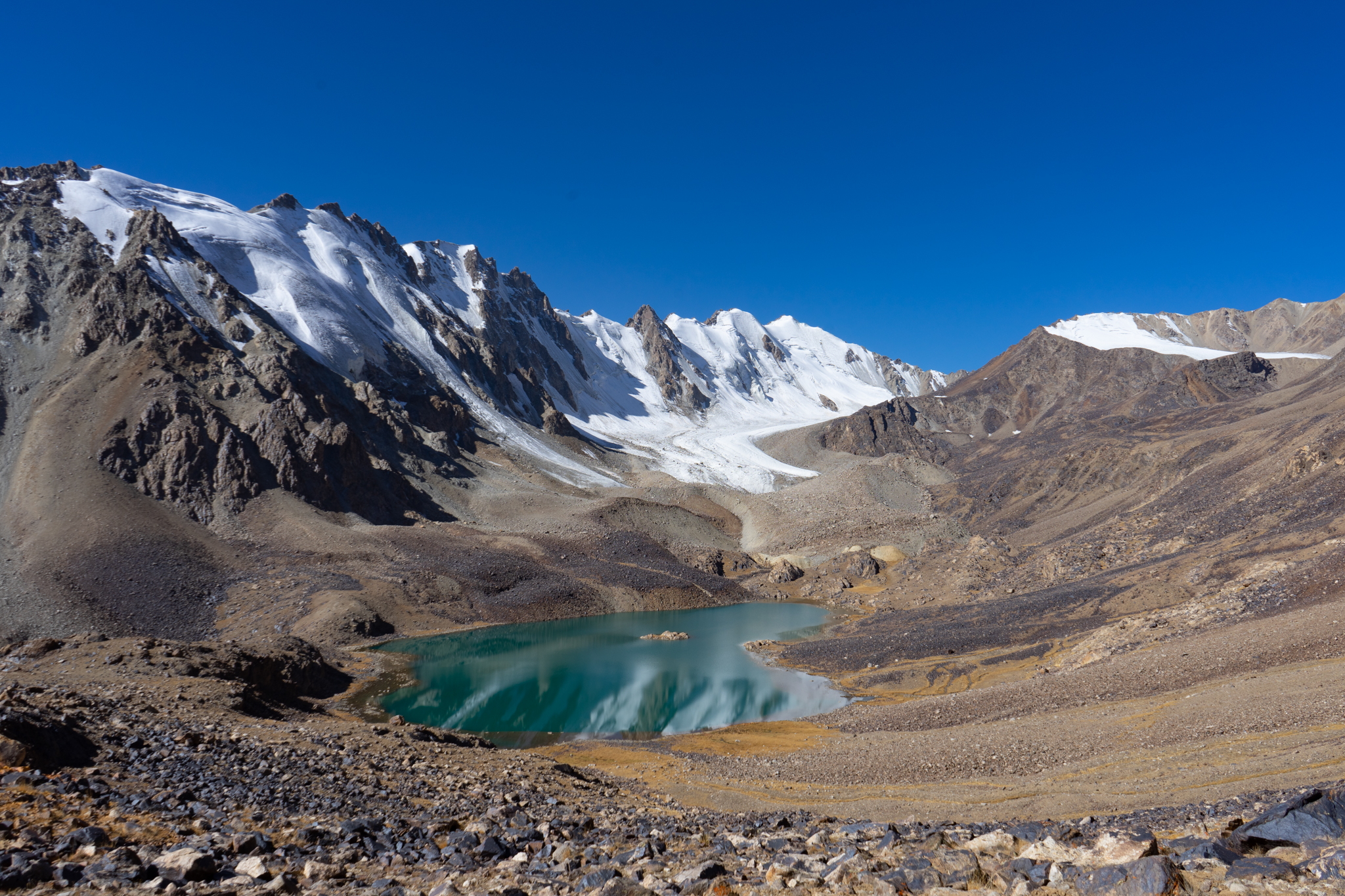
Up till now the mapping app has shown dotted lines we could follow. Now, we’re about to enter a valley with no hiking routes marked and an unnamed pass of 4770m high. The topo map shows contour lines, a few mountain lakes and glaciers. We’ll rely on these features to navigate and make the crossing of that pass. The highest lake at the foot of the pass, Oqkul, looks brilliant and we decide to set up camp for a couple of nights to explore the area.
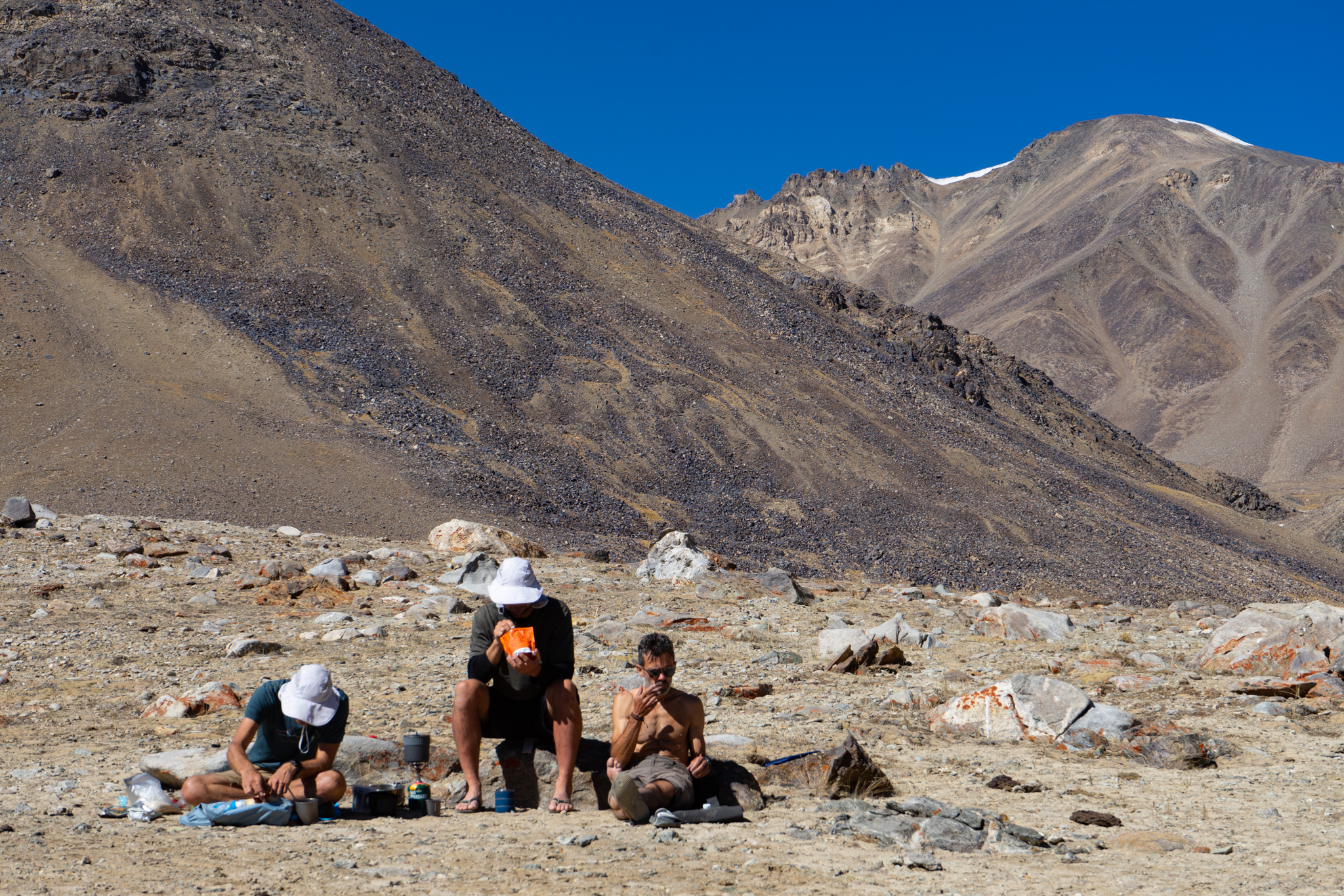
We have our eyes on a 5300m high peak, with what seems like a doable approach. As we get closer, we realise that the climb to the final ridge is steep with loose, rotten rock. Not worth it. In front of us is a long glacier that winds its way up to another high ridge. That seems much more feasible and attractive.
Out of the blue Kim, probably our strongest team member, asks me whether I’m ok. I have been moving very slowly this morning, and not feeling fit at all. I’ve been pushing away the fatigue by simply denying it, but being confronted by Kim’s question I realise that four weeks in the Pamirs has started to take its toll. The honest answer is that I’m not ok. I turn back as the rest of the team shuffles up the glacier. I stumble back to our camp, crash inside my tent and allowing my body to surrender to the fatigue.
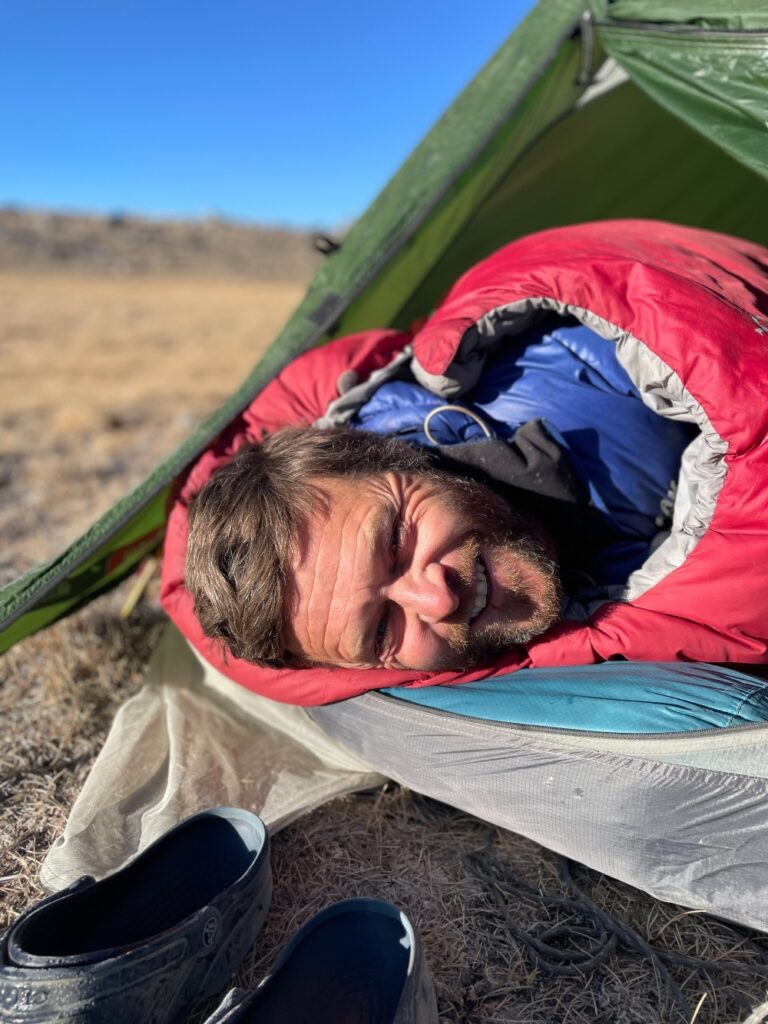
After a 13-hour night in the sleeping bag I feel a bit better, psyched for the grand finale. The pass looks fairly easy, despite the lack of trails. It’s a long day to our final destination, a desert settlement called Bulunkul. This is officially the coldest inhabited place in Central Asia with a recently recorded low of -65 Celsius.
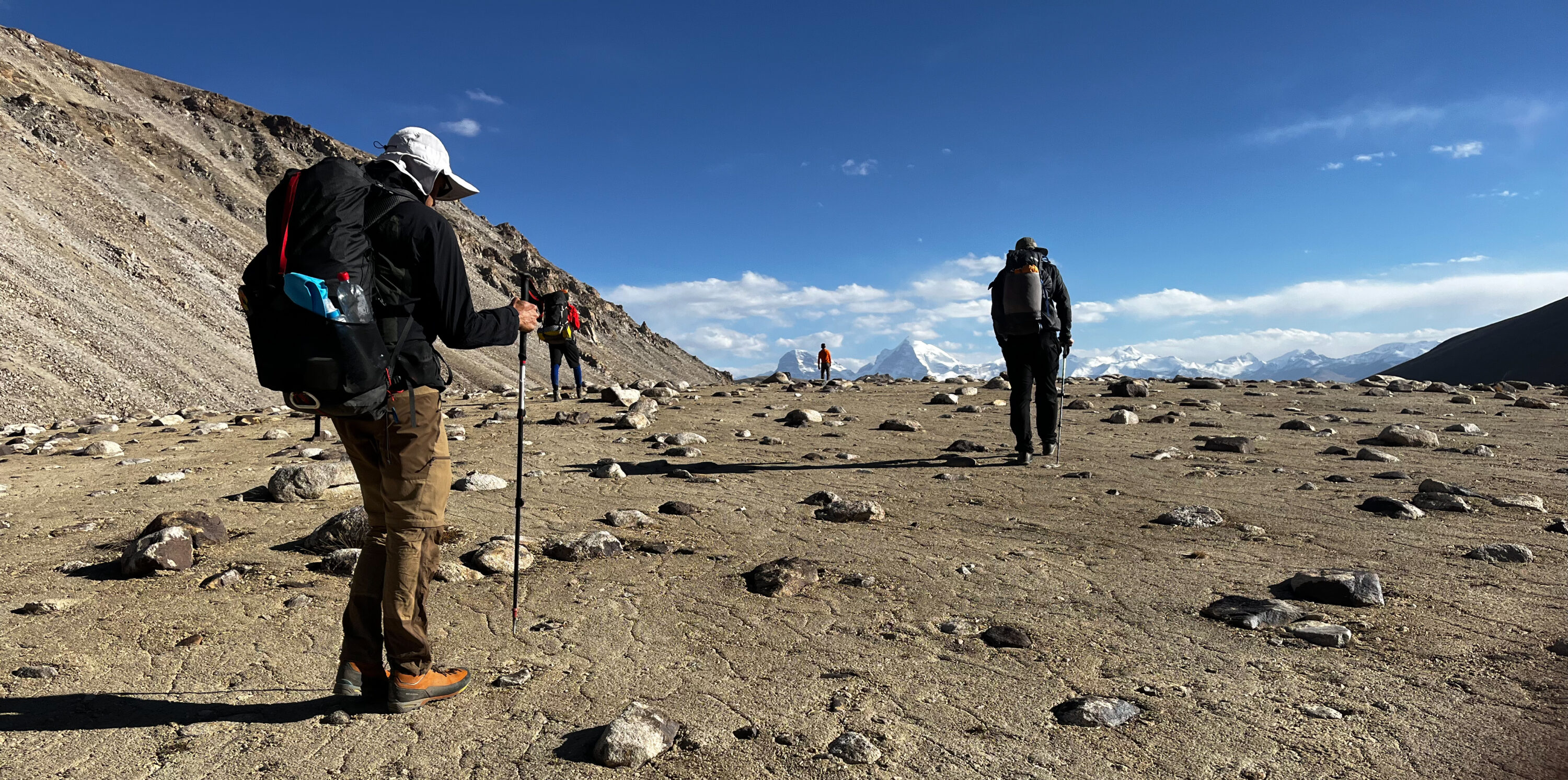
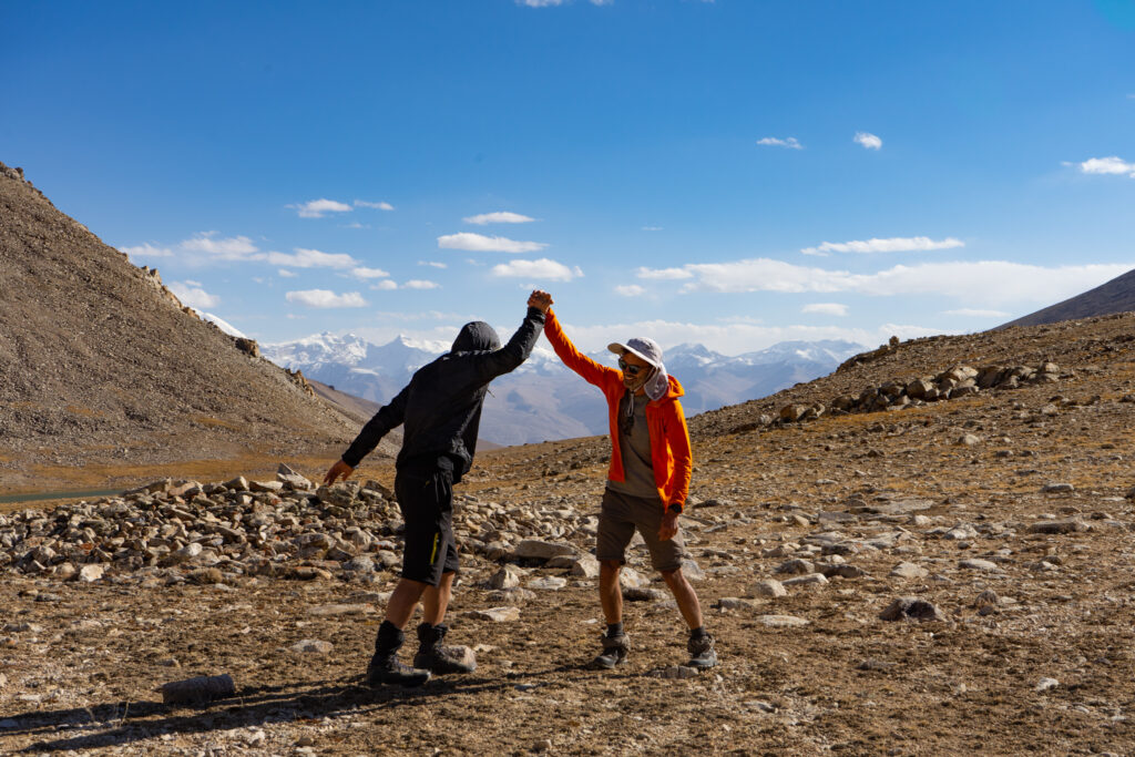
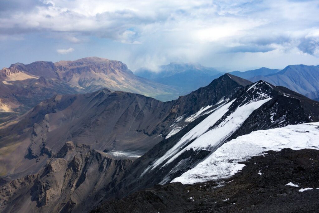
After an easy climb we reach the top of the pass. We look across the endless desert plain of the Murghab Plateau with a distinct white pyramid poking out on the horizon. That must be Kongur, an almost 8000m high peak in Chinese Xinjiang and the eastern boundary of the Pamirs. We did it. We found a second hiker’s passage between the Bartang and the Wakhan valleys, once more connecting the dots of another section of the Pamir Trail.
As it stands, the team have mapped 58 stages covering upwards of 850km of trail but there are still 20 more stages to connect. When complete, the Pamir Trail will link together more than 1000km of hiking trails across the mountains of Tajikistan. You can find more information on the Pamir Trail project here.
Don’t miss a single adventure
Sign up to our free newsletter and get a weekly BASE hit to your inbox
Other posts by this author
Story • Jan Bakker • Jul 27, 2022
Dusty Trails and Hidden Waterways
Bikerafting the wetlands of Mabamba Bay
Story • Jan Bakker • Jul 21, 2020
A Muddy Walk through the Mountains of the Moon
Tales from deep within the UNESCO listed Rwenzoris mountain range.
Story • Jan Bakker • Mar 03, 2020
Jigsaw of Broken Slate
Exploratory climbing on the roof of Azerbaijan
You might also like
Story • Kieran Creevy • Jun 16, 2023
Scrambling Before Scran on Scotland’s Misty Isle
Sun-drenched ridge lines with expedition chef Kieran Creevy on the Isle of Skye
Video • BASE editorial team • Jun 02, 2023
How To Clean And Care For Hiking Boots
Our top five tips to give your hiking boots a 'glow up'
Video • BASE editorial team • Mar 30, 2023
How To Break In Leather Walking Boots
5 fast hacks for breaking in your boots, beating the blisters and reducing the ankle rub