West by Northwest: Lundy Island by Standup Paddleboard
Feature type Story
Read time 12 mins
Published Apr 12, 2023
Author David Pickford
Photographer David Pickford
About 12 miles off the North Devon coastline sits a small granite outcrop known as Lundy Island. Derived from the Old Norse for Puffin, its name hints at its turbulent past occupied by various groups over centuries including Vikings and also pirates. In the Middle Ages, Lundy was a centre for wool production, and during the 17th century, it became a base for privateers and smugglers. An island steeped in folklore, its history is peppered with tales of treasure and ghosts.
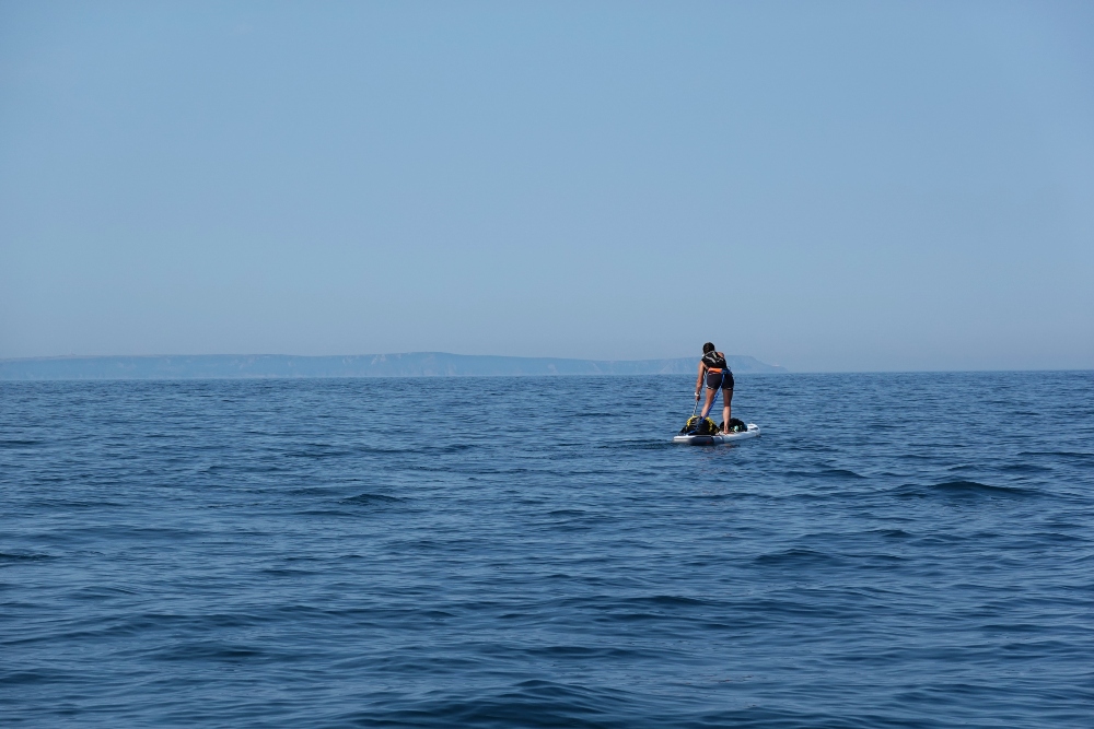
Today, Lundy’s rugged cliffs and picturesque coves are a designated Site of Special Scientific Interest known for its large populations of puffin and seal, a popular destination for wildlife enthusiasts, and those seeking a remote and peaceful getaway. But while tourists make the voyage to this small island by ferry each year, in the summer of 2022 David Pickford, along with a select group of paddlers, set off on standup paddleboard to cover the open water crossing.
We left home at the crack of dawn. It’s always the best time of day to set off on a proper mission; that heady mixture of coffee and bleary-eyed adrenaline fires you up every time. And today we needed to catch the early morning ebb tide to reach our destination: a small island off the North Devon coast, marking the intersection of the Bristol Channel and the Celtic Sea.
The road northwest was empty and silent. Crows and buzzards circled over dead-still treetops under a blood-orange sky. There was barely a breath of wind: a large high pressure system had hovered stubbornly over Britain for the past few weeks, creating textbook-perfect open ocean paddling conditions.
The small cove at Lee Bay was mirror-smooth when we arrived. A few gulls floated lazily, like specs of dust on molten glass. Far out in the bay, the tell-tale lean on a lobster pot buoy confirmed what we already knew. The ebb tide had just started to flow, and would speed our progress westwards into this perfect summer’s morning and the heart of the sea.
The idea of getting to Lundy on a standup paddleboard completely unsupported had been much discussed within the small team of SUP enthusiasts I paddle with regularly. We knew that the island had been reached before on a paddleboard, by long distance paddler Fiona Quinn, on her Land’s End to John O’Groats trip. Fiona – probably very wisely – used boat support for the sea-based section of her trip. As far as we knew, whilst the trip gets done regularly by experienced sea kayakers, nobody had paddled to Lundy unsupported by SUP before.
Too much wind from either the north or south might create a scenario where you could miss the island completely. And that would probably not make for a good day out
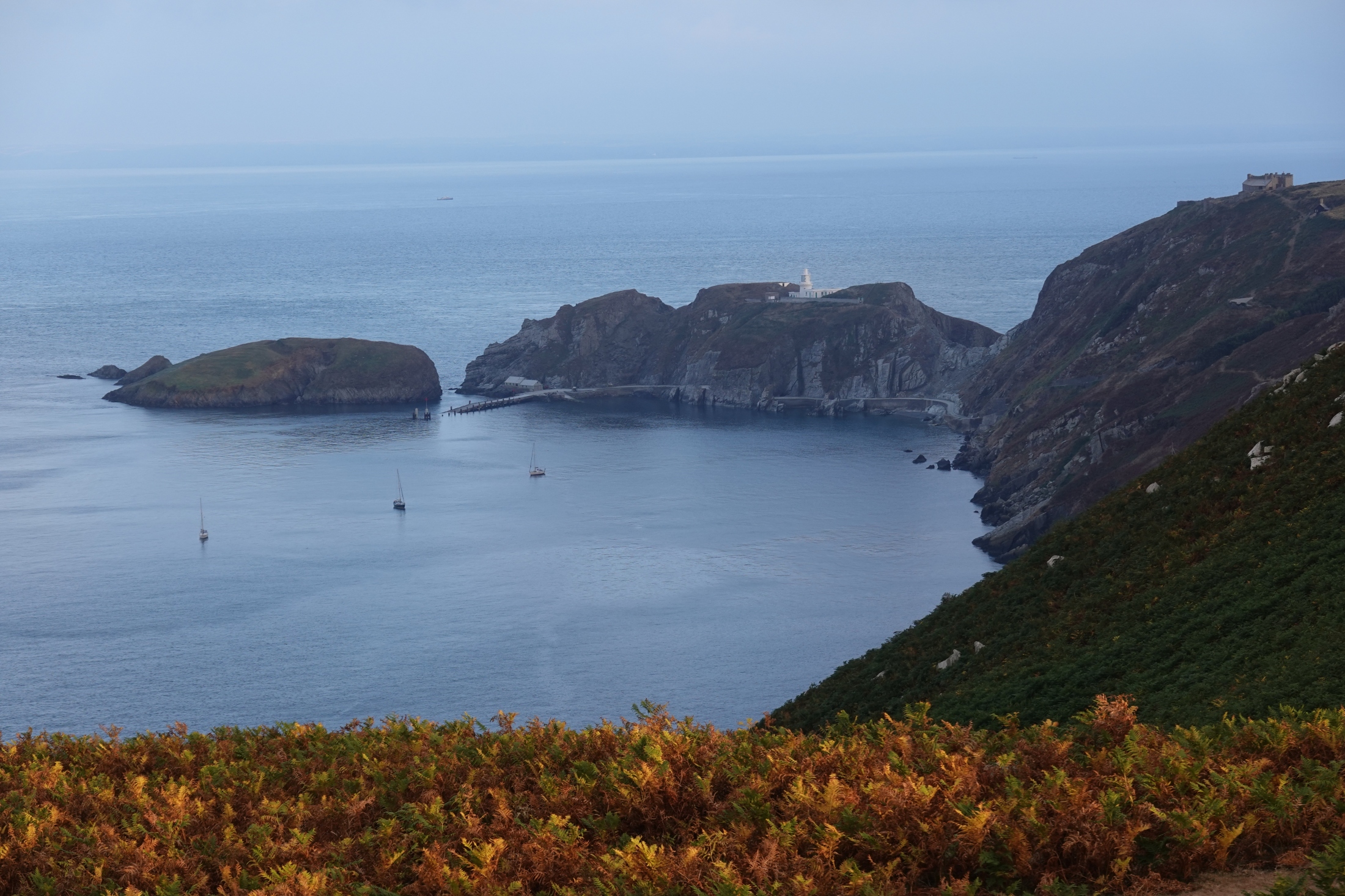
Lundy is a remarkable little island. It was England’s first statutory Marine Nature Reserve, and has its own endemic species of cabbage. It also sports an extremely colourful history involving plenty of piracy, Ottoman occupation, and a crackpot one-man monarchist movement by a chap called Martin Coles Harman in the 1920s, which featured a new coinage system organised in denominations of ‘Puffin’; he was fined five pounds and fifteen guineas by the House of Lords, but he kept his spurious claim to being ‘King of Lundy’.
It’s a full 35 kilometres, or just under twenty miles, from Lee Bay to the landing beach on Lundy’s southeast point. It’s a decent distance, and makes this a fully committing offshore trip; once you’re being carried westwards out to sea in the tidal stream off Bull Point, which marks the western end of the Exmoor Coast, you’re definitely not going back to England until the tide changes direction. At the same time, the strong tidal current certainly helps your progress west.
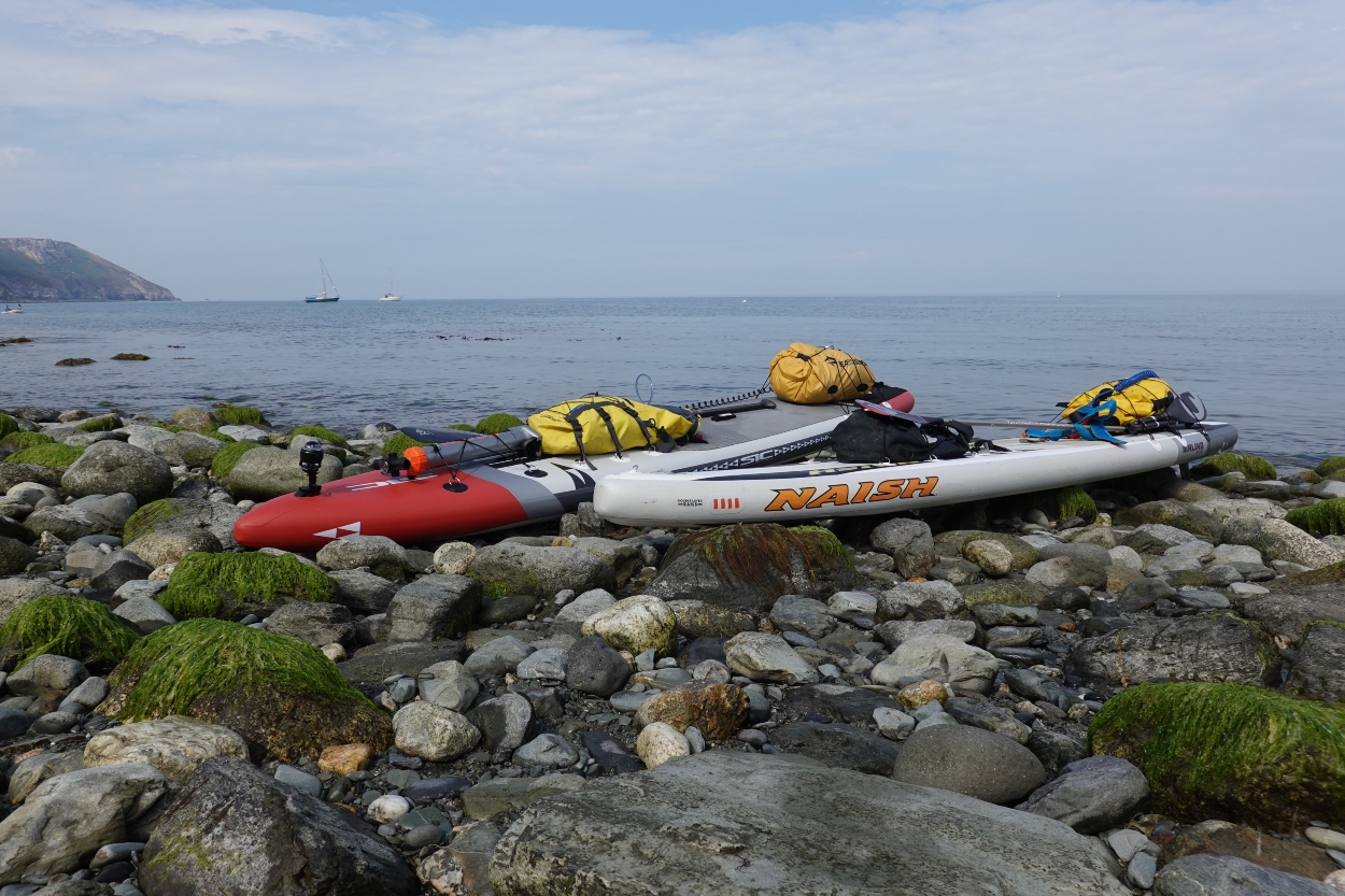
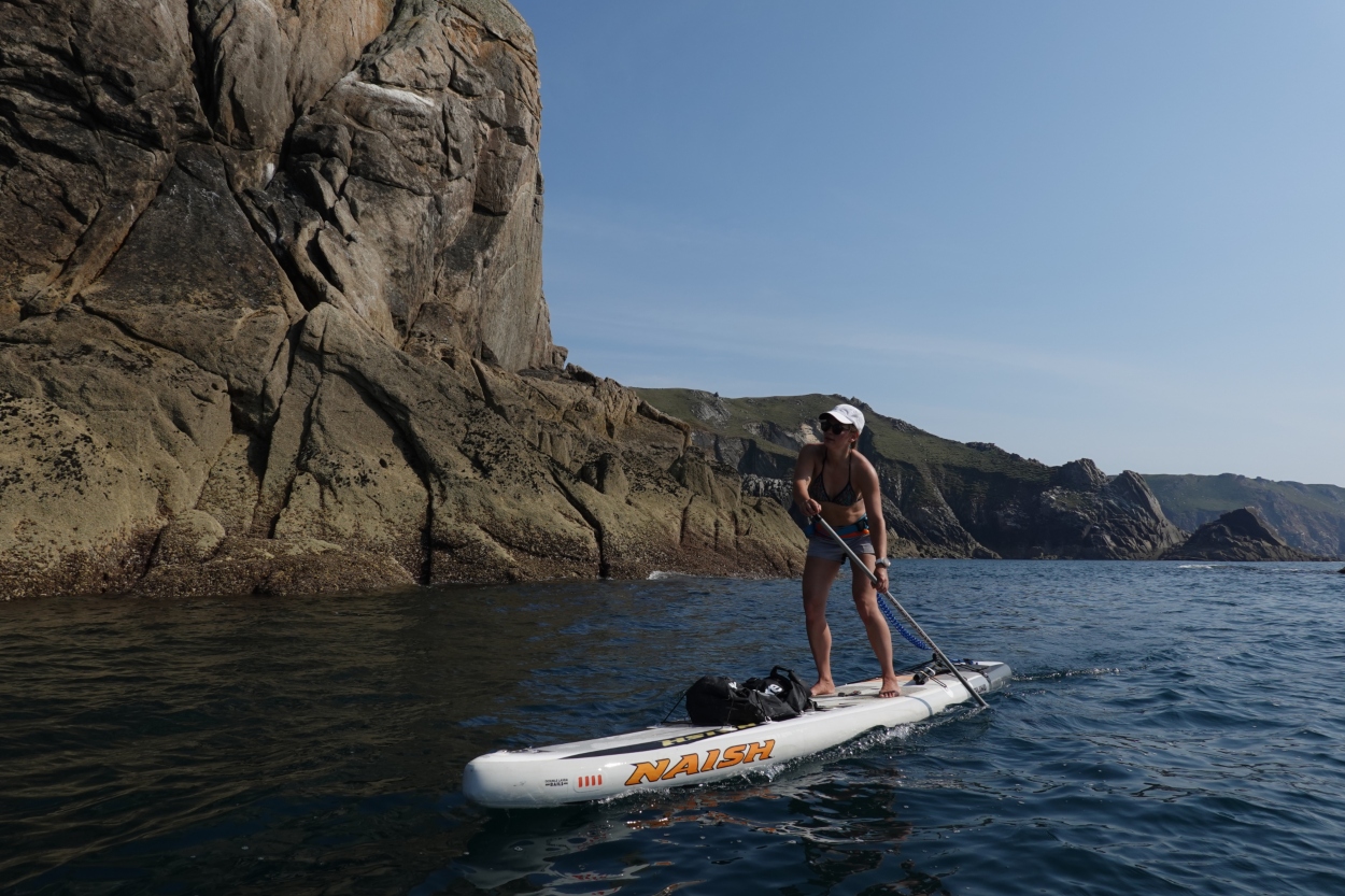
The paddle out to Lundy is a famous trip by sea kayak, and in good conditions it’s a fairly straightforward paddle for the experienced. SUPs, however, are not only considerably slower than sea kayaks but they’re also a great deal more affected by the wind. The additional leeway (the technical term for the degree to which the wind blows a vessel sideways through its forward progress) is several orders of magnitude higher on a SUP. We realised that a key factor in pulling this voyage off would be to take advantage of a day of very light wind, ideally less than 5 knots, and with minimal swell.
Another complicating factor is that the tidal stream doesn’t flow exactly westwards towards Lundy from Lee Bay, but rather west-south-west. For this reason, you need to use a northerly tidal vector (a correcting angle of course) on the initial 10 kilometres to put yourself in the right position for the tide to ‘drop’ you down towards Lundy. If you plot the correct route on a chart, it looks like a gentle arc rather than a straight line. Adding any wind into this equation – other than a perfectly direct tailwind – would not be ideal. Too much wind from either the north or south might create a scenario where you could miss the island completely. And that would probably not make for a good day out.
This particular morning, however, offered precisely those perfect conditions we’d sought; minimal swell and nothing but the faintest breath of wind from the east-northeast. After twenty minutes of rapid-fire sorting of boards and gear, we pushed off from Lee Bay’s tiny cobblestone slipway just after eight o’clock, and without another boat in sight. Our friends Gavin and Jonny had made their voyage successfully two days before, and in slightly windier conditions than we found today. The plan was for my partner, Dorka, and I to rendevouz with them on Lundy’s landing beach just before their return trip on the afternoon flood tide.
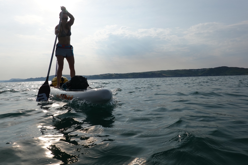
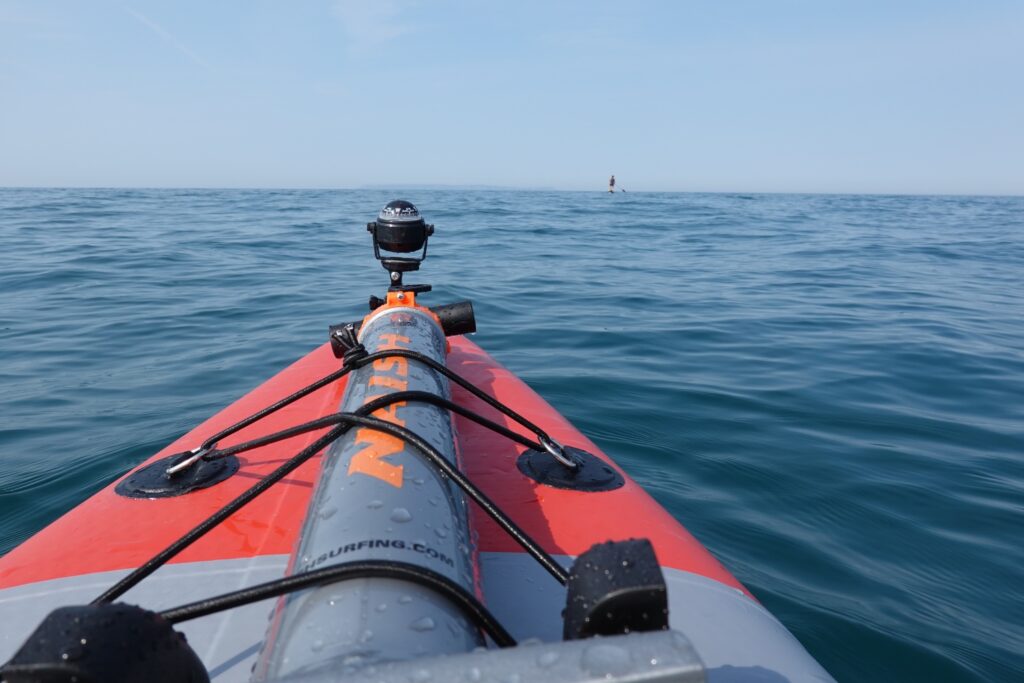
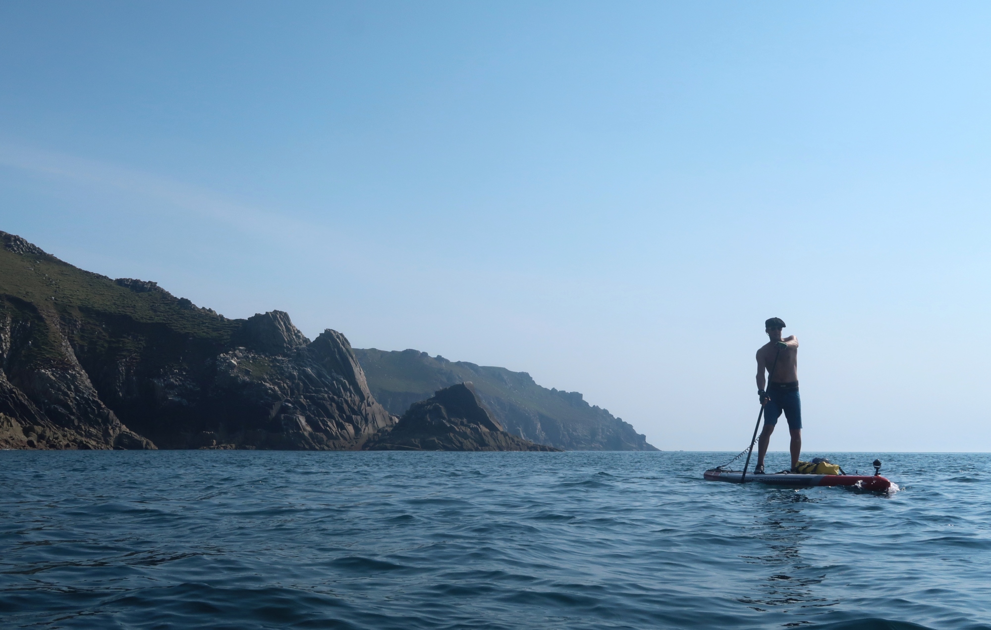
As we passed the prominent lighthouse on Bull Point, which marks the western end of the Exmoor Coast, we caught the full force of the ebb tide running west. The addition of a lightweight sea kayak compass screwed to the camera mount on the bow of my SIC Maui board using an improvised GoPro attachment made the tidal vectoring for the next 10 kilometres a whole lot easier. I just set the needle for ten degrees west-north-west and away we went, carried by the ebb stream into the heart of the Celtic Sea.
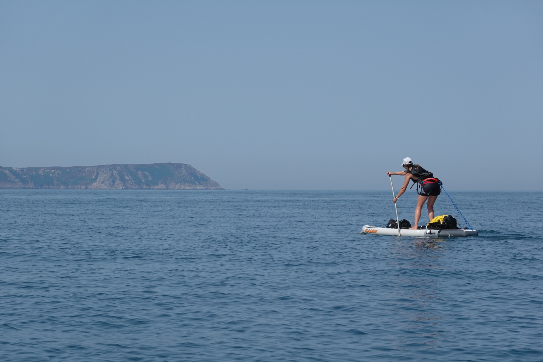
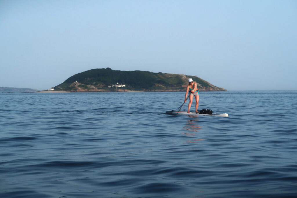
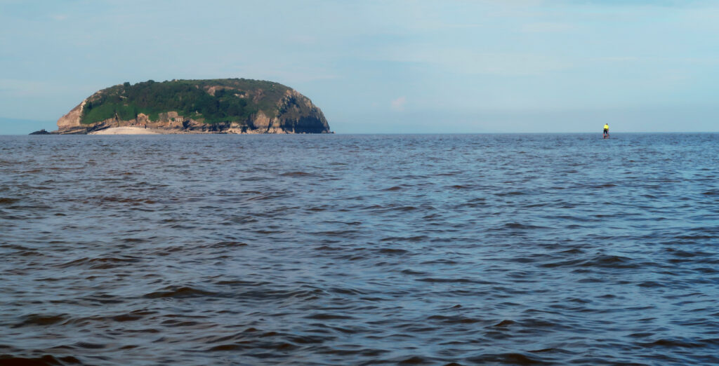
Lundy itself shimmered on the horizon dead ahead. It’s a strange and wonderful thing, this little island: a three mile long slab of granite sliced off from mainland Britain and miraculously dropped in the middle of the Celtic Sea between North Devon and Pembrokeshire. A small pod of porpoises breached the water not far to the north, rising and falling in that effortless, arcing motion, coming in towards us for a while before heading further out to sea at speed.
After we’d left Bull Point well behind us to the east, the sun’s heat was building; the wind that had ruffled the sea earlier had slackened right off. I checked our progress on my GPS: 18.2 kilometres. We were right at the mid-point of the crossing. A pair of gannets were diving for fish a hundred metres to starboard. A few oystercatchers floated on the sea not far to the north, breaking the silence of the sea with their distinctive trilling call as they took off. Lundy, meanwhile, was getting bigger; we’d easily be there in a couple of hours by my reckoning. The weather was perfect, but the wildness of the situation wasn’t lost on either of us. Ten miles offshore in the middle of a strong tidal stream, we were really in quite the location to be standing on a pair of 14 foot long race boards, without any other vessels in sight.
A small cruise ship approached us heading east, having spent the night in the lee of Lundy’s east coast. The slow line of its wake rose ahead, forming a sudden, momentary groundswell on an otherwise calm day.
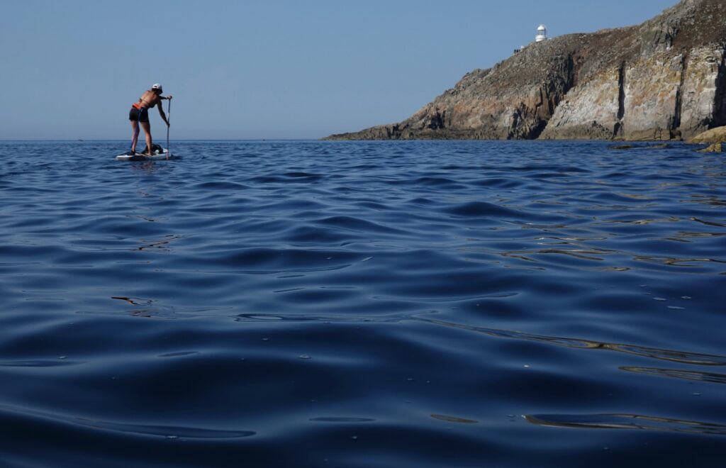
We came in to the landing beach on exactly the right course, well to the north of Rat Island, a tiny islet off Lundy’s southeast coast which creates a powerful back-eddy in the main tidal stream. This eddy actually pulls you south and east away from Lundy and back towards the distant coast of England if you get caught in it, as Gavin and Jonny experienced two-days before. The boys were waiting for us on the beach as we came in, and there were smiles all round and even a couple of cold beers for the two of us on arrival as a bonus. We’d completed the voyage in four hours twenty minutes, a reasonable time even in a sea kayak. The perfect sea state and weather conditions undoubtedly helped a lot. It also goes to show, though, that with a favourable sea and light winds, you really can do pretty much anything you can do in a sea kayak with a paddleboard.
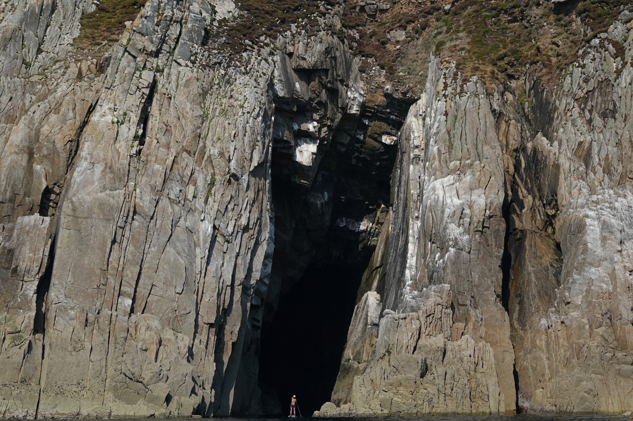
The four of us rested on the beach for forty minutes at low water, waiting for the tide to turn for Gavin and Jonny’s return trip to England. Dorka and I were then intending to paddle around the island itself that afternoon, adding another 15 kilometres to the trip and completing what we thought might just about be the best paddling day trip in the UK. All too soon, we were leaving the beach as a full team of four, and heading out together into the tidal stream once more. Just off the point of Rat Island we said our goodbyes, wishing the boys a good trip back as we turned west under Lundy’s South Light. The drama of the cliff-encrusted and cave-dotted west coast now awaited us.
A three mile long slab of granite sliced off from mainland Britain and miraculously dropped in the middle of the Celtic Sea between North Devon and Pembrokeshire
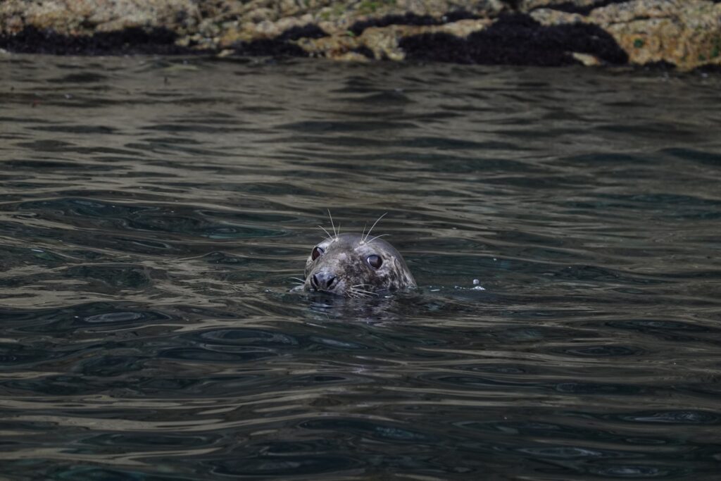
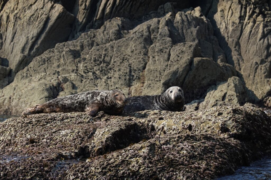
As soon as we turned the corner of Lundy’s southwest point, the first members of what would be a very large host of seals appeared, following us as we eddy-hopped the tide with that beguiling, dog-like curiosity. The stream was in fact running against us for this first section of the west coast, exactly as stated in Mark Rainsley’s South West England Sea Kayaking guidebook. We cruised upstream using the back-eddies around the offshore rocks and using the micro channels away from the main flow as our route; further out it would have been harder going against the full force of a 3 knot current.
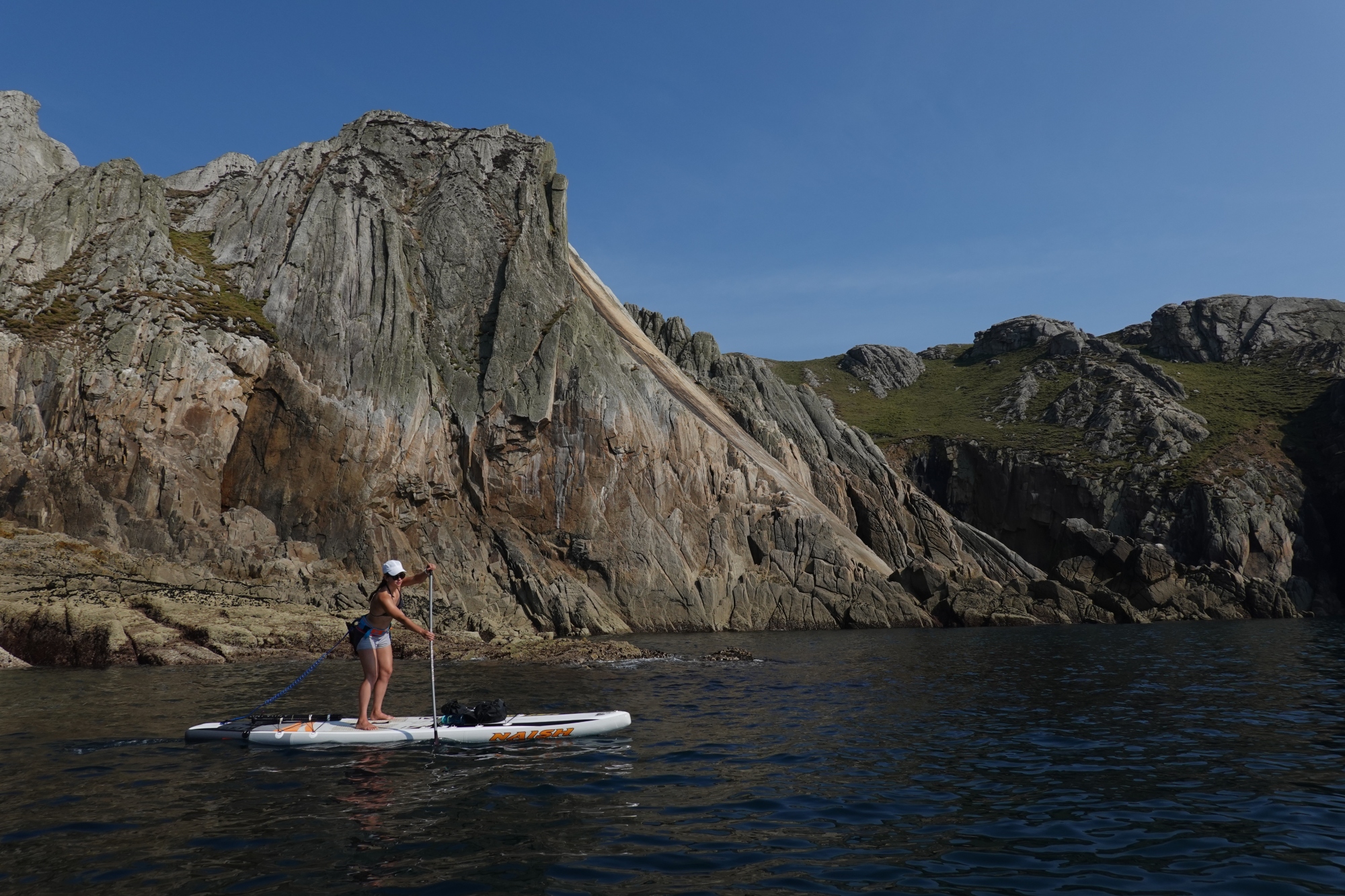
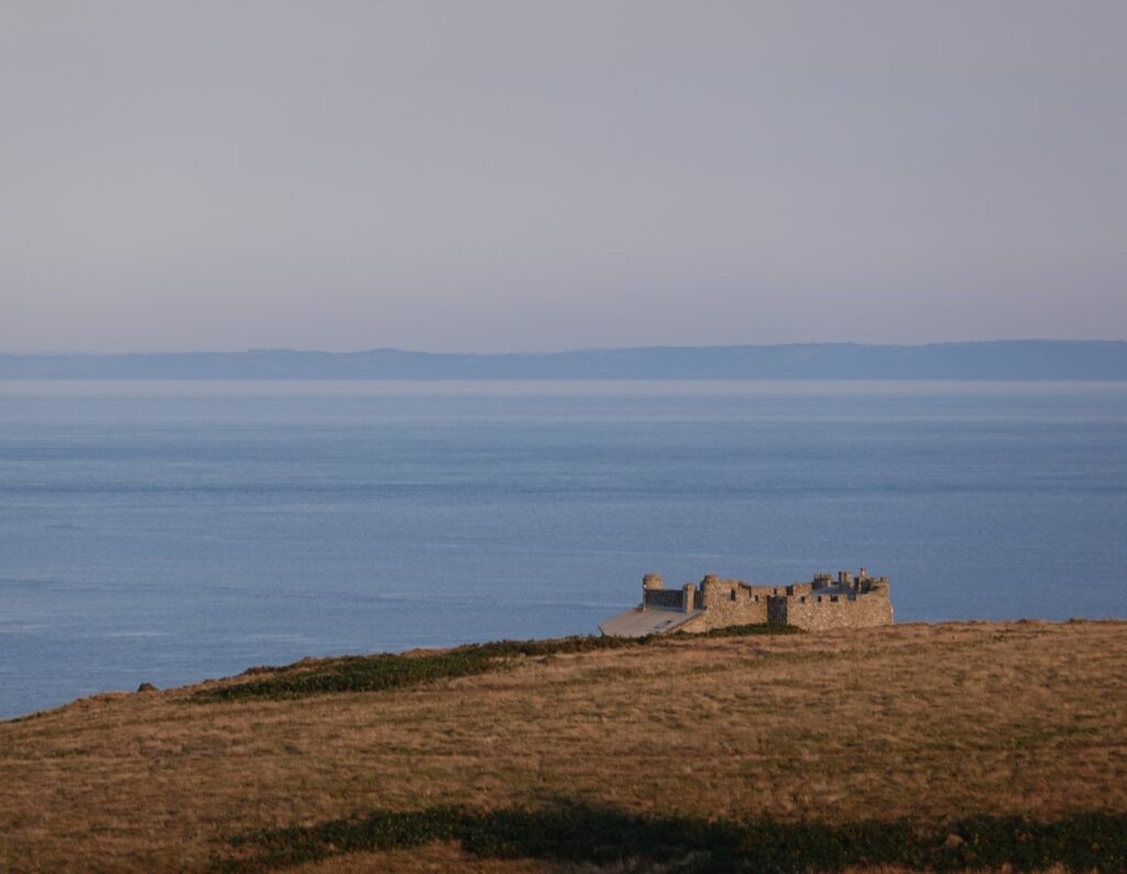
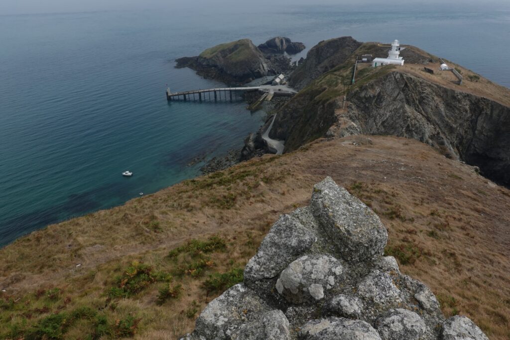
The further north you go up the west coast of Lundy, the wilder and more dramatic the scenery becomes. I’ve climbed extensively on Lundy’s cliffs and know the coast well, but to see it close-in from the sea creates an even more spectacular impression than observing the coast from the cliff top paths. Once Battery Point is passed – with its distinct Napoleonic micro-fort and gun emplacement atop a striking rock archway – things really start to get interesting.
Our host of seals followed us with gusto into the wide bay that encases The Devil’s Slide, Lundy’s most famous cliff; a smooth slab of red and gold granite that falls from the cliff top straight into the sea for four hundred feet. Here, it was so calm that we actually swam right off the boards, without needing to land, in the narrow inlet just north of the Devil’s Slide. Half a dozen seals were in the sea with us, their silver shadows darting and turning underwater. They would rise and breach the surface with that distinct, strong exhalation, then stare back at us with their wide eyes and spiky whiskers. What do they think of us when they observe us in this way, these wild sea creatures with such strangely human qualities? Who do they think we are? It is no wonder that the myth of the Selkie – the half-seal half-human spirit – emerged in Celtic myth and folk tradition. For me, the seals’ brief, curious, free-spirited companionship is always a gift; we take part in their existence when we meet them, as they do in ours. There are very few wild animals with whom it is possible to have this sort of exchange in their native environment.
Heading north from the Devil’s Slide, we picked up the full force of the early ebb tide running around North Light; a ferocious race forms here, and even today, in perfectly calm conditions, we could see the crests and breaking waves of a big tidal rapid just north of the point, only a hundred metres from the rocks; imagine what it would be like here in a fifty-knot winter gale!
All too soon, though, we were clearing North Light and entering the completely sheltered water of the east coast, and leaving the drama of Lundy’s western cliffs behind. We’d been paddling for over seven hours, approaching the 45km mark, and were both starting to feel it in our shoulders and calves. But despite the fatigue, the final section down the east coast felt like a victory lap; it’s an easy cruise back to base from here, really, and the seals followed us most of the way.
We made landfall back on the shingle beach just before six o’clock; we’d been paddling for over eight hours today and on the water for over nine. And what a day it’s been; just over fifty kilometres of standup paddling through some of Britain’s most dramatic coastal scenery, including a long offshore crossing and a circumnavigation of a truly spectacular island. You’d be pretty hard pushed, I think, to find a better day of open water paddling in the UK than the crossing out to Lundy combined with the circumnavigation of the whole island.
You’d be pretty hard pushed, I think, to find a better day of open water paddling in the UK than the crossing out to Lundy combined with the circumnavigation of the whole island
We’d planned to paddle back to England the next day, but the forecast changed and the high pressure started to break with an ominous thundery disturbance; huge clouds started to build over Exmoor and Hartland Point to the south the next morning, the wind started shifting and veering, and the visibility dropped right off. Being caught in a thunderstorm on a standup paddleboard ten miles offshore is not, by any stretch of the imagination, a very good idea. It definitely wasn’t the best weather for the return leg, so we decided to catch the ferry back the following day. To complete one-off adventures like paddling out to Lundy and around the island in a day, it’s all about choosing the right conditions, using the right board and kit, and never believing it’s all going to be okay if the weather or sea state doesn’t look okay. On this occasion, the sea was calm but the weather wasn’t good at all, so it was the right decision to abandon the return trip.
In the end we didn’t need to catch the ferry; we met up with a friendly yacht crew and hitch-hiked a lift back to England later that night on a small cruiser, Cutty Wren, on her way back to Weston-Super-Mare. We departed our bivouac in the fisherman’s cave by the slipway at 2am to paddle out into the bay and meet skipper Mark, Andrew and Alan, who welcomed us aboard with much-needed coffee as we made our getaway from the island on the early morning tide.
Coming into Ilfracombe at dawn the next morning, the sky was a vast, tungsten grey sheen; the high pressure had finally broken, and heavy weather was coming in. By the time we’d had a much needed greasy spoon breakfast and returned to Lee Bay, the sea looked decidedly hostile as a strengthening breeze worked against the tide, turning the water off Bull Point into a frenzy of whitecaps. It couldn’t have been more different than when we set off for Lundy 48-hours earlier on that perfect summer’s morning.
A standup paddleboard is an extreme type of craft to use for open ocean, offshore trips. But it’s also one of the most rewarding ways to travel across wild stretches of water. It can be both the very best and also the very worst vessel for open water travel, and these two things can sometimes become true on the very same voyage. On that particular August day we paddled out to Lundy, though, there was nowhere else in the world I would have rather been than following the compass bearing west by northwest, bound for that shining strip of stone in the middle of the Celtic Sea.
Don’t miss a single adventure
Sign up to our free newsletter and get a weekly BASE hit to your inbox
Other posts by this author
Story • David Pickford • Jul 24, 2022
Vectors in the Stream
A voyage between islands across some of the world’s strongest offshore tides
Story • David Pickford • Feb 04, 2022
Tidelands
Travels in the unexpected wilderness of the Bristol Channel
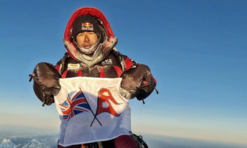
Interview • David Pickford • Dec 01, 2021
The Nims Interview
David Pickford catches up with the high altitude mountaineer and star of 14 Peaks / Project Possible
You might also like
Video • BASE editorial team • Apr 26, 2023
5 Tips For Taking Care Of Your Paddleboard
Expert advice for keeping your SUP in top condition
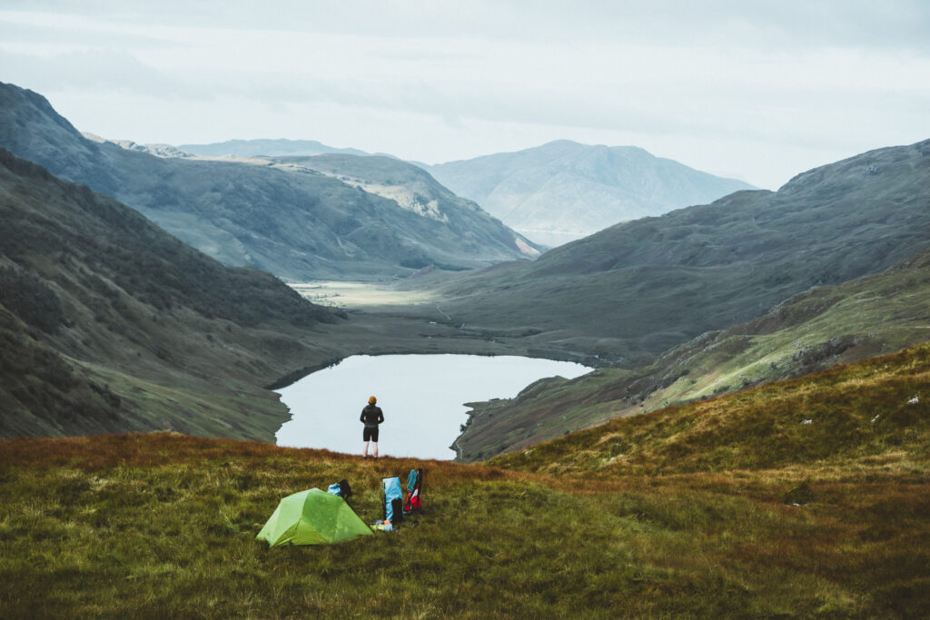
Story • Aaron Rolph • Nov 16, 2022
The UK’s Last Remaining Wilderness
A hike and SUP adventure to discover Knoydart, a wild peninsula in the Scottish Highlands
Story • David Pickford • Jul 24, 2022
Vectors in the Stream
A voyage between islands across some of the world’s strongest offshore tides