Tidelands

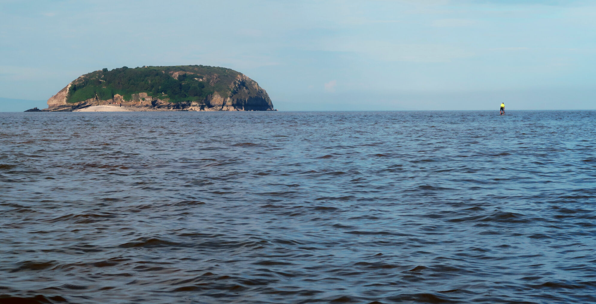
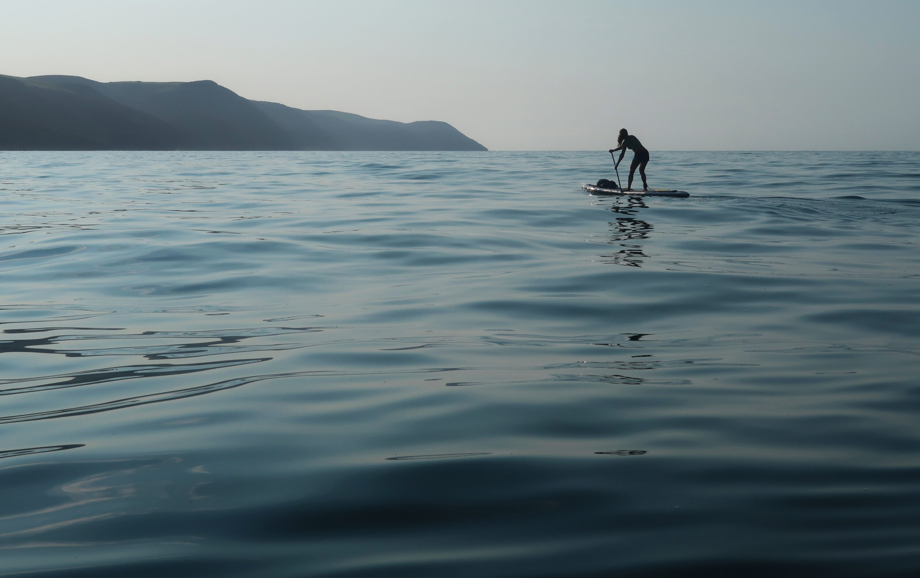
Gavin Symonds taking a west-south-west tidal vector towards Steep Holm island, one of several islands in the Bristol Channel. Now uninhabited, it contains many interesting historical features including a derelict pub, visible to the right of the landing beach.
To The Bridge
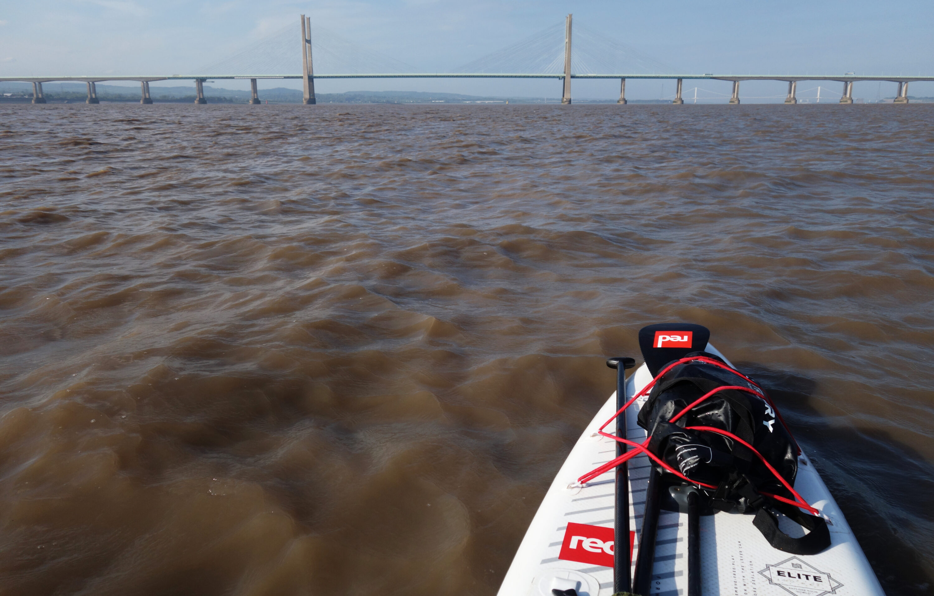
In the distance, the bridge stretches across the vast expanse of muddy water like a curving silver blade. The enormous concrete supports of the suspended section silently guard the tidal cauldron surging beneath them: the Shoots Channel. High overhead, the afternoon light glints against the steel retaining rails of one of the UK’s major roads, held in improbable equilibrium above the five kilometre-wide estuary. At certain times of the year, the difference between high and low water under this bridge can be over 14 metres, the height of an average three-story building.
The powerful tidal current is now vectoring towards the bridge as if the water itself were attached to an invisible elastic band. I check my watch: 10.5 knots. This is not a normal speed at which to be moving on a standup paddleboard. I am paddling more to maintain a position in the dead centre of the two huge central supports than to propel myself forward. In front of each of the bridge supports, standing waves rise as current meets concrete, forming multiple whirlpools at either side like the bow-wave of a supertanker.
As the bridge rears up directly ahead, I feel my heart rate rise as the character of the water under my board begins to change; from a smooth, rolling current with intermittent eddies, it begins to shift, first to a series of overfalls, then to something different altogether. The crests and bumps of a massive tidal rapid dance in the near-distance. Spanning almost the entire width of the Shoots Channel, the rapid advances like a monstrous aquatic apparition, a kind of hydrological chimera.
In the dead-centre of the Shoots Channel, heading towards the New Severn Crossing.
The water suddenly turns dark beneath the hull; I’ve crossed into the bridge’s shadow. A hundred metres above, drivers on the Second Severn Crossing are listening to The Archers omnibus and planning purchases at the nearby Cribbs Causeway retail park. Below them, I am in a rather different environment. Alone on the powerful stream between Wales and England, I’m being pulled towards some of the wildest tidal water I’ve ever seen. It’s not so much frightening as fascinating; with the skills and kit to deal with what’s coming up, I’m not in any danger here.
The huge rapid evolves as I enter it. Upstream of the bridge, multiple chains of small standing waves pile on top of one another for hundreds of metres as the tide flows over the shallow shoals surrounding the limestone reef of Black Rock. On either side of the rock, the standing waves morph into crazed colonies of miniature whirlpools, spinning off from one another like the isobaric map of the central Atlantic during peak hurricane season. This is the sluicing, surging heart of the Bristol Channel; even on a perfectly calm day, it’s an extremely intimidating environment. The serious nature of the place is compounded by the extreme infrequency of safe landings. From here, there are just two places I can feasibly land in the next twenty miles: Beachley and Chepstow. I’m aiming for the latter.
My strategy was to now enter the river Wye on the flooding tide, the mouth of which lies a short distance beyond the bridge. After what seems like a disproportionately long time, but on later reference was actually just 15 minutes, I clear the worst water of the Shoots Channel. With the Welsh coast now just a few hundred metres to port, the hull of the board suddenly falls silent as the parallel mudbanks of the Wye estuary open up dead ahead. An oystercatcher lands on the water ahead of me, breaking the silence with its distinctive cry. I’m in flat water at last, and glide the final two kilometres upriver to land on the floating pontoon at Chepstow, which leads auspiciously into the garden of The Boat Inn.
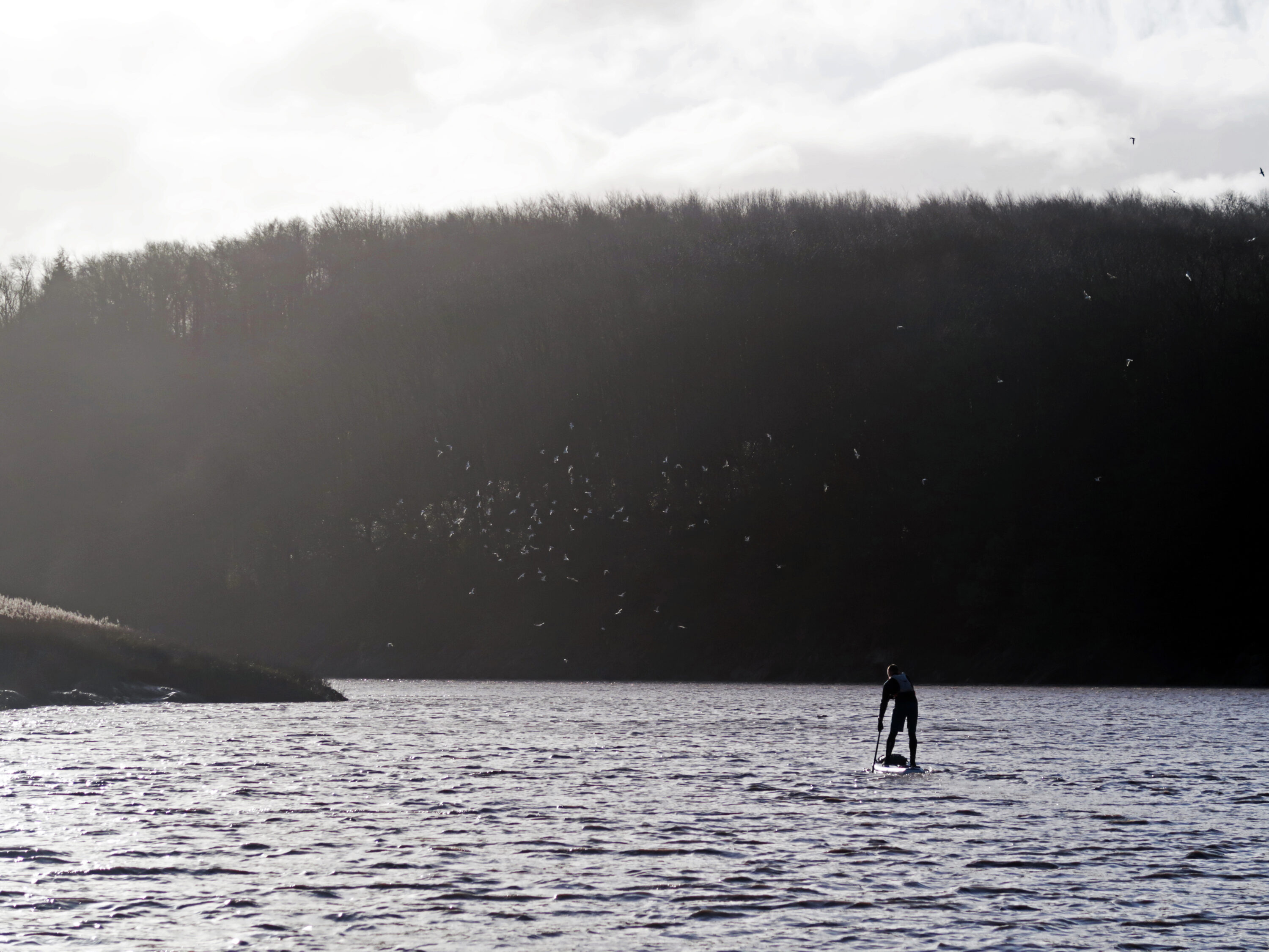
Gavin Symonds riding the flood tide under a flock of gulls on a wild winter’s morning as he enters the river Avon, one of the major tributaries of the Severn Estuary. Only a few miles from the centre of one of the UK’s major cities, this place remains a haven for marine wildlife.
A Wilderness Apparent
Making the crossing from England to Wales via the Shoots Channel by kayak or SUP compresses a big adventure into a relatively short journey that can be done, potentially, on an evening after work. It also brings you headlong into the liminal, transitory, ever-changing and uniquely beautiful environment of Britain’s tidal estuaries, of which the Severn is the largest and wildest by a substantial order of magnitude. As Mark Rainsley points out in his Southwest England Sea Kayaking guidebook, whilst ‘characterised by mudflats and motorway bridges… an outwardly unappealing prospect, [the Bristol Channel] is actually one of the region’s most challenging paddles’.
There’s a deeper point about the relationship between the environment and the exploratory imagination here. Sometimes it’s in the most unlikely of arenas that the most compelling adventures can be found: the Bristol Channel is certainly one such arena. Fringed by the industrial outskirts of two large cities, this place remains a haven for wildlife as large container vessels approach or depart Portbury Docks, one of the UK’s major commercial shipping hubs. Despite – and in some ways because of – its rudimentary and occasionally post-apocalyptic aesthetic, the Bristol Channel is a place where you can explore the British coastline on its own terms.
This vast estuary is a magnificently wild place. You could say it’s the diametric opposite of a highly curated Instagram feed. It’s not obviously photogenic. There’s nobody about. And it is profoundly, exhilaratingly real.
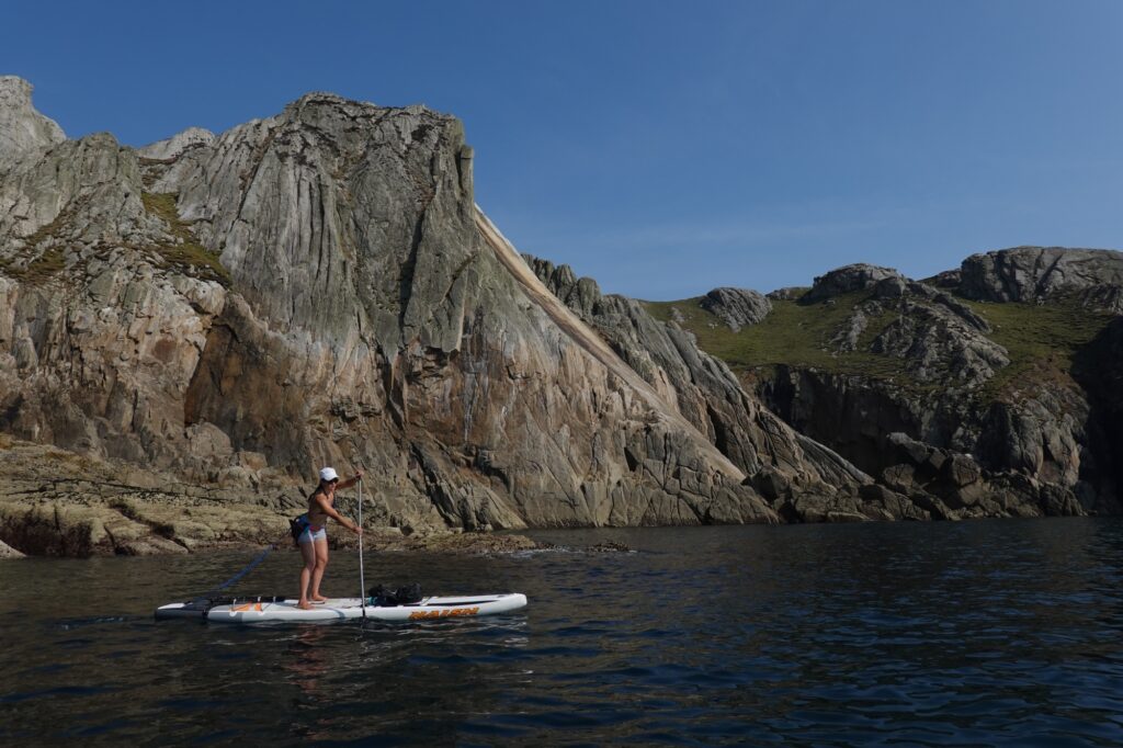
Even on a perfectly calm day, these waters can be an extremely intimidating environment
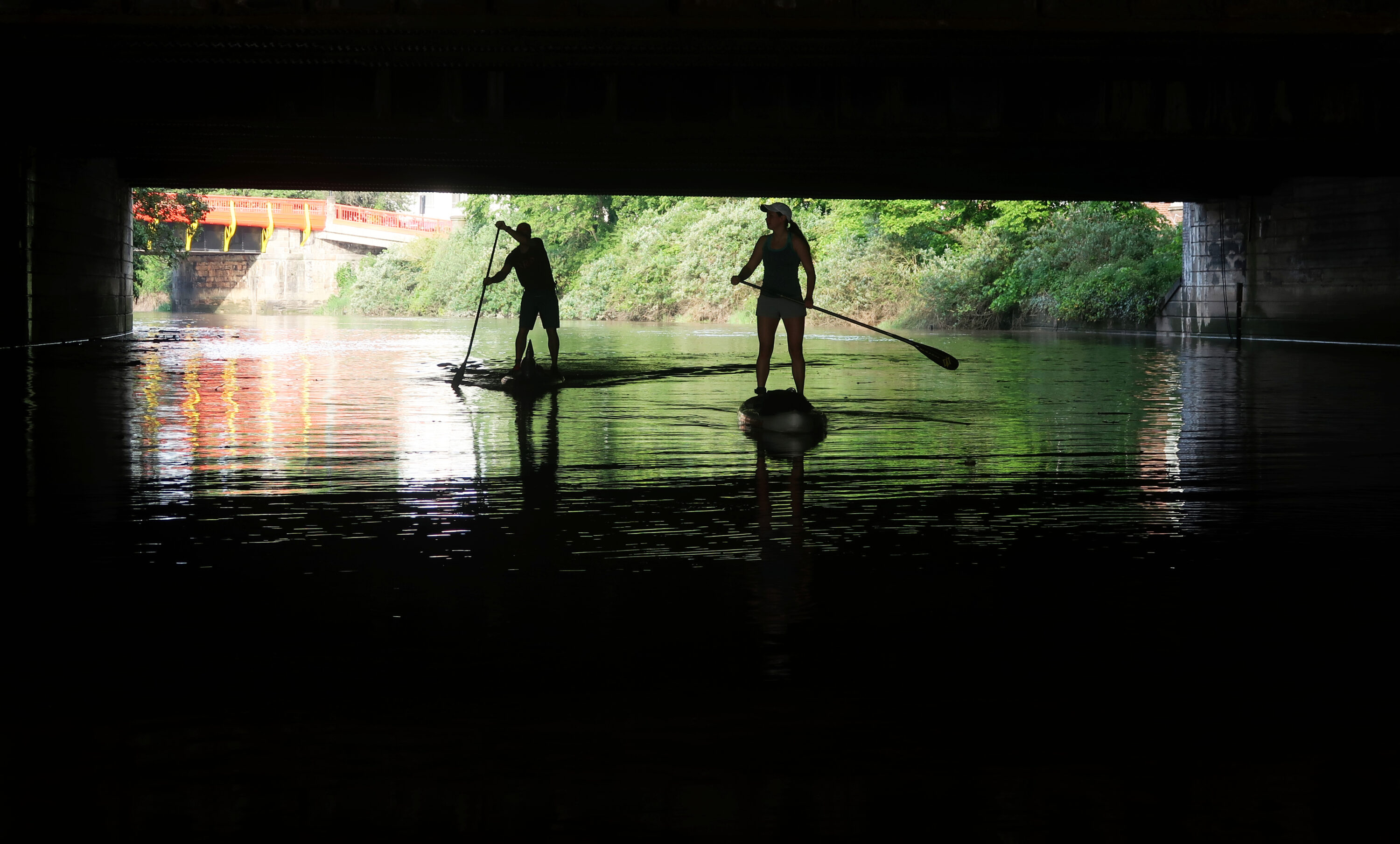
Gavin Symonds and Dorka Fekete take the tidal route into central Bristol on the river Avon; here, they’re underneath the main rail line between Bristol and London.
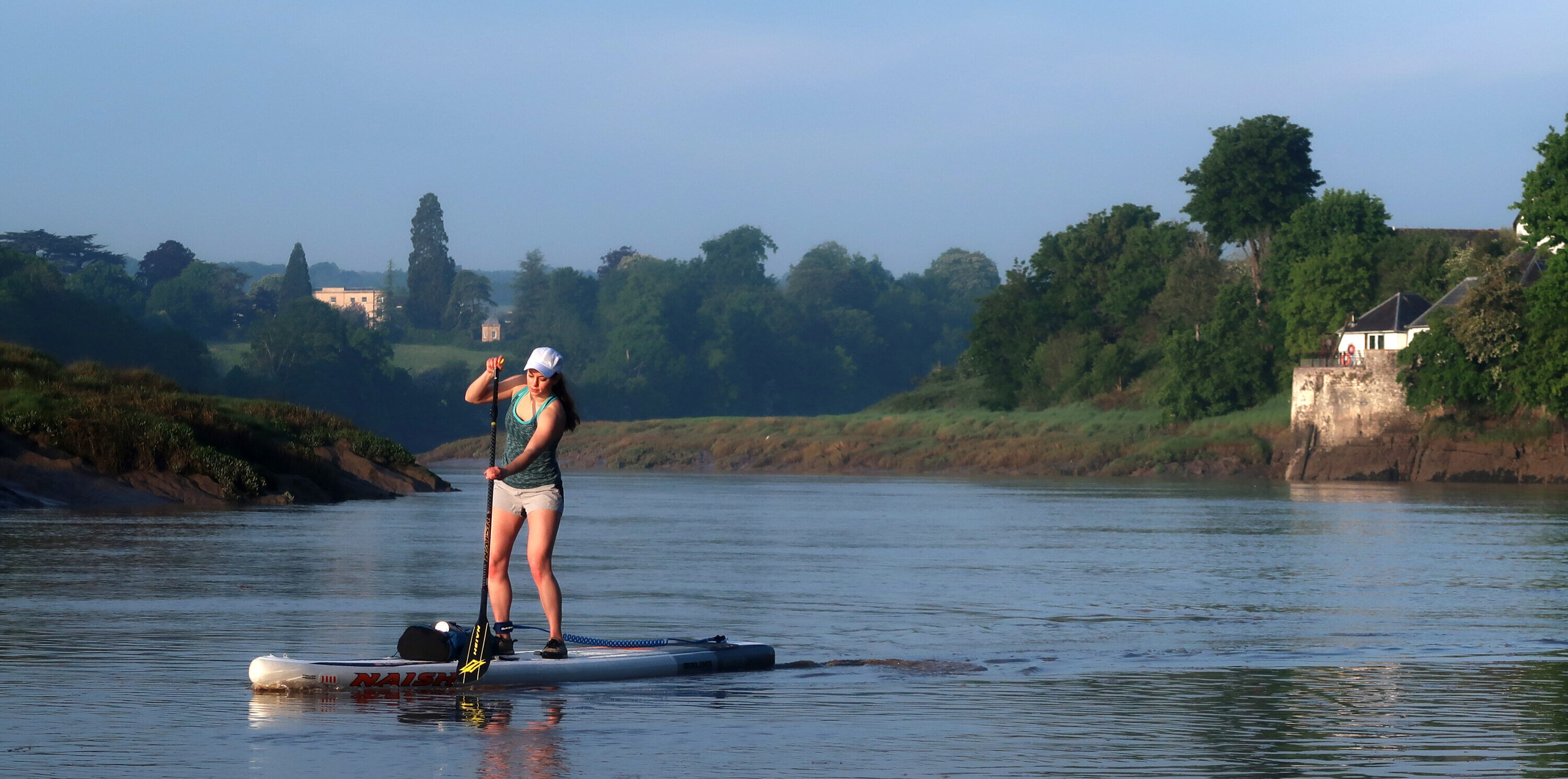
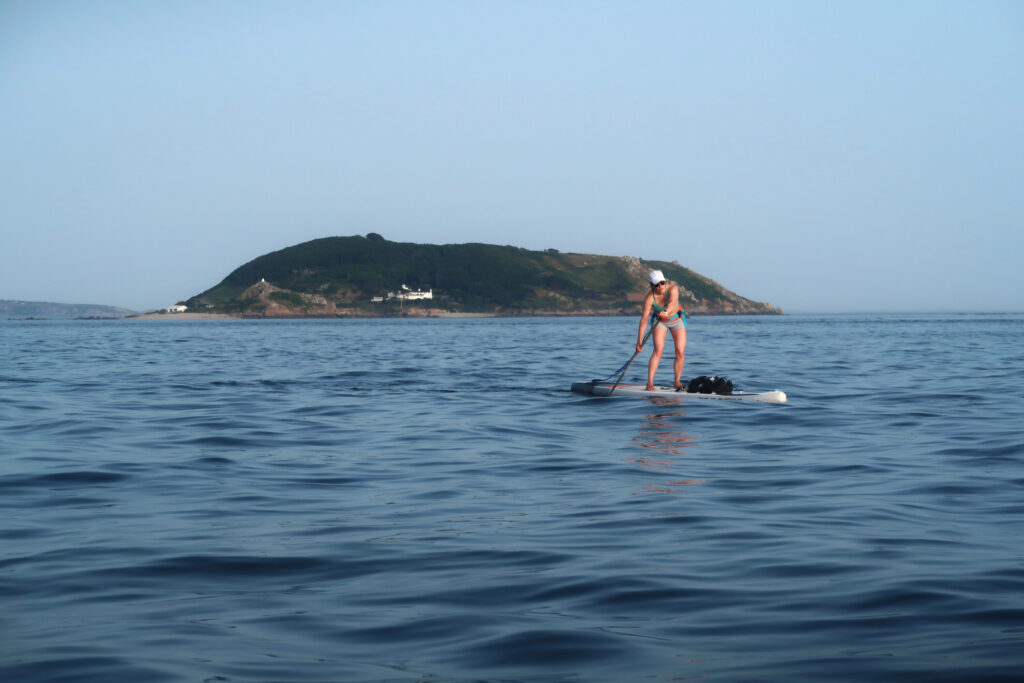
Dorka Feteke heading upriver from the Severn into the Avon on an early morning flood tide. The distinctive riverside property on the right is the Old Powder House, built in 1775-76 to store gunpowder for ships, which was not allowed into Bristol docks for fear that it might explode.
Tales From the Islands
Perhaps the finest trip of all in Britain’s biggest tidal compressor, is the voyage out to the two tiny islands of Steep Holm and Flat Holm – an unlikely pair of ‘desert islands’ salubriously positioned between the fleshpots of Penarth and Weston-Super-Mare. These islands are in fact fascinating places, appearing to float improbably on the sea from certain angles; Steep Holm, the higher and more dramatic of the two islands, has the character of a kind of West Country Atlantis: an ‘edgeland’ of the highest order.
It’s essential to do this trip on a day of light winds and fair weather, due to the considerable tidal vectoring required, and the risk of missing the islands completely if blown off course. It’s a complex paddle, and shouldn’t be undertaken by an inexperienced team.
Whilst Steep Holm is now uninhabited, the relics of human activity are everywhere; there are derelict Victorian fortifications, abandoned Napoleonic cannons, a spooky WW2 searchlight post, and even a ruined tavern above the island’s only landing beach. It’s a bit like Mad Max with seagulls.
The best strategy for the trip is to head out with the ebb and arrive at Steep Holm just before low tide, and then make the short four kilometre crossing from Steep Holm to Flat Holm at slack water, which lasts for less than thirty minutes around here.
Timed right, you’ll arrive on the latter just as the tide is beginning to flood. We took a quick break here on a shingle beach that’s probably only visible for around an hour either side of low water under the striking lighthouse on the southern tip, imaginatively called ‘Lighthouse Point’. Suitably refreshed, we headed back for England and our launching spot on Sand Point, the headland north of Weston-Super-Mare. The return journey is slightly more complicated than the outward leg, as it involves a ferry-glide of roughly 10km across the Bristol Channel’s tidal flow. After a while, though, we hit the swirls and bumps of the tidal rapid that flows off Sand Point, and arrived back at our launch spot on the beach to the north after a memorable seven hour quest deep into the tidal wilderness.
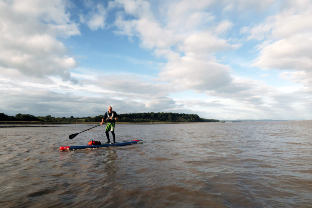
Gavin Symonds coming in to the slipway at Beachley after a 38km trip on the ebb tide from Newnham-on-Severn.
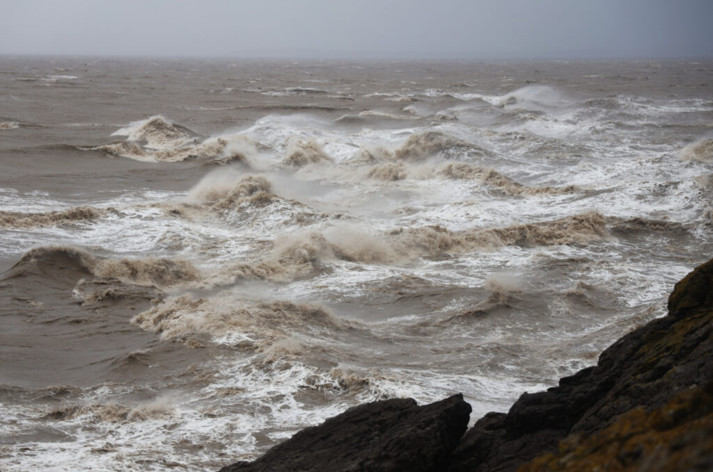
The tidal rapid off Sand Point, just north of Weston-Super-Mare, in Force 8 gale. The Upper Brahmaputra meets the Bristol Channel.
Our trip out to Steep Holm and Flat Holm was completed in early summer 2020, as the UK was emerging from the strange isolation of the first Covid lockdown. International travel was all but impossible; the government’s revised guidance was to ‘stay local’. If our island-hopping trip between England and Wales was an imaginative interpretation of that advice, so be it.
I pieced together various sections of the English and Welsh coasts of the Bristol Channel during various trips, spread over several years, and I’ve now travelled the entire length of the Severn Estuary and the Bristol Channel by SUP, from the upper limit at Gloucester to the Exmoor coast where the estuary meets the Celtic Sea. The more time I’ve spent on and around these waters, the more I’ve become intrigued by them, and the more I’ve come to respect their wildness. At dead low spring tide, for example, there’s nine miles of treacherous mud between Burnham-on-Sea and the sea itself. Nine miles!
The Bristol Channel even creates its own weather through various wind acceleration zones. During spells of high pressure, it often generates strong north-easterlies when there’s barely a few knots of wind inland; during cyclonic periods, the Exmoor coast accelerates the prevailing wind coming in from the Atlantic, often producing powerful westerly and northwesterly airstreams. Because of its status as one of the most navigationally complicated and dangerous shipping lanes on Earth, this estuary even gave rise to its own unique design of sailing boat, the ‘Bristol Channel Pilot Cutter’. Developed locally by master boatbuilders during the nineteenth century to escort pilots quickly to waiting ships, the boat’s combination of speed, manoeuvrability, seaworthiness and ease of handling (it could be sailed by just two people) has been described as ‘the best sailing boat design ever’ by maritime experts. It had to be that good, because of where it was used.
Unexpected stuff always happens out here. The late September light refracting in white and gold over the Severn bridges as we approached from the north on the powerful ebb current. Finding that magical landing-spot on an expanse of blue-grey sand the size of five football pitches in the middle of the Channel downstream of Lydney. The hard graft of battling a sudden Force 5 crosswind turning the massive bend at Frampton-on-Severn. Approaching the big rapid upstream of Newnham surrounded by floating tree-trunks like prone primeval monsters. Watching the strange mystery of the tide flowing in both directions at the same time under the Severn Bridge at Beachley. Standing awestruck by the primordial roar of the Severn Bore [a tidal wave that takes place at certain times of the year] as it moves upriver. And listening to the constant eerie sluice of the powerful current under the hull, a reminder of the natural energy of this highly-charged place.
The vast expanse of this great estuary is a shape-shifting, visionary space on unexpected power and beauty
Dorka Feteke heading for Foreland Point on the Exmoor coast.
The vast expanse of this great estuary, like its counter-directional tides, is both a gateway to the past and a portal into the future. It’s a shapeshifting, visionary space of extraordinary power and beauty. With the constant ebb and flood of the tide, the ghosts of its nautical history move across the same water that runs past large industrial plants, monumental bridges, nuclear power stations, wind turbines, and various other infrastructural components of an advanced twenty-first century economy.
Because the notion of adventure itself is a human concept, it is perfectly adapted to spaces that have themselves been shaped and changed by humans over time – just like the Severn Estuary. True adventure doesn’t require a wilderness devoid of human life to enact itself to the full. In more than one sense, this estuary is a living representation of the adventurous mindset of human beings. The long sea voyages to unknown lands that once departed from here; the immigrants who first arrived here; and the adventures in technology, transport and energy that are now enacted here – all of these are fundamental parts of the human story. By exploring this unique wilderness on its own terms, strange secrets might appear and vanish in its mud and silt: the lost channels of vanished rivers, abandoned jetties, shifting shoals, and the ghostly shadow of an ancient harbour overlooked by cranes assembling one of the world’s biggest nuclear reactors. And then the tide roars back in from the Celtic Sea to the west, covering the littoral land completely, making it seem for a few brief hours as if none of it had ever existed at all.
This story first appeared in issue #06 of BASE magazine. You can find all our back issues and current subscription offers, here.
Don’t miss a single adventure
Sign up to our free newsletter and get a weekly BASE hit to your inbox
Other posts by this author
Story • David Pickford • Apr 12, 2023
West by Northwest: Lundy Island by Standup Paddleboard
An open-water SUP voyage from the north coast of Devon to the iconic island of Lundy
Story • David Pickford • Jul 24, 2022
Vectors in the Stream
A voyage between islands across some of the world’s strongest offshore tides

Interview • David Pickford • Dec 01, 2021
The Nims Interview
David Pickford catches up with the high altitude mountaineer and star of 14 Peaks / Project Possible
You might also like
Video • BASE editorial team • Apr 26, 2023
5 Tips For Taking Care Of Your Paddleboard
Expert advice for keeping your SUP in top condition
Story • David Pickford • Apr 12, 2023
West by Northwest: Lundy Island by Standup Paddleboard
An open-water SUP voyage from the north coast of Devon to the iconic island of Lundy
Story • Aaron Rolph • Nov 16, 2022
The UK’s Last Remaining Wilderness
A hike and SUP adventure to discover Knoydart, a wild peninsula in the Scottish Highlands