A 240 Mile Hike Through Scotland’s Most Spectacular Landscapes

The Cape Wrath Trail. A 240-mile, unmarked route through Scotland’s most spectacular landscapes. This is a two-and-a-half-week adventure from Fort William to the north-westernmost point of mainland Britain, Cape Wrath – its name derived from the old norse for “Turning Point”. The route ventures through some of Scotland’s wildest regions, encountering the country’s grandest mountains, loneliest glens, highest waterfalls and remotest beaches. Annually, few people complete the long-distance route which is regarded as one of the UK’s most challenging. With minimal facilities on offer, making use of bothies and the array of wild camping on offer an absolute necessity. This is the purest essence of Scottish outdoor culture.
The Cape Wrath Trail explores every variety of terrain that assembles Scotland: bashing through the boggy moorland, wandering the lush and lonely glens, wading the winding rivers, up and over the high mountain passes, strolling around the calm lochs, under waterfalls and unwinding at the remote beaches. It also sees several long stretches of marching on tarmac road, which ironically are by far the most taxing. Each day brought with it new challenges as we negotiated the ever-changing landscape.
Under a yellow weather warning for rain, our route began in the rich green glens of the western Highlands. A respectable introduction to the trail. A persistent downpour followed us up Conaglen, soaking every fibre of our clothing. Morale was low at the end of the day as we stewed in our tent, brewing up our dinner in our poorly selected campsite result of lack of option and fatigue. A steep learning curve. Miraculously, this was our only day of heavy rain – almost unheard of in Scotland. The following morning we woke up with optimism and ascended over a bealach which took us into an anonymous lonely glen. This became a recurring theme throughout the trip.
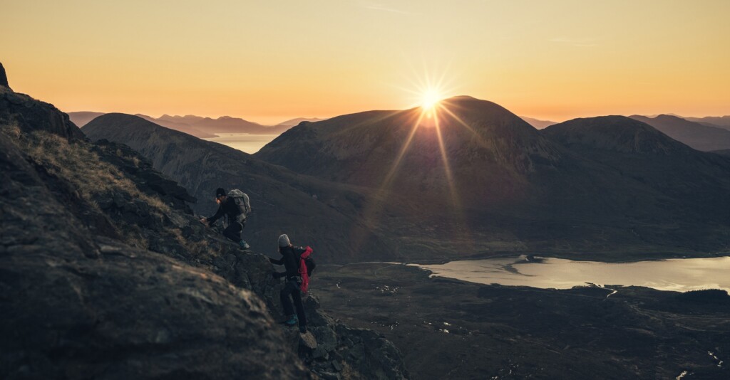
Like so often on the trip, the bealach was a transition into a new mountain range which usually brought with it its own fresh set of challenges. Each morning we checked the guidebook for an idea of the elevation profile ahead of us, outlining our objective for the day. Climbing 800m to the shoulder of the Forcan Ridge just to come right back down again into Kintail, for example. With a 25kg pack, this was real physical challenge but a simpler feat opposed to the mental challenge of the bog in Knoydart.
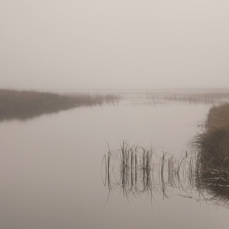
A foggy morning at Maol-bhuidhe. We arrived here during a warm glowing sunset and woke up in a blanket of fog. In the poor visibility, we took a b-line for the river which was ‘somewhere over there.’
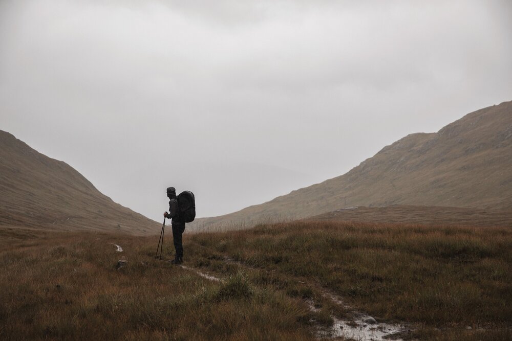
Day 1 and a yellow warning for rain ringing true.
Glendhu Bothy. Where we were met with wild horses running off the hill.
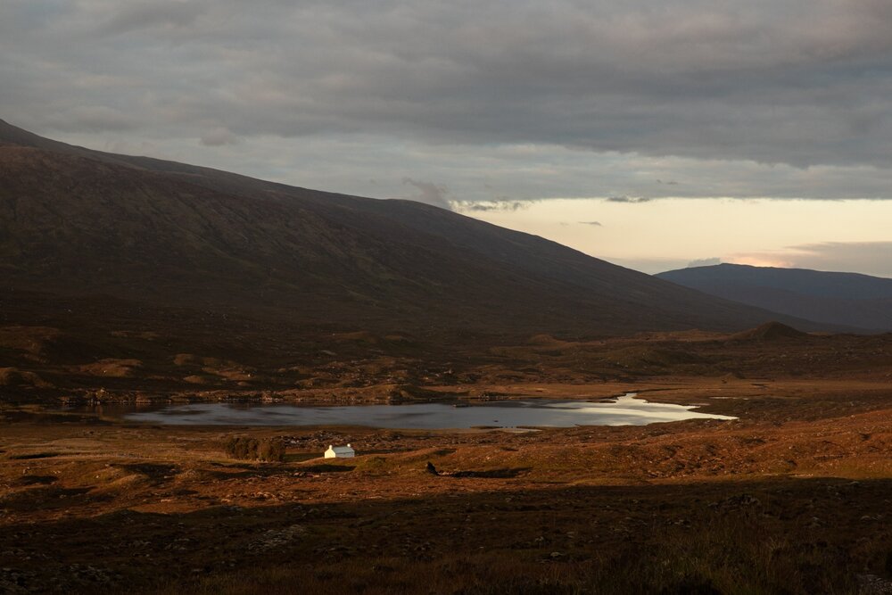
After hours of squelching through bog and seemingly vast emptiness, we arrived at Maol-bhuidhe bothy as the sun set
Bashing through the relentless bog was a major mental hurdle and delivered our first doubts as to whether we’d be able to complete the route
Knoydart is one of the last great wildernesses of Scotland and the wettest region in the country. Following the first day’s heavy downpour, bashing through the relentless bog was a major mental hurdle and delivered our first doubts as to whether we’d be able to complete the route. Four miles in, we’d had enough and declared our campsite on seemingly the only firm and dry patch of grass. In the shadow of the Knoydart hills, we watched the low lying clouds and river rush through the valley.
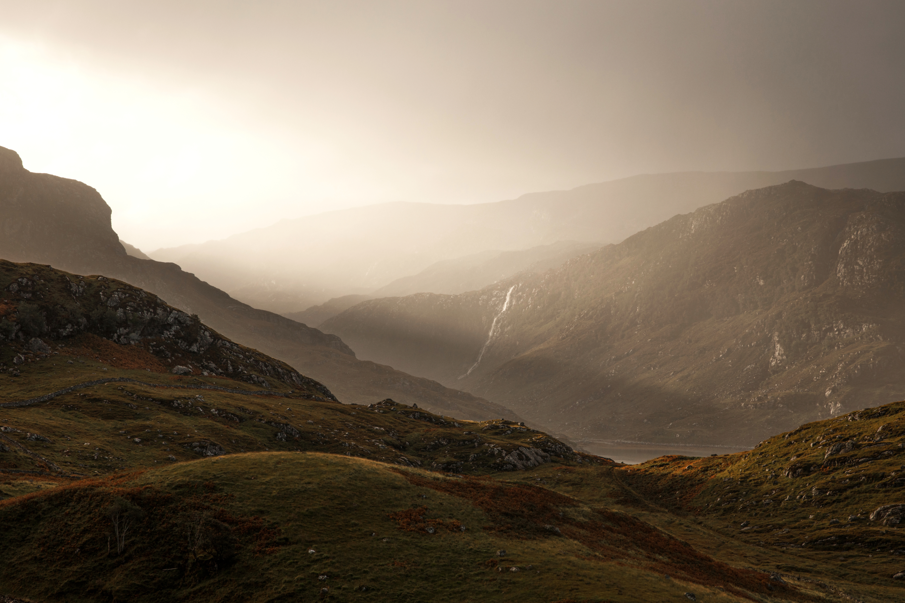
We always appeared to be following the ways of the river, meandering down a glen to a loch, or up valley to a waterfall. It would bring apprehension knowing there’d be a river crossing we’d have to face somewhere up ahead. After the rain of the past days, rivers that weren’t even listed on the map became major obstacles as we waded, bare feet with water up to our torso and our boots tied around our necks. A period of dry weather welcomed us as we skirted the steep hillsides above the Falls of Glomach – one of the tallest waterfalls in Britain, surrounded by sheer drops either side. It was a sketchy descent down into Glen Elchaig. We were soon greeted with a tarmac road at Strathcarron and a point of civilisation, meaning a welcome pint and a meal that wasn’t freeze-dried.
There was always a problem to solve on the trail. A blister, an issue with the backpack, knee pain. The next day started on tarmac, the long walk on a busy road became tiring and boring all too quickly. After hours of dreaming of a flat surface, I now craved the unstable bracken as my feet developed multiple blisters from the hard ground.
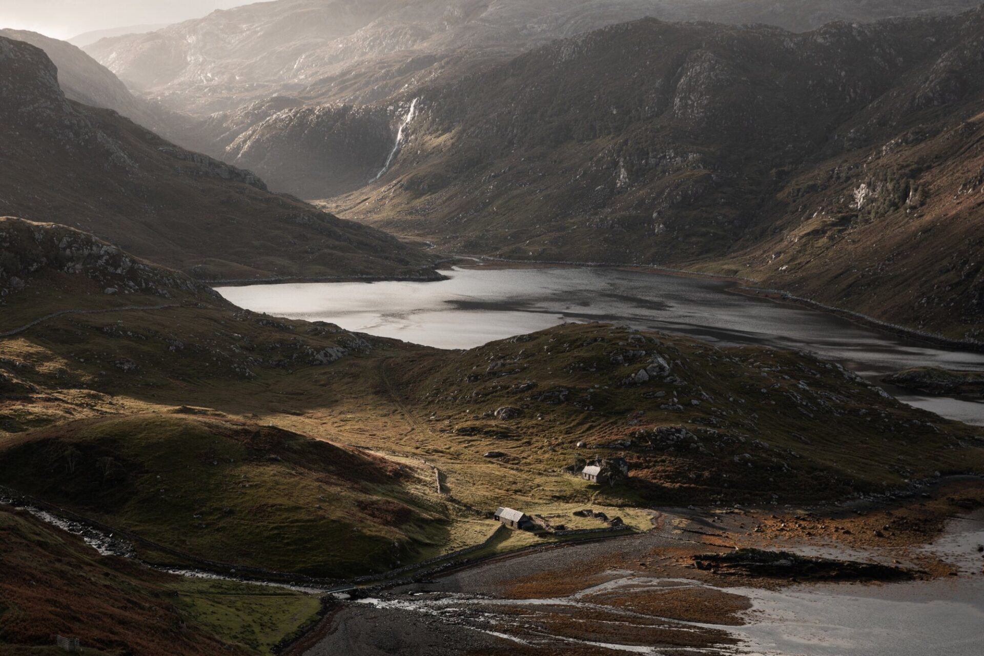
Morning at Loch Glencoul.
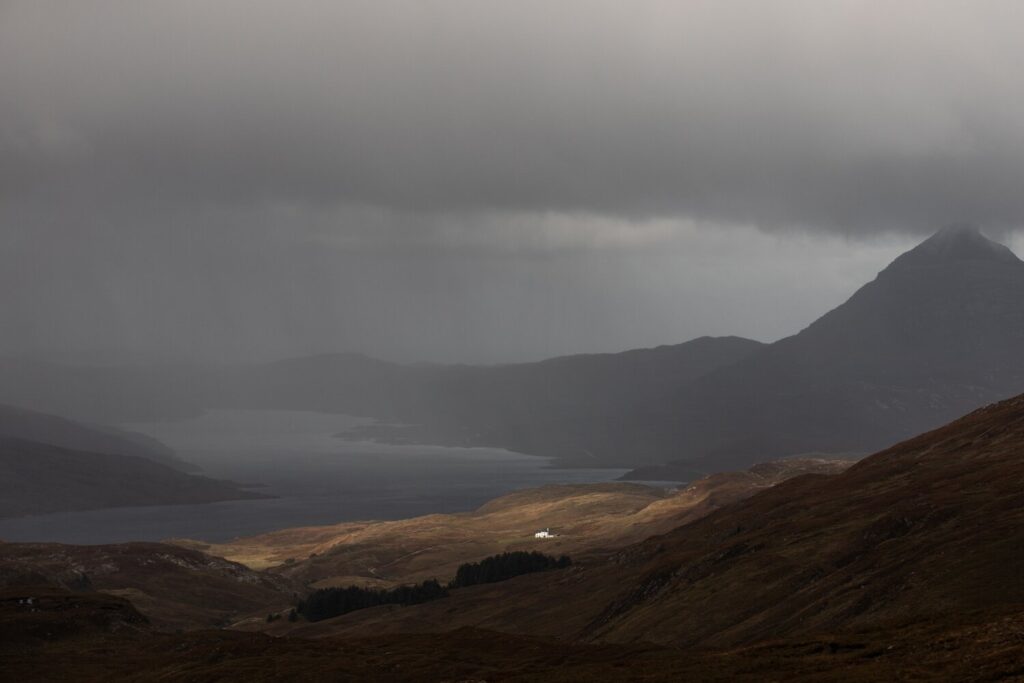
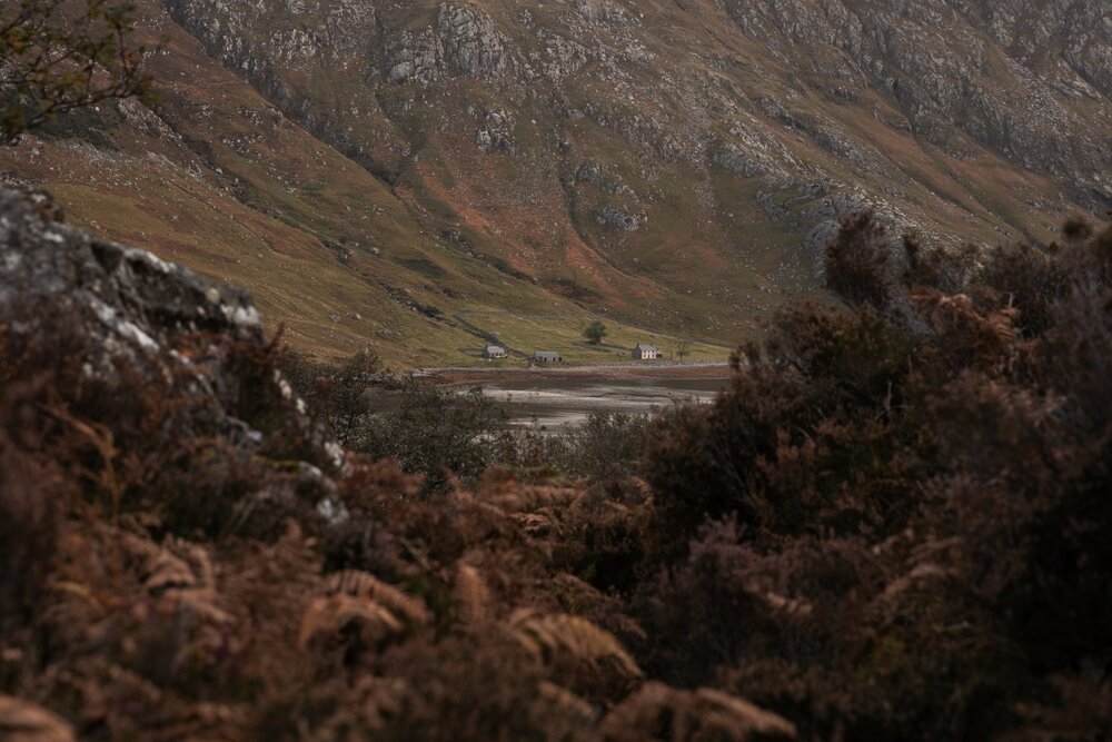
From the Am Bealach of Ben More Assynt, looking down to Loch Assynt where the sun emerged through the rain clouds illuminating a beautifully situated house.
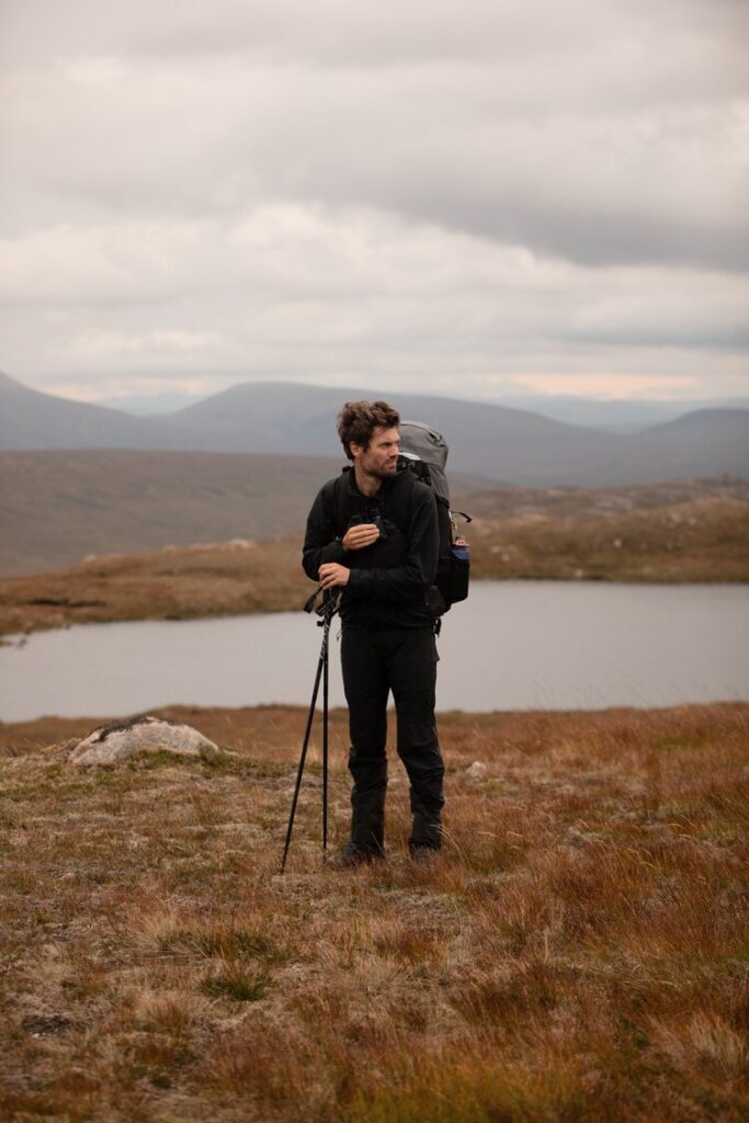
Portrait of my trail companion and good friend, David Cooper.
We finally reached our midway point in Torridon where we collected our re-supply package and pushed on past the shores of Loch Maree.
Day 15 was bookended by lochs, Loch Glencoul to Loch Stack. I had wanted to visit Loch Glencoul for many years and it was everything I hoped it would be. There’s a bothy nestled into a peninsula surrounded by water fed by Eas a’ Chual Aluinn waterfall – the highest in the UK. There’s always something beautiful to look at in this lonely corner of the loch. The pathless terrain was rough, tiring and wet, but here we were rewarded with one of the most beautiful sections of the route. We followed the shores of the loch around the headland, past Loch Glendhu and then onto Loch Stack where we set up our penultimate camp before heading to the coast.
We got our first glance of the ocean which signified the end of our journey. The northwest coast, the finishing point now in our scopes. We reached the remote beach of Sandwood Bay in the evening, treated to a hazy pink sunset from our camp, looking down the mile-long white sands as the waves crashed in from the Atlantic. The last freeze dried meal – which truth be told, by this point I’d become quite fond of – and a reflective conversation as we rested on the rocks until darkness before the final push over the barren moorland towards Cape Wrath.
After hours of dreaming of a flat surface, I now craved the unstable bracken
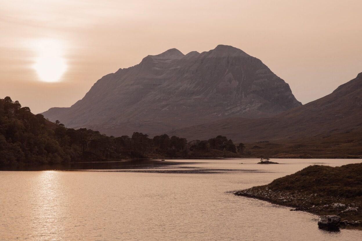
A hazy evening at Loch Clair as the sun set behind Liathach.
Separated from the mainland, Cape Wrath is 107 square miles of moorland wilderness, the peninsula is a bleak but captivating landscape, almost featureless until the lighthouse. We could go no further north – this was our turning point. It was a peculiar way to end an adventure with no one to greet or congratulate us. Only an eerie and barren landscape. We sat in the lighthouse, alone we thought, until John Ure (who has lived there for 13 years) threw open the shutters and offered us warm sustenance in the form of beans on toast.
17 days ago, our adventure’s theatrical introduction came in form of the short ferry across Loch Linnhe to Camusnagaul, where we’d begin our journey. Last night, we got our epic cinematic finale at Sandwood Bay where we concluded our thoughts as the sun set over the Am Buachaille sea-stack and watched the waves rolling in over the white sands. But now, as is so often characteristic of this kind of journey, co-ordinating multiple modes of transport (a 4×4, a ferry and a taxi), as we left the Cape we were rewarded with our awkward, anti-climatic ending.
Don’t miss a single adventure
Sign up to our free newsletter and get a weekly BASE hit to your inbox
You might also like
Story • Kieran Creevy • Jun 16, 2023
Scrambling Before Scran on Scotland’s Misty Isle
Sun-drenched ridge lines with expedition chef Kieran Creevy on the Isle of Skye
Video • BASE editorial team • Jun 02, 2023
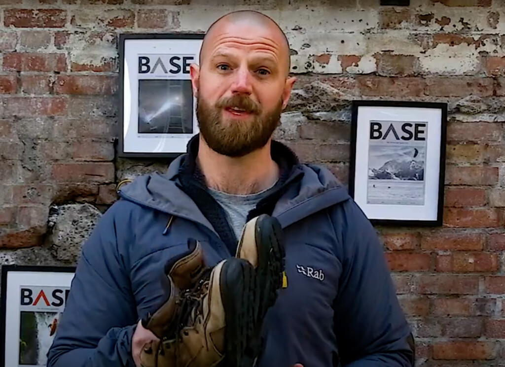
How To Clean And Care For Hiking Boots
Our top five tips to give your hiking boots a 'glow up'
Video • BASE editorial team • Mar 30, 2023
How To Break In Leather Walking Boots
5 fast hacks for breaking in your boots, beating the blisters and reducing the ankle rub