The Salt Path
In partnership with

Perhaps the ultimate example of exploration on your own terms, hiking trails are probably the simplest form of adventure infrastructure in place. In Britain, the longest distance way-marked national trail also just so happens to be one of its most accessible.
Having started life as a patrol route to stop smugglers in the 19th century, The South West Coast Path stretches 630 miles of cliff, cave, beach and harbour of Somerset, Cornwall, Devon and Dorset. It also happens to cover some of the most stunning landscapes in the country, internationally-important wildlife habitats and the Jurassic Coast World Heritage Site, the only place on Earth that displays 185 million years of geological evolution.
While facing the SWCP in its entirety is a colossal task, by hand-picking specific segments catered to your time frame and geographical accessibility, running or hiking for single or back-to-back days can make for some of the most rewarding and accessible adventures.
Below David Miller shares the personal significance of the SWCP along with some of his photography highlights from years spent exploring it. We’ve also included some basic route information from our friends at komoot to get you set up for your own SWCP adventure this summer.
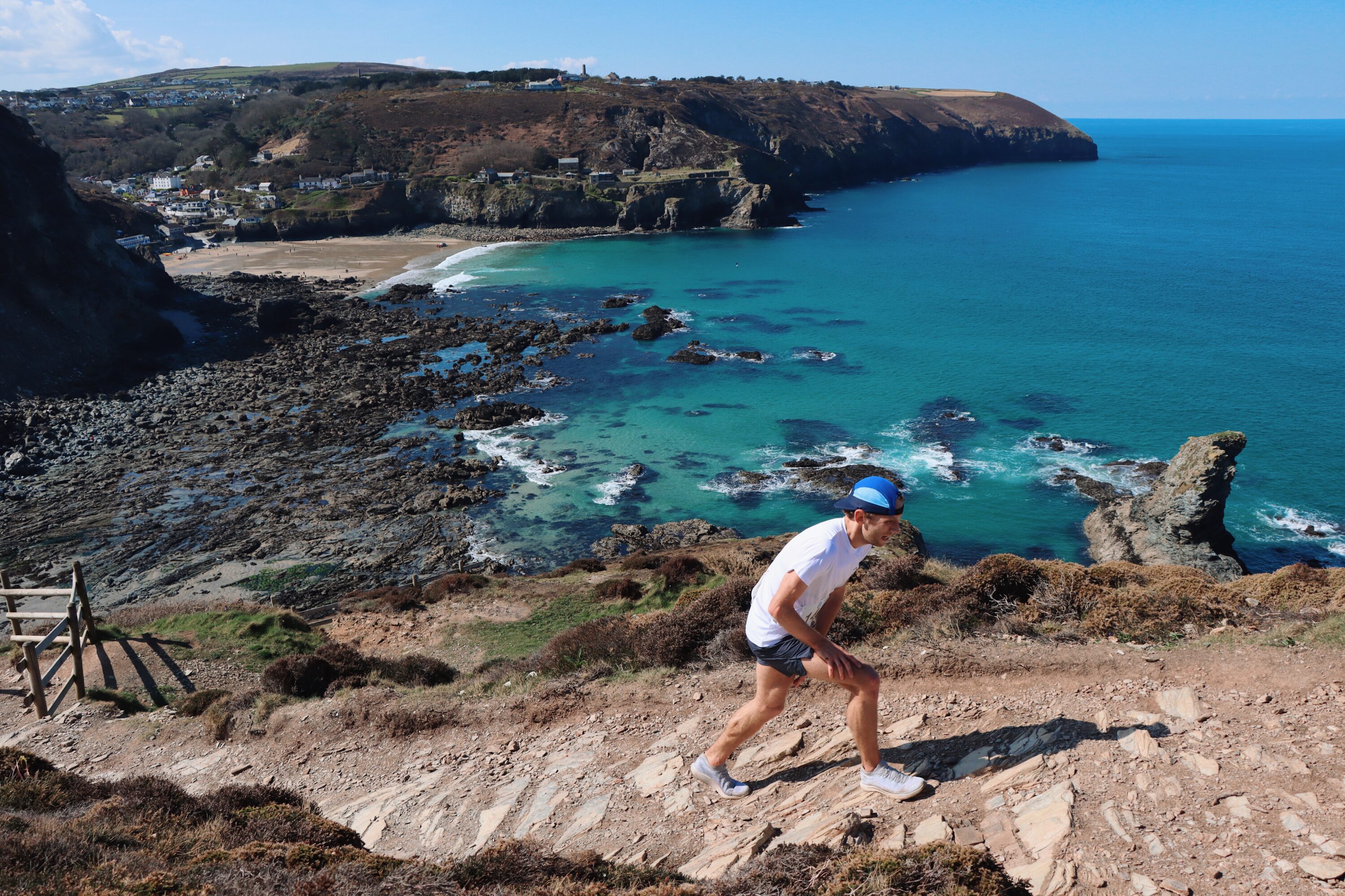
Runner Jamie Stephenson cruising to a course record at the Cornwall KVK race in St Agnes.

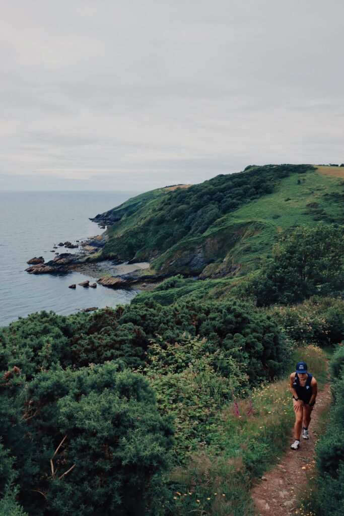
Ashley Scott taking the high line around the Isle Of Portland.
Close your eyes and picture yourself running across the top of a steep, blustery clifftop. Powerful waves crash on the rocks below and the rugged coastline stretches as far as the eye can see. Rain and south-westerly winds add to the drama, testing your resilience.
Running the South West Coast Path is the place to see Mother Nature in full force, with every day and every part of the path bringing new experiences and a new adventure. This long distance trail has always had a hold on me. Better when it’s rough, when the wind is howling and the rain is driving across the horizon intent on pummelling you into submission. Boy does it feel good finishing that five-miler. That smugness because you achieved the amazing.
Being a creative is something I’ve only discovered later on in life. No regrets but now at 36-years-old I want to show the world trail running through my eyes. It’s my calling and my camera allows me to do this. Basically a license to explore. Living on the coast has naturally allowed me to capture runners on this amazing path, the country’s longest national trail with an elevation gain of 35,024m, just a little short of climbing Mount Everest four times!
If you fancy escaping the world for a while, the section between Lands’ End and St. Ives is as remote as it gets. Dropping down and out of multiple coves featuring technical terrain, make no mistake on how difficult this section of coast path is going to be!
Being a Dorset boy though, I have to recommend checking out the section between Weymouth and Lulworth Cove that us locals call the rollercoaster. Be prepared to work hard up the severely steep hills and to be blown away by the famous scenery – arguably one of the greatest views in the country when you come over the brow of the White Nothe. Totally worth it.
See you on the trails!
Part 1: Minehead to Padstow
Starting out on the rugged moorland of Exmoor National Park before passing the surfing beaches of Woolacombe and Croyde and into the sand dunes of Braunton Burrows before making your way around the Taw and Torridge Estuary. The latter part of this section, from Westward Ho! to Padstow, is considered to be one of the most challenging but most spectacular sections of the trail, with dramatic cliff-top views, hidden coves, golden beaches, serene villages, and plenty of wildlife.
To get to Minehead, Taunton railway station is served by direct trains from London, Birmingham, Manchester, and Bristol. Then, catch the 28 bus service, which runs every 30 minutes to Minehead.
From Padstow, you can catch the 11A bus service to Bodmin Parkway railway station, which has direct trains to London and has connections around the country.

Will Harper-Penrose running through the Cornish mining relics at Wheal Coates.
Part 2: Padstow to Lizard Point
Across the North Cornwall coast, you’ll explore dramatic headlands, cliffs, hidden coves, sleepy fishing villages, and some of the most picturesque and best surfing beaches in Britain.
From St. Ives, the coastline becomes wild, providing a real sense of solitude, even in peak season. You’ll explore the Cornish Mining World Heritage Site and eventually discover Lands’ End.
After turning the corner at the end of the land, the landscape has a sub-tropical feel as white beaches, turquoise seas and palm trees flourish. As you continue onto the Lizard peninsula, you will notice the landscape has a character all of its own. This section ends at Lizard Point, the southerly most tip of Britain.
If you’re using public transport for this section, you’ll need to catch a train to Bodmin Parkway railway station, which has direct trains from London and has connections around the country. From there, you need to catch the 11A bus service to Padstow.
To get home, you can catch the L1 bus service from Lizard to Redruth railway station, then catch a train to Plymouth railway station, which has direct connections to London and has connecting services to the entire UK.
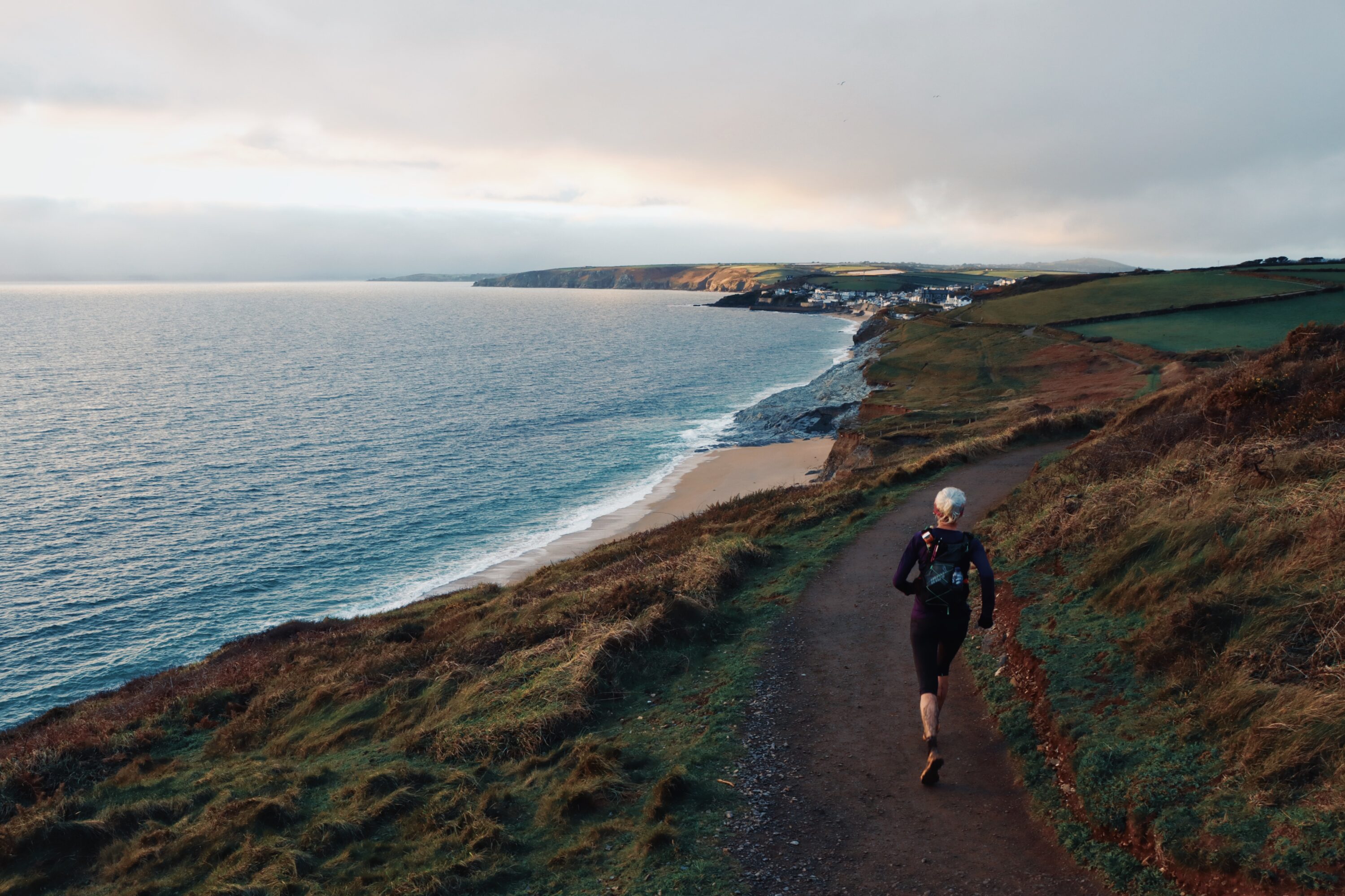
Nicky Spinks finding her flow approaching Porthleven.
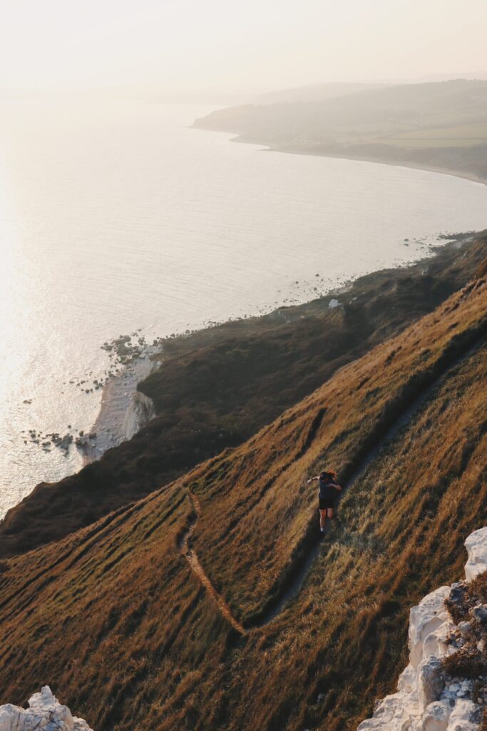
‘Forgive me, lad,’ he said, ‘if I have spoke too roughly. There is yet another way that we may try; and if thou hadst but two whole legs, I would have tried it, but now ’tis little short of madness. And yet, if thou fear’st not, I will still try it. Just at the end of this flat ledge, farthest from where the bridle-path leads down, but not a hundred yards from where we stand, there is a sheep-track leading up the cliff. It starts where the under-cliff dies back again into the chalk face, and climbs by slants and elbow-turns up to the top. The shepherds call it the Zigzag, and even sheep lose their footing on it; and of men I never heard but one had climbed it, and that was lander Jordan, when the Excise was on his heels, half a century back. But he that tries it stakes all on head and foot, and a wounded bird like thee may not dare that flight. Yet, if thou art content to hang thy life upon a hair, I will carry thee some way; and where there is no room to carry, thou must down on hands and knees and trail thy foot.’
J Meade Faulkner from his book Moonfleet.

Ellis Bland passing through Kynance Cove during the 100 mile Arc Of Attrition race.
Part 3: Lizard to Torcross
This spectacular, unspoilt section of the coastline is defined by its rugged headlands, picturesque villages, hidden bays, historic sites, lush farmland pastures, and a plethora of beautiful beaches.
Migrating birds are known to arrive at this coast first and leave it last and in summer, much of the grassland erupts into a sea of wildflowers.
You can catch a train to Plymouth railway station, which is served by direct trains from London and Bristol. From there, you would need to catch a train to Redruth railway station, then catch the L1 bus service to The Lizard.
To get home, you would need to catch the number three bus service from Torcross to Plymouth.
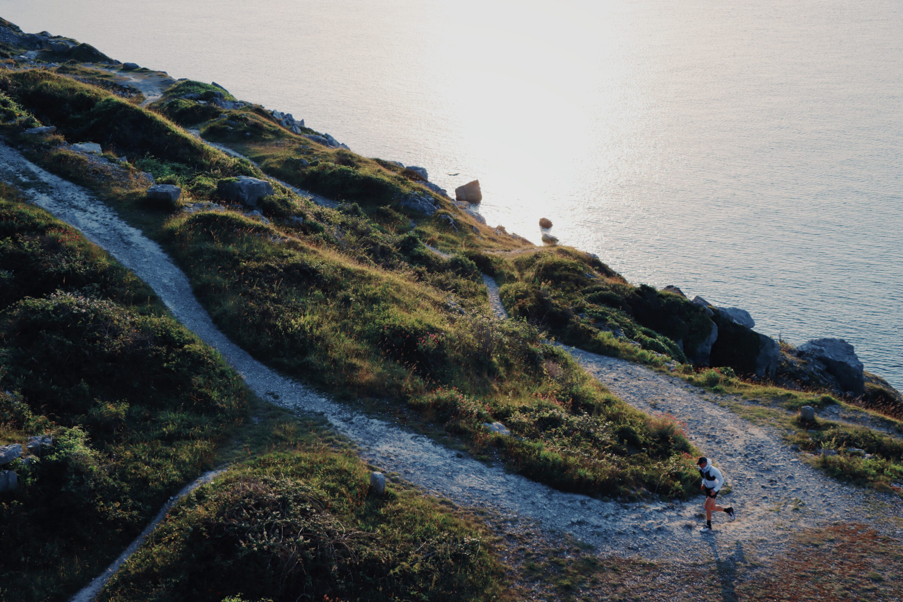
A trail runners paradise at Church Ope Cove.
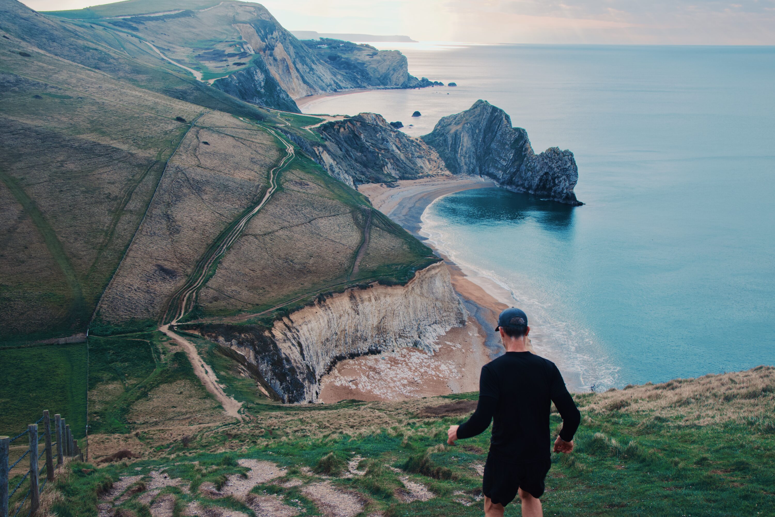
Phil Mills riding the rollercoaster on the Jurassic Coast World Heritage Site.
Part 4: Torcross to Poole
This final section of the SWCP is a magnificent finale along the Jurassic Coast World Heritage Site.
Exploring a unique and internationally-important landscape, this coastline is filled with fascination, steeped in beauty, and rich in opportunities to spot rare flora and fauna.
Here, you’ll discover the only place in the world that displays 185 million years of geological evolution, the Jurassic Coast as well as the English Riviera Geopark, a dramatic and beautiful landscape that is also of global importance. There’s still plenty of hidden coves, sleepy villages, dramatic headlands, rugged cliff-tops and golden beaches with turquoise waters too.
If you are planning to get to the start via public transport, you will need to catch a train to Plymouth railway station, which is served by direct trains from London and Bristol. From there, you would need to catch the number three bus service to Torcross.
As the Coast Path essentially finishes in Bournemouth, you are best to catch a train from Bournemouth Railway Station, which has direct trains to London and connecting services.

Golden Hour on the South Dorset Ridgeway.
There is no set itinerary or direction for completing the trail. However, this series of Collections from komoot, follows the most popular itinerary: 52 days of hiking, split over eight weeks, starting from Minehead and finishing at South Haven Point. At this pace, you have time to explore the many sights along the trail and take in the wonderful scenery.
What makes the SWCP really special is the ease at which it can be separated into individual segments for as long or as little time as you want or is available to you, be that running or hiking.
Despite visiting some of the most isolated and rugged sections of coast in England, the fact that the trail passes by every coastal town and village does mean there are some easy options for public transport to and from your chosen section, plenty of options for accommodation and also re-supply.
Passing by some of the most spectacular landscapes in the South West does mean much of the route is popular and in places, at peak times of the year can feel busy. That said, the trail is so long that many sections afford a real sense of solitude and many of the beaches, coves and villages you pass are also very serene as there is no easy access to them.
Perhaps you have plans to take on the SWCP this year, already have your favourite section or maybe you’ve already completed the entire thing? Let us know in the comments below.
Don’t miss a single adventure
Sign up to our free newsletter and get a weekly BASE hit to your inbox
You might also like

Story • Kieran Creevy • Jun 16, 2023
Scrambling Before Scran on Scotland’s Misty Isle
Sun-drenched ridge lines with expedition chef Kieran Creevy on the Isle of Skye
Video • BASE editorial team • Jun 02, 2023
How To Clean And Care For Hiking Boots
Our top five tips to give your hiking boots a 'glow up'

Video • BASE editorial team • Mar 30, 2023
How To Break In Leather Walking Boots
5 fast hacks for breaking in your boots, beating the blisters and reducing the ankle rub
