Can Bikepacking Fight River Pollution?
In partnership with
Feature type Story
Read time 15 mins
Published Jan 10, 2023
Author Chris Hunt
Photographer Pete Scullion
In the north of England, the Northumberland National Park is home to some of the most pristine natural landscapes in the country, famous for a rich historical heritage, the Cheviot Hills and some of the UK’s best dark skies. It’s also home to the Coquet and the Breamish rivers, two of England’s cleanest waterways. But, as the farming communities of this region experiences an economic shift and the rivers become increasingly polluted, these are vulnerable lands. In the summer of 2022, I spent two days riding the Slymefoot Slide, a new off road bikepacking route, to find out more.
A Lawless History
He had been complaining about the increased number of gaugers, soldiers and thieves on The Street, the main north to south route that crossed the Cheviot Ridge near Mozie Law and passed at a convenient distance near the pub. Twice he had been stopped and searched, twice he had received unwelcome blows and once he would have been in danger of his life if his assailant had not suddenly panicked at a strange noise and run off. That time he had owed his life to a wild goat but he knew how close he had come to ending his life on a lonely wind-swept moor. – Roger Allen, Tales from the Slymefoot
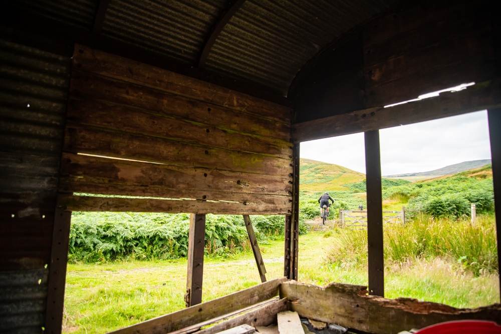
On a remote drovers road deep in what today makes the Northumberland National Park, just a few clicks south of the Scottish border is the Coquet Valley. Here the Sylmefoot Tavern was a notorious waypoint, known for gambling, drinking and violence between travellers in a region famed for treachery and general villainy.
‘The valley is full of stories of treason, murder and illicit whisky production,’ says local mountain biker Tommy Wilkinson. ‘Inevitably, when you get a group of people who are unafraid to use violence to protect their interests, congregating in one place, sparks can fly. It epitomises what life was like in the valley between the late 1600s and late 1800s. It was lawless, or rather governed by rules that were as close to an eye for an eye as you can imagine.’
Today, all that’s left of the Slymefoot is a small rubble of rocks of which no one is even assured of their relevance. The people who occupy these lands are somewhat different too. Smugglers and thieves replaced by upland farmers and foresters. The legend and mystery of the old tavern however remains as does a general sense of wildness across the surrounding country.
An Environment Under Threat
Tommy’s Northumberland roots are several generations deep and while he’s still a keen bike rider, nowadays he also splits his time as an accomplished filmmaker and a self-declared environmental pragmatist.
‘My Grandparents were the shepherds at Uswayford farm for about 40 years, and my dad was brought up there. Back then they had about 2000 sheep over 2500 acres – there was no Uswayford Forest when my grandparents first arrived, it was all peat bogs, moss and remnants of ancient trees,’ he says.
Today, this entire region relies heavily on the economy of farming and forestry but the government subsidies which enable those practices are changing — likely to leave the area exposed to rapidly developing policy shifts. And its rivers are under threat too.
The Breamish and the Coquet are two of the cleanest rivers remaining in the country. The Upper reaches of these rivers some rare attributes – allowed to move around freely as they should; braiding, finding new routes, unimpeded by weirs and dams and connected to their floodplains. While fish can struggle with these barriers and extra pollution downstream, if they get through they can find a space to spawn in clean, fresh and clean waters. But unfortunately in 2019, even these, alongside every other river in the country failed a chemical test.
The future of this environment, will require the engagement of a younger section of society, the key to which, Tommy believes, lies in the introduction of outdoor sports and adventure into the local economy. As such he has established a series of downhill mountain biking races, co-founded the Cheviot Valleys Trail Stewardship, and in 2022, he designed a multi-day bikepacking route built to explore the highlights, experience wild clean rivers and encourage connections between people and these lands. The route, of course he names after the infamous tavern, the Slymefoot.
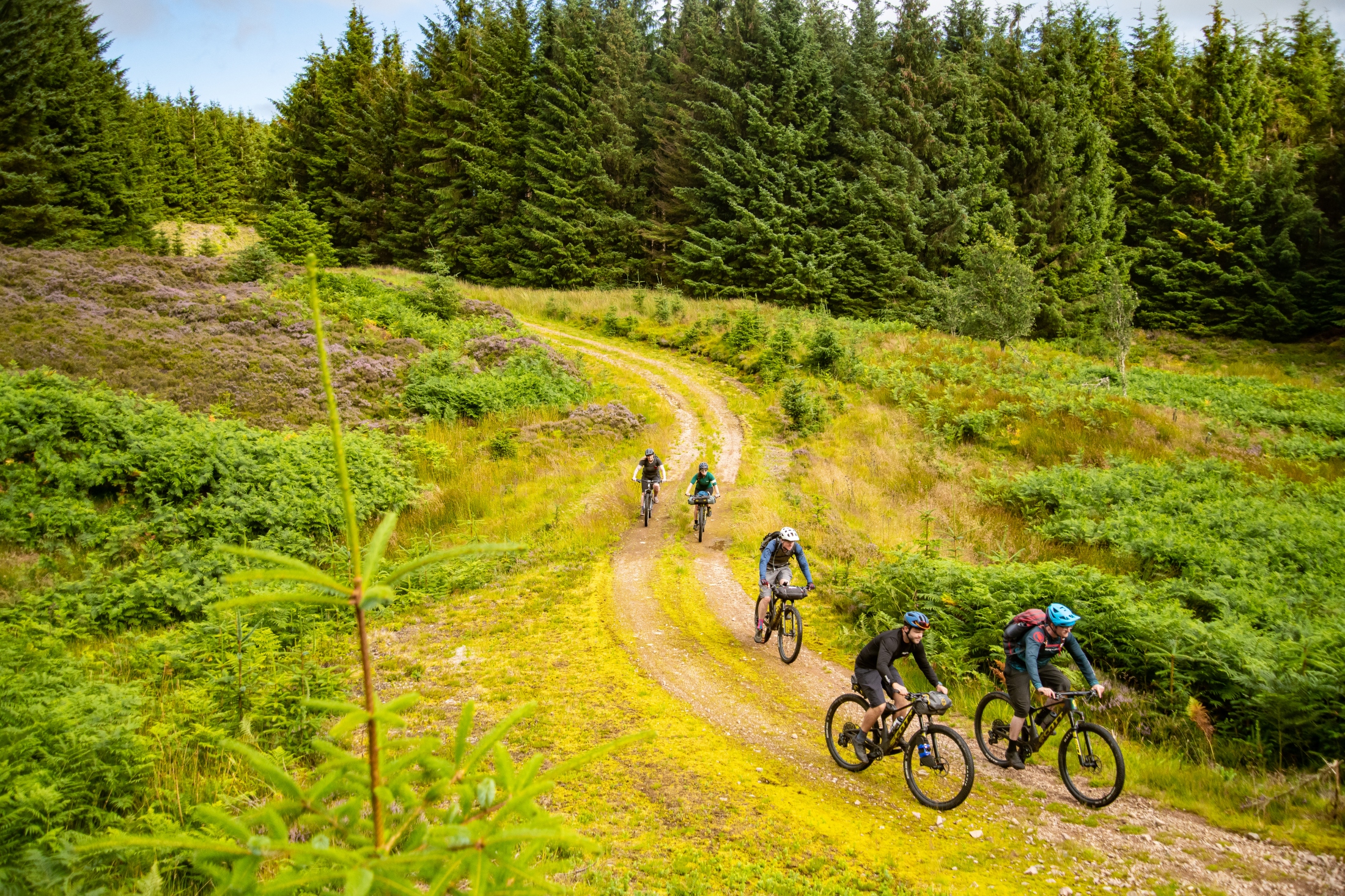
In August, I got to ride the Slymefoot Slide alongside Tommy and an assorted group, brought together by a curiosity for the region. Together we’d be among the first to explore the route and discover the raw nature of these valleys, hills and rivers.
Bikepacking the Slymefoot Slide
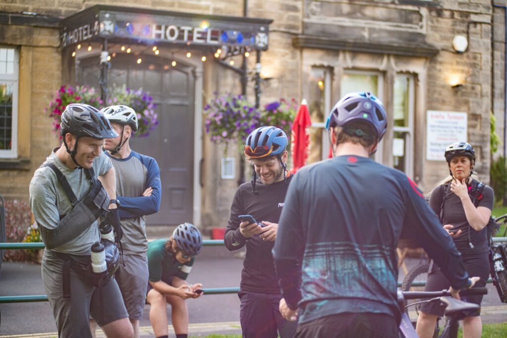
Bright and early, our newly bonded group meet at Armstrong Cross in the town centre of Rothbury. Few of us know the area in any detail, and so the opportunity to explore it in the hands of those who’ve designed the route feels like one worth savouring.
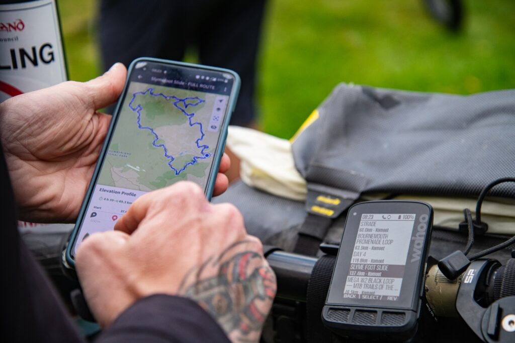
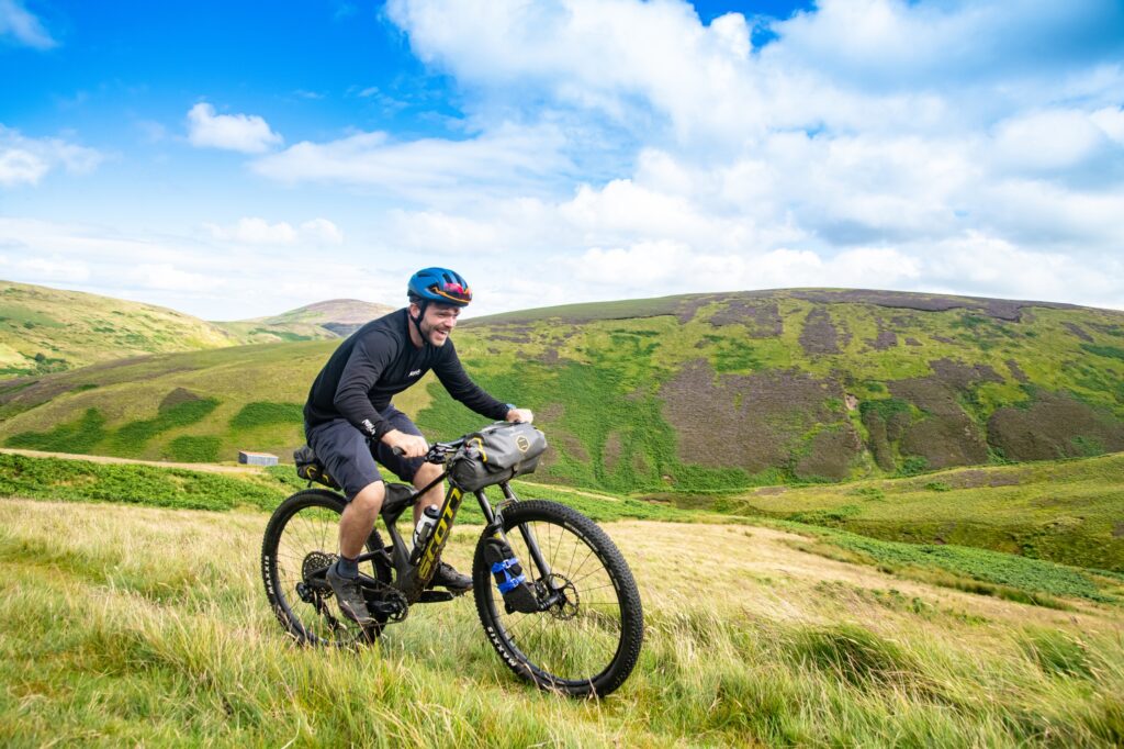
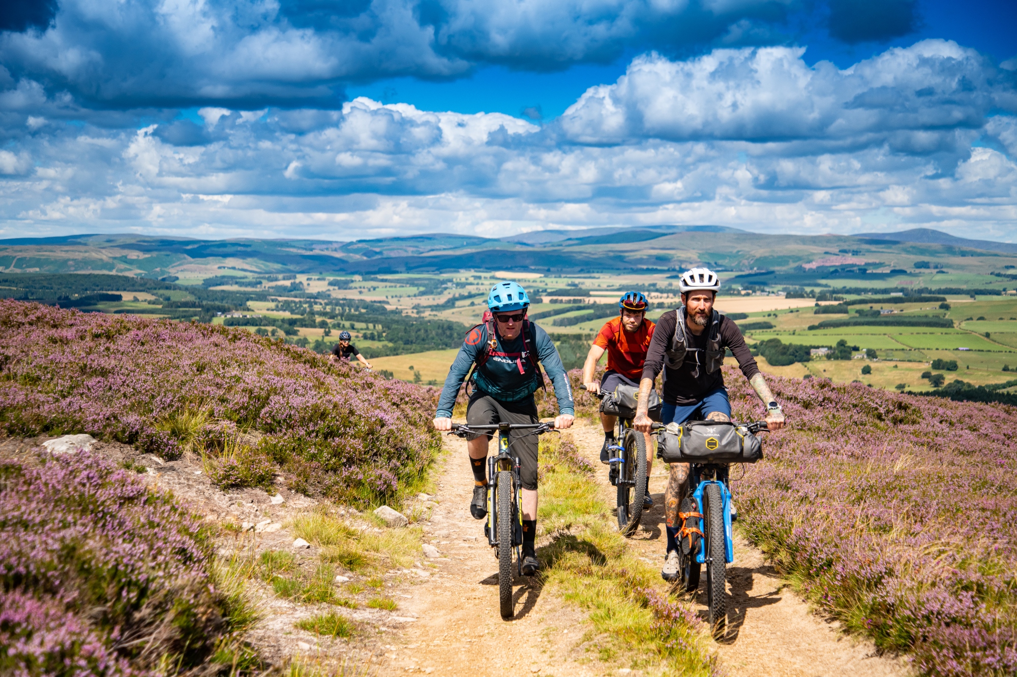
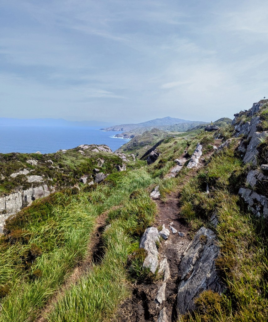
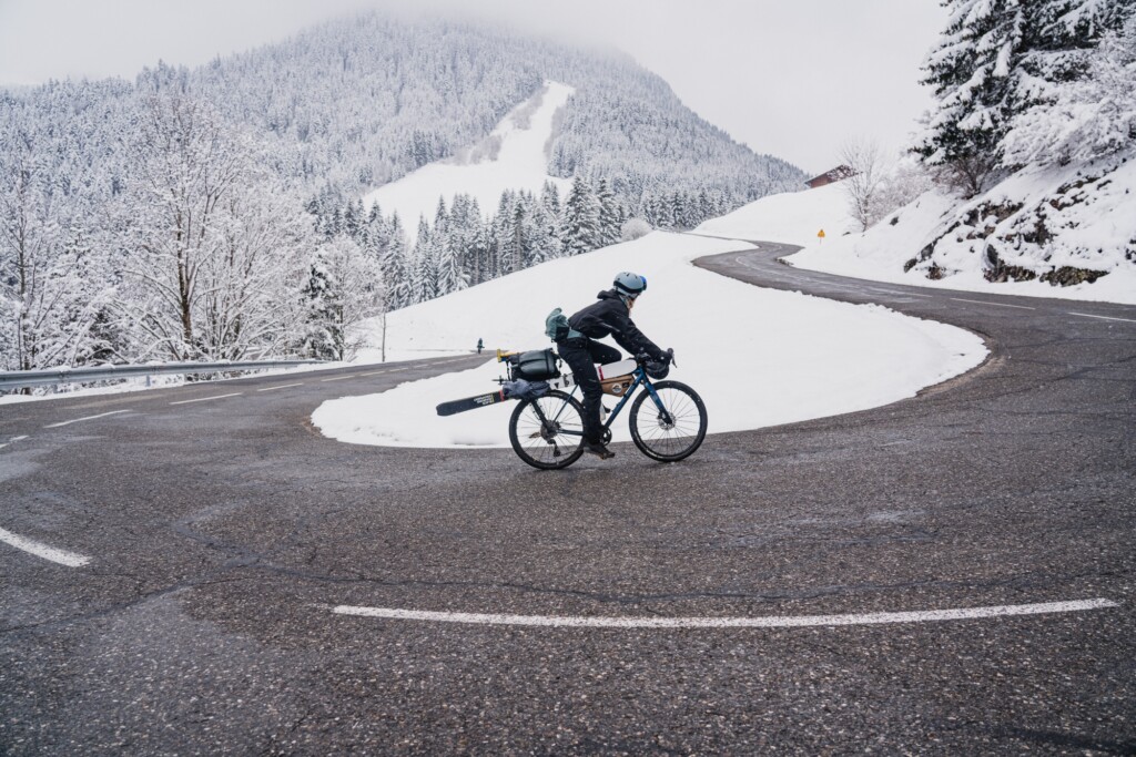
We load the GPX file onto our respective devices and are soon heading north, climbing our way through narrow back lanes and bridleways skirting the small surrounding hamlets before entering the Northumberland National Park proper. The route we have ahead of us is a total of 114km of off road exposed moorland and forest gravel tracks with an accumulated elevation of almost 3000m. Today is set to be our longest. A gruelling 82km and the skies weigh heavy with a dark indication of what might be to come.
There is a wild spirit about the communities and feeling of the place, a freedom to get on with things
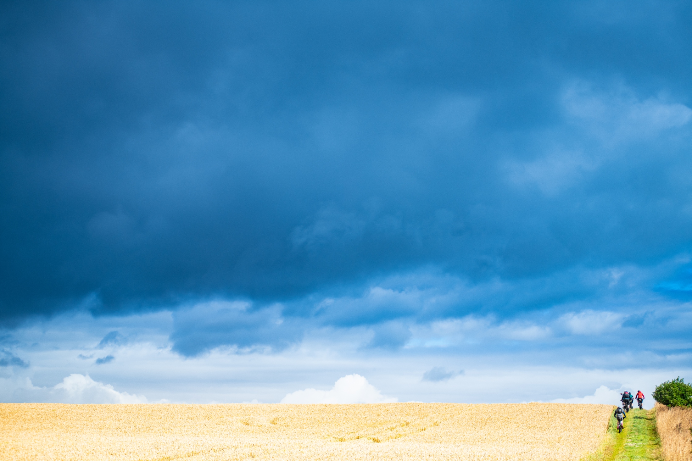
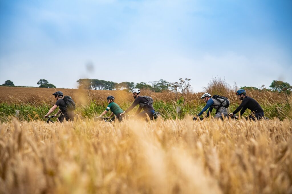
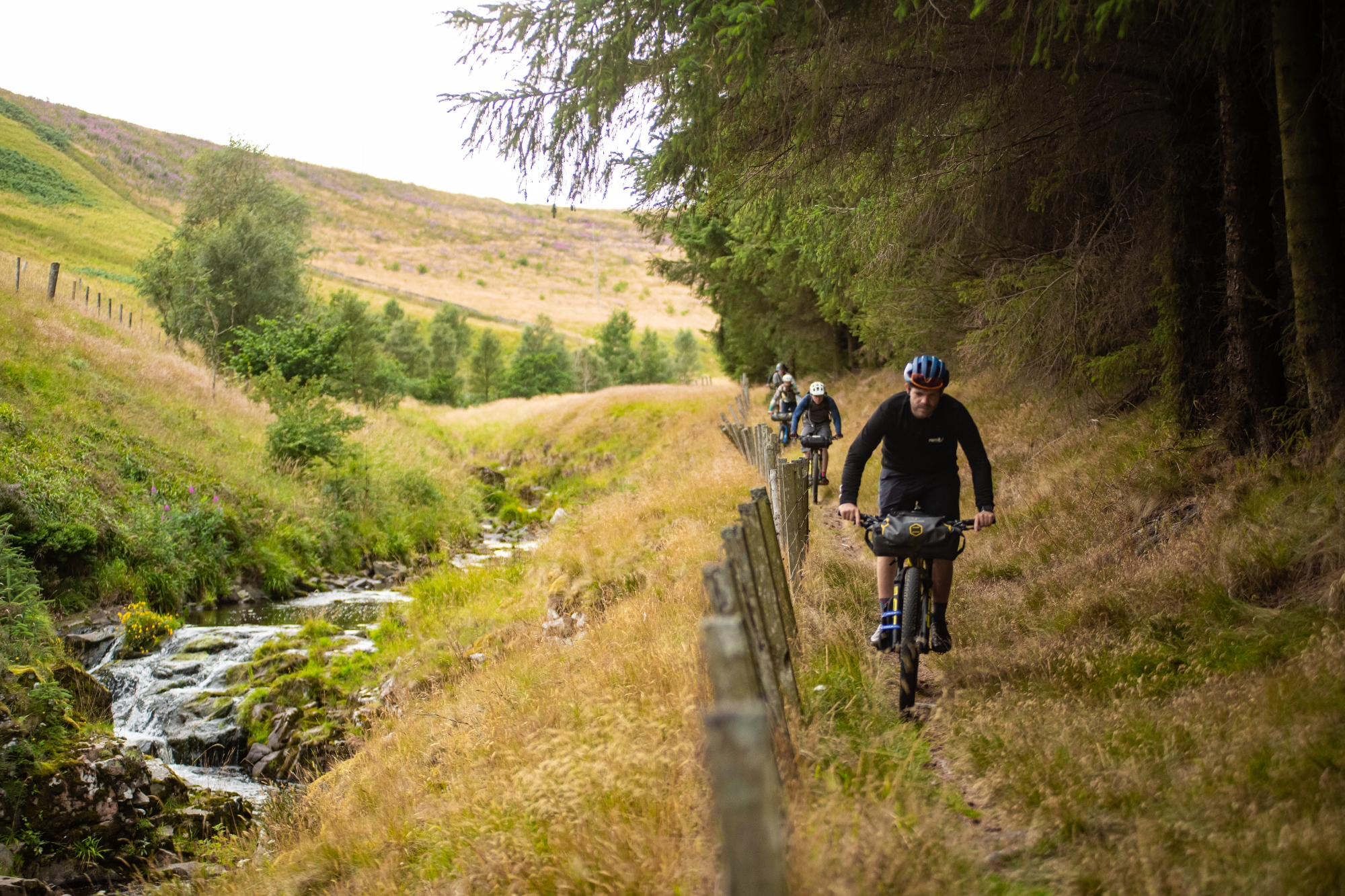
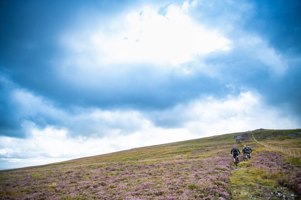
We soon hit the farming territory this region has become known for, and we find the single and doubletrack paths that line fields of wheat and rape. The clouds ahead of us remain threateningly dark in contrast to the vibrancy that surrounds us.
We meet the road and follow a winding tarmac descent down to the valley floor where we’re hit with a torrential downpour. Jackets on and zipped tight around our helmets, we take brief respite behind the high sided hedges from the horizontal wind and rain where we can. One thing we have to thank the blowy conditions for is the speed at which these downpours pass overhead and we’re soon continuing our climb onto the exposed moorland that makes up large swathes of this national park.
The Coquet Valley is the most sparsely populated region within England with about six people per square kilometre, which means as a city dweller much of the time, this landscape feels untouched and remote, wild perhaps.
‘It’s a difficult term to contextualise when it comes to this area,’ explains Tommy. ‘It’s not wild in the ecological sense, the land is managed the way it is out of economic needs, choice, culture etc, and it is very much managed. However I would say there is a wild spirit about the communities and feeling of the place, a freedom to get on with things, enjoy the space and see wildlife that is declining, such as the curlew, lapwing, snipe and raptors.’
As we make our way further into the park, the terrain becomes steeper, the landscape less accommodating of us and our bikes. Steep hillsides seem to rise from nowhere. In cycling terms these aren’t large climbs, varying between 100 and 300 meters at a time, but they’re brutal, comically steep, ruler straight and littered with spherical boulders ranging in size between tennis ball and football. We all adopt the strange familiar hunched over stance – enough weight over the front of the bike to keep the front wheel connected and enough in the back to keep the rear from spinning out – as we zig zag through the maze of rocks desperately trying to keep the pedals turning.
Reaching a vantage point we can see several patches of flattened trees within the managed plantations – a visual scar left by Storm Arwen earlier in the year. Tommy tells me how the storm is remembered locally for its surprisingly violent impact on the landscape, having brought with it wind speeds measuring as much as 98mph close by. I keep the conversation going as long as I can, buying valuable time in a bid to catch my breath in the howling wind.
We descend into the Breamish valley, where we connect with the eponymous river before stopping for lunch. Among the last 14% of English rivers to maintain good ecological health, these are two of the England’s healthiest waterways. But even these are vulnerable and, like every river in England, failed their chemical test in 2019.
Sat with a steaming bowl of hot soup and cheese toastie to boot, at the Ingram Cafe, Tommy outlines how river conservation in this instance includes a bikepacking route.
‘There’s a theory around shifting baseline syndrome. Where things degrade, that degradation becomes normal and we accept it as the norm, so enter an ever declining curve of health, and that curve isn’t smooth by the way either. It can drop drastically due to poor decisions,’ he says.
‘Rivers are critical in sustaining our lives, and how they are managed can either threaten our lives through increased flooding impacts or protect us from natural occurrences, filter our drinking water, give us clean spaces to swim in and more.
‘If we let our norm become the degraded rivers that currently fill our country, we take another step towards environmental calamity driven by our own hubris. It’s in our control to fix this, and we must. Understanding what we are looking at can help.’
They’re brutal, comically steep, ruler straight and littered with spherical boulders
The beauty of designing a route for people to discover this region is its ability to connect and engage its riders with this beautiful landscape. A reminder of what nature is and how it should look.
‘Seeing two healthy upper catchments of rivers is vital to our understanding of what rivers should be like,’ he says. ‘Teeming with bugs, birds, fish and clear, rocky bottoms.’
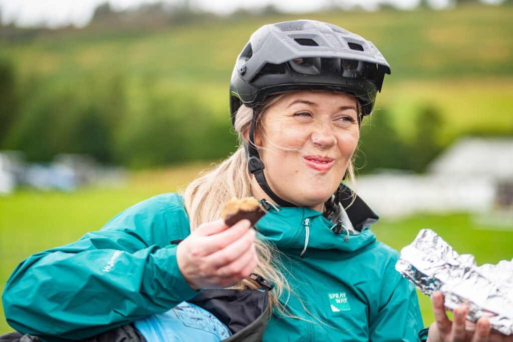
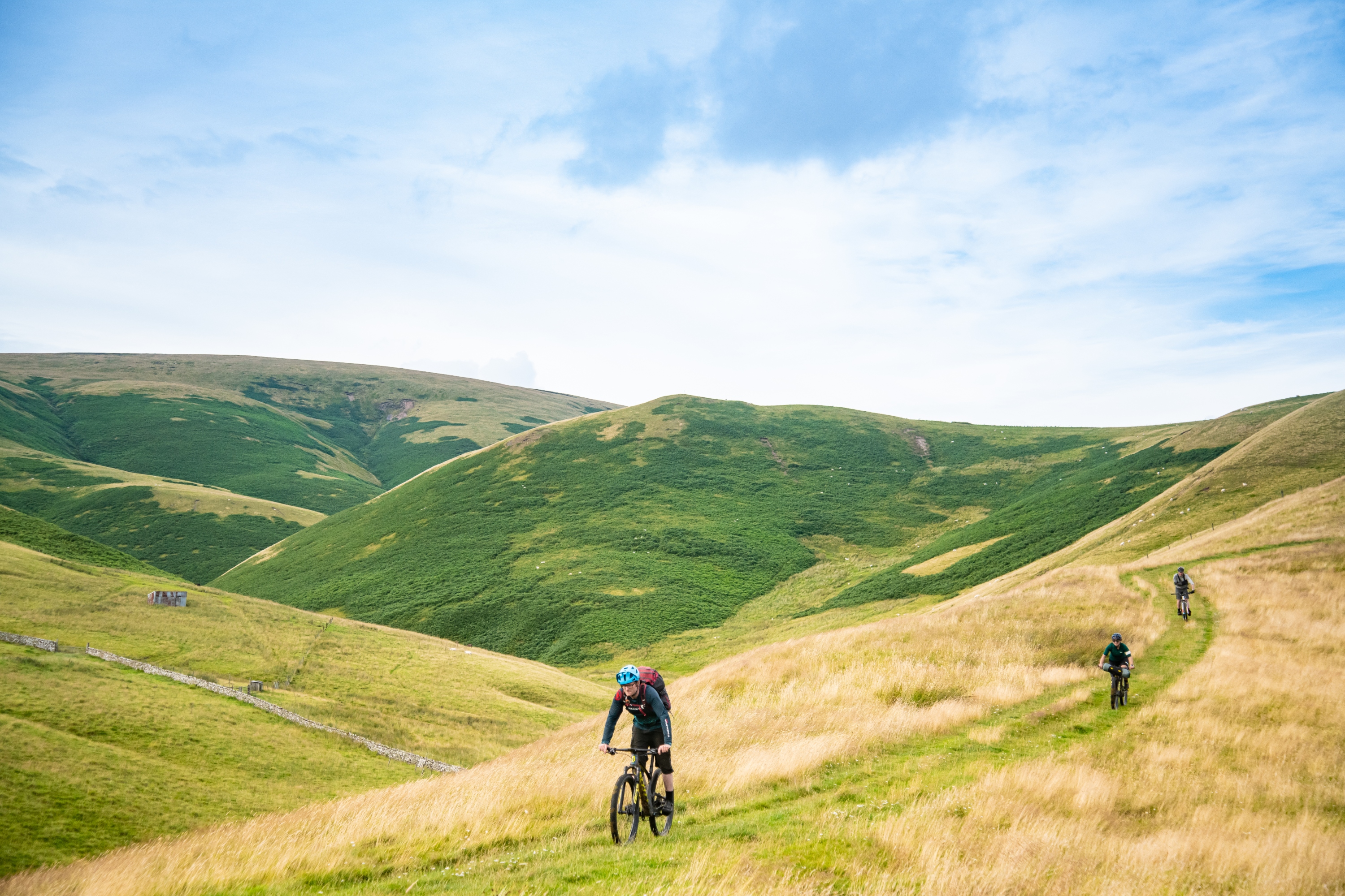
Leaving the cafe, we start the familiar uncomfortable process of on-the-bike digestion, trying to find warmth and movement again in our legs as we start the slow long ascent into the Cheviot Hills. From here we’ll follow the upper reaches of the Breamish river towards the Scottish border and the highest point of our journey, the aptly named Windy Gyle.
As our bodies absorb the calories we consumed at lunch, we group together. We share stories and find out a little more about each other to the sounds of derailleurs collectively clicking into our lowest available gear. Climbing slowly along the long ascent up Salters Road, we head for the Scotland border at what will eventually be our highest point of the two days.
With a little trouble, we negotiate our way through more fallen trees courtesy of the damage caused by Storm Arwen. Creating an assembly line, we each pass our bikes forward and over various fallen trunks, scrambling over and ducking under various obstacles in the way eventually out onto noticeably more exposed terrain.
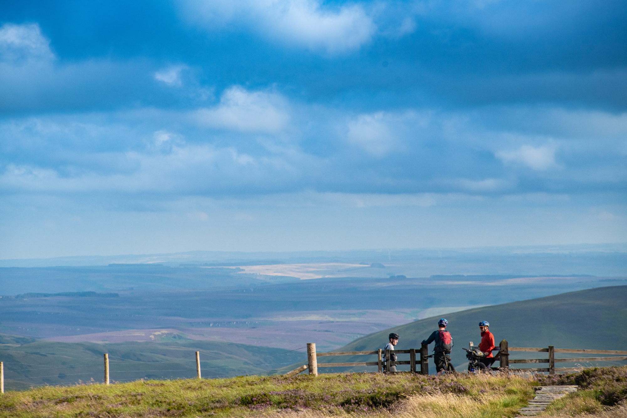
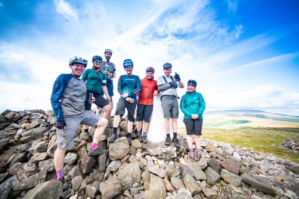
The rounded muscular definition of the Cheviots stand pronounced all around us as the views open up in every direction. We reach the fence representing the Scottish border and our route takes a sharp left to run parallel along it, following stone slabs before the final pitch to the summit of Wyndy Gyle at 619m.
We each pass our bikes forward and over various fallen trunks, scrambling over and ducking under various obstacles
We attack the climb at our individual speeds before regrouping at the cairn on the summit. With a proud smirk I can’t hide, I dig a hip flask from my saddle pack. As I turn to offer it to the group, I see I’m not the only one to prioritise whisky on a bikepacking trip. We share a dram from each other’s and enjoy the far reaching views across the distinctive Cheviot Hills, into Scotland and the North Pennines behind us.
As with any high point, we’re now rewarded with a lengthy descent. Long flowing grassy moorland singletrack leads us into the Coquet Valley. We set off in single file following successful lines and avoiding obvious misjudgements. The long fast downhill connects us with the Coquet River and The Street where the Slymefoot tavern once stood.
Having set off around 8 this morning, now as the sun dips beyond the steep hills that encase us and a chill descends upon the valley, my sore muscles remind me of the length of our day.
From here, in the steep-sided valley we follow military roads before shortly peeling off to connect with flowing singletrack alongside the Usway Burn river. A real highlight of the route this is some of the funnest trail riding alongside a stunning stretch of pristine water.
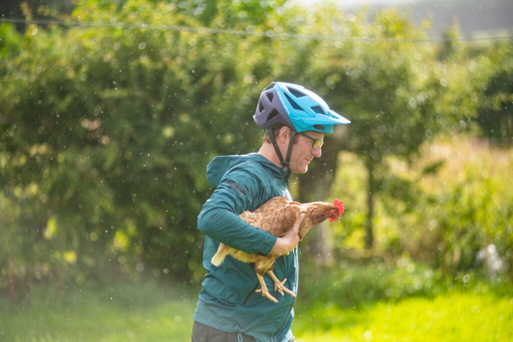
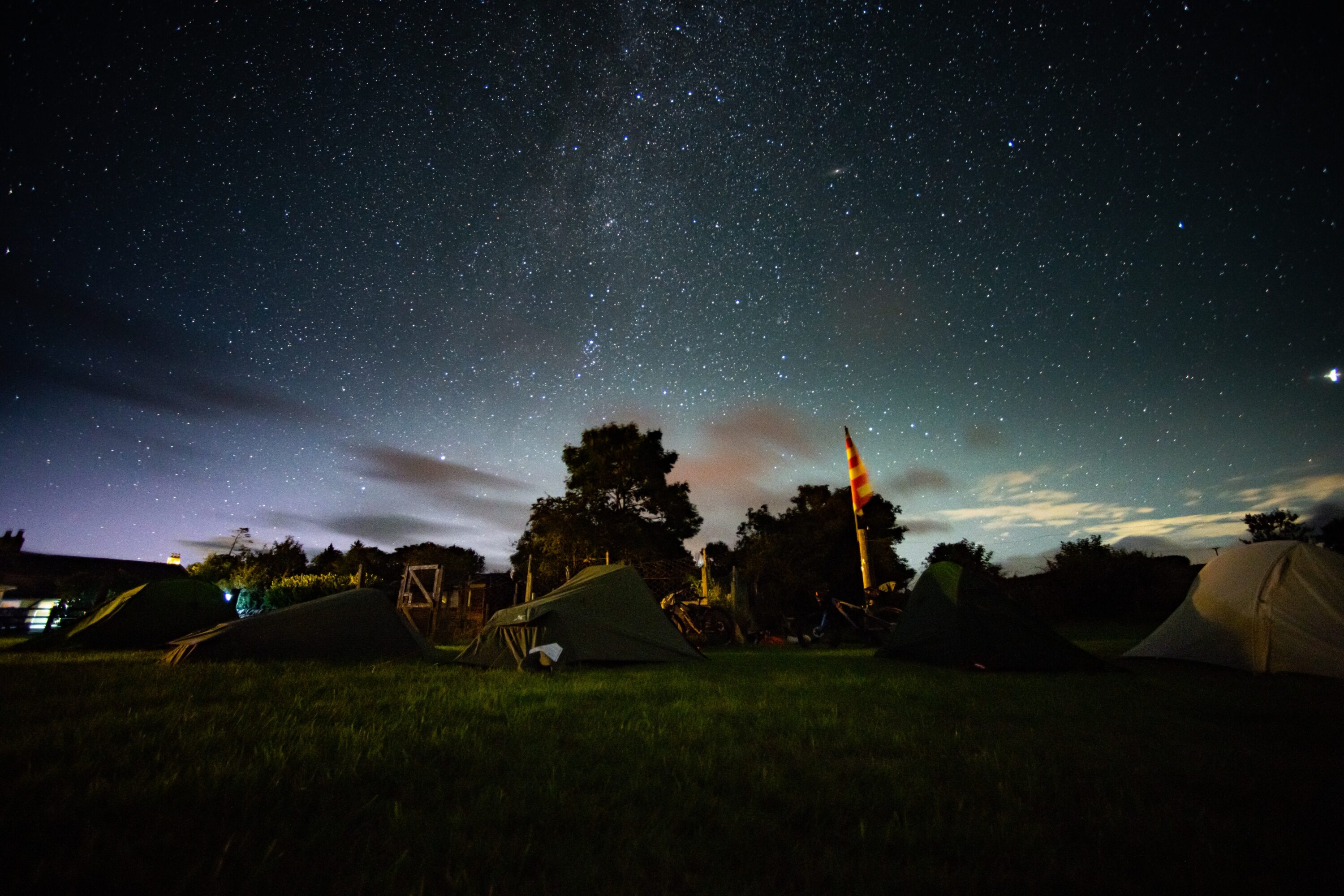
Eventually the Usway Burn meets the Coquet as does our tucked away singletrack connect once again with the tarmac that flows beside it. While it’s been a long day, tangible in the aching of my legs, it’s nothing a flowy stretch of tarmac can’t solve. In that familiar sense of childhood excitement we find ourselves unable to hold back from edging our front wheels ahead of one another as the pace slowly quickens until we reach our final destination, the Rose & Thistle in Alwinton. The pub’s owner has agreed to let us set up camp in the garden alongside his chickens and under the famously dark skies of the national park.
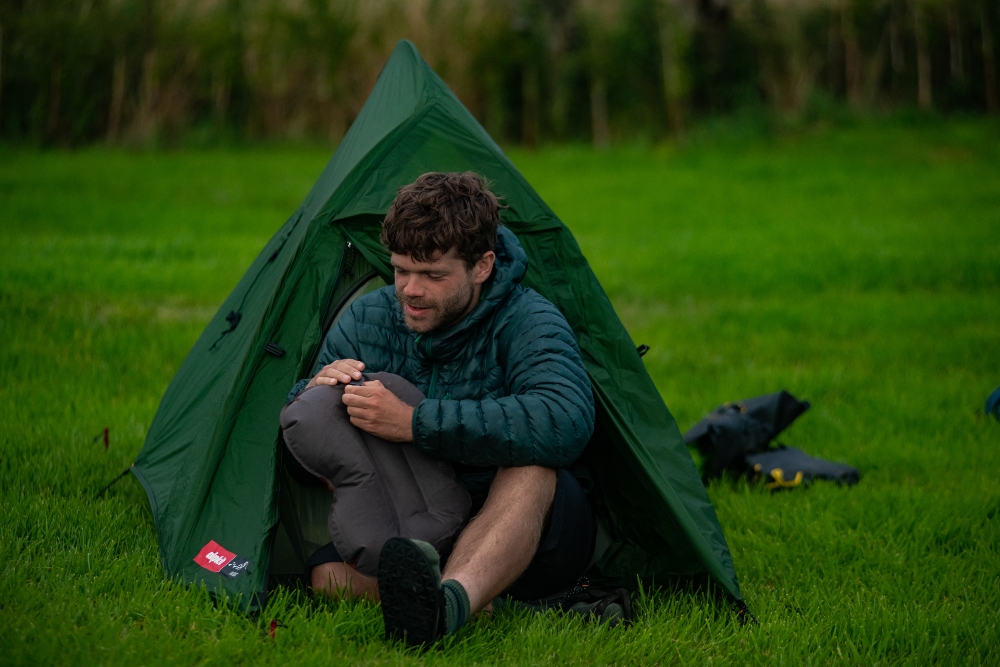
Waking to pecking on my tent door and the smell of a cooked breakfast, we rise to perfect sunshine and a not too distant rainbow, reminder of the ever-volatility of weather in the North. We stuff sleeping bags and tents back into bikepacking bags which we strap back onto our seatposts and handlebars, and we roll out for what I’m promised will be a much shorter, easier day.
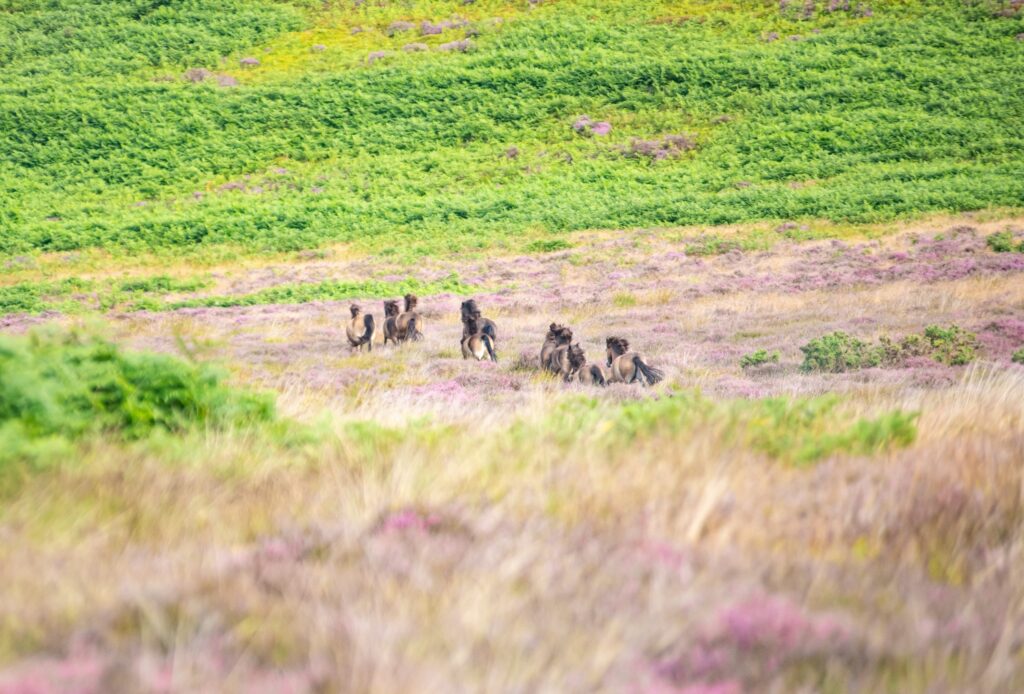
Today’s one major objective is the lengthy but thankfully more gradual climb of the Whitefield Trail. The dreamy gravel doubletrack which carves a route through a sea of purple heather as the Simonside Hills opens up around us. We stop for a few moments to enjoy the sunshine and marvel at a pack of wild Exmoor ponies tearing through the brush below. The vantage point here is perfect for an appreciation of how far we’ve come as we point into the distance retracing in reverse our lines of travel, following the Coquet Valley up into the Cheviot Hills.
Our final push takes us along the edge of Harwood Forest – a reserve for the local red squirrel population and host to more perfect single and double track trails – before our final descent back into Rothbury marking the end of our journey.
While it’s not even been two full days since we left the same spot, as we return with fatigue in our legs and smiles slapped across our rosy faces, the feeling of escapism and genuine adventure we’ve gained along the Slymefoot Slide is unquestionable.
Now, back in Rothbury town centre, sat with plates of food and cold beers in hand, we reflect on the experiences and views of the past two days and conversation once again settles on the state of our rivers.
‘I’m sure we all have images of being sat next to, or playing in water as kids. It’s a huge part of our national psyche, imagery and literature, and that’s important to conserve,’ says Tommy. ‘But there are many rivers I wouldn’t let my 2-year-old near due to huge risks of getting ill.’
Since the River Pollution Act was passed in 1951 and its subsequent amendments in the decades that followed, urban rivers have slowly been cleaning up their act over recent decades in the clean up process of the toxic industries of our cities. The same however cannot be said for rural rivers which have declined in health due with sewage discharge and pesticides.
‘Rivers really are critical in sustaining us, and how they are managed can either threaten our lives through increased flooding impacts or protect us from natural occurrences, filter our drinking water, give us clean spaces to swim in and more,’ says Tommy. ‘Of course, we don’t know what the future will hold for forestry and farming, both potentially vulnerable industries. A healthy river can provide another source of economic resilience if other parts of the area’s economic mix do suffer going forward.
Don’t miss a single adventure
Sign up to our free newsletter and get a weekly BASE hit to your inbox
Other posts by this author
Story • Chris Hunt • Jul 04, 2023
Evolution of Flow: E-mountain Biking in the Swiss Alps
Exploring Crans Montana and the Tièche valley on two wheels
Story • Chris Hunt • May 05, 2023
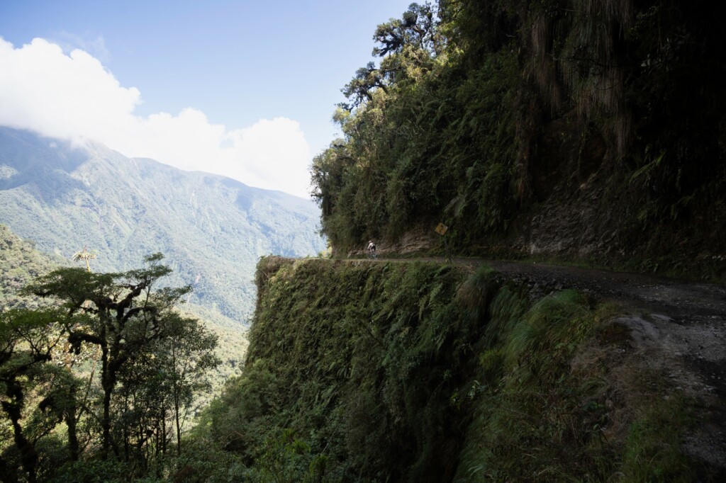
Life-affirming discoveries near Bolivia’s Death Road
Sami Sauri explores the winding gravel tracks of the Yungas surrounding La Paz, Bolivia

Interview • Chris Hunt • Oct 21, 2022
The Man Cycling 1 Million Vertical Metres in a Year
Jack Thompson's latest challenge will see him ride the height of Everest 113 times this year, all in the name of mental health awareness
You might also like
Story • Matthew Pink • Jun 16, 2026
Bucket-listing on the edge of Rebel County
A wild roving hike'n'bike weekend on the Sheep's Head Peninsula, West Cork, Ireland.
Story • Gaby Thompson • Jun 26, 2023
Bike. SKi. Fondue. Repeat
A backyard adventure with close friends in the French Alps
Video • BASE editorial team • May 26, 2023
Top Five Bikepacking Essentials Every Rider Needs To Know About
Don't leave home without these must-have bits of bikepacking kit