Throat of The Dog: Bikepacking the Zillertal Alps
In partnership with
Feature type Story
Read time 12 mins
Published Feb 09, 2023
Author Chris Hunt
Photographer Tristan Bogaard
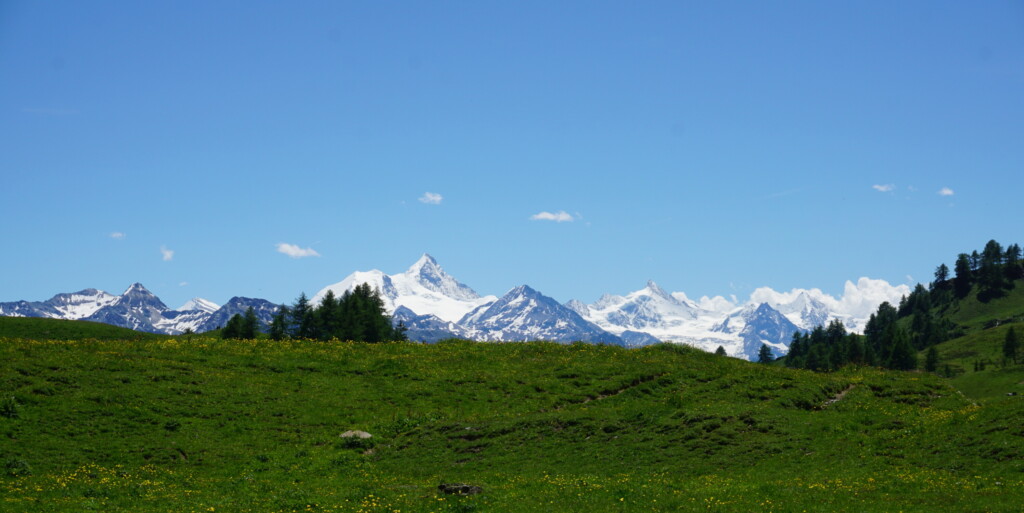
In Italy’s northeastern corner, the distinctive limestone towers of the Dolomites stand proud over the flowering meadows beneath them. Iconic switchback roads, historic via ferrata and world-class skiing ensure these mountains receive plenty of foot-fall year round. Track just a little further north though, and you’ll find a far lesser-known mountainous spine scoring the land to form the border with Austria. These are the Zillertal Alps, characterised by its deep gorges, icy rivers, glaciated peaks and the divide between Tyrol and South Tyrol.
Following the creation of the brand new bikepacking route, I headed out for three days of gravel tracks, fast, technical descents and plenty of hike-a-bike on the Zillertal Trail with the route’s designers Tristan Bogaard and Belén Castelló.
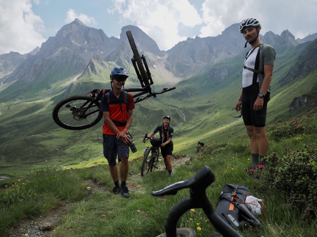
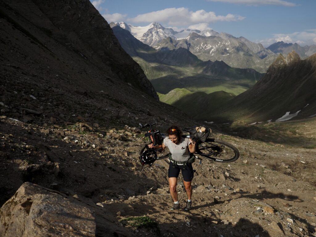
I’m not sure anyone else has really noticed, but it’s hot… like, really hot. Sweat drips from my nose, eyebrows and chin, and my t-shirt, stained with salt, tells of what has already been a long morning. My bike — loaded with three days of kit — is across my shoulders. The sharp angles of a modern cross-country mountain bike geometry dig awkwardly into my spine.
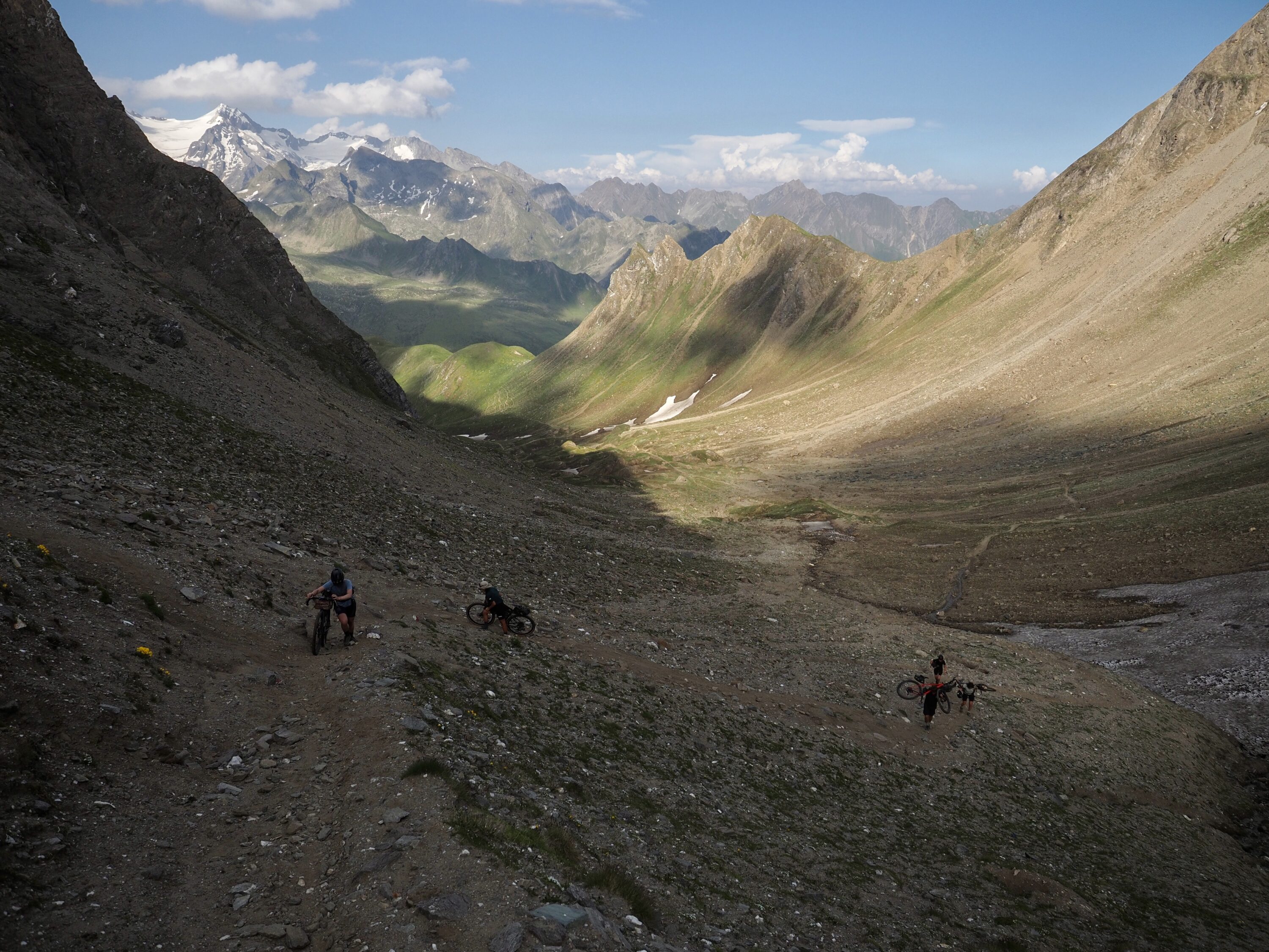
For three hours now we’ve been hiking up a steep, loose scree slope somewhere along the mountainous on the border of Italy and Austria and I still can’t see the top of the pass where we’re heading. There’s little in the way of shade up here. Yesterday’s message on the WhatsApp group haunts as it laps my brain – pack light we’ll need to carry our bikes. Seems I didn’t pack light enough.
When I was first sent the details of the route — 177km over two and a half days, I agreed and barely gave it a second thought. But now, having moved about 3 kilometres in as many hours, I curse my former self. I should have heeded the packing warning more wisely.
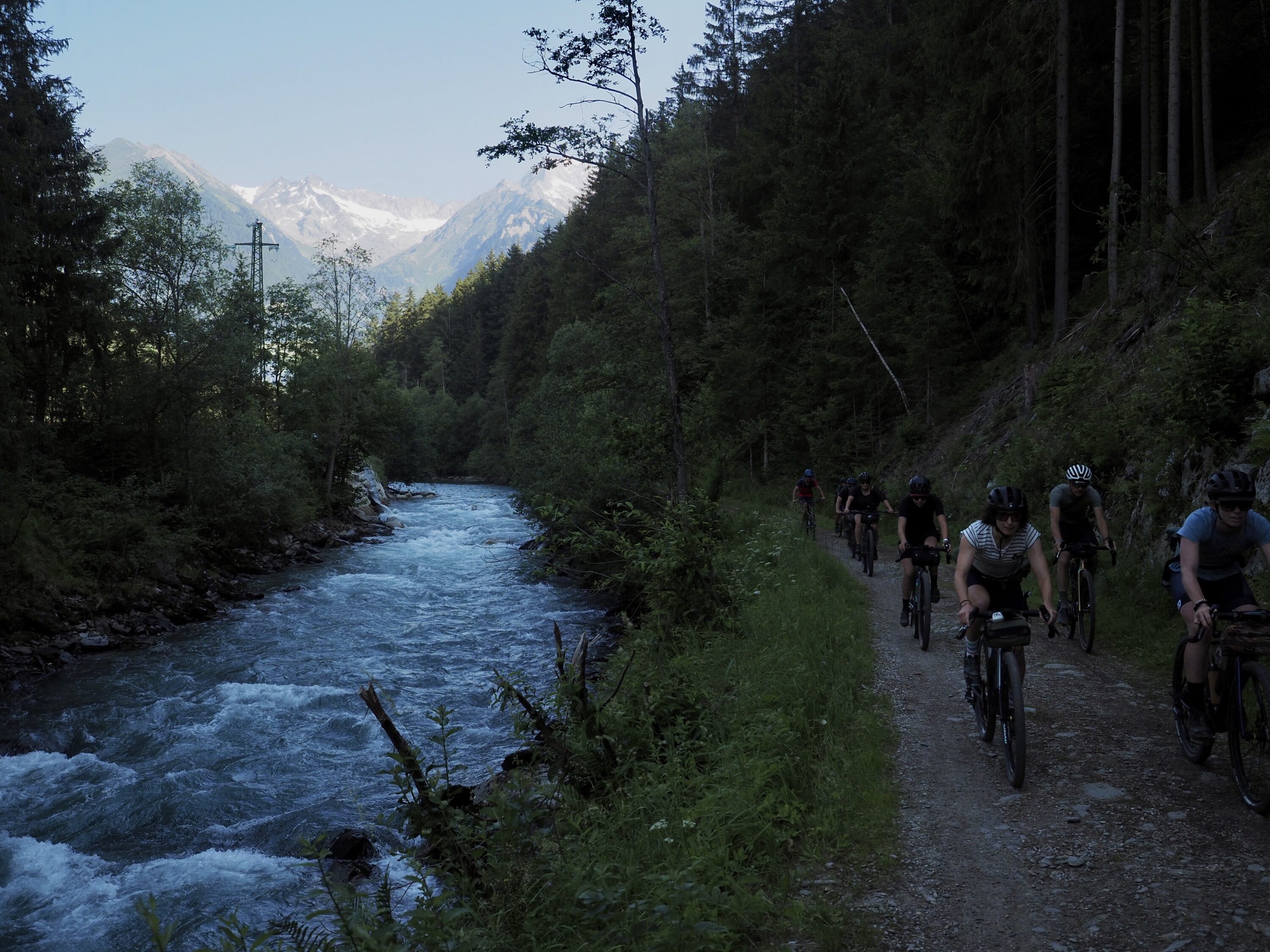
After a fast, dreamy descent this morning from the Pfitscher Joch refugio alongside glacial rivers, vibrant wild flowers and snow capped peaks, I don’t think I’m alone in having been lured into an unrealistic idea of what the rest of the route would entail. Those easy morning kilometres feel like a longtime ago. Today’s objective, the Hundskehljoch – The Throat of the Dog — will take us all the way to sunset.
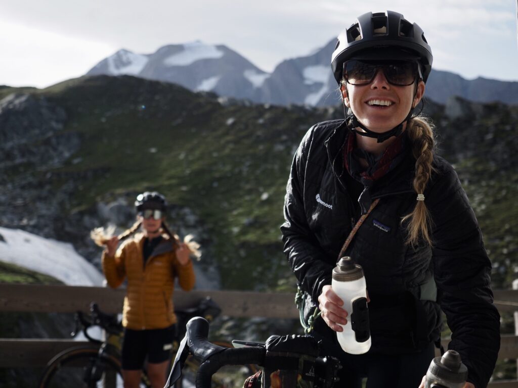
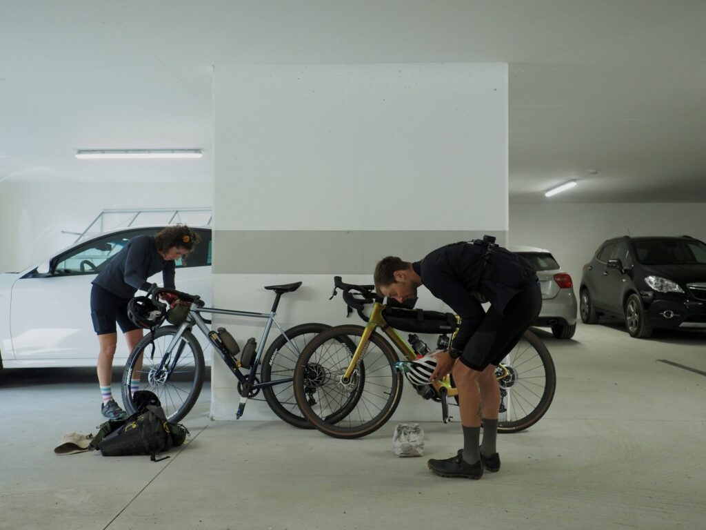
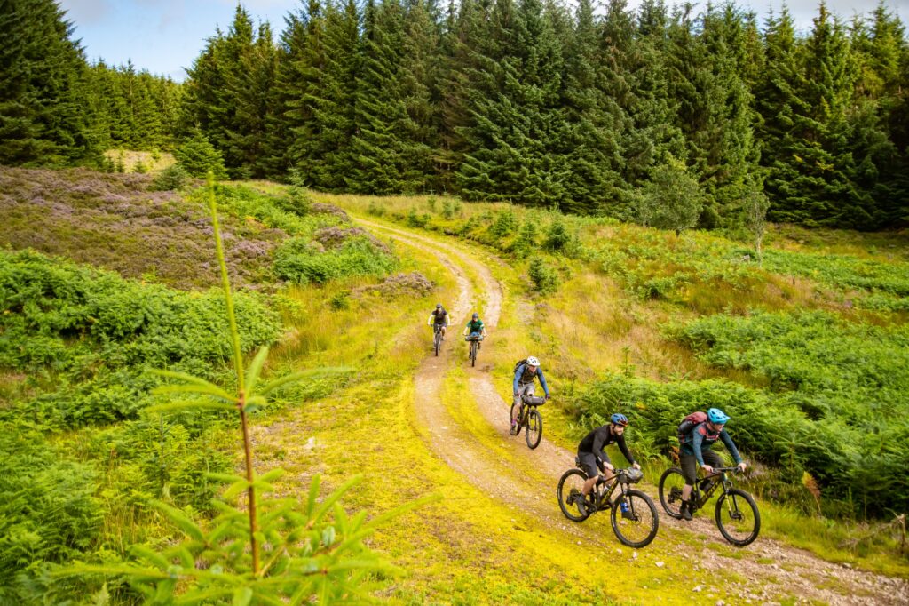
We’re an eclectic group from all corners of Europe: ultra-racers, first time bikepackers, full-time tourers and experienced route designers. What has brought us together is the opportunity to ride and — in some significant sections hike — for the first time a route crafted by Tristan Bogaard and Belén Castelló. In summer 2021, making their way towards the Italian Alps, put off by the sheer number of people on the trails, the full-time cycle touring couple reached for the map in search of something new.
Different machines find success and failure in different parts of the trail but they do so in equal measure and make no mistake, we’ll all be walking with our bikes sooner or later
‘We looked a little northwest of the Dolomites and found this chain of mountains on the map. We didn’t even know its name. So we did some research and found out they were the Zillertal Alps – mountains shared between Austria and Italy,’ Belén tells me. ‘But as soon as you start digging into it, it was very difficult to find routes. While there were a lot of existing bike paths, they all just followed the valleys around the edge of the mountains. There’s traffic, there’s houses, there’s people. You don’t get this peaceful sensation, being integrated with nature. So using komoot we started studying the possibility of crossing them.’
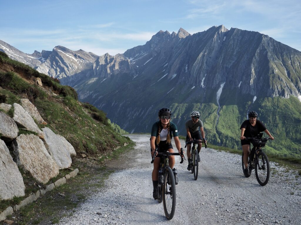
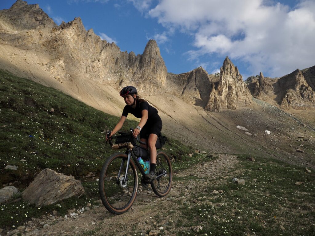
Their new route, the Zillertal Trail, links together three high passes in the Zillertal Alps: 177km of remote mountain roads, gravel tracks and hiking trails with 4,700m of cumulative elevation gain crossing the Italian — Austrian border twice. There is no perfect bike for a trail like this. Smooth tarmac is interspersed with grassy singletrack, rocky scree, smooth slabs and river crossings. Across our team we’ve got the full spectrum of options, from lightweight carbon gravel racing rigs with 35mm tyres to full suspension mountain bikes. Inevitably different machines find success and failure in different parts of the trail but they do so in equal measure and make no mistake, we’ll all be walking with our bikes sooner or later.
‘The thing about including hiking trails is that they allow you to connect incredible sectors like these sick gravel paths up high. You cannot get to them unless you hike your bike at the top of the passes,’ continues Belén. ‘If you look at the geography here, there’s a lot of valleys going into the mountains, but they stop as if in the past they used to be glaciers. So they’re not connected. But with the bicycle, you can reach the end of all the valleys on gravel tracks, then, there’s usually something like three kilometres of a hike-a-bike. So for us, the experiment was going there and seeing if those kilometres of hike-a-bike were actually doable or not.’
A quick glance at the elevation profile shows distinct objectives in the form of three mountain passes either side of 2500m to complete a circular route. Designed to be ridden over 4-5 days, in this instance – the result of other project commitments within the team, we’ve got just 2.5 to complete the trail.
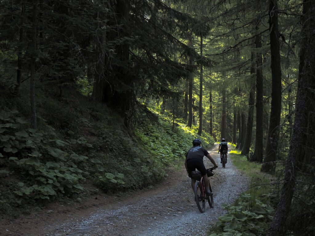
Since starting at the bottom of the valley – today’s view has remained pretty constant. I’ve zig-zagged over asphalt, gravel, and now a narrow hiking path between boulders the size of a small hatchback, hauling my bike up and over sections as I go.
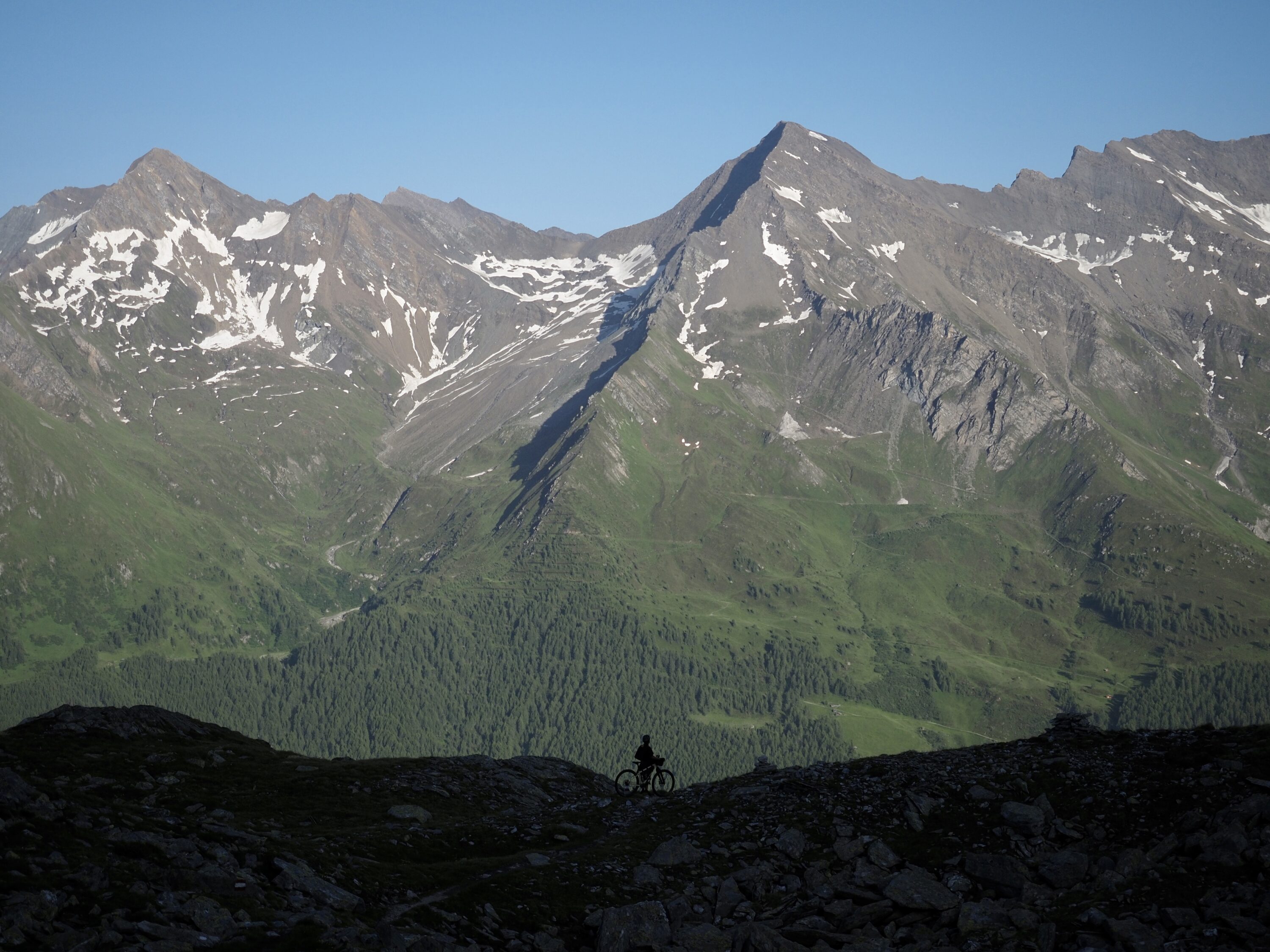
With Austria to our backs, eventually cresting the pass at 2550m, ahead of us stands the Durreck mountains over the border into Italy. With the valley beneath us already cast into shadow, the jagged snow-capped summits light up in the last of the evening’s golden light. The brutal efforts of the last few hours fade into the cool air of the evening.
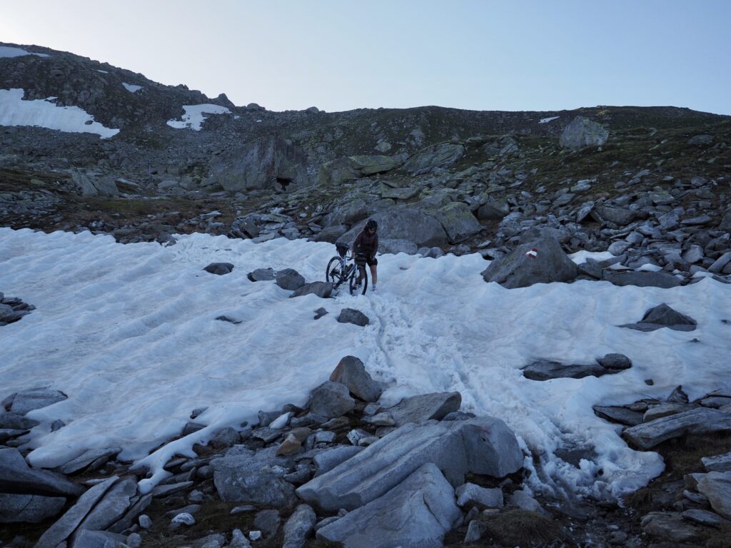
While there’s a shared relief within our group having reached the top, with the descent before us we’re far from done with The Throat of the Dog. The trail is steep and technically demanding. Somewhat cooked, this isn’t the time to push my mountain biking prowess. The hike-a-bike is not over yet. Adding a layer of clothing and taking a bite of whatever is close to hand, we continue with our bikes on our backs. While I’m glad to have the long gruelling ascent behind us, the leg shaking downclimb is no less tricky.
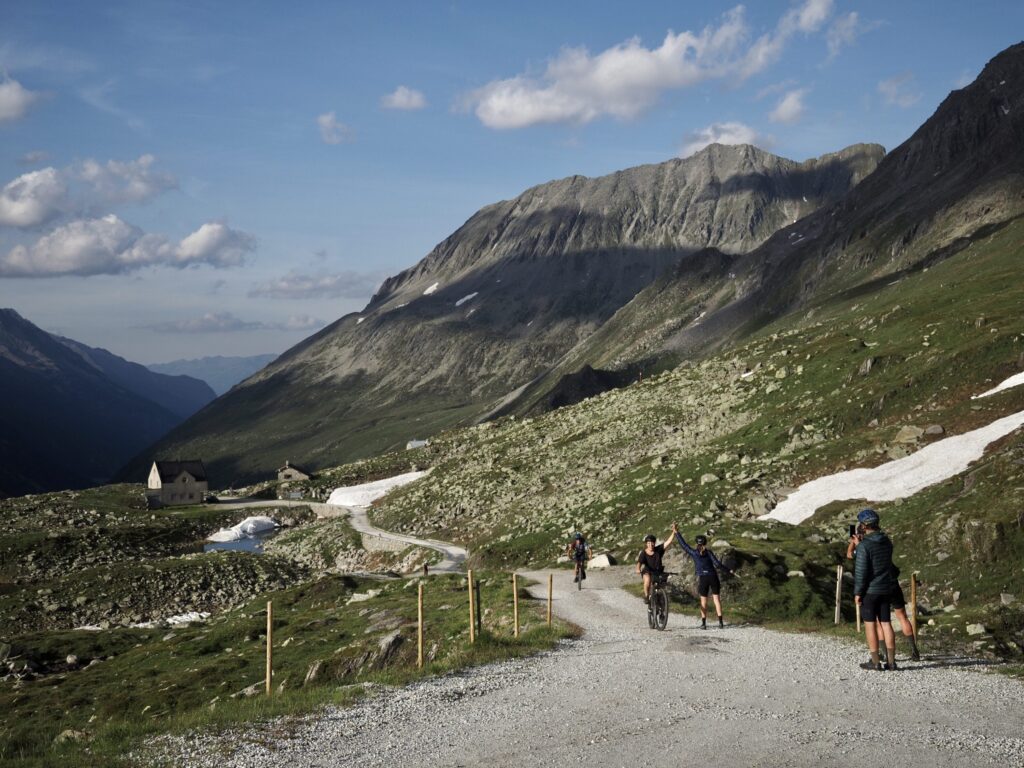
Eventually, having traversed yet more snow and rock, we reach the gravel road at the foot of the mountain and the pack regroups. Morale is high as we pass our sugary choices among one another, our eyes the only thing to give away just how deep we’ve each gone.
We’ve rejoined on a fork in the road, an inviting winding gradual descent or a sharp straight climb ahead. I take one look at Tristan and realise we’re destined for the latter. Climbing switchbacks at this late stage in the day while I can see the asphalt in the valley below is salt in my now gaping wounds but eventually the path flattens, my tyres spin freely and the burn in my legs starts to subside.
You know it’s hot when you’re seeking glacial rivers for respite. As we steadily ascend, the allure of cascading snow melt is too strong to resist
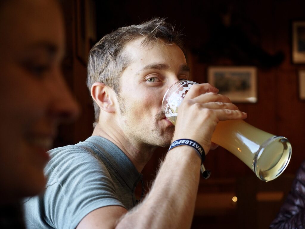
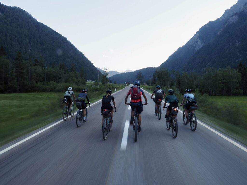
Despite completely emptying our tanks, you’d never know it by the time we hit the tarmac. Like school kids, none of us can resist the tempting thrill of speed as we race each other down the valley and into town. It’s gone 10pm once we arrive at our guesthouse in Lutago. Hungry and tired, we call around in search of takeaway sustenance. We interrogate what’s left of the route over pizza and beer with Tristan and Belén, sleeping soundly to the idea that the worst of the hike-a-bike is behind us.
The following morning marks our final day on the Zillertal Trail — 98km and 2250m of elevation. After the previous day, I’ll keep any preconceptions of what the day holds at bay.
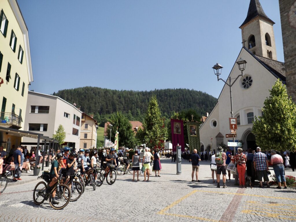
By the time we set off, it’s already even hotter than yesterday, but we make quick progress through the traditional villages within the valley between Lutago and Brunico. It’s easy going as we strike the balance between minimal output and maximum breeze. In Brunico we stock up on caffeine, carbohydrates and sugar and prepare ourselves for the final objective of the trail.
After little snowfall over winter and a particularly dry spring, water levels are low. So low in fact that many of the village’s fountains have already been turned off. Following green valleys strewn with wild flowers we soon arrive at the bottom of the climb.
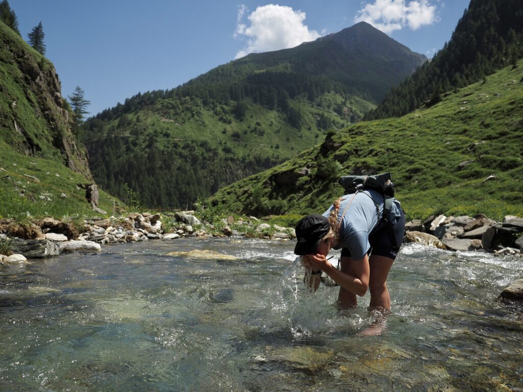
You know it’s hot when you’re seeking glacial rivers for respite. As we steadily ascend, the allure of cascading snow melt is too strong to resist.
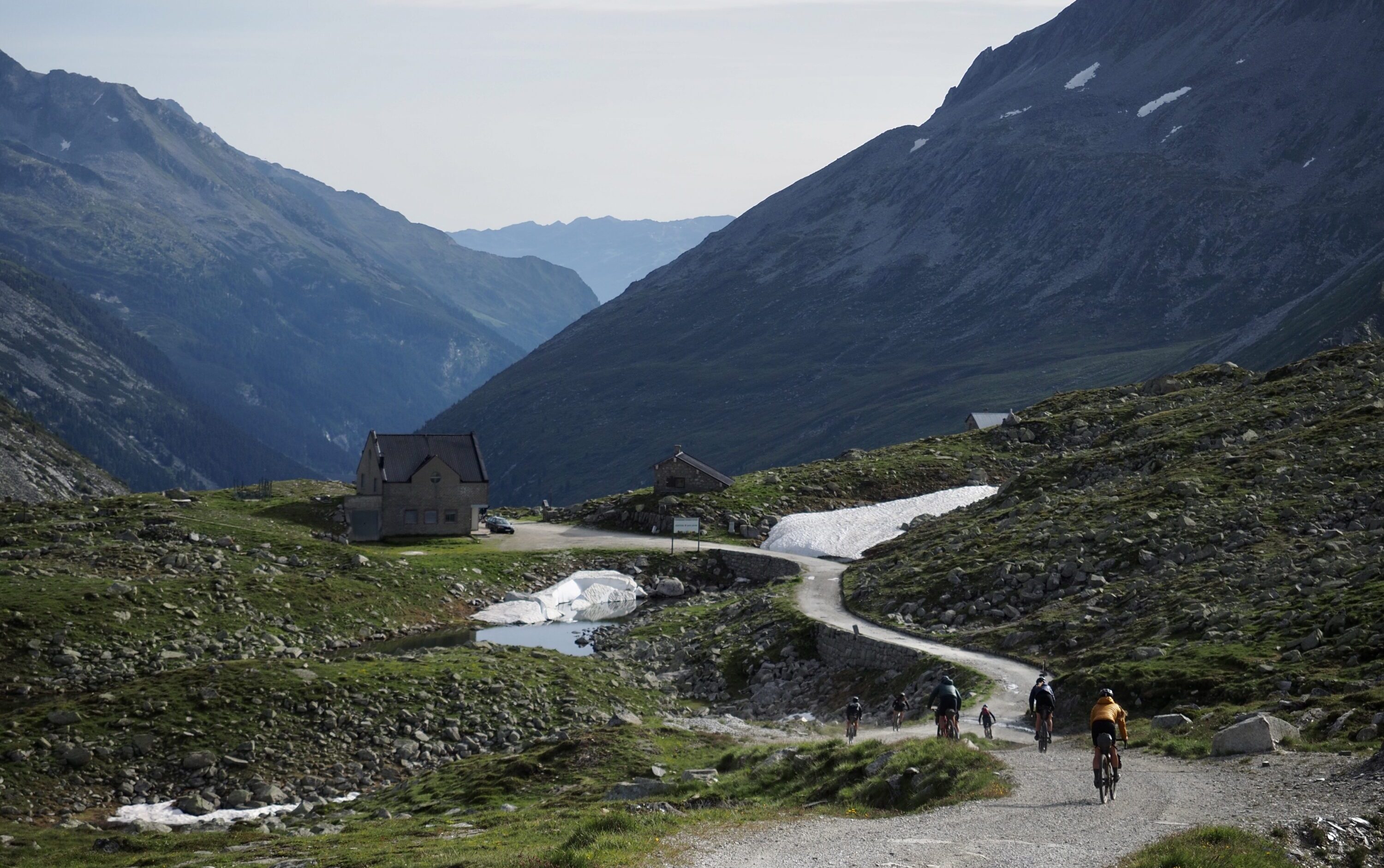
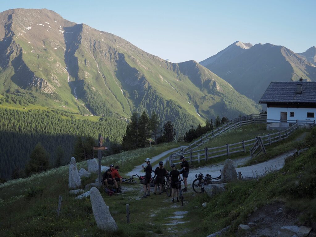
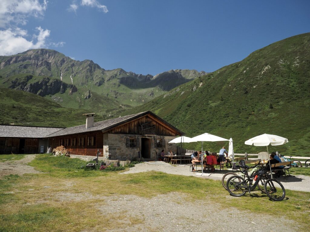
The asphalt runs out in Pfunders. From here, we transition to the gravel that leads us up to the Weiterbergalm mountain hut. This is our last checkpoint before we venture off the path to the foot of the Pfunderer Joch, the third and final pass of our journey. We order plates of sweet and savoury pancakes to share before the final push.
‘Where are you headed from here?’ The hut’s owner / chef enquires with us about our plans.
‘Up and over Pfunderer Joch.’
Clearly used to hikers rather than cyclists hauling their bikes over the pass, his expression is one of mild confusion. ‘Camping at the top?’
‘Nope – we’ll try and make it over and back down to Vipiteno.’
Hmmmm,’ the man glances at his watch. ‘Still a big day.’
Collectively, the group looks to Tristan. ‘We’ll be fiiiine,’ he protests in defence.
Gathering ourselves and our bikes for the final climb of the trail — as well as a 4x pack of liquid Snickers I have stashed in the ice-cold drinking fountain in the hope they’ll reshape — a group of hikers arriving at the hut wish us luck.
With various ridgelines standing tall in front of us, it’s hard to visualise from here exactly where we’re aiming for. In the foreground, sharp singletrack switchbacks scale a steep grassy mound. A good enough place to start I guess.
I figured we’d be riding 95% of today’s trail but once again the bike finds its place on my back.
The gap between now and yesterday’s hike-a-bike suddenly shrinks as once again we prepare our bikes and our bodies for a lengthy stint of hike-a-bike. ‘Trust me, you’re gonna lose your mind when you get to the top!’ insists Tristan, sensing the team’s collective displeasure.
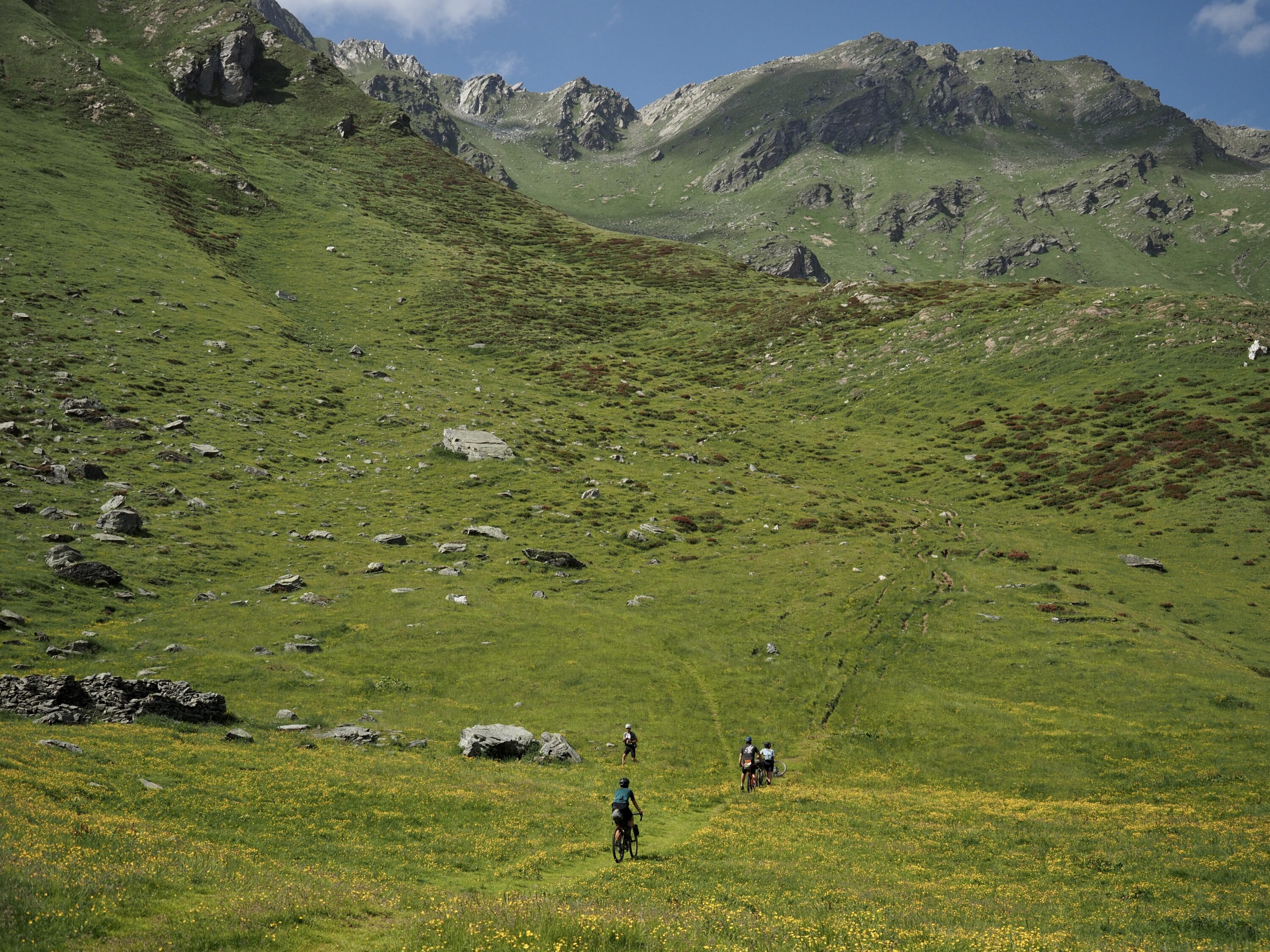
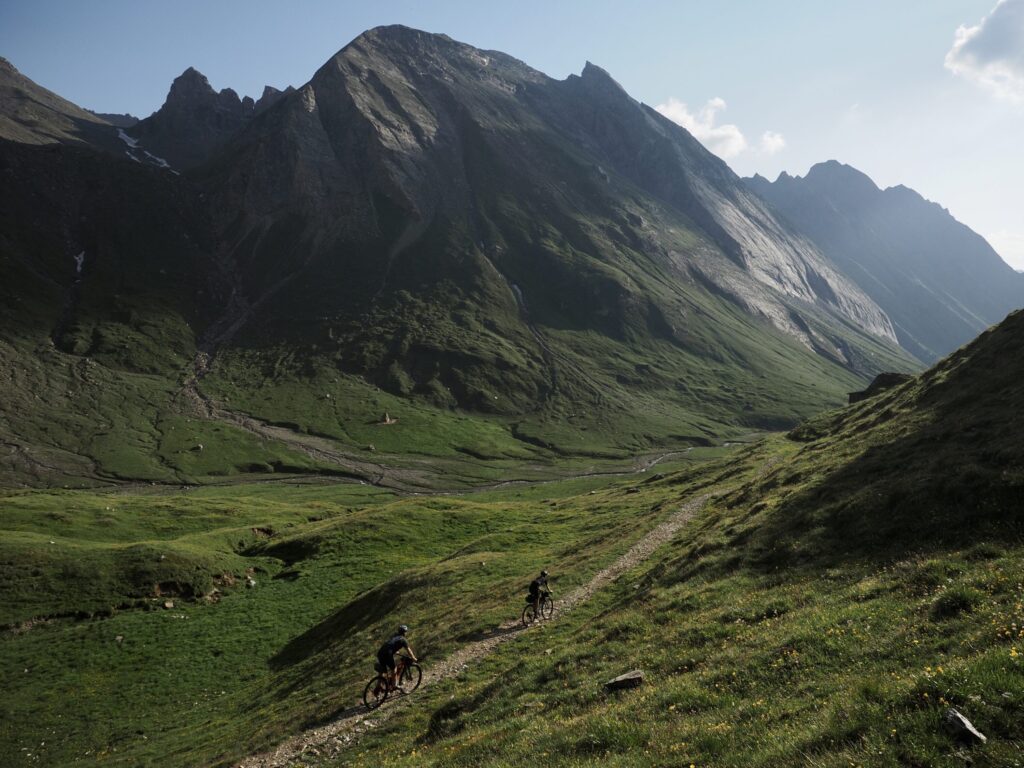
Progress once again slows to a crawl but eventually we arrive at a small hut atop the first ridge. From here, the trail flattens out into level singletrack through a stunning green alpine meadow scattered with blue and white alpine daisies. Ahead of us a small river crossing and the path soon dissolves into a wide scree bank before bending a corner rendering the pass out of sight. Where are we? The landscape has changed, suddenly it feels more akin to the Alpine valleys of Kyrgyzstan than what I’d ordinarily associate with this part of Europe.
I’d love to see someone’s reaction to meeting eight cyclists and eight bikes on top of this remote mountain pass
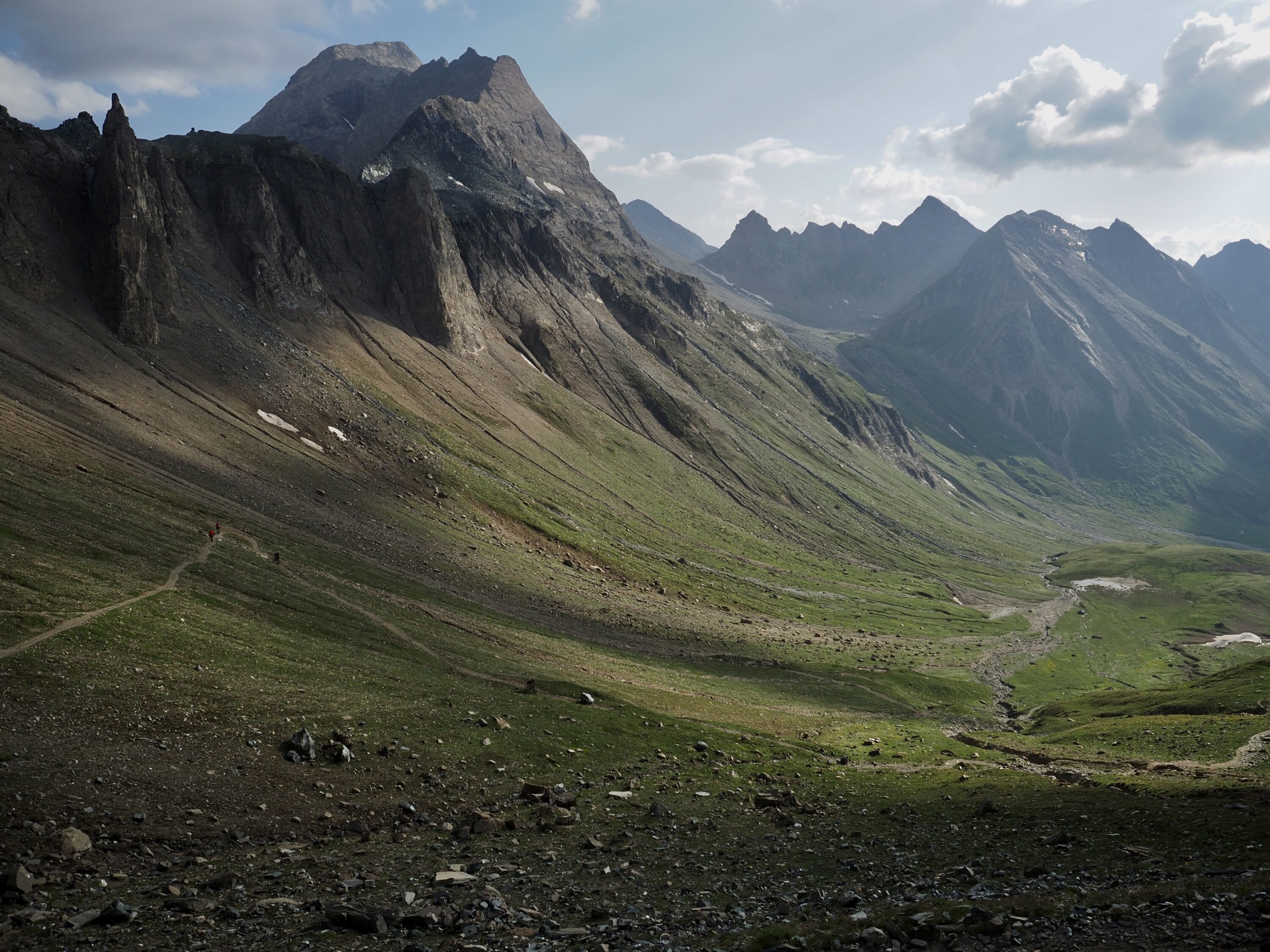
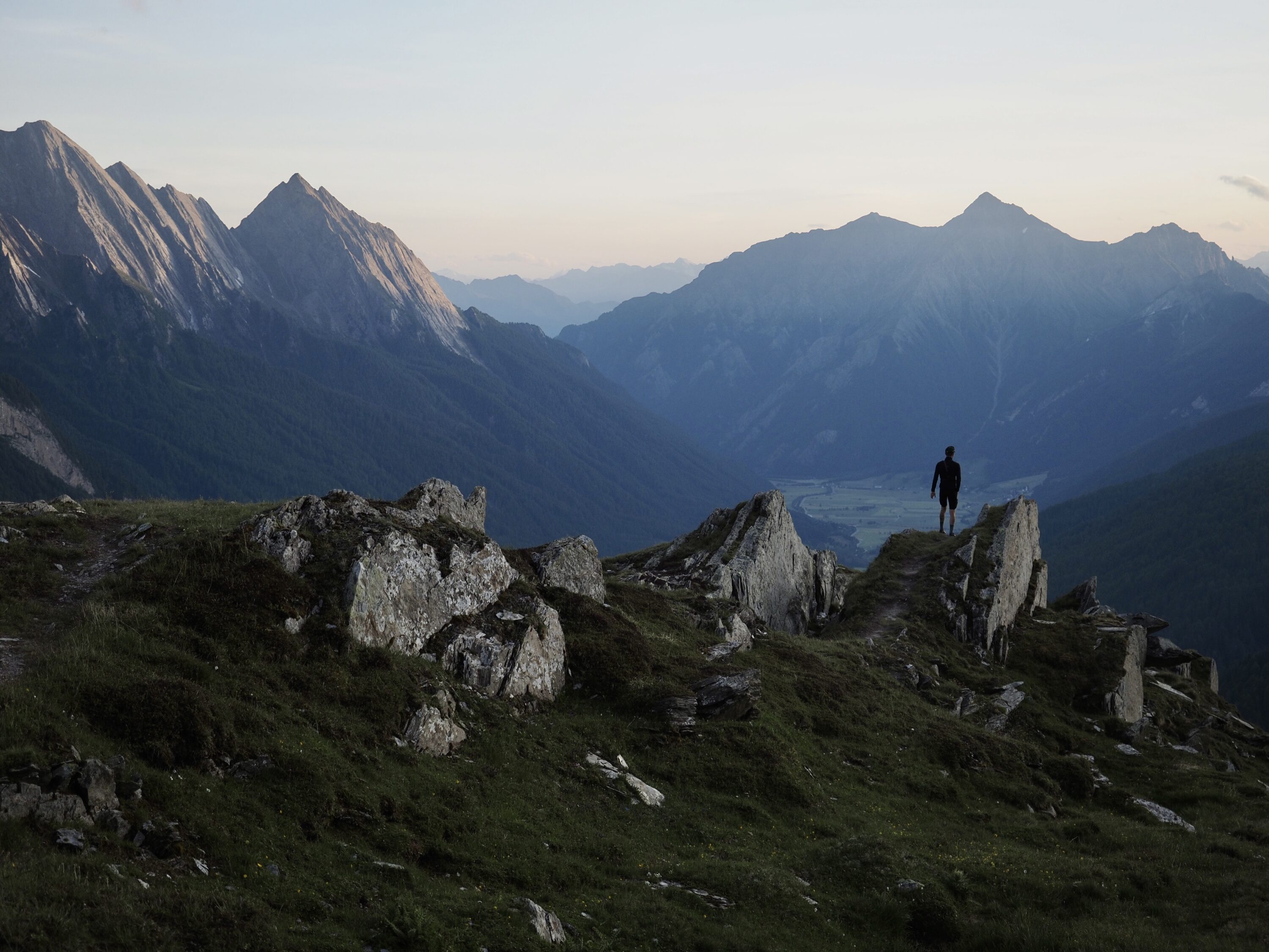
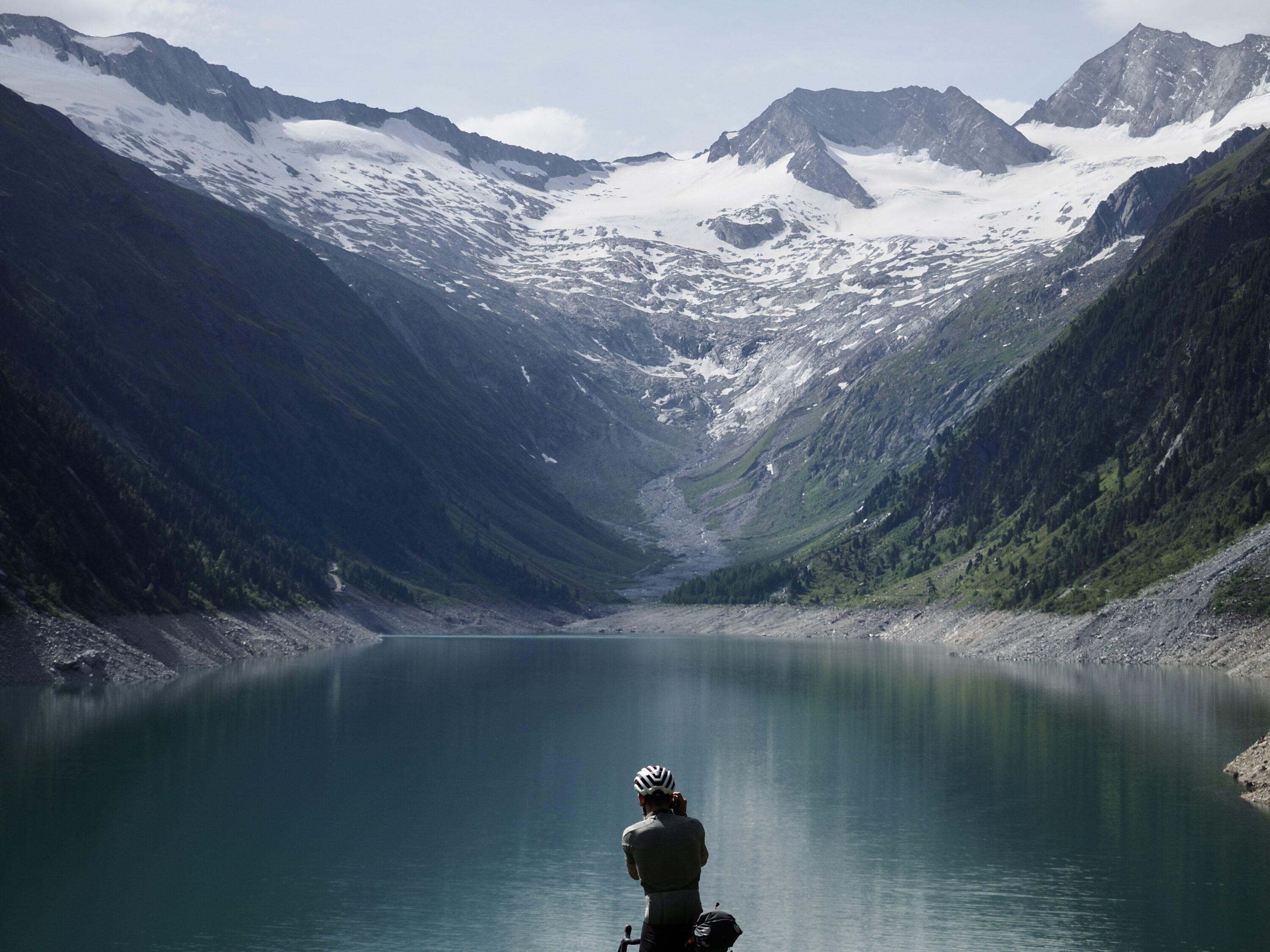
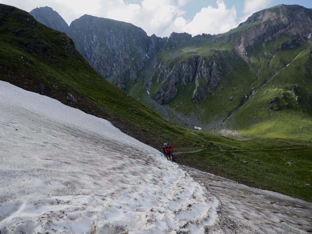
We come to another steeper scree slope with patchy snow either side of us. The group detaches to match our individual paces. Concentrated on sure-footing and keeping my bike comfortable either on my back or by my side, I realise my head has been largely down or facing straight ahead. I take a second to do a quick 360 and take in my surroundings. With the added altitude I now can see far across the valley — to a huge glacier opposite. The trail we’ve followed winds relentlessly down the valley from which we came, around the corner and out of sight.
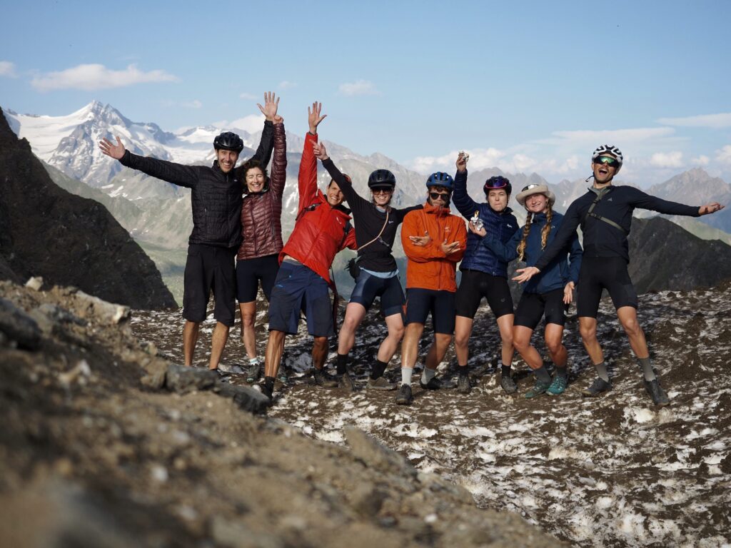
There’s not a single other soul up here — but I’d love to see someone’s reaction to meeting eight cyclists and eight bikes on top of this remote mountain pass. Opening out into the valley ahead of us, the other side has a totally different feel to where we’ve come from. Huge jagged spires of granite and gneiss tower over the valley floor beneath. Northern Italy or Mordor, I’m not 100% sure. Before us winds dream gravel singletrack all the way to the valley floor below us. This is the apex of this trail, the moment the past two days have been leading to. Damn it Tristan, you were right!
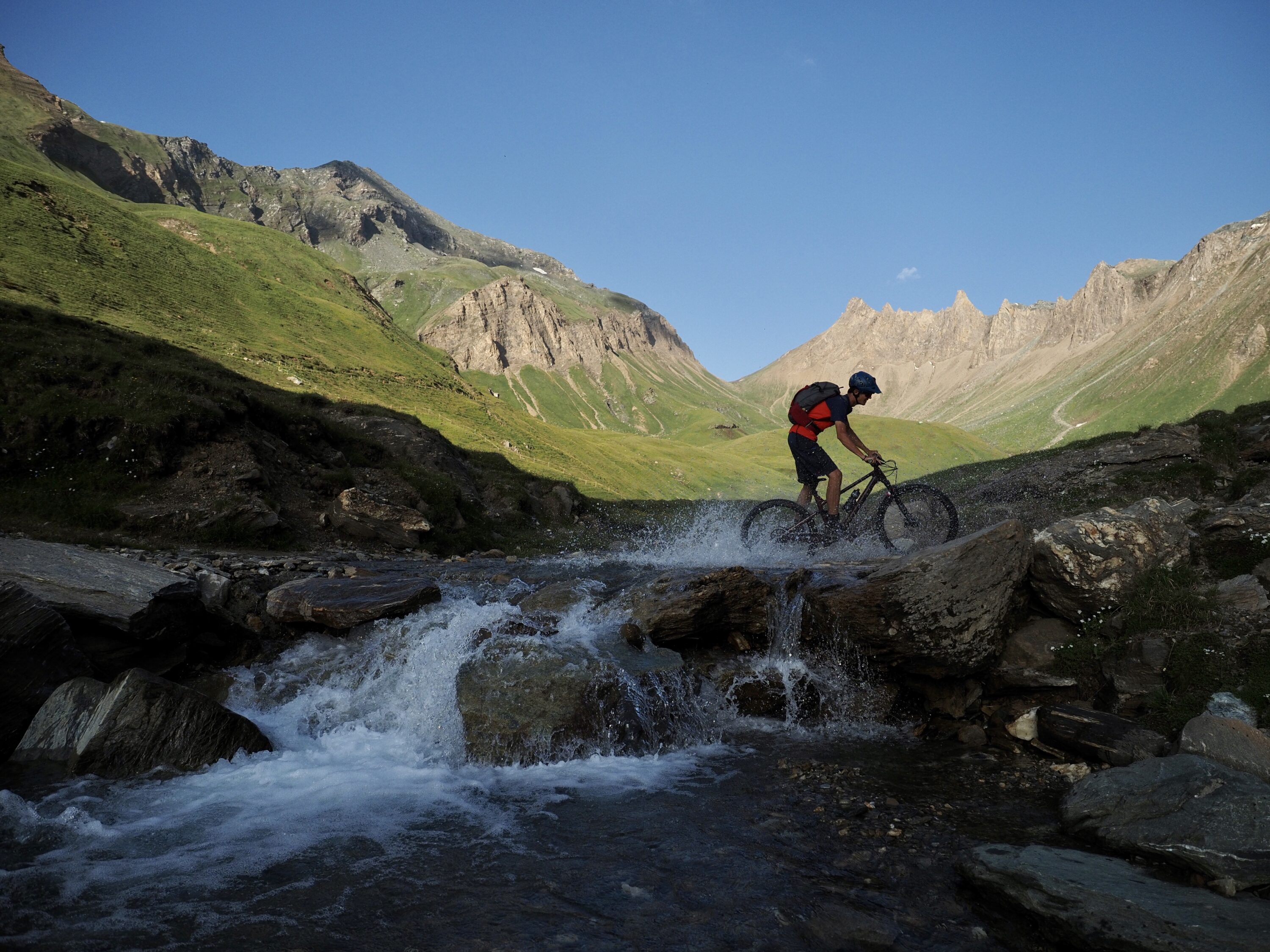
We afford each other plenty of space, descending in groups of two, leapfrogging each other as we wait and snap photos of the pair behind us as they flow through the gravel switchbacks. We reassemble at several river crossings along the way, making sure each of us makes it across safely, firing off photos with each turn.
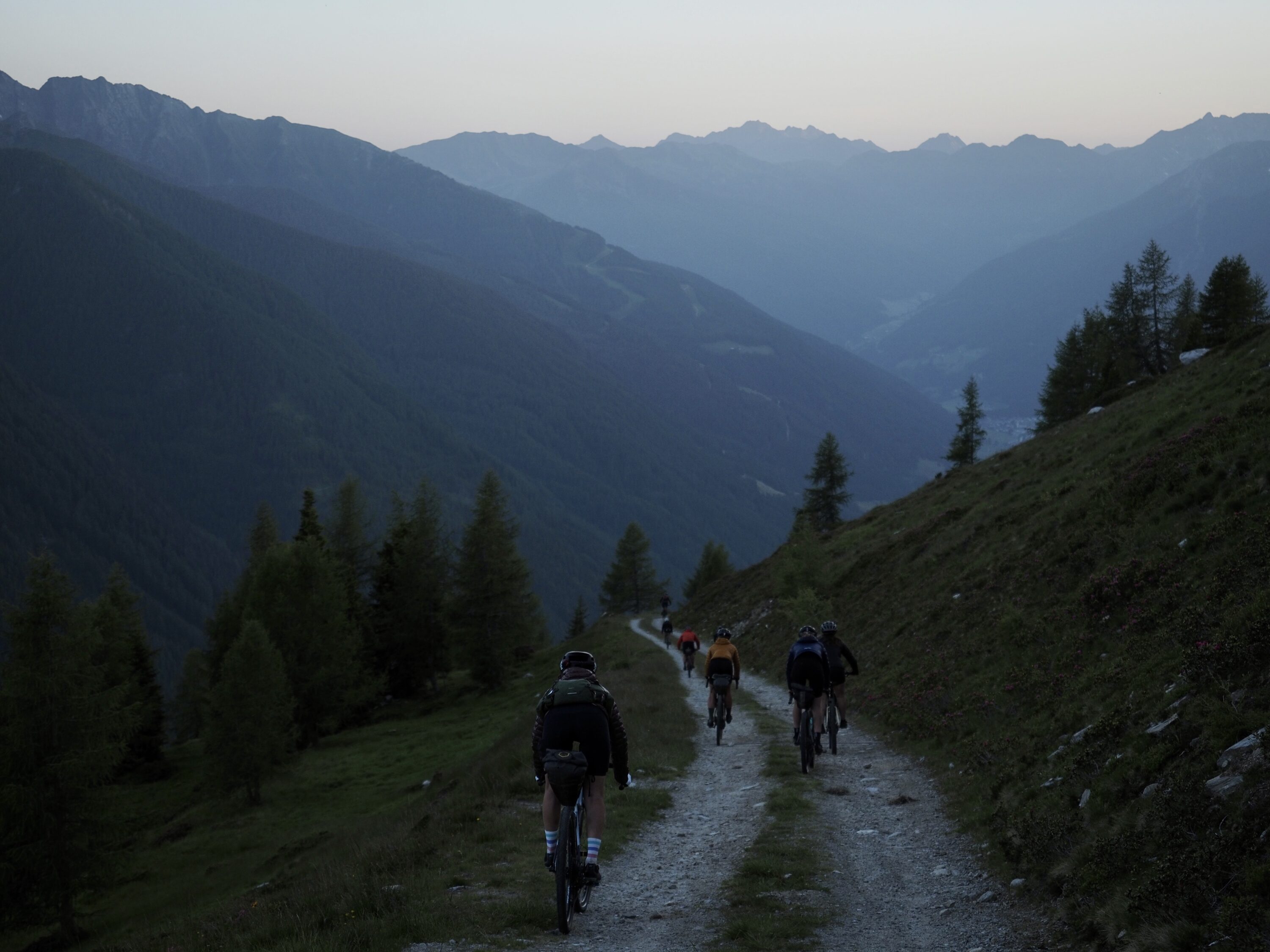
The rocky exposed singletrack turns to sheltered forested doubletrack which eventually transforms to asphalt and soon we’re back on the road to Vipiteno. We’ve done it, the first complete group traverse of the Zillertal Trail.
We regroup where trail meets road and once again like children we descend at maximum velocity back to town. Behind us, the mountains seem to close the gates to the view of where we’ve just come from. From here, you’d never the know the valley, glacial rivers or the pass we’ve crossed even existed.
For more information about the Zillertal Trail, head over to the komoot collection.
This story first appeared in issue 08 of BASE magazine. To make sure your among the first to read every story from BASE, you can subscribe for FREE and get each issue delivered directly to your door.
Don’t miss a single adventure
Sign up to our free newsletter and get a weekly BASE hit to your inbox
Other posts by this author
Story • Chris Hunt • Jul 04, 2023
Evolution of Flow: E-mountain Biking in the Swiss Alps
Exploring Crans Montana and the Tièche valley on two wheels
Story • Chris Hunt • May 05, 2023
Life-affirming discoveries near Bolivia’s Death Road
Sami Sauri explores the winding gravel tracks of the Yungas surrounding La Paz, Bolivia

Story • Chris Hunt • Jan 10, 2023
Can Bikepacking Fight River Pollution?
The Slymefoot Slide is a brand new multi-day bikepacking route in the heart of the Northumberland National Park

You might also like
Story • Gaby Thompson • Jun 26, 2023
Bike. SKi. Fondue. Repeat
A backyard adventure with close friends in the French Alps
Video • BASE editorial team • May 26, 2023
Top Five Bikepacking Essentials Every Rider Needs To Know About
Don't leave home without these must-have bits of bikepacking kit
Story • Charlie Bell • Apr 06, 2023
The Highs and Lows of Cycling 1300km Through The Atlas Mountains
The Atlas Mountain Race is a brutal bikepacking race across Morocco's sand-strewn deserts and snow-capped mountains