The Old Road: Bikepacking the Old Chalk Way
In partnership with
Feature type Story
Read time 15 mins
Published Feb 03, 2022
Author Chris Hunt
Photographer Ben Wormald
From the English Channel to the North Sea, The Old Chalk Way is a new 575km bikepacking route designed to explore Britain’s most ancient highway joining the Dorset and Norfolk coasts.
It’s a route steeped in both geographic and cultural history as it passes by some of England’s most iconic neolithic monuments, following a chalk vein from coast-to-coast. Riders can follow what now exists as flowy chalk single and double-track, fast-rolling forest gravel, back lanes, desire lines and drovers roads.
This is the story of this newly formed route’s genesis and its first complete ride. With our route partners komoot, we’ve included five section maps, the stories of our experiences along the way and a detailed breakdown of what you’ll need to take on The Old Chalk Way yourself.
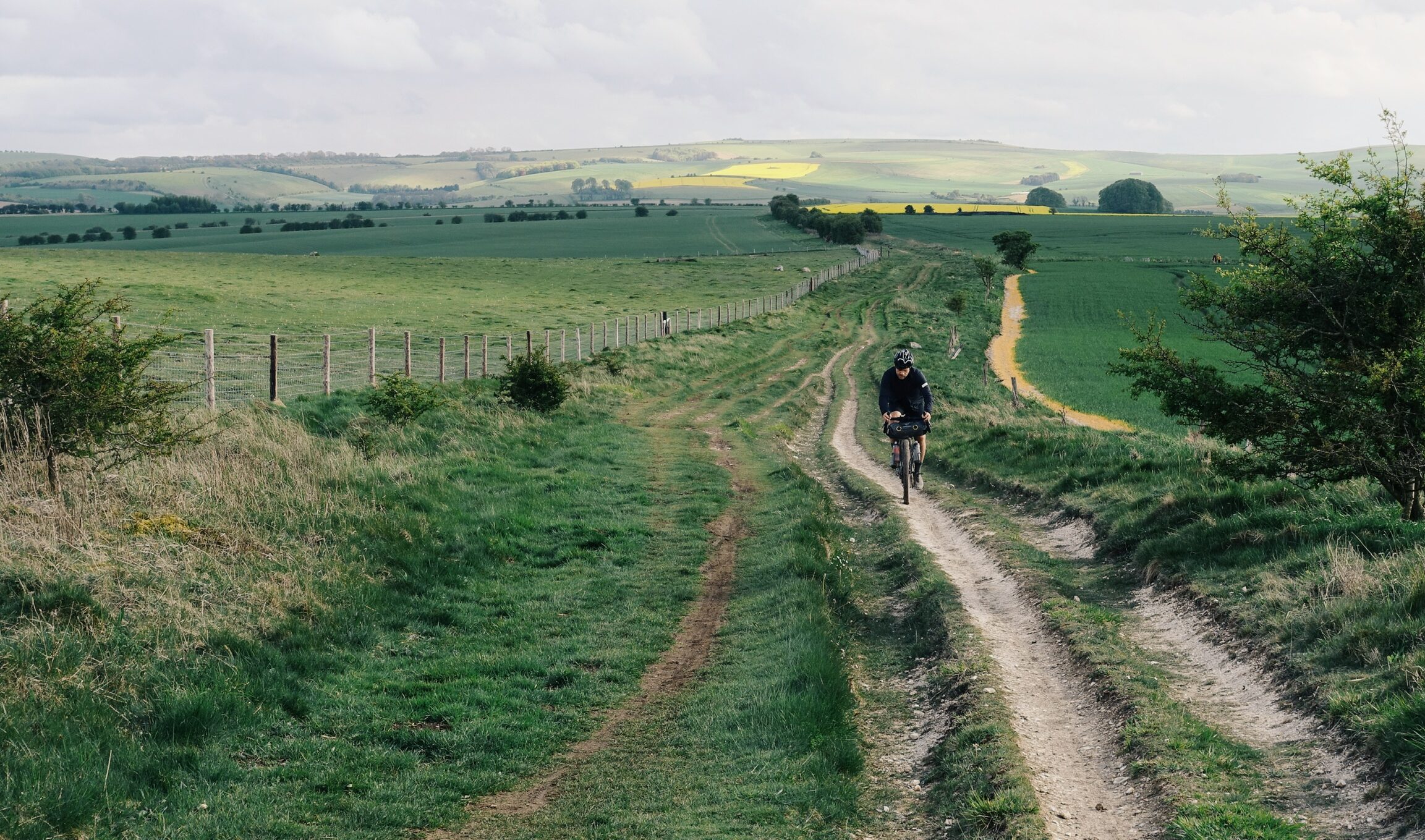
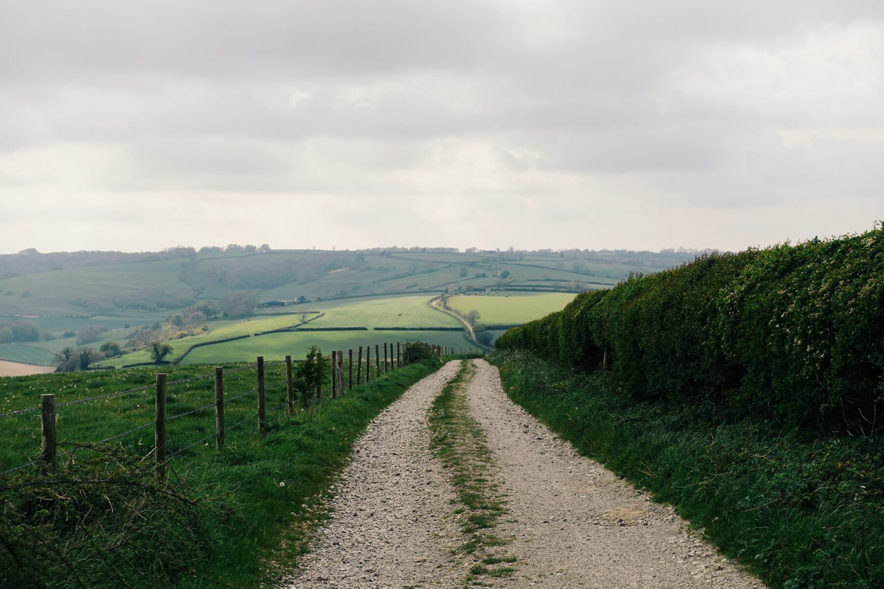
Day 2 on the Wessex Ridgeway. Moving away from the coast, the singletrack climbs to the chalky plateau of Cranbourne chase. Classic Old Chalk Way scenes.
Britain’s Oldest Highway
The Greater Ridgeway, also known as the Great Chalk Way, once provided a dependable trading route from the Dorset coast to the Wash in Norfolk. Largely atop a chalk ridge, the elevated dry terrain made for safe transit in the past, capable of supporting livestock and carriages alike; the open landscape provided its travellers with an advantage against potential attack.
The route can be divided into four individual trails: the Wessex Ridgeway, the Ridgeway, the Icknield Way and the Peddars Way. Together, these linked routes traverse more than five hundred kilometres of rolling chalkland passing through 11 counties and visiting some of the most impressive and best preserved prehistoric sites from Stone Age long barrows and Iron Age hill forts to stone circles and sculpted chalk figures.
Archaeological evidence suggests that this ancient way laid the foundations for the trading of cultures and goods, not only within England but across the channel and the Irish Sea. Today it provides a modest sense of wilderness that’s easily accessible from anywhere in Britain.
How we planned the route
At the end of the long, dark winter of intermittent lockdowns, my steadfast riding partner Ben and I started talking about linking up what remains of the four routes by bike.
Much of it, we knew, existed as bridleways open to mountain biking and horse riding. What we weren’t sure of was how well the route would stand up to a bikepacking trip, how it naturally flow together as one complete entity.
We’d pieced together the route the best we could, weaving the highlights of the established trails – which permitted riding bikes – together with the best riding which vaguely followed the direction of travel, sure to hit as many of the iconic historical sites along the way.
Despite a rather grim weather forecast, eventually, in the spring of 2021, our calendars aligned with a window of opportunity. But, considering the amount of rainfall during the 24 hours preceding our departure we were unsure, at best, as to how our loaded gravel bikes would cope with the mud and the notoriously slippery chalk.
Below is the story of the days that followed: Our first complete ride of The Old Chalk Way.
We’ve broken it down into four parts and five komoot maps which reflect the four distinctly different sections of the route with maps of 100km sections (which we think works well as a daily distance to aim for).
If you’re keen to find out more and to ride this yourself, at the bottom you’ll find all you need to get your own adventure on this new route under way.
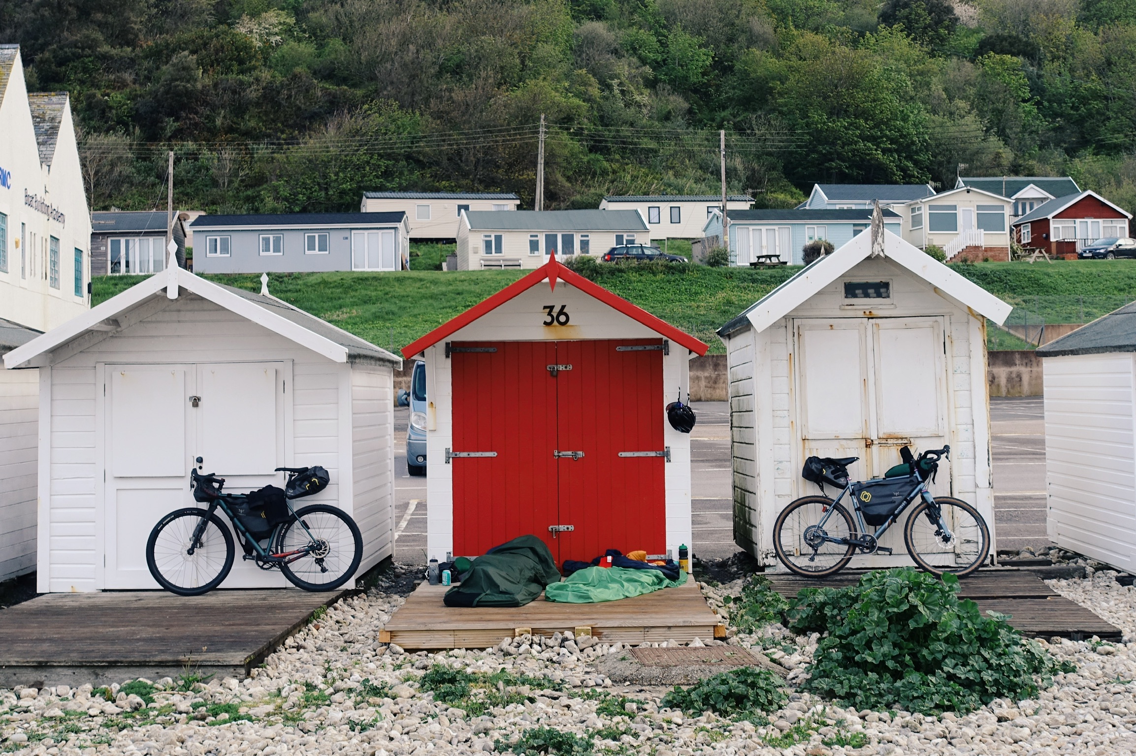
Lyme Regis micro-brewery provided the perfect pre-bivvy lubrication before bedding down for the night. The problem – as is so often the case with a night under the stars – was how early the sun rose and also the keen nature of the local dog-walkers.
The starting point
Riding the train south from Bristol through the flooded plains of the Somerset Levels, and alongside the swollen banks of the River Exe, did nothing to settle our uncertainties. As the skies grew darker, we reached the beach at Lyme Regis. Our first bivouac spot beside the dormant beach huts on the edge of the Channel marked the beginning of our journey towards the distant coast of the North Sea.
The clattering together of pebbles as the first of the morning’s dog walkers hit the beach was the starting pistol to our journey. Under an overcast dawn sky, we’re hopeful that those seemingly short hours of sleep were enough to dry the trails
Time to get moving.
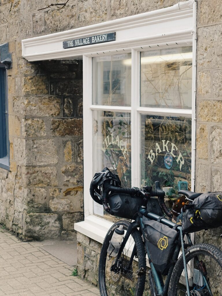
Nothing like bleeding the village bakery shelves dry pre-elevenses.
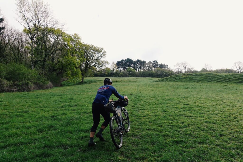
One to test out the achilles early on.
The Wessex Ridgeway
Lyme Regis – Shaftesbury – Avebury The terrain that lines Dorset’s Jurassic Coast is notoriously steep. Something we’re abruptly reminded of as we take our bikes for their first walks of the journey. We struggle our way down nettle-lined waterlogged singletrack gullies, across rocky streams, pushing our bikes up through steep grassy fields and hauling them over wooden stiles. We’ve been riding for close to an hour, but we’ve travelled just 8km. We’ll feel every kilometre of the five hundred-odd ahead of us.
We make our way up beside the Iron Age hill fort atop the chalky outcrop of Pilsden Pen, the second highest point in Dorset, and the views are expansive. The chalk here is an outlier from the Cretaceous period [145 to 66 million years ago] sat amongst the Jurassic strata of marl and clay. Here on the border with Devon, it’s a fitting nod to the geographical context of our route. Our backs to the granite that forms the land westwards, we follow the chalk north-east.
Just 30 kilometres in, and I slump my already weary body onto a bench in the middle of the Beaminster village square and start an assault on the paper bag of baked pastry obtained on arrival. Unable to mask the hole left by the effort I put in to those first few hours, it’s not long before I’m back on my feet returning for more. We soon pass the Cerne Giant – perhaps Britain’s best known chalk figure, famous for its enormous phallus. The origins of the giant have been contested for centuries, and while still not 100% certain, recent soil samples suggest it was first dug out in the late Anglo-Saxon period.
Today much of the Greater Ridgeway is signposted as its separate designated trails, but like most prehistoric routes, it would never have been one singular track. Paths would have differed between the seasons and across successive ages. Various offshoots provided branches to forts, burial grounds and henges along the way. The pioneers of this route some 5,000 years ago didn’t have bikepackers in mind, after all.
The terrain that lines Dorset’s Jurassic Coast is notoriously steep. Something we’re abruptly reminded of as we take our bikes for their first walks of the journey. We struggle our way down nettle-lined waterlogged singletrack gullies, across rocky streams, pushing our bikes up through steep grassy fields and hauling them over wooden stiles. We’ve been riding for close to an hour, but we’ve travelled just 8km. We’ll feel every kilometre of the five hundred-odd ahead of us.
We make our way up beside the Iron Age hill fort atop the chalky outcrop of Pilsden Pen, the second highest point in Dorset, and the views are expansive. The chalk here is an outlier from the Cretaceous period [145 to 66 million years ago] sat amongst the Jurassic strata of marl and clay. Here on the border with Devon, it’s a fitting nod to the geographical context of our route. Our backs to the granite that forms the land westwards, we follow the chalk north-east.
Just 30 kilometres in, and I slump my already weary body onto a bench in the middle of the Beaminster village square and start an assault on the paper bag of baked pastry obtained on arrival. Unable to mask the hole left by the effort I put in to those first few hours, it’s not long before I’m back on my feet returning for more. We soon pass the Cerne Giant – perhaps Britain’s best known chalk figure, famous for its enormous phallus. The origins of the giant have been contested for centuries, and while still not 100% certain, recent soil samples suggest it was first dug out in the late Anglo-Saxon period.
Today much of the Greater Ridgeway is signposted as its separate designated trails, but like most prehistoric routes, it would never have been one singular track. Paths would have differed between the seasons and across successive ages. Various offshoots provided branches to forts, burial grounds and henges along the way. The pioneers of this route some 5,000 years ago didn’t have bikepackers in mind, after all.

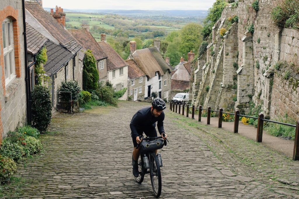
Those who know, know the struggle. Shaftesbury’s Gold Hill not making it easy.
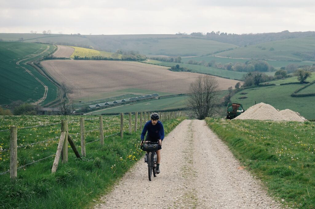
Gravel climbs amongst the pig farms of south Wilstshire.
If you want a taste of what medieval commuting might have been like, ride a bike over Salisbury Plain in a downpour
Whilst riding the full 550km loaded with all our food for the journey was indeed possible, it didn’t sound like much fun. And, unlike the traders, drovers and druids who went before us, we live in a world of convenience in the shape of of supermarkets and coffee shops. Detouring to Shaftesbury, we enter into the seemingly mandatory ritual of any bikepacking journey – sprawled across a supermarket car park floor, we make our way through a small mountain of calories to set us up for the day ahead.
From here, we head up over Cranbourne Chase, a high chalk plateau where the county lines of Dorset, Hampshire and Wiltshire converge. The downland here is scattered with Neolithic and Bronze Age monuments, as well as the remains of several Iron Age Settlements.
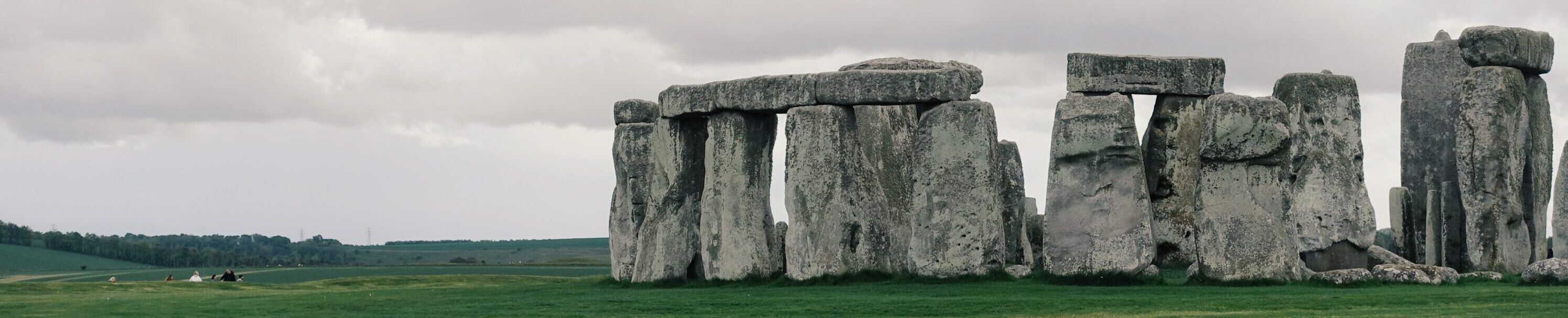
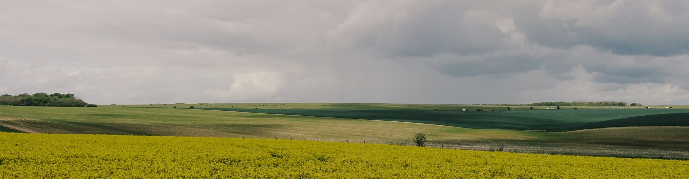
The flat gravel tracks traverse interlocking fields of rapeseed, barley and cattle. After waiting for a gap in a seemingly endless stream of traffic, we intersect the A303 parallel to Stonehenge. Rolling north, the clouds close in and the first few drops of rain lay down an unmistakable statement of intent.
With the red military flags of Salisbury Plain lowered to indicate no live firing is in progress, we cut across the training area: 10km of fast rolling, rocky, hard packed gravel. Here, out in the open we’re totally at the mercy of the wind and the rain; and predictably once we’re committed to the exposed plateau, both start right on queue. It takes just moments before we’re wet through. Our bikes, our bags and our clothes are splatted with the sand and mud from the now-saturated track. We grind our way across rocky paths alternating between tail and headwind, avoiding the kind of potholes which threaten the shape of our wheels. If you want a taste of what medieval commuting might have been like, ride a bike over Salisbury Plain in a downpour.
The Ridgeway
Avebury – Swindon – Ivinghoe Beacon We take a moment’s rest at Avebury henge. Home to the largest megalithic stone circle in the world, this is where our route picks up the Ridgeway. Sat with my back against the stones, from deep within my frame pack I dig out the last remaining stragglers from a broken pack of yoghurt-coated raisins. Thick with mud, dust and dried chalk, you’d be forgiven for assuming our bikes had been uncovered as part of a recent archaeological dig at this ancient site.
Joining the first section of the Ridgeway, our tyres roll with a welcome lack of resistance across the firm chalk channels. We snake along the trail, weaving and hopping between confused grassy tracks as they connect and reinvent themselves. Enjoying the calm of the moment and the silence around us, we both come naturally to a stop. Noting the dark sky behind us, a solitary drop of rain splashes off my shoe. Followed by another, and another. I almost welcome it. In this quiet moment, the rain feels refreshing on my weary body.
The situation soon escalates. Forced into the trees to seek cover, we find ourselves on an intersection of several minor trails, all of which are quickly transformed into fast-flowing torrents of white water. We could be in trouble here.
As anyone who has ridden on it knows, sodden chalk is not the preferred terrain for a bike ride. We’re left pushing our bikes uphill through the inch of water flowing back down the hill against us. The downhill is worse. We slide from side-to-side, struggling to stay upright, and it’s made ten times worse by the weight of our loaded bikes. We hit the road and follow it downhill into the nearest town.
Waking the following morning in a small empty barn on the edge of Wantage to a perfectly crisp, sunny spring morning, we’re soon stuffing the context of our bikepacking bags back into place and any leftover snacks from the day before into our mouths. The air is cold, but the trails have mostly dried out.
We take a moment’s rest at Avebury henge. Home to the largest megalithic stone circle in the world, this is where our route picks up the Ridgeway. Sat with my back against the stones, from deep within my frame pack I dig out the last remaining stragglers from a broken pack of yoghurt-coated raisins. Thick with mud, dust and dried chalk, you’d be forgiven for assuming our bikes had been uncovered as part of a recent archaeological dig at this ancient site.
Joining the first section of the Ridgeway, our tyres roll with a welcome lack of resistance across the firm chalk channels. We snake along the trail, weaving and hopping between confused grassy tracks as they connect and reinvent themselves. Enjoying the calm of the moment and the silence around us, we both come naturally to a stop. Noting the dark sky behind us, a solitary drop of rain splashes off my shoe. Followed by another, and another. I almost welcome it. In this quiet moment, the rain feels refreshing on my weary body.
The situation soon escalates. Forced into the trees to seek cover, we find ourselves on an intersection of several minor trails, all of which are quickly transformed into fast-flowing torrents of white water. We could be in trouble here.
As anyone who has ridden on it knows, sodden chalk is not the preferred terrain for a bike ride. We’re left pushing our bikes uphill through the inch of water flowing back down the hill against us. The downhill is worse. We slide from side-to-side, struggling to stay upright, and it’s made ten times worse by the weight of our loaded bikes. We hit the road and follow it downhill into the nearest town.
Waking the following morning in a small empty barn on the edge of Wantage to a perfectly crisp, sunny spring morning, we’re soon stuffing the context of our bikepacking bags back into place and any leftover snacks from the day before into our mouths. The air is cold, but the trails have mostly dried out.
Forced into the trees to seek cover, we find ourselves on an intersection of several minor trails, all of which are quickly transformed into fast-flowing torrents of white water
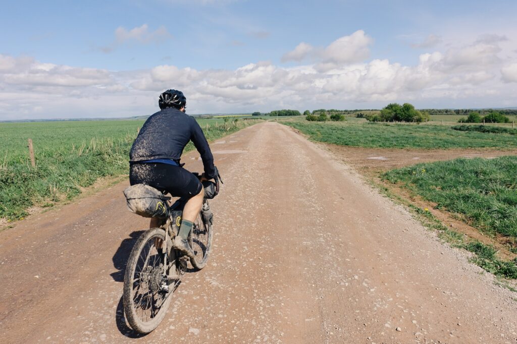
Saddle packs proving to be a less effective mudguard than anticipated over Salisbury Plain.
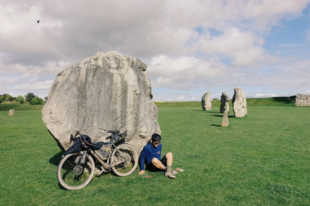
By Avebury stone circle, my body felt like dead weight that my legs would barely support. As I slumped into the rock, both my helmet and glasses flew off my head in perfect synchrony.
Back on the Ridgeway, we fly down into the next town following a mixture of single and double-track through the forest. Amidst Thameside grandeur, we’re reminded again of our proximity to civilisation. Even in the most isolated parts of this section of the route, we’re rarely more than 10km from the nearest town.
Eastwards, The Ridgeway lines the edge of the Chiltern Hills through forests and valleys. This is our biggest day as we aim for 160km through punchy forest trails into Hertfordshire. We ride the well-maintained tracks through Ashridge Estate and up to Ivinghoe Beacon.
Among the remains of another Iron Age fort on top of the beacon, we’re once again reminded of those who walked these routes before us. East of here, the land flattens into the Fens. As we battle our way through the traffic of Luton, the geography around us transforms itself again.
Thick with dust and chalk, you’d be forgiven for thinking our bikes had been unearthed as part of an archaeological dig
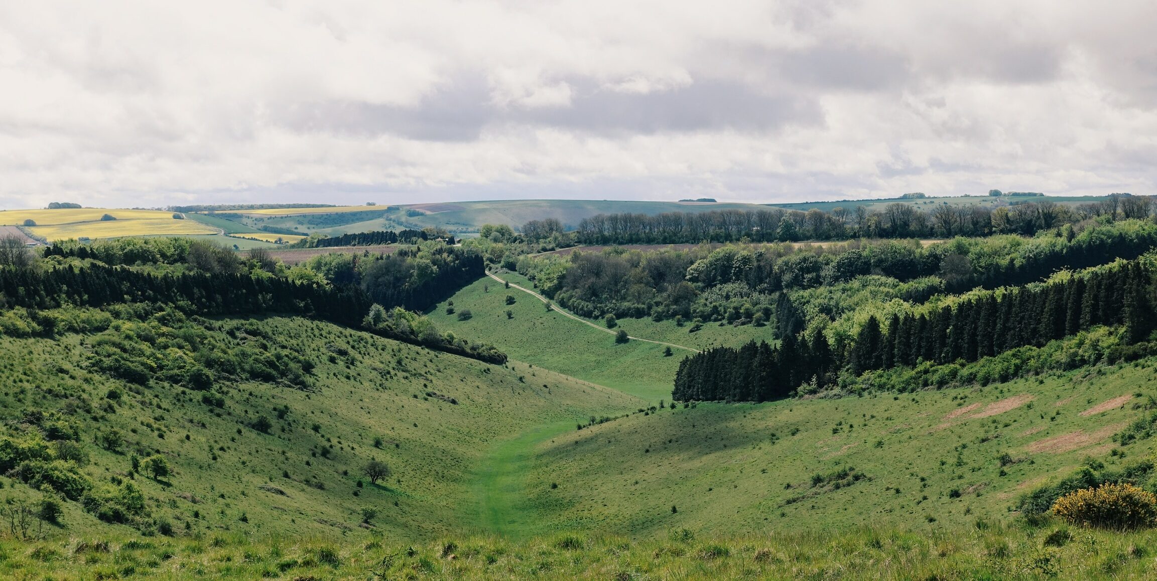
Regardless of an uncertain forecast, spring was a great time to trial the Old Chalk Way with long days, relatively dry terrain and lush green, but not overgrown trails.
The Icknield Way
Ivinghoe Beacon – Newmarket – Thetford Famed by the white coastal headlands and spires rising from the waters of the English Channel, it was the warmer climates of the Cretaceous period that saw high eustatic sea levels creating shallow inland seas, resulting in huge quantities of chalk deposited across the county. Lasting nearly 80 million years, it was a period in which the Earth was free of ice when dinosaurs roamed the land, and these inland seas were inhabited by now-extinct marine reptiles. Much of the landscape of southern England is now defined by those large chalk deposits, an area of land which boundary draws almost a perfect line from the Dorset coast to Norfolk’s North Sea. Our ancient highway almost perfectly shadows this line.
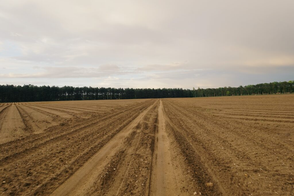
Joining the Icknield Way, we trade the grassy chalk spine we’ve become used to for sandy gravel trails passing pig farms, huge grain stores, and open farmland. The bruised skies and muggy air threaten another change in the weather. Whilst the landscape here is still very British, somehow it feels more like we’ve entered the American midwest. Whether a reflection of the land around us or simply our own exhaustion, it all suddenly feels very cinematic.
Through the heather and pines of Thetford Forest, the sandy forest trails extend seemingly without end. The soft tracks make for fun riding, but thanks to the intermittent downpours, our bikes feel and sound terrible. They’re caked with wet sludge, mud, grit and sand once again. We’ve got more than 400 off-road kilometres in the legs, and my perception of time slips into the realm of the psychedelic.
Eventually we reach Thetford, stuff our faces with the quantity of food only familiar to these kinds of trips, and bed down in the wedding gate of a small rural church on the outskirts of town. In the morning, we’ll join the final leg of our journey: The Peddars Way will lead us all the way to the North Sea.
Famed by the white coastal headlands and spires rising from the waters of the English Channel, it was the warmer climates of the Cretaceous period that saw high eustatic sea levels creating shallow inland seas, resulting in huge quantities of chalk deposited across the county. Lasting nearly 80 million years, it was a period in which the Earth was free of ice when dinosaurs roamed the land, and these inland seas were inhabited by now-extinct marine reptiles. Much of the landscape of southern England is now defined by those large chalk deposits, an area of land which boundary draws almost a perfect line from the Dorset coast to Norfolk’s North Sea. Our ancient highway almost perfectly shadows this line.
Joining the Icknield Way, we trade the grassy chalk spine we’ve become used to for sandy gravel trails passing pig farms, huge grain stores, and open farmland. The bruised skies and muggy air threaten another change in the weather. Whilst the landscape here is still very British, somehow it feels more like we’ve entered the American midwest. Whether a reflection of the land around us or simply our own exhaustion, it all suddenly feels very cinematic.
Through the heather and pines of Thetford Forest, the sandy forest trails extend seemingly without end. The soft tracks make for fun riding, but thanks to the intermittent downpours, our bikes feel and sound terrible. They’re caked with wet sludge, mud, grit and sand once again. We’ve got more than 400 off-road kilometres in the legs, and my perception of time slips into the realm of the psychedelic.
Eventually we reach Thetford, stuff our faces with the quantity of food only familiar to these kinds of trips, and bed down in the wedding gate of a small rural church on the outskirts of town. In the morning, we’ll join the final leg of our journey: The Peddars Way will lead us all the way to the North Sea.
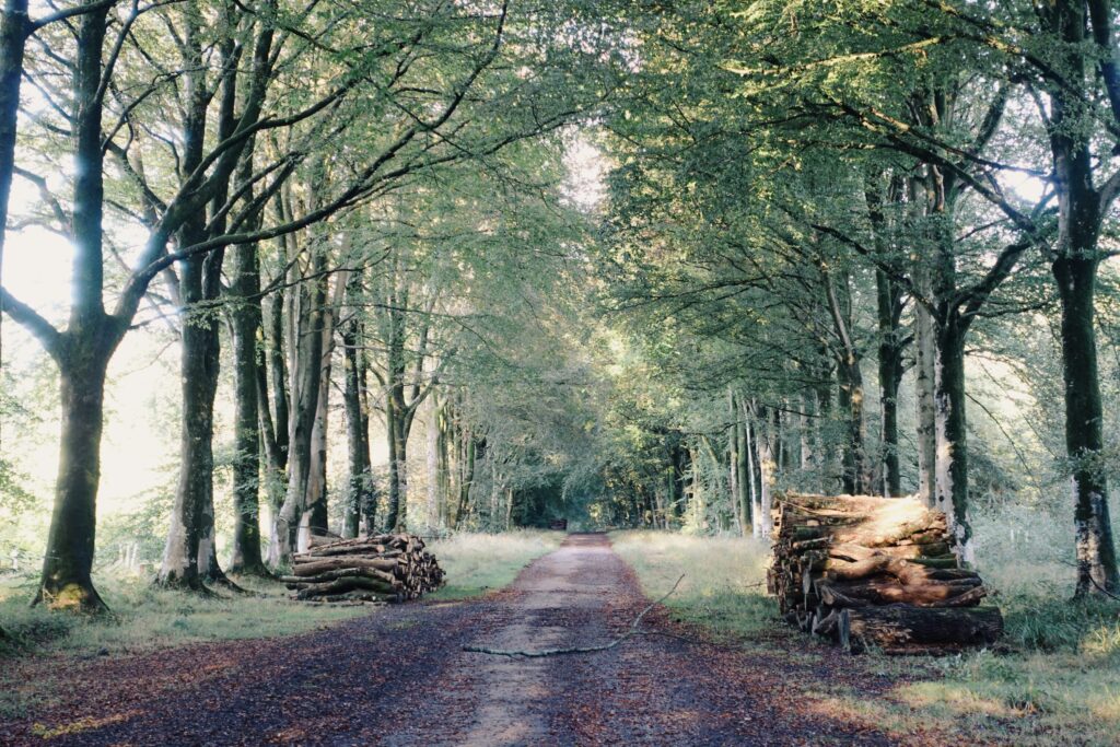
Lesson #1 of creating a bikepacking route: must contain log piles.
In reaching the Peddars Way, the elevation profile finally subsides, as does the pain in our legs.
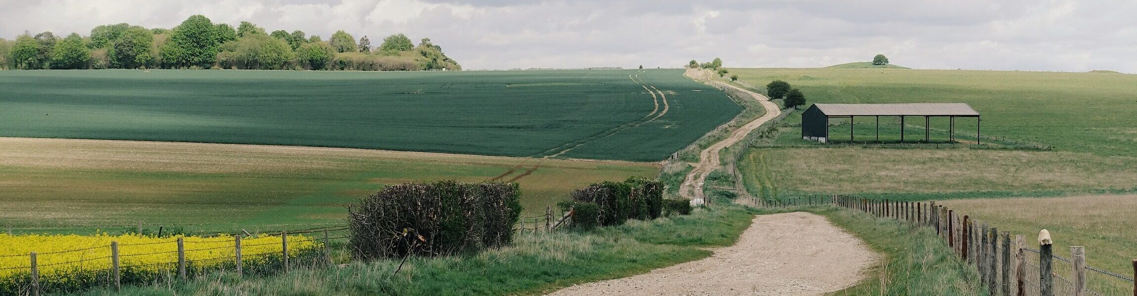
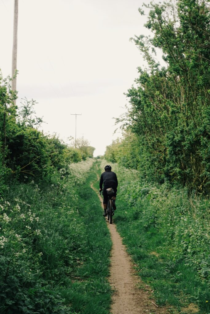
Way more rideable than it looks.
The Peddars Way
Thetford – Holme-next-the-Sea Widely accepted as a Roman construction, the original Peddars Way is likely to have preceded the time of the Roman conquest. As we join it, our direction shifts. Having ridden the past four hundred-odd kilometres consistently north east, we point our bikes almost directly north. The energy of the final push kicks in. With refreshed minds and refreshed surroundings, the final 75km is a breeze.
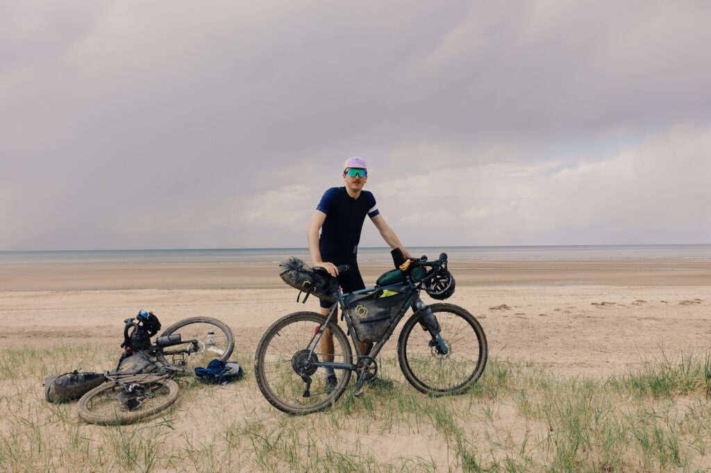
As we come over the brow of a hill, a faint silver line stretches across the sky: the North Sea. Side by side our pace quickens, the unmistakable skeletal forest of an offshore wind farm resolves into view. We wheel our bikes over sand dunes and through beach grass towards the shore.
Forming a transect from coast-to-coast, our journey had led us more than 500 kilometres across southern England; the continuous tread of our rubber tyres having followed the same lines forged by foot and hoof more than 5,000 years before us. The ghostly presence of the countless traders and drovers, druids, soldiers, and ramblers who’d passed along this way before us were never far away.
Widely accepted as a Roman construction, the original Peddars Way is likely to have preceded the time of the Roman conquest. As we join it, our direction shifts. Having ridden the past four hundred-odd kilometres consistently north east, we point our bikes almost directly north. The energy of the final push kicks in. With refreshed minds and refreshed surroundings, the final 75km is a breeze.
As we come over the brow of a hill, a faint silver line stretches across the sky: the North Sea. Side by side our pace quickens, the unmistakable skeletal forest of an offshore wind farm resolves into view. We wheel our bikes over sand dunes and through beach grass towards the shore.
Forming a transect from coast-to-coast, our journey had led us more than 500 kilometres across southern England; the continuous tread of our rubber tyres having followed the same lines forged by foot and hoof more than 5,000 years before us. The ghostly presence of the countless traders and drovers, druids, soldiers, and ramblers who’d passed along this way before us were never far away.
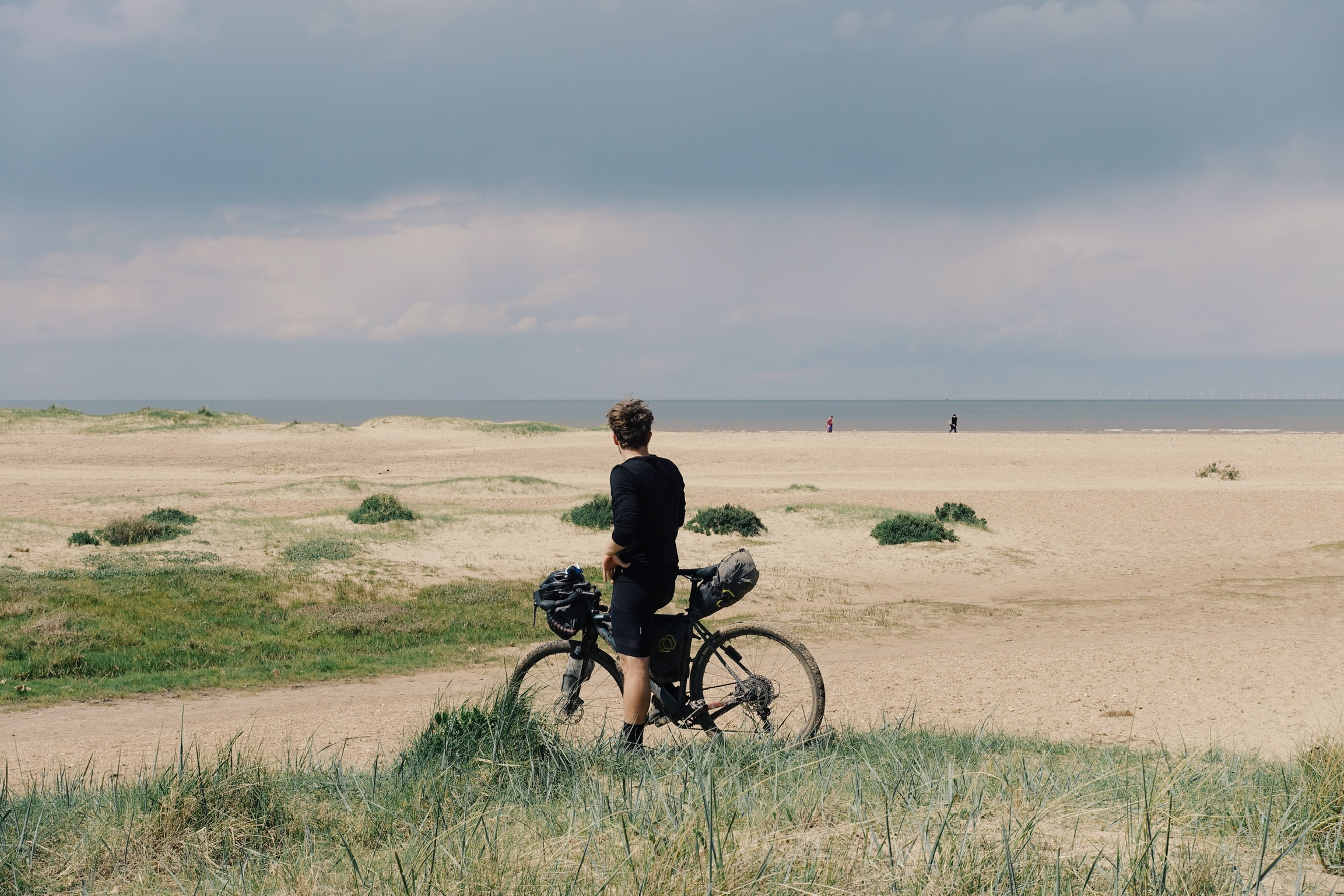
End of the line. The rectangular bay known as the Wash is one of Britain’s broadest estuaries and where Norfolk meets Lincolnshire and both fall into the North Sea.
Now it’s your turn
We created the Old Chalk Way in the hope to see other bike riders get out and experience their own adventures along this ancient highway which we think accounts for some the best gravel riding in southern England.
This wasn’t an epic, life-changing adventure to the ends of the earth. Besides the creation of the route, it had required minimal logistical groundwork.
Completing the journey in five days including a weekend, it hadn’t require major adjustments to our schedules, either. Yet the trip did provide us with a welcome escape from everyday life. A chance to ride the hidden contours of our home country and an opportunity to connect with the texture of history that’s literally lined into the mud and chalk of England.
Below, we’ve included some basic information to help you get started in planning your own rides along the route, be those one dayers or combining multiple days to complete the whole route.
For more information again, be sure to follow the link below to oldchalkway.cc. If you’ve ridden the route or have plans to do so this year, let us know in the comments below.
Processed with VSCO with g1 preset
What to take
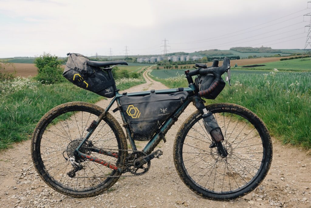
Covering road, gravel, mud, chalk and clay, large volume tyres are a must for this route. While we rode on 650B X 47c rubber, we’d recommend anything above 35c tyres with good tread. You could ride anything from a gravel bike to a hardtail mountain bike. The author rode a VAAST A/1 magnesium all-road bike with a full set of Apidura’s Expedition bikepacking bags.
For any ride along the route, you’ll you’ll need a solid repair kit including multi-tool, chain quick-links, pump, spare tubes and a puncture repair kit. If you’re planning to camp along the way you’ll need a lightweight sleep set-up you can fit on your bike (although pre-booked accommodation is a more luxurious option) and the capacity to carry plenty of food and perhaps a stove and cooking set-up too.
Processed with VSCO with g1 preset
Route options
Designed by Ben Wormald and Chris Hunt, the mixed-terrain route has been carefully crafted with natural flow and momentum in mind to make the most out of the journey. It stays true to the old ways where possible while hitting some of the best sections of road and alternative gravel trails along the way to make it work as an updated route specifically for bikepackers.
With strong train links along the entire route, The Old Chalk Way can easily be divided into much shorter sections and ridden separately over individual days or over a weekend. The route passes close to and through several towns making hostels, pubs and campsites all easily accessible.
Don’t miss a single adventure
Sign up to our free newsletter and get a weekly BASE hit to your inbox
Other posts by this author
Story • Chris Hunt • Jul 04, 2023
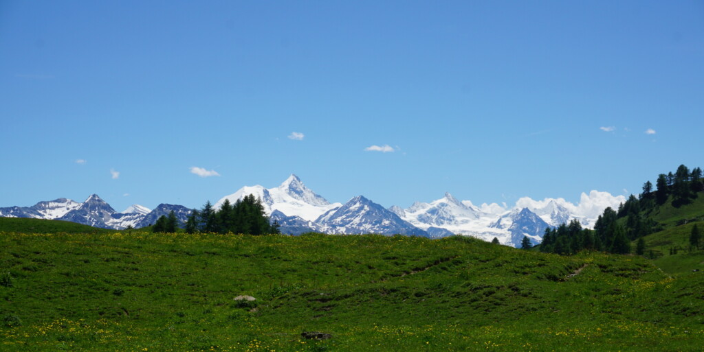
Evolution of Flow: E-mountain Biking in the Swiss Alps
Exploring Crans Montana and the Tièche valley on two wheels
Story • Chris Hunt • May 05, 2023
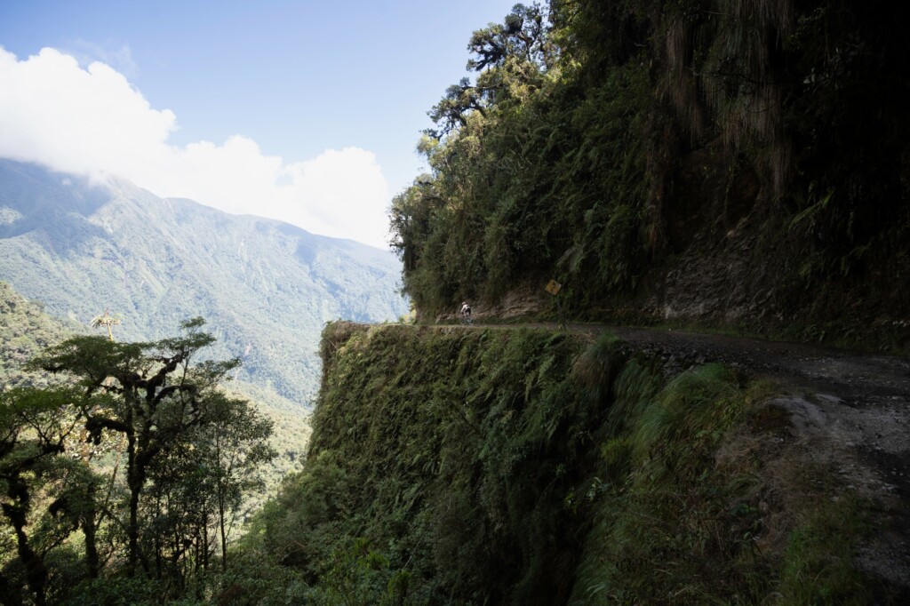
Life-affirming discoveries near Bolivia’s Death Road
Sami Sauri explores the winding gravel tracks of the Yungas surrounding La Paz, Bolivia

Story • Chris Hunt • Feb 09, 2023
Throat of The Dog: Bikepacking the Zillertal Alps
A 175km traverse of the mountainous spine between Italy and Austria

You might also like
Photo Essay • BASE editorial team • Mar 18, 2024
Hunting happiness through adventure in Taiwan
BASE teams up with adventurer Sofia Jin to explore the best of Taiwan's underrated adventure scene.

Story • BASE editorial team • Nov 21, 2023
Five Epic UK Climbs You Should Try This Winter
Craving a snowy mountain adventure? Inspired by the Garmin Instinct 2 watch (into which you can directly plan these routes), we've compiled a list of five of the best for winter 2023-24!

Video • BASE editorial team • Jul 04, 2023
Zofia Reych On Bouldering, Life And Neurodivergence
Climbing is a driving force in Zofia's life, but for a long time, it also seemed to be a destructive one