Footsteps on the Gambia
Feature type Story
Read time 10 mins
Published Mar 09, 2022
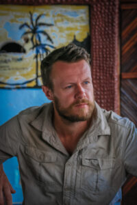
Author Chaz Powell
Photographer Tim Roberts
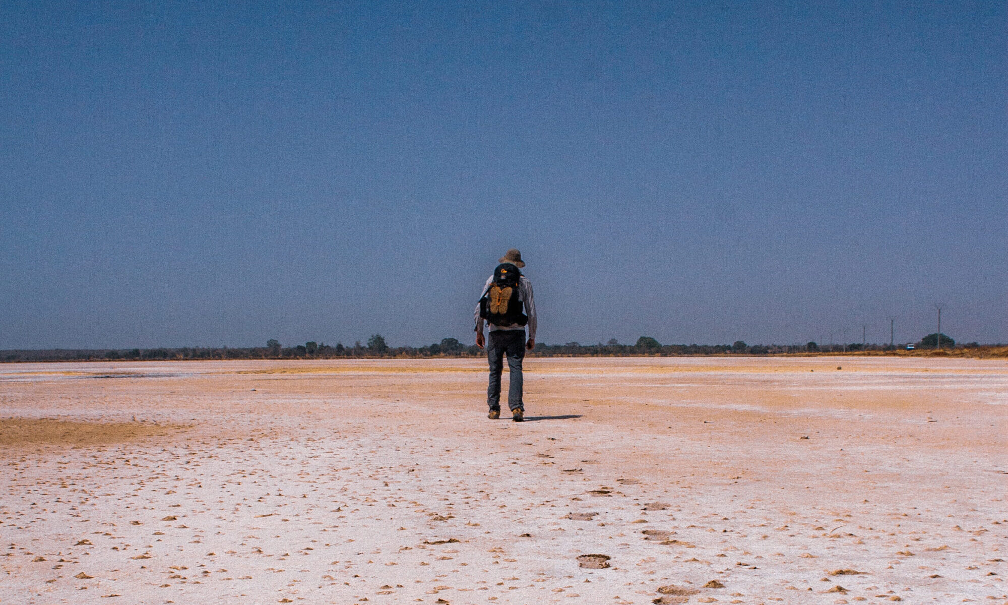
Home to one of the largest lion populations in West Africa, the Niokola-Koba National Park isn’t exactly the sort of place you’d want to be passing through on-foot. For Chaz Powell and Tim Roberts however, there wasn’t much choice. Not if they were to complete their 47-day expedition to walk 1120km from source to sea, the entire length of The Gambia River. The park was the reason no one had completed the full expedition on-foot before them. But set to arrive at the gates without the essential permit to allow them legal passage, lions would be the least of their worries.
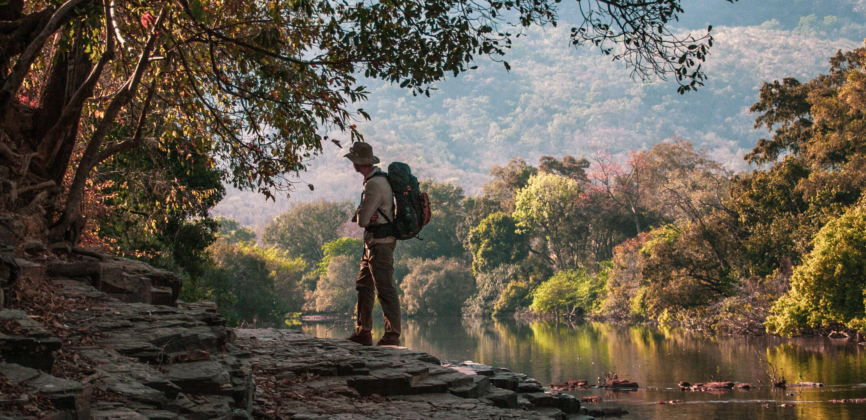
From the Fouta Djallon plateau in central Guinea, The Gambia River is a 1,120 kilometre flowing artery, cutting through Senegal and The Gambia, before eventually finding its exit to the Atlantic Ocean at the city of Banjul.
We began our journey in Conakry, Guinea’s capital. Here, we had arranged with a local trekking company to transport us deep into the highlands of the Fouta Djallon, a ten-hour drive through the country’s remote interior, to the river’s source.
Eventually, we reached the city of Labé, where we traded our 4×4 for a local bush taxi which would take us to the village of Hore Dimma, where we’d find the source of The Gambia. It should’ve been straightforward, but after only 30 minutes of rattling along the heavily potholed track, we were already two punctures down with a treacherous polkadot of potholes ahead of us on the dirt track. Our driver out of spares, we’d have to walk the final 5km.
As we walk into the village at Hore Dimma, we’re instructed to track down the Chief to request permission to access the sacred land of the river’s source. This was a routine my companion and expedition photographer Tim Roberts and I would soon become accustomed to. The ritual of asking for permission to walk through the land is a way of showing our respects and to make our objectives known amongst the local villages as we make our way through their land.
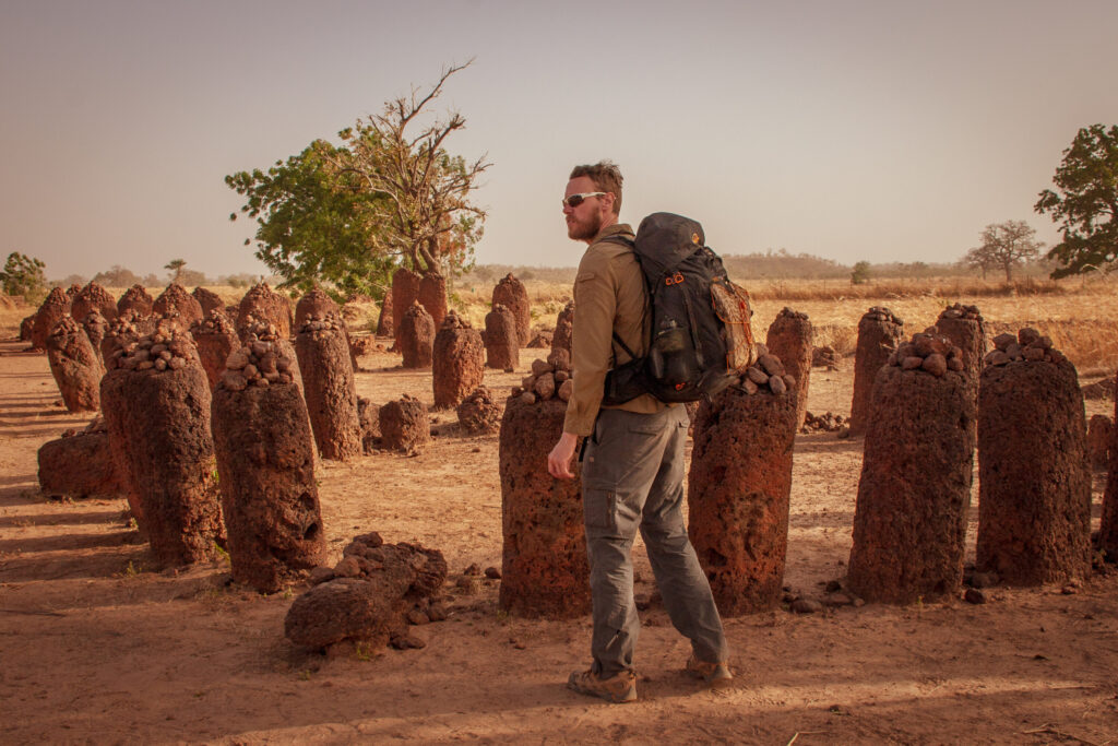
The villages we passed through were straight out of a fairy-tale; enormous, towering mosques at their centres with sprawling alleyways leading from all sides
Having sought out the Chief, he and his entourage duly escorted us to the source, a surprisingly small, walled-off pool of water. It was hard to imagine how this tiny puddle would soon transform to this major river system flowing all the way to the ocean over a thousand miles away. And so the enormity of the challenge ahead of us landed. We said our ‘thank yous’ and ‘goodbyes’ and we set about our journey to walk the length of the River Gambia.
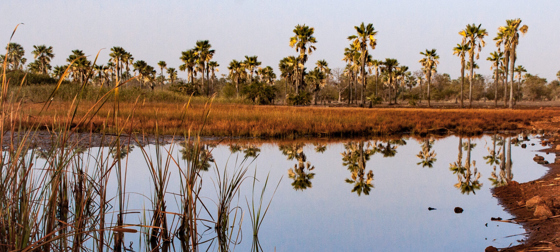
Because of the amount of rainfall it receives, these rolling grasslands and sandstone mountain plateaus are often referred to as the ‘water tower of West Africa’. It’s here that the headwaters form the start of four major rivers: The Gambia, The Senegal, The Tinkisso (a tributary to the Niger) and the Pongo.
Amidst the marshy grasslands, weaving through thick overgrowth, the river begins its journey. The start to our own journey navigated with more difficulty, as we climbed up and over steep and rocky dirt tracks that ran through the core of this high mountainous plateau.
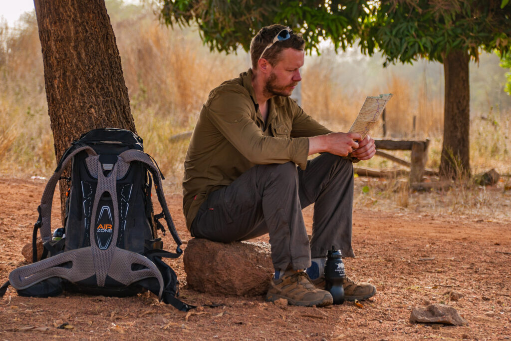
Our plan was to hike until dusk each evening, at which point we’d look for a place to pitch our tents for the night. Just 10km along on our first day though, we met a man at a small market and got chatting with him about our journey. Fascinated by our plan, the man invited us to camp in his backyard. We knew we’d need to find a place to stay before too long so this kind offer was one we could not refuse. This was only our first day of hiking, and already we’d been blessed with the welcome of this man. A total stranger, compelled by kindness to help. The following morning, we thanked him and offered to leave some money for him and his family. The man refused, insisting that we were his guests and wishing us luck as we parted ways.
It wasn’t long before we found our rhythm as we passed through these warm and welcoming places punctuating our path. Between them, we camped in wild and majestic spots alongside the river, relishing the isolation surrounding us.
Guinea was the shortest but most remote section of our journey, and by far the most humbling. The villages we passed through were straight out of a fairy-tale; enormous, towering mosques at their centres with sprawling alleyways leading from all sides towards the hearts of people’s homes. The further into the country we got, the larger and more imposing the river became.
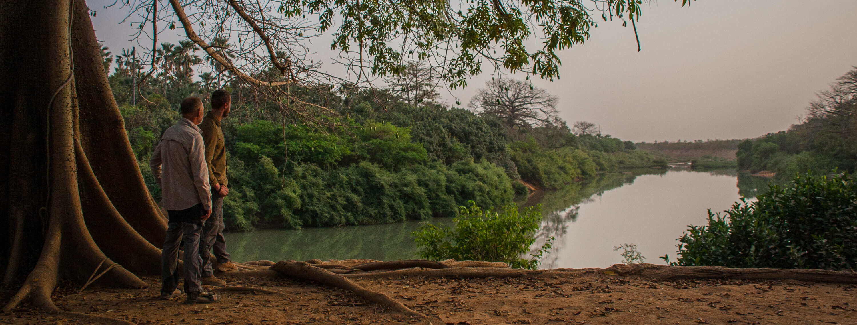
Crossing the border into Senegal, we made plans in Kédougou to meet with a park ranger from the Niokolo-Koba National Park. This was the biggest sticking point of our journey. If we were unable to walk through the park, at best, we would be forced to take a huge detour well away from the river. At worst, we would have to abandon our expedition altogether. We rested up for a couple of days, bracing for the news.
Eventually we heard, and the news wasn’t good. It wouldn’t be possible. A permit would take too long to organise and process – we were in shock. Was this our trip reaching a premature and unceremonious end?
I had been in talks with the charity I was raising funds for during the expedition. They had some contacts in Senegal who they thought might be able to help us out. The contacts were from the gold mining industry, the effects of which we’d seen quite a lot since crossing over the border from Guinea. We’d passed through several remote camps on the riverbanks and seen first-hand the industry’s damaging effects on elongated stretches of the river. The companies in charge of the mining industries hold a great amount of bureaucratic power across much of Africa. Here, money talks, as the saying goes. Our chances of making it through the park now sat solely in the hands of those contacts in Senegal.
The following morning, we met with the contacts who asked us for copies of our passports and told us to wait. Several anxious hours passed by, but low and behold, the permits were soon in our hands. We could continue into the national park!
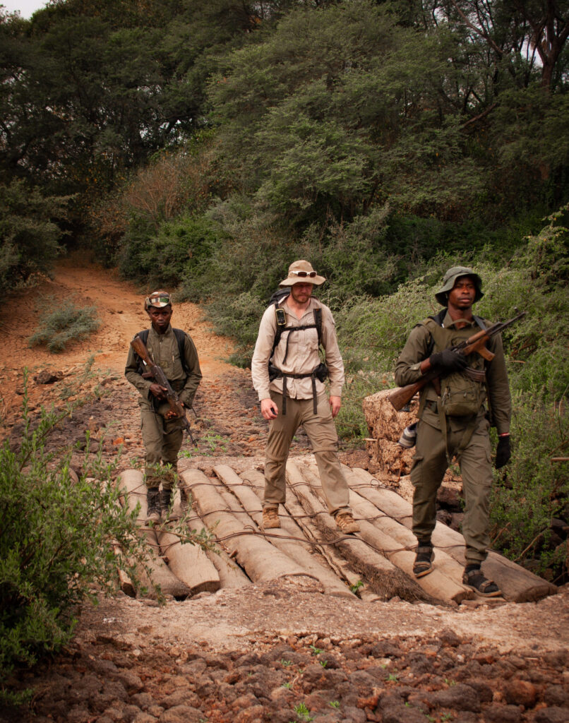
By now, we’d been in Kédougou about five days and were itching to be back on the move. We set off on-foot, following the river once again towards the national park. It was another two days before we reached the park gates where we were introduced to Solly and Abdu, the two rangers who would escort us on the four-day crossing. We stocked up on food supplies for ourselves and our guides and prepared for what was to be the most tricky section of our journey both mentally and physically.
More often than not, it was a lion and each time it was as if my heart stopped
I woke the following morning with a fever. I felt weak and my appetite was non-existent. Not the ideal state in which to be walk through a region home to a prolific lion population.
In the park, we walked in single-file: one ranger at the front and one at the back. A raised fist signalled that they had spotted something in the distance and that we had to halt immediately. More often than not, it was a lion and each time it was as if my heart stopped. But Solly and Abdu were cool, competent and professional in the face of this imminent threat. They knew that if we remained still, the lion would simply go about its business and pass us by. And they always did.
The more days that passed, the better I started to feel. Escorting us from ranger base to ranger base, these guys were some of the most incredible people we were lucky enough to meet on our journey. We were in constant awe of their work in guarding and protecting the park, and so grateful of the kindness, humour and hospitality they showed us during our time in this incredible area.
Reaching the end of the of the Niokolo-Koba National Park felt like a huge weight had been lifted from our chests. From here, we were in touching distance of our final country of the expedition, The Gambia.
Crossing the border into The Gambia, we had reached the only English-speaking country out of the three on our journey, so we knew that at least communication would be easier from here on out. There were more towns, more accessible tracks and more amenities on our route. This coupled with the fact that the lions were well behind us, put our minds at ease, allowing us to really get into the stride of our final section. There were now roads that flanked either side of the river, meaning that we could cover ground much easier and faster.
We reached Janjanbureh (formerly known as Georgetown), a town founded in 1823 by Captain Alexander Grant as a settlement for freed slaves. As the country’s second largest town, it was our first proper opportunity since leaving Kédougou to find accommodation and stock up on supplies for the final leg of the journey.
By now our bodies were aching, and the cracks were beginning to show as the tensions between us grew. It had been an incredible journey. We had passed through places many will never set foot in. We were witness to the beauty of the people and the humble lives they live next to the river – the source of life. But none of it had come easily.
The streets got busier and the wild places fewer. Sea birds flew over our heads and the banks of the river became sandier
We left Janjanbureh with full bellies, hearts reinvigorated and our spirits lifted for what was to be the final leg of our journey.
This last section of our walk was a time for us to reflect and enjoy our final advance towards the Atlantic Ocean. The closer we got to the finish, the more populated and touristic the areas became. ‘Toubab’ – the Central and West African name for tourist – now seemed to follow us, which during our trek we’d learned was often was a clear sign the area was used to tourism.
The streets got busier and the wild places fewer. Sea birds flew over our heads and the banks of the river became sandier. The Gambia River was now over 10km wide as it wound its way to its final destination.
It’s a strange feeling, reaching the end of such a big journey on foot. We’d become acutely aware of the river’s every change, in awe of its evolution and the subtle evolutions that take place as it passes through such varied landscapes. In a strange way, we now felt a part of the river and in the same sense it felt a part of us and our story.
Don’t miss a single adventure
Sign up to our free newsletter and get a weekly BASE hit to your inbox
You might also like
Photo Essay • BASE editorial team • Mar 18, 2024
Hunting happiness through adventure in Taiwan
BASE teams up with adventurer Sofia Jin to explore the best of Taiwan's underrated adventure scene.
Story • Kieran Creevy • Jun 16, 2023
Scrambling Before Scran on Scotland’s Misty Isle
Sun-drenched ridge lines with expedition chef Kieran Creevy on the Isle of Skye
Video • BASE editorial team • Jun 02, 2023
How To Clean And Care For Hiking Boots
Our top five tips to give your hiking boots a 'glow up'