Savage Paradise
Feature type Story
Read time 15 mins
Published May 10, 2022
Author David Weimer
Photographer David Weimer
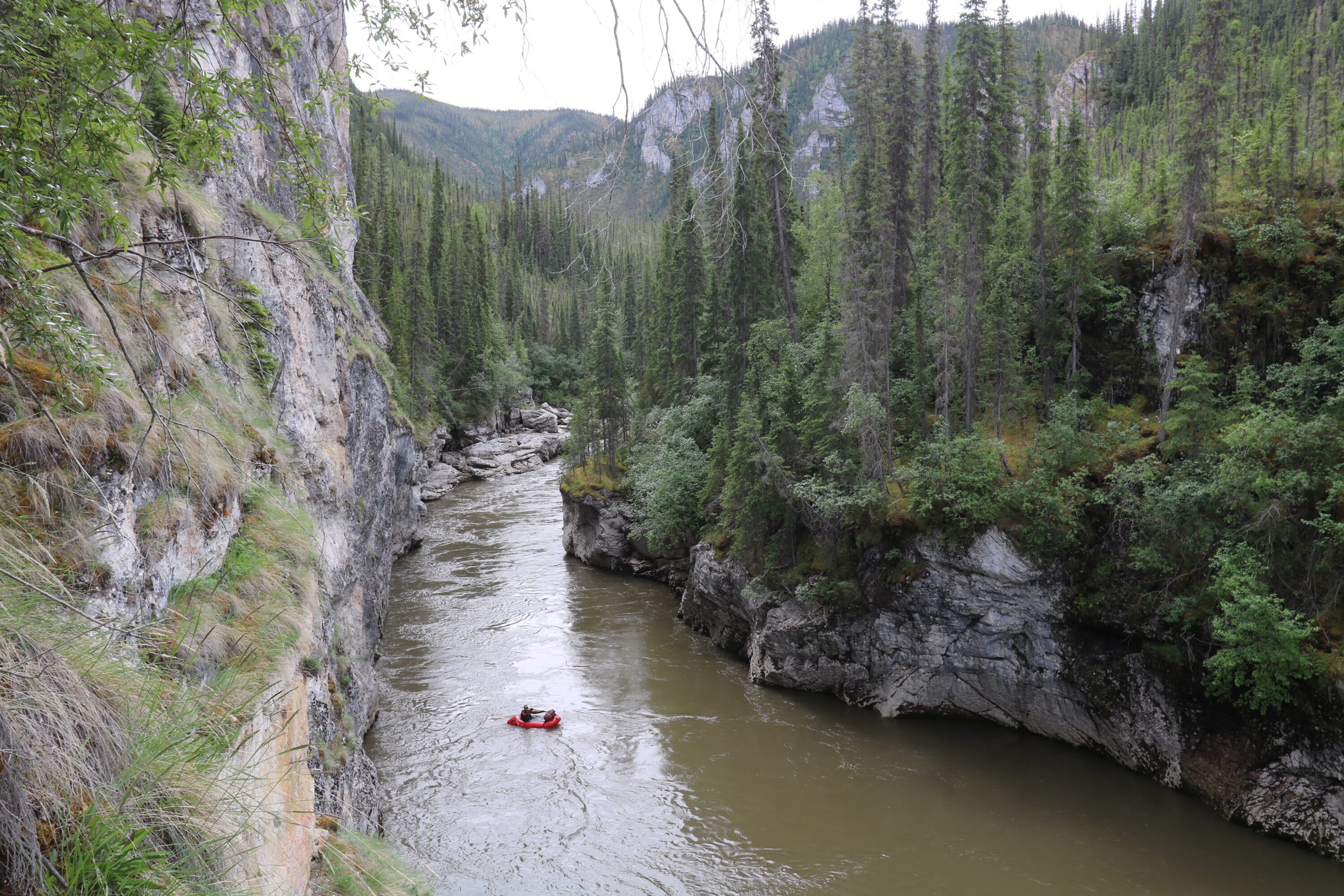
A landmass roughly twice the size of the UK, reaching from British Columbia up above the Arctic Circle, the Yukon is home to some of the wildest and most sparsely populated landscapes in North America. In the east of the territory, where its border forms a perfect right angle with Alaska, the Tatonduk River forms one of its most spectacular valleys. Armed with packrafts and climbing ropes, David Weimer set out to explore the Tatonduk Valley and make a rare descent of its river. This story first appeared in issue 07 of BASE magazine.
Ueli Staub running the Mother Bear Canyon above the waterfall.
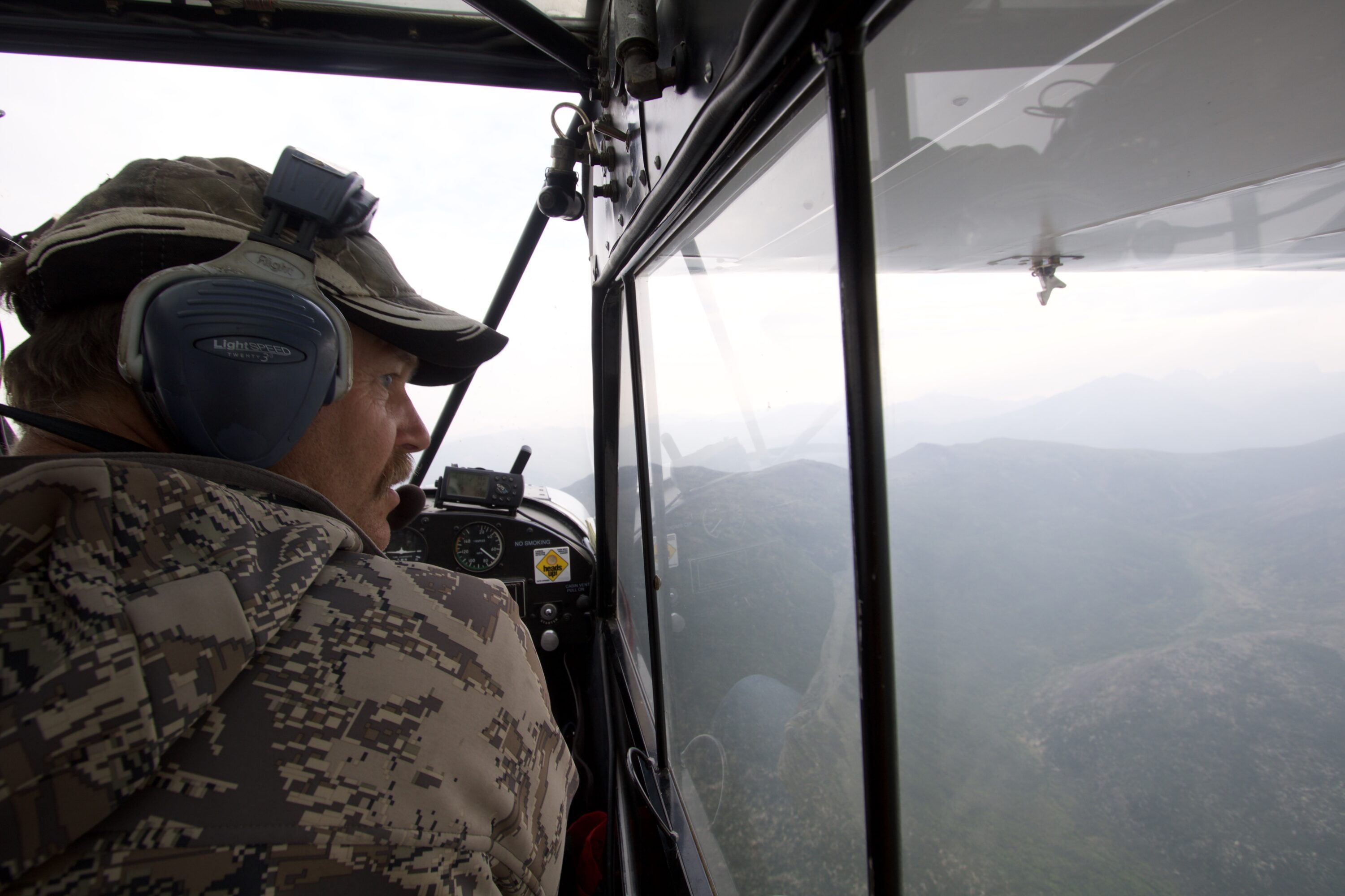
‘I don’t even like to fly over that canyon,’ said Dan Reynolds, the bush pilot and hunting guide who was flying me to the headwaters of the Tatonduk River – an obscure ribbon of whitewater I had obsessed over for the better part of two years. The canyon in question was the crux along our paddling objective. It was the reason why people didn’t go there.
Dan owns a massive hunting concession which extends from his cabin near Dawson City, Yukon Territory, all the way to the Alaska border – 6000-square miles of some of the most remote, pristine areas of North America. Our goal, the Tatonduk River, flows directly through it.
‘I take 12 hunters out a year,’ Dan said. ‘That’s what the land can support.’ As we flew over the area in his Super Cub – a one passenger, supercharged monoplane, with cartoonish oversized tundra tires– I realised that everything below us, the forests, rivers, mountains, all of it, stretching into the horizon – is all Dan’s. And I was a little curious why he had limited his clients to so few. Wealthy, big-game hunters from all over the world want to hunt moose, caribou, Dall sheep, wolves, and even grizzly bear on his concession. A guided moose hunt, for instance, averages $23,000 US dollars per client. With prices like these, Dan’s backyard is a veritable goldmine. However, he didn’t seem to care. His interest lies in game management. ‘It was a hard winter for the Dall sheep,’ he mused. ‘There are half as many as there were last summer.’
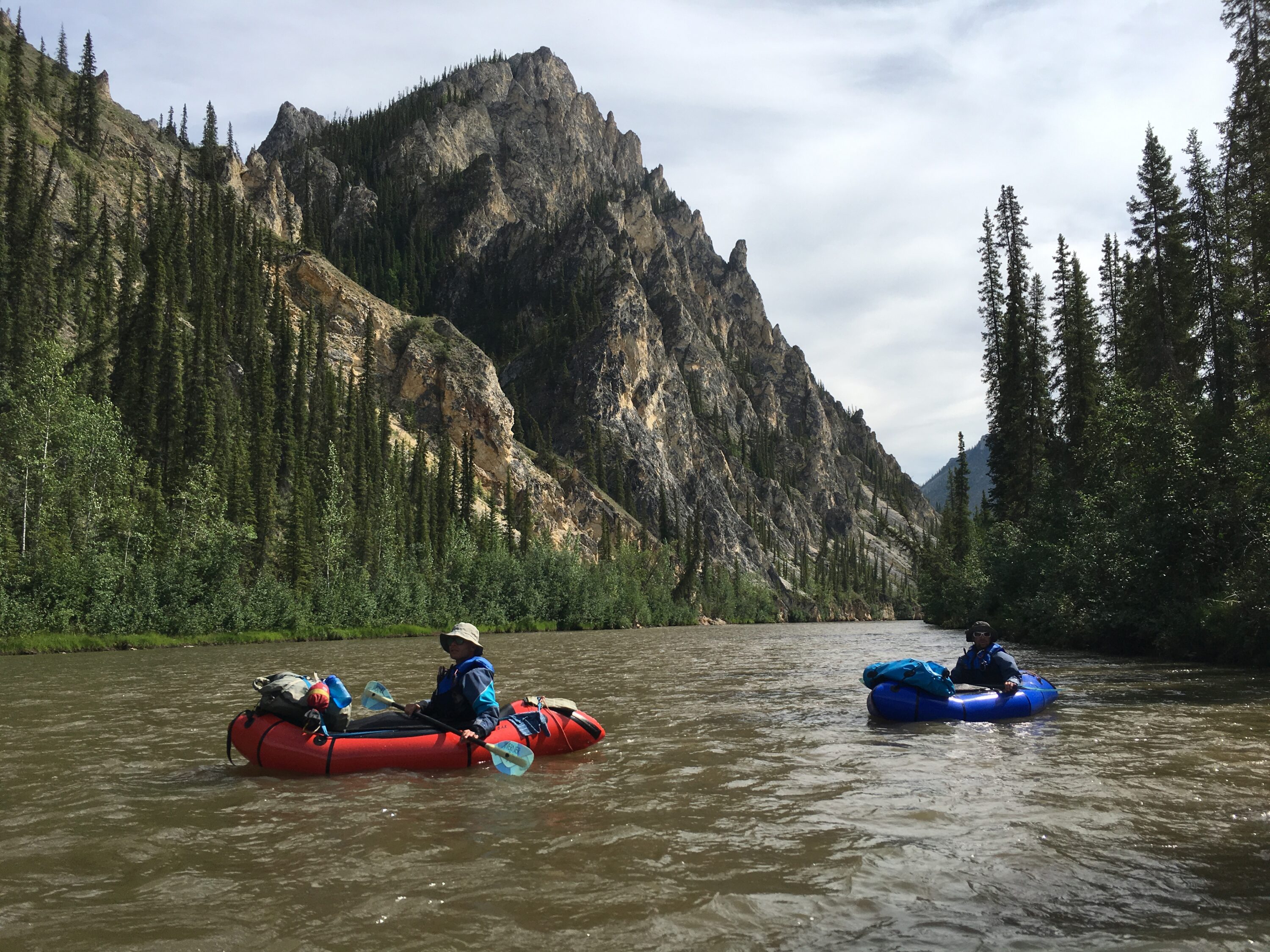
Dan has a small cabin with a primitive airstrip on the bank of the Tatonduk. His father owned it before him, along with the hunting concession, and he’s been coming since he was a child. As we neared, I saw a huge trail leading down to a grassy meadow beside the river. It was a game trail, or perhaps a game highway, the Dall sheep had rutted-out over the centuries. This was where the ewes came to give birth. Dan banked the plane hard to avoid the area and startle the animals. The river had recently flooded and took out half the airstrip but Reynolds maneuvered the Super Cub expertly and lands in an area small enough for a helicopter pilot to be proud of. He dropped me off, then flew back to retrieve my two friends, Oliver Amann and Ueli Staub. The plane, as well as the airstrip, is only big enough to fly us in one at a time.
Dan Reynolds flying his Super Cub. Smokey haze from forest fire.
It was my third trip to Tatonduk. In 2015, while floating the Yukon River, I stopped at the confluence to get a glimpse of the surrounding area. In 2016, Mike Cragen and I embarked on an off-trail, 150-mile loop on the edge of east-central Alaska that toured the most remarkable, yet least visited areas bordering Yukon-Charley Rivers National Preserve. We named this ambitious circuit The Borderpatrol and it centred on exploring the Tatonduk. The route went across the Canadian border, down the Tatonduk River with packrafts (which, as far as I could tell, was the second descent of the South Fork) and back across the U.S. border.
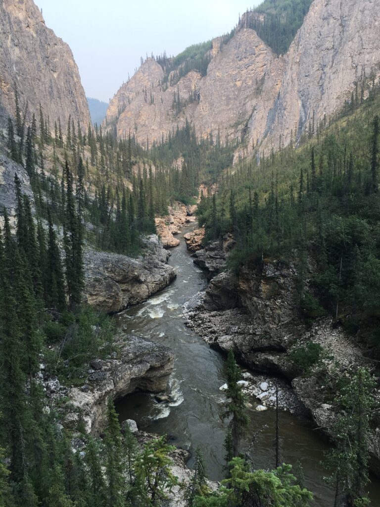
What we found did not disappoint. The geology in the valley was completely unusual to the subarctic. Hidden amongst the cliffs were several natural arches, slot canyons, caves, and even a miniature volcano which erupted in 2012. And to top it off – the Grand Canyon of the Tatonduk – which has vertical walls rising hundreds of feet to either side. It seemed unbelievable, but the gorge narrowed into a slot so tight – game animals could leap across it in one jump.
The valley was a geologist’s dream and a paddler’s nightmare. The area was so unique, I believed it could, and should be incorporated into some kind of natural preserve – just like Yukon-Charley Rivers National Preserve across the border. If it were, the two areas would be interconnected, protecting a huge swath of wilderness. So I brought my friends, my cameras, and my naiveté, and set out to document one of the most unusual and spectacular valleys in all of Yukon Territory.
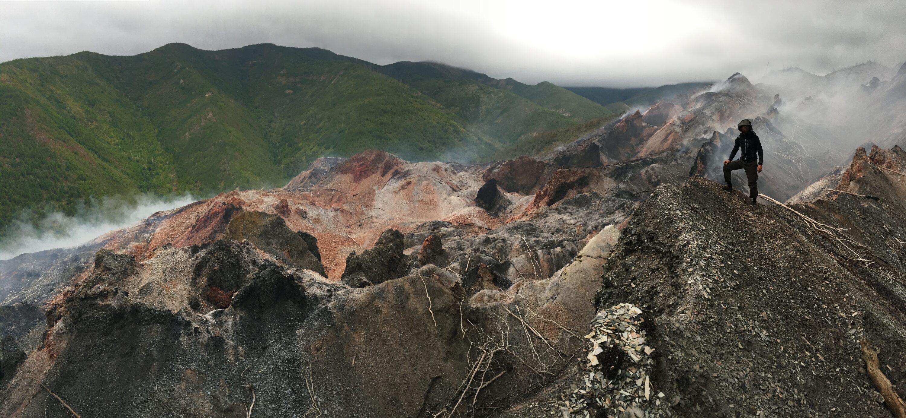
Mini volcano. Standing here too long could melt the soles of your shoes.
Large rocks ricocheted down the cliff, cannonballing into the river around us. Was this an accident or were the sheep purposely trying to kill us?
The sun was beating down at 11pm. T-shirt weather in the land of the midnight sun. Dan had offered the use of his hunting cabin for the night. It was spacious, clean, but not exactly mosquito proof. We considered erecting our tents until we spied a guest book. The last two entries were dated a year ago.
Sept. 15 – While scouting the west-ridge for moose, we glass a huge, 10-foot grizzly on the tundra below… Tom S.
Sept. 18 – Griz dead and in camp. Measures just 7-foot 6-inch. Tom needs to see more bears. Greg M.
We chose to sleep in the cabin. We weren’t ready to deal with the bears just yet. The comfy but primitive abode reminded me of legendary trapper Dick Cook, who homesteaded on the lower section of the Tatonduk. His exploits were documented in John McPhee’s classic book, Coming into the Country. Cook built his log-home by hand and lived there for nearly four decades. He had dealt with the threat of bears on a daily basis, it was all normal living for him. In 2001, Cook, who was then 70-years-old, accidentally swamped his canoe and subsequently drowned in the frigid waters. His body was found floating near the mouth of the river; proof that bad things can happen to even the most skilled, seasoned outdoorsmen. If it ain’t the bears that get you, I reasoned, it’s the river.
The next morning we inflated our packrafts and began the descent. The contour lines on our map pinched together, revealing the canyons ahead. But first we had to cruise past the meadow where the sheep were sleeping. Dan never hunts this area and asks us not to disturb them. As quiet as we were, they smelled us. Thirty white sheep stampede for the river, splashing across in front of us, and quickly climbed the striated canyon wall until they were high above. Large rocks ricocheted down the cliff, cannonballing into the river around us. Was this an accident or were the sheep purposely trying to kill us? And when, I wondered was the last time these sheep had seen people?
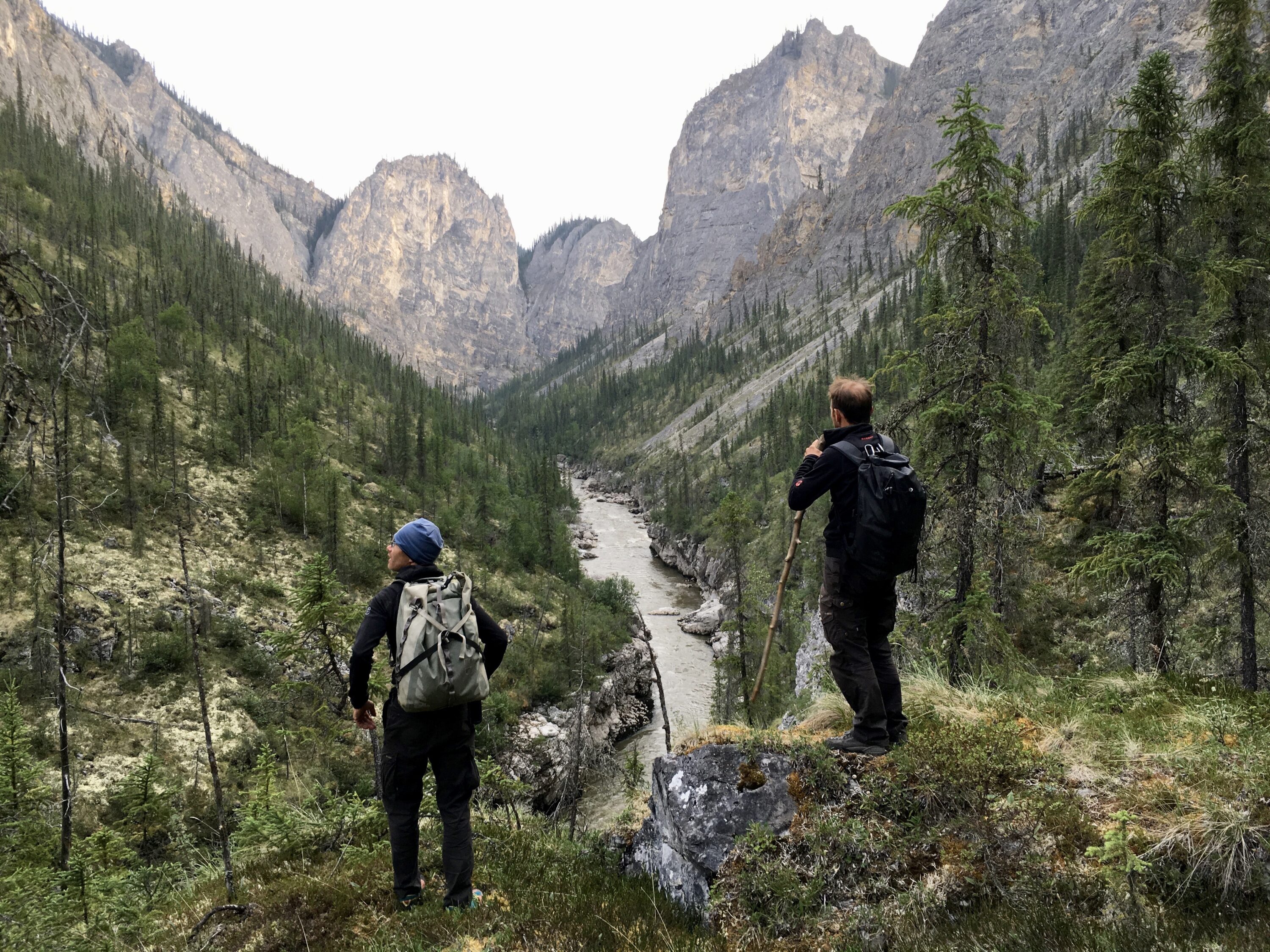
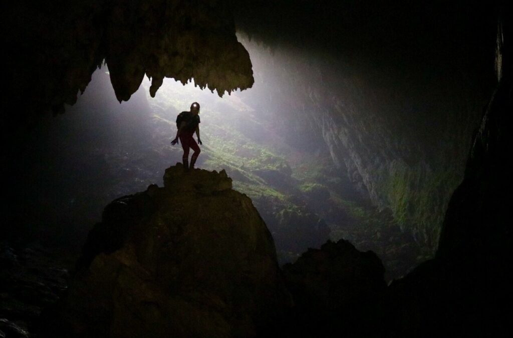
Oliver Armann and Ueli Staub take a moment to appreciate their surroundings and asses their next steps as they begin their portage through the Eye of the Needle Canyon.
In June of 1980, Jerry S. Dixon was working as a Fire Management Officer for the Bureau of Land Management (BLM) in Eagle, Alaska. He had been a smokejumper – a highly trained wildland firefighter who uses parachutes to access remote and rugged areas. But then he had an accident. Jerry is among the few smokejumpers in history to have survived a double parachute malfunction. Afterwards he had an epiphany. He decided to stop jumping out of airplanes.
Jerry was the only BLM representative for an immense tract of public land around Eagle. The establishment of Yukon-Charley Rivers National Preserve had been proposed but not yet implemented, and in Eagle, there was almost unanimous opposition to the park. The idea that the government was now going to control the wilderness and demand permits for things like mining and hunting did not sit well with the residents. Store owners posted signs that read: PARK SERVICE NOT WELCOME HERE.
Although many of the townspeople thought of Jerry as ‘one of the bad guys’, he was outgoing, amicable, and he had something in common with most of the residents: he loved the Yukon wilderness.
Dixon was also a whitewater kayaker. During this time, he had accomplished a daring, solo first-descent of the North Fork of the Tatonduk River, was mesmerised by the area, and wanted a shot at the South Fork too. This time he implored his paddling friend from Idaho, Ron Watters, to join him in the adventure. Having flown over the South Fork and seen the canyons for himself, Jerry knew there would be some monstrous portages to contend with. The pair decided to use Spezi inflatable kayaks, which were heavy, but easier to portage than the typical 13-foot fiberglass hardshells of the day. The Spezis, however, couldn’t quite fit in a backpack. They also had a nasty reputation for wrapping around boulders, trapping their occupants. Packrafts would have been ideal, of course, but they had yet to be invented.
Jerry described the trip in his book Wild for Alaska. The duo named the many topographical features along the river which I have adopted for this article. Sadly, Jerry died of Lou Gehrig’s disease in 2010 and I was never able to speak with him about the accomplishment.
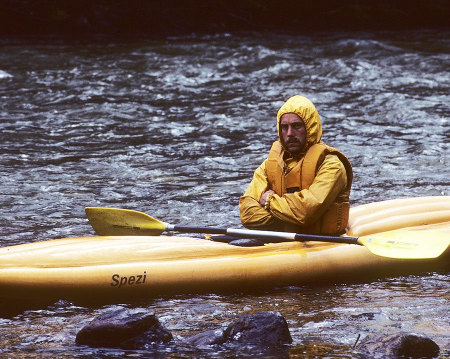
Jerry Dixon during 1980 first descent of South Fork Tatonduk River. Photo by Ron Watters.
It was our second day on the river and we were having a blast. We felt like explorers discovering an untouched land for the first time. There was no trash, no footprints on the gravel bars, no evidence of logging, no incessant whine of airplanes flying overhead. The valley was ours and ours alone. This awareness was especially poignant for Oliver and Ueli who live in Switzerland. ‘In our country, every tree is accounted for,’ said Oliver. ‘If you walk through a forest in the Alps, there are no fallen trees lying on the forest floor, they are harvested long before they ever touch the ground.’
‘Camp fires are illegal too,’ said Ueli. ‘You need a special permit, only certain people can get them, and it’s only allowed once a year.’
I looked at the healthy stands of black and white spruce and tried to imagine what it would be like to account for each and every tree. Oliver continued, ‘You can’t do a trip like this in Europe, every river is dammed. You can paddle short sections, portaging the dams, but camping is forbidden.’
Oli and Ueli beneath Pinnacle Mountain.
I gestured with my hand to imitate a boat plummeting over a lip to certain death
We continued our paddle towards Mother Bear Canyon. I knew from Dixon’s book there was a hidden, river-wide, 25-foot waterfall somewhere along our path. Now, I like whitewater just as much as any river-runner who considers this type of hobby ‘fun’. But I am also conservative. Admittedly, some might say that I am annoyingly conservative. So yes, the idea of running an unknown canyon containing a hidden waterfall somewhere along its length, scares the hell out of me. However, the waterfall didn’t seem to bother Oliver or Ueli one bit. They were both keen to hit some real whitewater.
It should be noted that my friends’ first language is Swiss-German. Their English is superb, however, some common phrases and idioms were simply lost in translation. So, I wasn’t sure if either of them had completely understood me. ‘Guys!’ I said a little louder, ‘Do you know what I mean when I say waterfall? I don’t mean whitewater, I mean waterfall – the whole river going over a cliff.’ I gestured with my hand to imitate a boat plummeting over a lip to certain death.
‘Yes, yes, we understand,’ they laughed. ‘We will scout from the river.’ They jumped into their packrafts and sealed their sprayskirts. Not wanting to be left behind, I nervously followed. We paddled out of the swirling eddy and dropped into a canyon with smooth granite walls. It was tight and claustrophobic. I kept listening for the telltale roar of a waterfall. Would I hear it? The powerful current pushed us along through a series of wave-trains and splashy rapids, nothing difficult, but a flip could have proven serious.
Rounding a large bend, just 50-yards away, I saw the river disappear over the horizon. I yelled, ‘There it is!’ We paddled quickly to a large eddy and exited the rafts. My mouth was dry. A great relief washed over me.
It was a hard portage with all our gear and boats to the base of Mother Bear Falls. The river cascaded 25-feet, ricocheting off polished conglomerate, and culminated in a cloud of mist and spray. It was a beautiful, tranquil spot – worthy of a roadside attraction in any national park. But the hordes of tourists were thankfully missing, no network of roads or infrastructure there to support them, no array of port-o-potties leaking their stench into the landscape. The area was lonely in the best way possible; pure, unbridled wilderness.
The next two canyons, Thunder and Merganser, were more fun than frightening. The river felt small, splashy, like a flume ride at an amusement park. Scattered along the cliffs above, we spotted a series of natural bridges. Jerry and Ron named the most prominent which look like the gestures of a giant hand: OK Arch, Knuckle Arch, and Thumbs Up. Arches rarely form in the Far North due to the slow dissolution of limestone during the long and cold subarctic winters. Even when these natural oddities have formed at high latitudes, they are usually destroyed by repeated glaciations. Just another example of how the Tatonduk Valley is a unique and special place. But it wasn’t the formations that had captured my imagination – it was the gorge ahead.
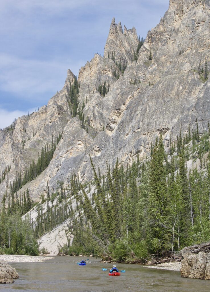
Oli and Ueli drift across the peaceful waters beneath Pinnacle Mountain (named by Jerry Dixon and Ron Watters).
The word Tat-on-duk comes from the Hän Athabaskan word which roughly translates to Broken Rock. That might be the best description of the gorge we were about to encounter. Imagine a mountain that has split in half, the entire river forced through the crack. Ron Watters sent me this vivid description of the canyon as he remembered it.
The walls are smooth and vertical, sometimes overhanging. The water is slow at the beginning and it’s strangely inviting. You can almost hear the Sirens inviting you in. It might be tempting to paddle a short distance – just a short distance – to see what it’s like. But if you did, it would be a black widow’s embrace. You would be there for the duration – however short or long that might be. Once in the gorge there would be no way to climb out from river level. And what might you encounter? Walls closing in. The river beginning to hurtle downward. Then the black widow herself: a mass of logs forming a narrow spiny plug extending 30 feet or more above the surface of the river.
The ‘spiny plug’ Watters is referring to is every river-runners worst nightmare: a strainer of monolithic proportions. Years of debris piled together to create a natural dam capable of purifying the river of any unfortunate soul brave enough, or dumb enough to get near it. I have paddled a fair share of rivers and have never seen a strainer able to form in a river with such high volume. It was impressive and terrifying at the same time.
Beginning of South Fork Tatonduk Grand Canyon
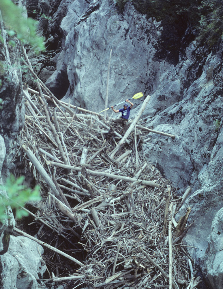
Jerry Dixon straddling the ‘Black Widow’. Photo by Ron Watters
I had tried to circumvent this obstacle by portaging down the left side of the canyon with Mike Cragen in 2016. This was a mistake. After an hour of hiking with heavy packs, on scary precipitous ledges, we were cliffed-out and forced to retreat. This was the same cliff that Oliver, Ueli and I had brought climbing gear for. Our objective was to reach the Eye of the Needle – the largest arch in the valley – it stood like a sentinel on the canyon rim overlooking the gorge. There was a distinct possibility that no one had ever been there before.
Oliver and Ueli are expert mountaineers and have climbed all over the Alps together, so I was more than happy to relinquish the rope to them. At the base of the 40-foot cliff, Ueli took the lead. The rock was flaky, unprotected, and looked more difficult than I had remembered. At the start of the climb, there was a small tree which had grown out of a crack in the rock face. If Ueli had fallen just above this, the rope might have caught the tree and arrested his fall. But he had climbed above this point-of-safety and was traversing far out over the void to find better holds. If he slipped, he would have fallen past us and hit the boulders some 70-feet below. No one spoke. Oliver grew silent as we watched his brother-in-law make the final, delicate moves to the top. Soon, Ueli had an anchor built and was belaying us up.
At the Eye of the Needle, we took photos and ate sardines. There was no evidence that anyone had been there before us, and we made sure to erase any evidence of our own passing. The following day, we would see a Dall sheep standing on top of the arch; seemingly to mock our efforts. In the distance we spotted another natural bridge, this one undocumented. You would only be able to see the hole in the rock from our vantage point. I decided to name it Swiss Arch, in honour of my two friends, who had travelled halfway around the world to share this adventure. I might have come here without them, but I was glad I didn’t have to.
If he slipped, he would have fallen past us and hit the boulders some 70-feet below. No one spoke
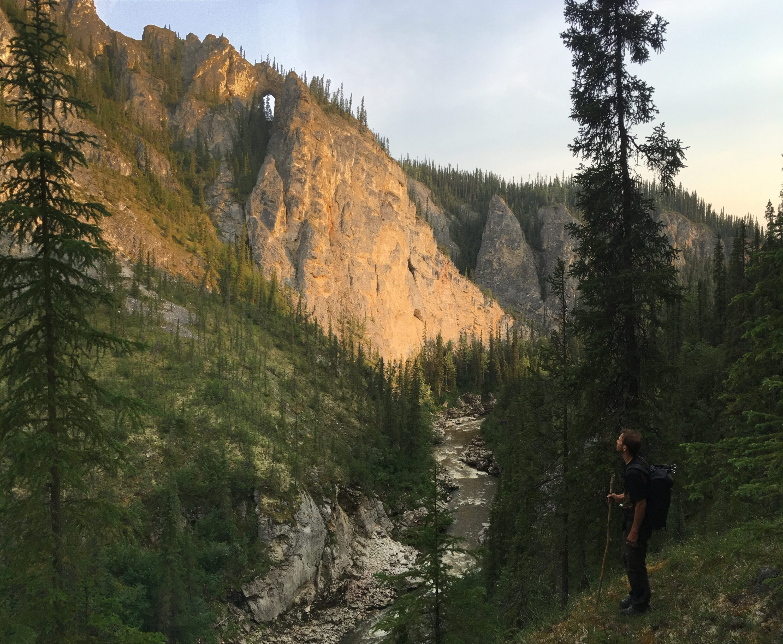
The aptly named Eye of the Needle Arch, basking in the evening glow.
Inside the gorge, the river hurtled down into a fissure and disappeared. We couldn’t see the black widow herself but we knew she was there – right where the canyon was at it narrowest. A faint game-trail led towards this spot and then continued on the opposite side. It was true, game animals could leap across the gorge in one jump. Downriver, there was an adjoining valley with sheer walls rising to either side. It would take ropes to access. Had anyone ever been there? I believed, with good reason, the valley would remain unexplored until our return.
The Tatonduk Valley has remained pristine because very few people know of its existence. For a long time, I debated writing this article for that very reason. Simply publishing these words could reveal it to the wrong people, perhaps those who would rather profit than protect. However, if no one knows of its existence – no one is likely to care about its defilement either. Luckily, the remote location and subarctic winters will keep most people at bay. Most.
Author and naturalist Henry David Thoreau once wrote, ‘In wildness is the preservation of the world.’ It is a lovely but often misrepresented statement. Thoreau wasn’t writing about the wilderness; he was talking about the wild spirit within people. When visiting Tatonduk, I felt that wildness. How could I not? It inspired me to do what I could, however little, to protect this savage paradise. For now, I rest assured that as long as Dan Reynolds is managing his hunting concession, the area will remain protected and wild indeed. The only question remains: for how long?
Don’t miss a single adventure
Sign up to our free newsletter and get a weekly BASE hit to your inbox
Other posts by this author
Story • David Weimer • Nov 02, 2021
The Lost Kingdom
Subterranean expeditions into the Parque Nacional de las Cavernas del Río Camuy
You might also like
Photo Essay • BASE editorial team • Mar 18, 2024
Hunting happiness through adventure in Taiwan
BASE teams up with adventurer Sofia Jin to explore the best of Taiwan's underrated adventure scene.
Story • Tom Grant • Feb 23, 2023
Swat Valley Ski School
An impromptu ski lesson during a ski-mountaineering expedition to make the first descent of Falak Sar in northern Pakistan
Interview • Rosie Fuller • Jan 18, 2023
Interview: A Baffin Vacation
Sarah McNair-Landry on her 45-day multi-sport expedition in the Arctic Circle