Graveyard of the Atlantic
Feature type Story
Read time 12 min read
Published Sep 17, 2021
Author Chris McClean
Photographer Chris McClean
A long line of low-lying islands extends almost two hundred miles down the coast of North Carolina, from Virginia Beach to Cape Lookout. Known as The Outer Banks, these remote strips of wind-blown sand face the full force of the Atlantic Ocean, and are the stuff of legend. Once the final outpost of the notorious Bristolian pirate Edward ‘Blackbeard’ Teach, they were also the site of the Wright Brothers’ first successful powered flight in 1903. In late summer 2019, Chris McClean rode the full length of the archipelago with new friends and surfboards in tow, finding the islands just as storm-swept as their reputation suggests: a reminder of why this place once gained the well-earned nickname ‘Graveyard of the Atlantic.’
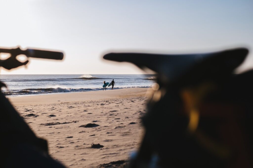
Somewhere north of Rodanthe, we rode past hundreds of perfect breaks on a hunch to reach a bank that would provide bigger and better waves. It did.
I landed in Trump’s New York amidst the humdrum of the climate protests in September 2019. The air was hot, dusty and dirty. And the train that took me from JFK to Williamsburg was rammed. I’d never been to New York before and I was full with anticipation. A sea of faces: sharp-suited businessmen, unkempt youths, families clinging to each other, and skater kids. Every aspect of society in every single carriage. I had three days in the city, but the purpose of my trip Stateside wasn’t New York. It lay over three hundred miles south, along the line of lonely islands known as The Outer Banks that separate the inshore North Carolina coast from the open waters of the Atlantic.
After three days in the Big Apple I woke early, let myself out, bought coffee to go and a bagel, and make my way across town to a bus station in the Lower East Side. My seat was next to a large lady, who was on her phone the entire journey. Somewhere around Philadelphia, she pulled out a huge box of fried chicken and proceeded to munch her way through the entire thing whilst still managing to hold down a conversation. On paper, eight hours on a sweaty bus with only a bagel and a handful of nuts for company sounds horrible, but strangely it wasn’t; I was so full of excitement for the second part of the trip.
My destination was Virginia Beach, the coastal town just east of Norfolk, Virginia. I was dumped unceremoniously in an empty parking lot beside a handful of boarded-up superstores, a bowling alley and a small restaurant tucked in the corner. I bought a drink and watched the patrons. I couldn’t work it out. Halfway through renovations, it was seemingly part jazz club, part brothel, part Caribbean takeaway and part cabaret installation. I didn’t have enough time to figure it out as my phone buzzed and my ride was waiting outside.
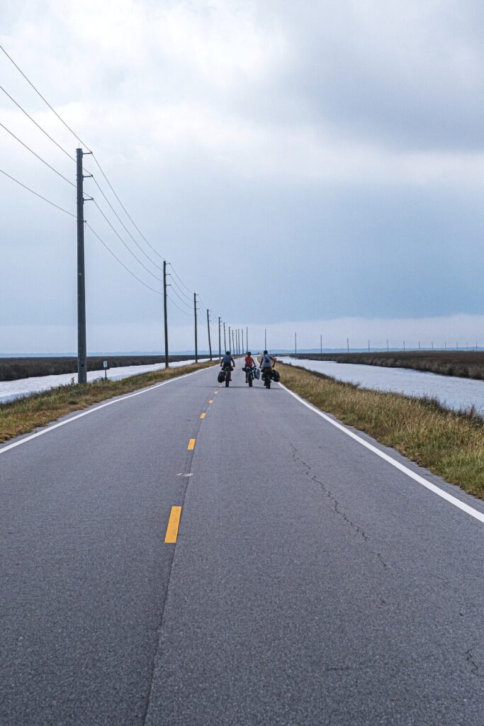
The longest stretch of highway we rode was on Cedar Island: miles and miles of good asphalt with no cars whatsoever.
Bri stylish as ever on a sunset swell at Pea Island Nature Reserve on the Cape Hatteras National Seashore in the heart of The Outer Banks.
None of us had met before now. But in the deserted car park beneath the neon signs from Ollies Bargain Outlet shining down on us, we introduced ourselves and embraced. Exciting talking about the trip on which we were about to embark.
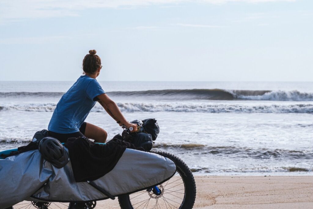
Our crew consisted of Bri, an easy-going local surfer and a lifeguard in the Outer Banks. She’d lived on the Banks her whole life; fishing, surfing, painting, and playing music – it all seemed pretty idyllic. Ry, her husband, was an Australian who’d come to lifeguard for a season. But smitten, he had stayed and married. Bri was tough-skinned and joy either to ride with or surf with, a smile, joke and a song never far away.
Gary, a scientist with the gift of chat, was analytical and always looking beyond the obvious. He was a seasoned traveller having ridden around Africa on a motorbike with a surfboard strapped beside him. He also surfs good, from years on the Californian and Baja point breaks, and is a joy to watch on the fast peaky Outer Banks’ A-frames.
Robin was a kind-hearted Floridian now living in Santa Cruz, and had organised the trip. I’d met Robin last year in Scotland the previous year on a bikepacking trip, and talked about surfing and bikes. We compared notes around campfires and promised to make something happen. Robin then made it happen, he brought four people that barely knew each other to the Eastern Seaboard with kit and bikes. Even when plan A doesn’t quite work out, Robin always has a plan B up his sleeve that kicks in smoothly and calmly, with limited fuss.
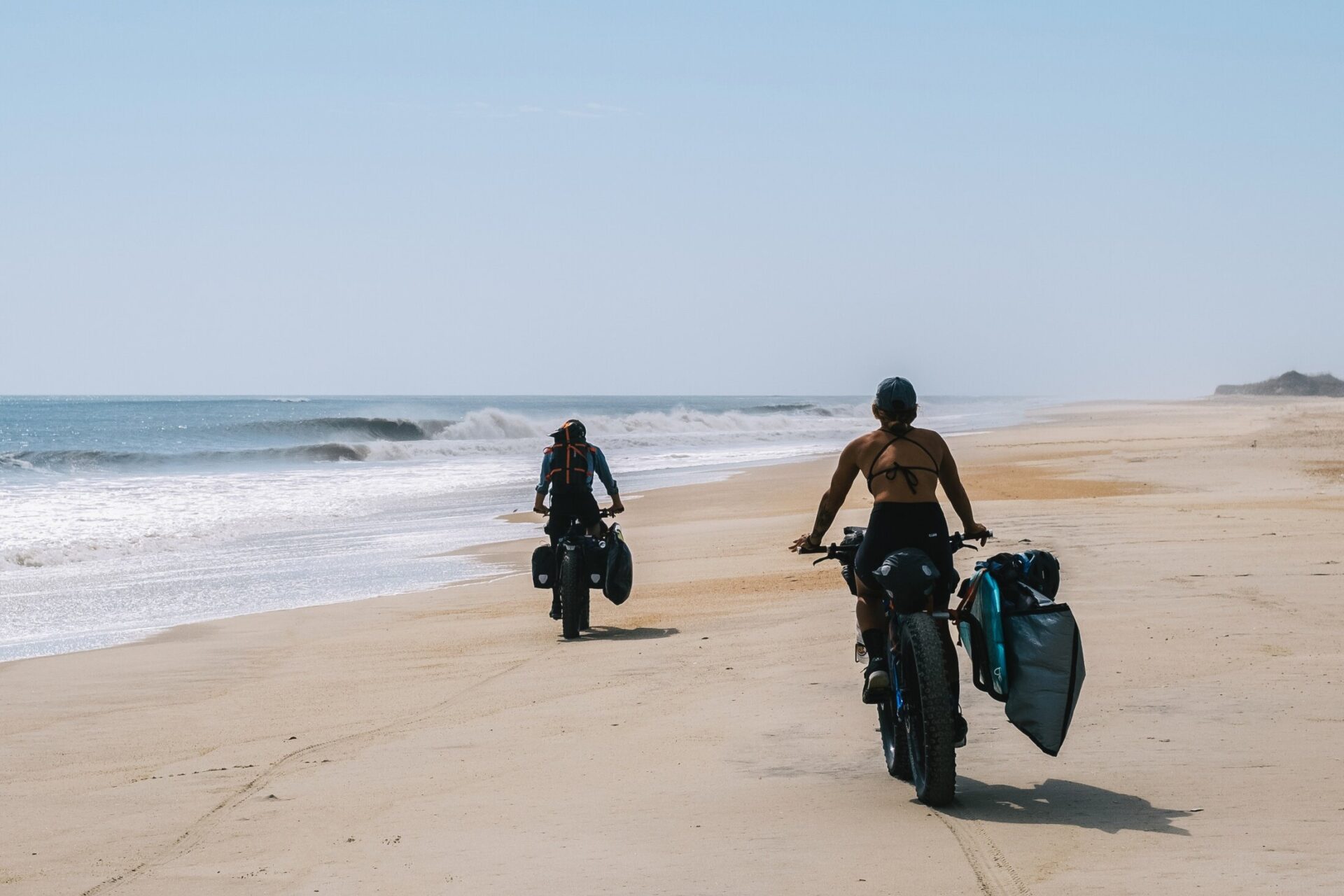
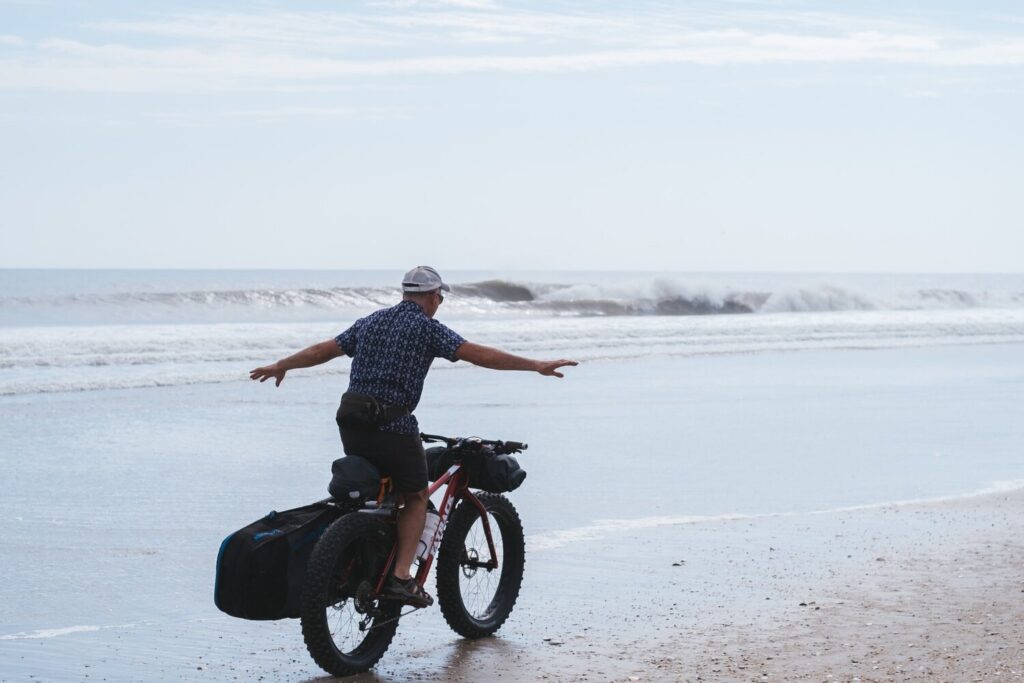
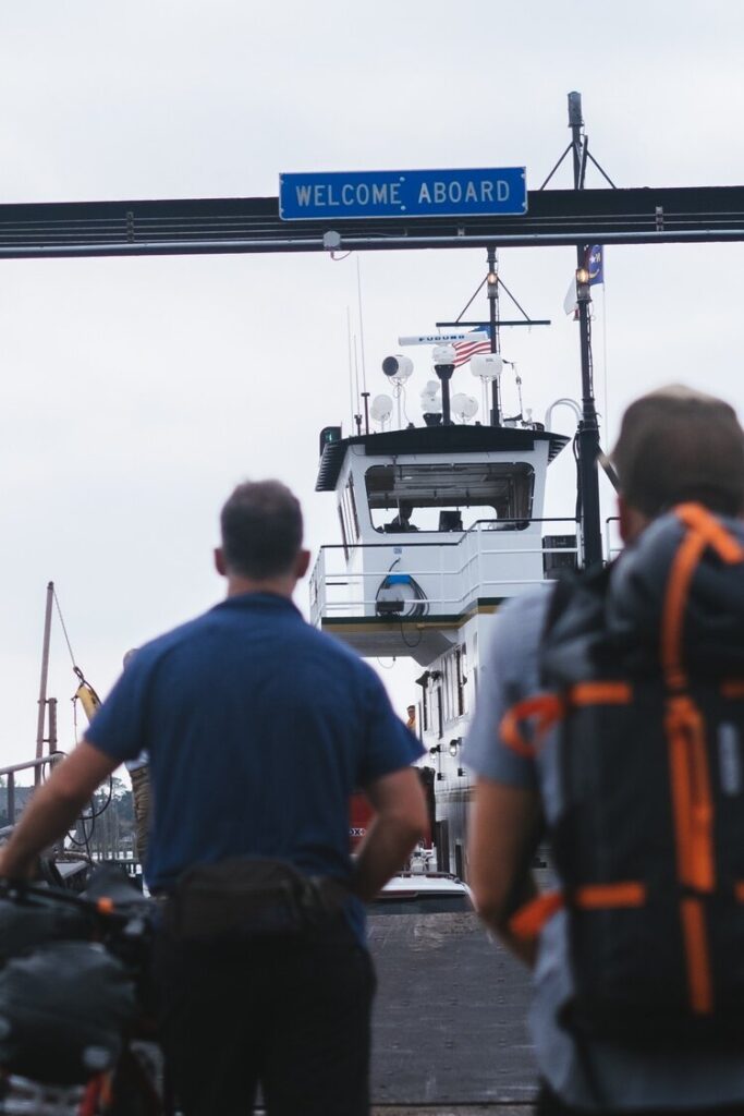
Plan A was pretty simple. We would all meet in Virginia Beach and, using ‘fat bikes’ from Fatback Bikes, we would travel sound from the furthest northern point of the islands to the southernmost point. We would surf and camp our way south, riding the beach as much as possible from Virginia Beach to Back Bay, and then False Cape, before crossing the state line into North Carolina. From here, we’d take in Currituck National Wildlife Refuge, Corolla, Duck, Kitty Hawk, the wonderfully named Kill Devil Hills, Nags Head, Pea Island National Wildlife Refuge, Rodanthe, and Cape Hatteras. From Cape Hatteras we would board a ferry and sail to Ocracoke, and from Ocracoke another ferry to Cedar Island, and then another ferry to Cape Lookout, before returning to the mainland via Harkers Island.
It sounds a long way, and it was. Two hundred-odd miles in just over a week, with heavily loaded fat bikes mainly on the sand, it was certainly going to be a challenge.
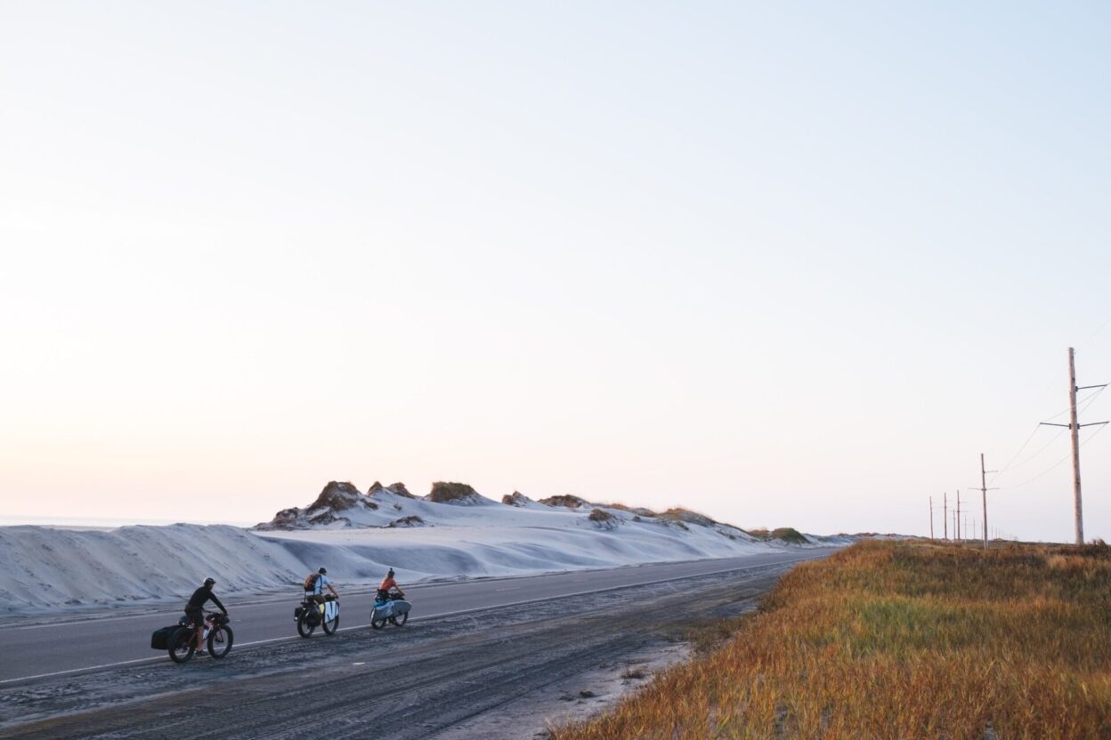
When the tide was too high and the sand too soft, we resorted to North Carolina Highway 12.
Back in Virginia Beach as we unpacked the bikes, attached racks and bags, ate pizzas and sank beers as we got to know each other. At this point Robin slipped it in that we needed a Plan B.
As we were planning for this trip, Hurricane Dorian had smashed into The Outer Banks, in particular into Ocraoke Island, just as Trump announced it was heading for Alabama. (The hurricane then immediately turned north and spun off into the Atlantic, largely missing the mainland US.) The destruction on Ocracoke, though, was so significant that the authorities had closed the island to all but residents and aid workers, meaning we were unable to travel via the island and the only current option was a 200-mile detour via the mainland to our finishing point. Robin said he had a plan, though, and he was working on it. As we finished tinkering with our bikes and one by one said goodnight we slipped off to bed with the excitement of the morning awaiting us, and the hope that Robin’s plan wouldn’t include too brutal a detour.
The Outer Banks are one of the most low-lying places in North America, and extremely exposed to hurricanes. Slowly but surely, these islands are being eaten up by the sea. OBX, as the region is affectionately known, is a unique coastal community steeped in culture, history, and rich in natural resources. Residents are resilient: they enjoy the setting, and they’ve become accustomed to the winds, storms, and other coastal hazards that shape their environment.
But it is an ever-changing landscape, and remains at the mercy of the sea. There are houses perched on stills on the beach, as if waiting for the sea to claim them. There are roads and houses knee-deep in sand. Rising sea levels are forcing residents from homes that are slowly washing out from under them.
The North Carolina Department of Environmental Quality says about six feet of coastal land erodes here every year. These rising seas are making already unstable strips of land prone to erosion. Each time a storm makes landfall, seawater carves inlets and deposits sand, spreading it across one side of the island while it erodes from the other like a slowly turning wheel.
For those who own beachfront property, the biggest concern is losing a vacation home, but other residents fear losing deep ties to the region. On some parts of the island, seawater has been known to flood cemeteries, threatening to wash away the buried remains of generations of locals. Residents have long debated how best to address the encroaching ocean; although they share a sense of community knowing they all face these creeping waters together no State-wide agreement has been reached. As they ponder solutions, the sea continues to eat away at the land.
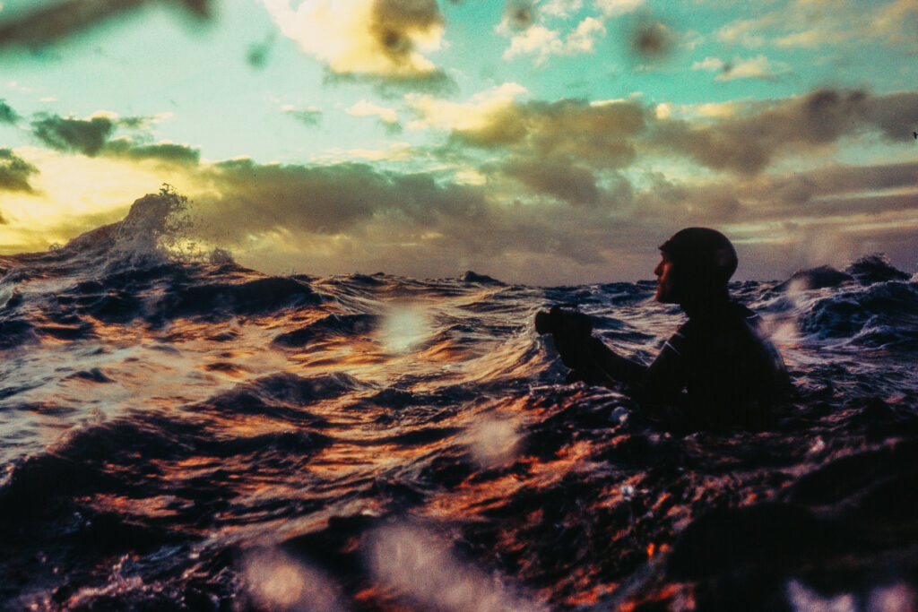
The surf was shifting, and felt sketchy; the Oregon inlet is a shark feeding zone as the fish move into the open ocean
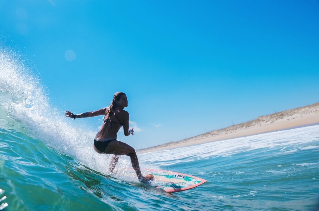
Bri drops in on a particularly fun bank near the town of Avon that was deceivingly powerful – one characteristic of Outer Banks surf is mellow-looking waves that pack a bigger punch than their size.
The best waves of the trip, for about half an hour before the tide filled in, just south of Pea Island Nature Reserve.
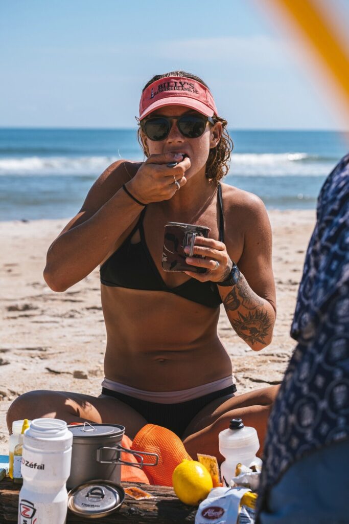
Breakfast, Cape Lookout.
Gary ‘Look mum, no hands’ Conley.
We cruised south down the beach, hollering at each other as yet another perfect set reeled down a new bank
When we first hit the beach after leaving our campsite in Virginia Beach the urge to jump straight in the water was strong, but the beach was crowded; Robin assured us in half an hour it’d be empty and we’d be able to surf alone. He wasn’t wrong,. The heat was unbearable, but the remnants of Hurricane Humberto had left good size waves and we had pristine offshore winds. After two hours on the bikes, the saltwater felt good and washed the heat and dust from our bodies. We rode some more, and with the last of civilisation approaching we stopped for lunch and beers. It’s incredible how good beer tastes after a bike ride, and knowing we didn’t have any supplies we had another.
Back on the bikes, spirits were high and the ride into Back Bay National Wildlife Refuge flew by. There were no people here at all. We took our time, and followed the sandy gravel paths. We were aiming for False Cape for the night, and we all had the thought of a sunset surf in the backs of our minds.
The surf was big and shifty here, and I didn’t really get much joy. However, when I swapped with Robin onboard a 6’1 bright yellow Wade Coffrey, I couldn’t help but smile; the board was fast and zippy as I slipped into a couple of nice peaky waves.
We all returned to shore with a smile. For a Brit, the camp conditions were something to dream of: no rain or midges, and we slept with no flysheet. When dawn came I was first up and out in the line-up. I knew this might be the last chance of waves for a couple of days as the swell dropped and we had a long day ahead of us in the saddle.
After catching some super fun small waves in Kitty Hawk, where we fished and cooked tacos with Bri’s family, another storm was making landfall. We started out before dawn to make it over the Herbert C. Bonner Bridge – one stretch of our journey where riding on the highway was unavoidable. Half asleep, we started to see the sun rising and for the first time in three days, we saw the surf. It was pristine perfect A-frames up and down the beach. We pushed our bikes over the mounds of sand freshly taken from the highway and ran with our heavy loaded fat bikes over the sand to the water’s edge. That morning was magical, beautiful light and fresh conditions; I shot from the beach before joining the others in the line-up.
The surf was shifting, though, and felt sketchy; the nearby Oregon Inlet is a major source of food for local sharks as the fish migrate from the Pamlico Sound to the Atlantic Ocean. But safely on dry land, fed and starting to warm up as the sun rose we started to plan our day. We wanted to make it to Avon that night, which was 30 odd miles away. Plus, this was the day when we could really score classic OBX waves, the clean and glassy kind that often line the pages of surfing magazines.
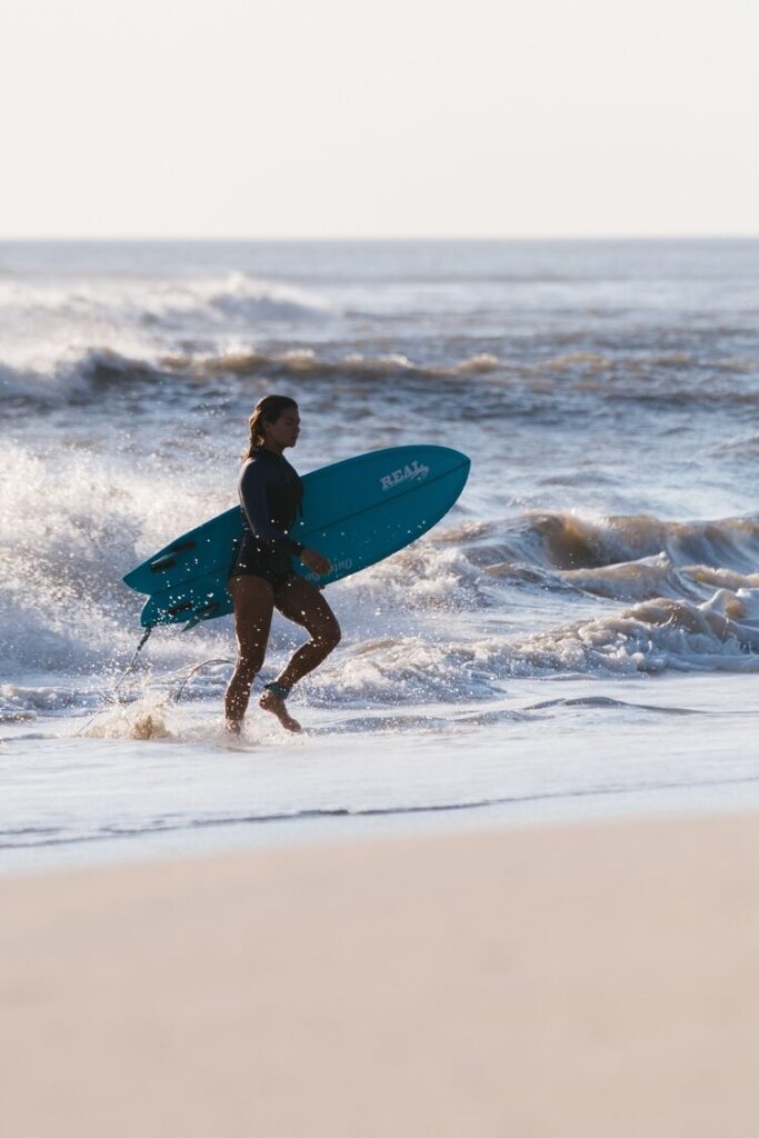
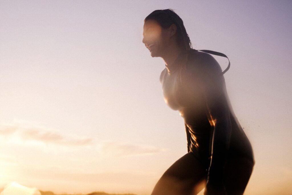
Bri finishes a classic Outer Banks early morning session.
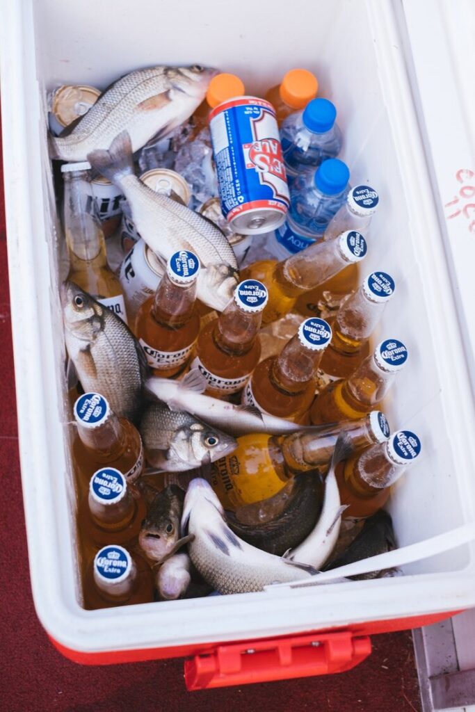
With beer and fishing, we embraced the Outer Banks way of life.
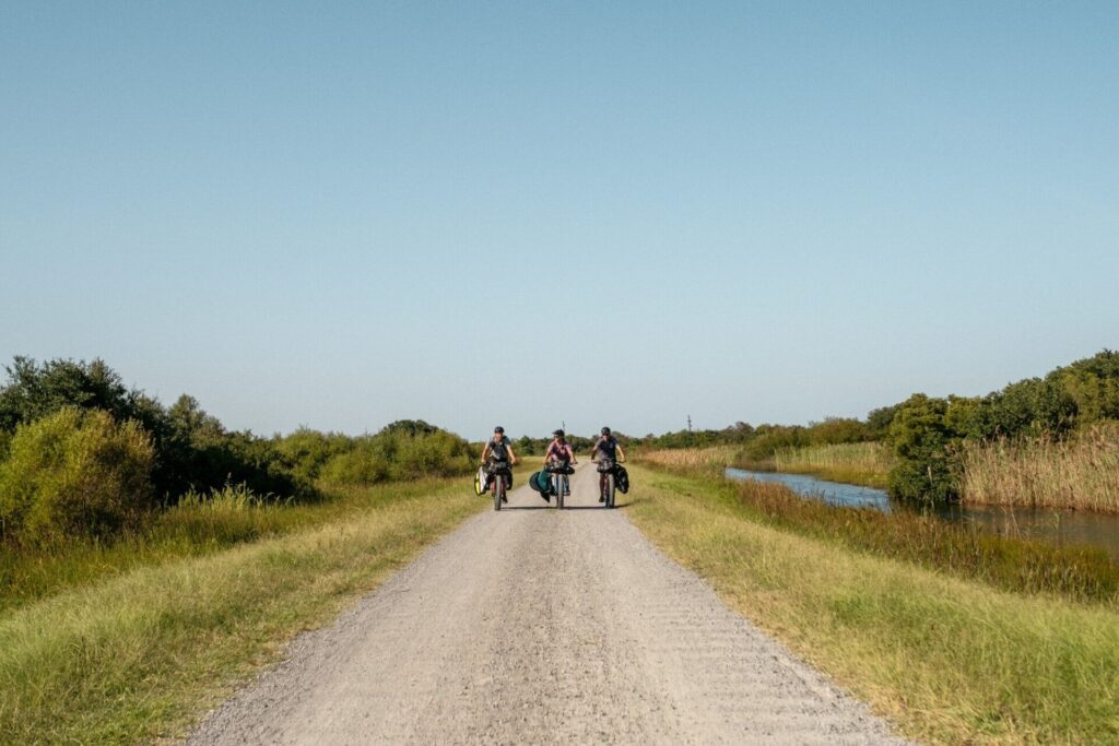
Gravel roads leading towards the North Caroline Stateline, Back Bay National Wildlife Refuge.
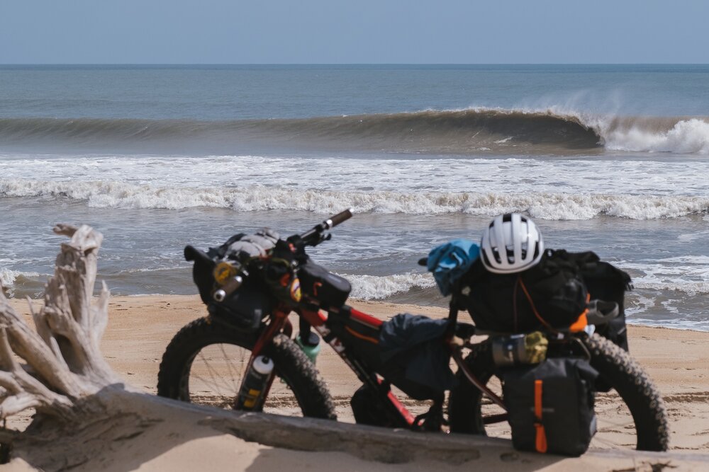
Clean and offshore at Pea Island Nature Reserve, the half-unloaded bikes framed our surf session.
We chose to ride along the beach, surfing the 100’s of peaks we saw that day in our mind’s eyes. I’d have stopped at all of them, but we cruised south hollering at each other as another set reeled down a new bank. We saw a few surfers as we rode, but Bri had a hunch a wave just to the north of Rodanthe would be working.
When we stopped, it was pumping. Bri and Gary paddled out and myself and Robin lathered on the sun cream and hid in the dunes shooting from various angles. The local guys have the place dialled, and we sit back to shoot. They both get a couple of sweet ones but each wave requires you to come in and run back up the beach to paddle back out to combat the rip. Before long, Bri and Gary are back at the bikes looking for snacks. With daylight hours getting short, we make the call to drag the bikes over the sand and through the dunes to the road with the hope of making Avon before sunset.
It was around here that we start to notice the piles of rubbish at the end of driveways, and they grew bigger the further south we went. Cory treats us like kings and we shower and have freshly made beds, fish tacos and ice cream. It felt glorious after several nights of wild camping.
Morning came too soon, and we wheeled our bikes out again to hit the road south. Plan B was actioned late last night as Gary, Bri and I slept. Robin was up early finalising the details and making calls. He shares it as we stop for breakfast. Ocracoke was now was off-limits due to the destruction caused by Hurricane Dorian. The island was closed to all but residents, relief and key workers who were allowed on the ferries over. And without the combined ferry trips via Ocracoke, we had a 200km detour by road to factor in. Robin has been connected with a chap called Chuck who was running The United Methodist Church’s disaster relief efforts on the island, and Robin had arranged for our passage across the island in return for volunteering with the relief effort. Chuck had told Robin we needed to be on the afternoon ferry: missing it wasn’t an option. We now had to plan the rest of the trip around this one ferry, and missing it meant had a 200km detour by road to Cedar Island.
This changed the whole outlook of the trip; from this point onwards, our journey wasn’t just about biking and surfing anymore. Ocracoke became our focus. And as the piles of discarded furniture and personal belongings beside the road became bigger, our resolve to help the stricken locals grew stronger.
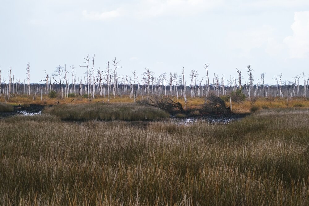
On Cedar Island the landscape changed dramatically; the destruction of Hurricane Dorian is evident in the stripped trees of this mangrove.
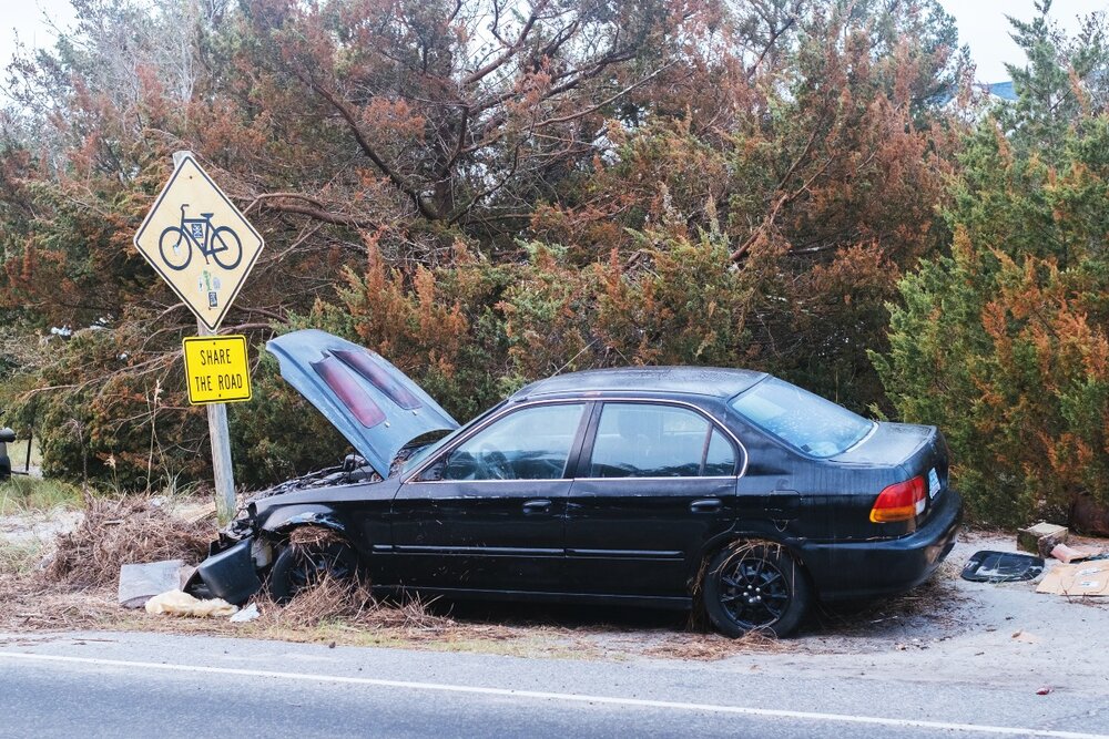
An abandoned car with an engine bay full of seagrass speaks volumes about what happened to Oracoke when the full force of Hurricane Dorian hit in late August 2019.
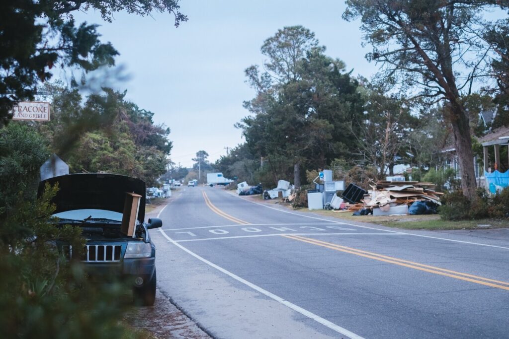
The devastated main street leading into Oracoke’s town centre; the expedition team took a few days off from the surf and the road to help the locals clean up after the massive storm.
The sulphurous afternoon went black unnaturally early. Then the wind. The world had become a drum
– Sylvia Plath (1932-1963
Getting to the ferry was just about doable, but we wanted to check for waves under the lighthouse at Hatteras. The swell had dropped too much and we made the wrong decision to ride along the beach towards the ferry terminal in Hatteras: the tide was high and it pushed us up on to the soft sand hindering our progress. It took us hours to reach Frisco allowing us to re-join the road. Hot and thirsty, we found water in a campground and hit the tarmac at full speed. Getting to the ferry was hit and miss, since fat bikes aren’t the fastest of vehicles when you’re in a hurry. As we pulled in to the ferry parking lot we could see the ferry was there, the gangplank still down and we were waved on by the attendant.
As we hi-fived and dismounted and set our wobbly legs on deck, the captain wanted to see our paperwork. Frantic going through emails on phones commenced, and although Chuck’s emails were all good the all-essential letter of acceptance from the sheriff’s office was missing. We couldn’t reach Chuck on the phone, so we disembarked and watched as the ferry we ‘couldn’t miss’ sailed for Ocracoke without us.
We sank beers in the Hatteras Grill and eventually, Robin managed to get Chuck on the phone. The necessary paperwork was sorted, and had us booked on the first ferry the next morning. We camped on a local campsite and stocked up from the local store, a classic American joint that sold everything from firearms to jams, and postcards to fishing bait.
With our panniers fully loaded, we were set for the morning. When morning came under the cover of darkness we packed down our tents and loaded the bikes. Rolling down the road and onto the ferry, this time successfully. And as the first beams of sun broke over the horizon of the Pamilco Sound a pod of dolphins trailed us as we sailed out onto the sound.
I was feeling pretty apprehensive as we sailed: I wasn’t certain what to expect the other side. The ferry was filled with people from all walks of life. Chancers and tradesmen, all seemed to be drawn to help whatever their motivation. As we docked and rolled on into the little port, we quickly found an island laid to waste by a hurricane. The poet Syvia Plath described a hurricane as ‘a monstrous speciality, a leviathan. The sulphurous afternoon went black unnaturally early… Then the wind. The world had become a drum. Beaten, it shrieked and shook. The only sound was a howl.’ No doubt this s what Ocracoke had felt like in the midst of Hurricane Dorian.
Catching the dawn ferry to Oracoke.
Bri mind-surfing perfect banks as we raced to the Oracoke ferry.
All smiles for Bri on the first evening surf of the trip, at False Cape State Park.
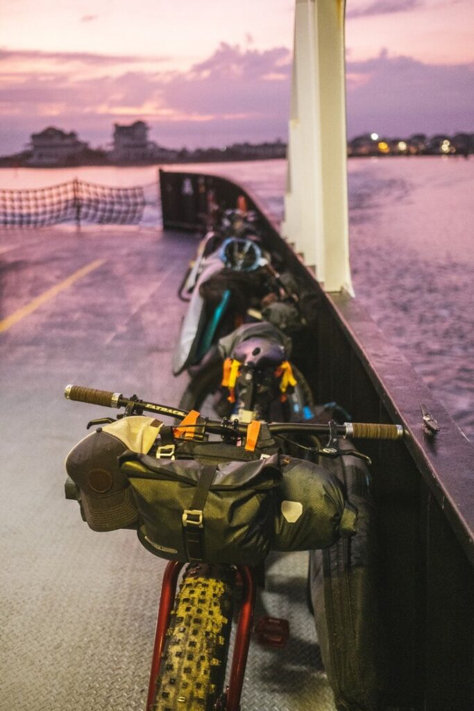
There’s something very satisfying about the combination of loaded bikes and ferries.
A cold beer makes the miles worth the pain, Harkers Island.
I was witnessing the aftermath of this ‘monstrous speciality’ that Plath so brilliantly described. Ocracoke was an island blown to bits, and this was three full weeks after the event. I can’t comprehend what it must have looked like directly after the storm had hit. The couple of days we spent on Ocracoke passed in a blur, we were given a house to work on with an experienced team, and we set about to remove any flood-damaged parts, which was basically the first 1.2 meters from the floor up. We ripped out walls and floorboards up to show beams and joists. It was hot, dirty and sweaty work – but it felt good to help out the people of Ocracoke in whatever way we could.
We missed our ferry as we tried to leave: the captain promptly turned around to pick us up, and we sailed onwards towards Cedar Island. From here, we hoped to get another ferry to Cape Lockout, but the ferry was no more and it was a Sunday, so no private boats would take us either. It’d be a long hot slog on the bikes. Sixty kilometres later, we rode on to Harkers islands and missed the last ferry to Cape Lookout – the most southerly point of The Outer Banks. We started to pitch our tents before a kindly couple gave us the keys to a little apartment, which was partly renovated so no beds, but it had A/C and we had cold Coronas.
We were on the first ferry the next morning and Cape Lookout was the perfect ending to our ride. Small fast peelers and the little Coffrey board went well, as I slipped down the line on a couple of lovely waves. Everyone properly filled their boots on our final surf of the trip, and came away smiling, sunburnt and stoked. We had a little ride as the sun went down to an apartment Robin had booked where we spent the evening looking back, ruminating over the past ten days with cold beers in our hands as we stripped the kit from the bikes. Would we ever do this trip again? We talked about Scotland and Mexico, and places further afield, and how fortunate we’d been with the weather.
Atlantic islands, no matter their geographical position, are always characterised by storms. Hurricanes, of course, have shaped life on The Outer Banks for centuries. I’m certain that extremely exposed coastal areas, such as these islands, will be the places where the effects of climate change are experienced most intensely. And, as we discovered on Ocracoke, they may also be the places where the motivation to deal with these huge issues will come from.
Don’t miss a single adventure
Sign up to our free newsletter and get a weekly BASE hit to your inbox
You might also like
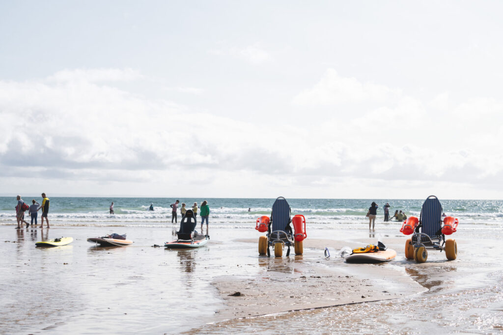
Story • Hannah Dines • Mar 01, 2023
Let My Disabled People Go Surfing
How do we ensure our coastlines are accessible to all? Para athlete and adaptive surfer, Hannah Dines finds out
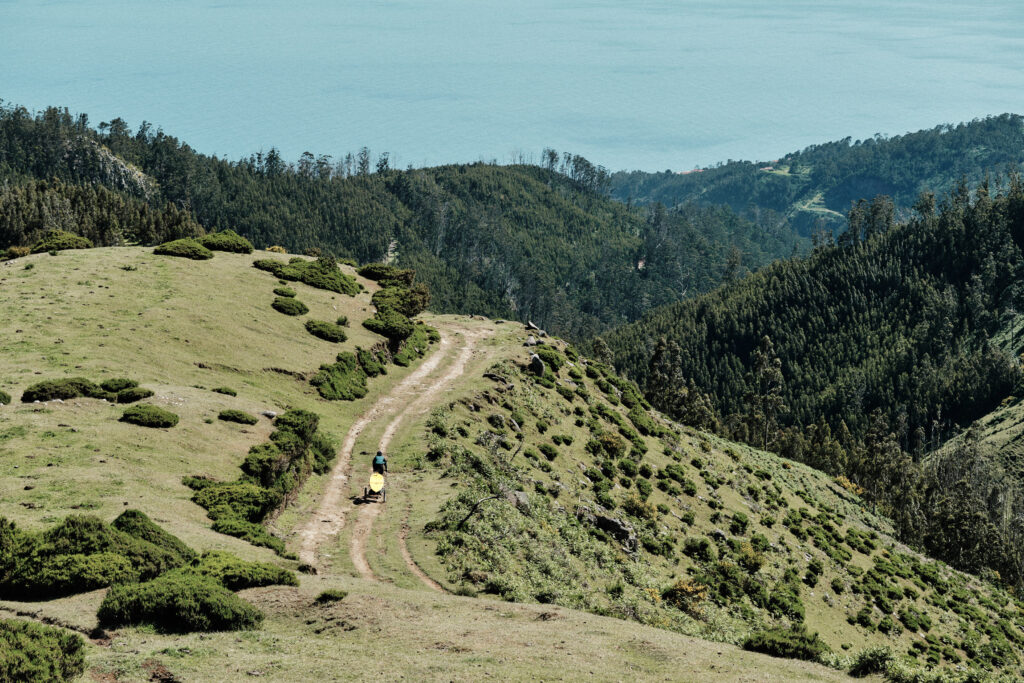
Story • Sami Sauri • Jul 13, 2022
32 Degrees North: Bikes and Waves on Maderia
Sami Sauri explores the best of this Atlantic island by bike and surfboard

Video • BASE editorial team • Mar 11, 2022
Recollections in Atlantic Reverie
A lifetime of human hearts bewitched by the sea